Sign in or Register
    • Featured
    • Recreational
    • Restricted
    • Off-Airport
    • Abandoned
    • Outpost
    • Home
    • Explore
    • Shop

    BLACK MOUNTAIN, UT

    • Overview
    • Reviews / PIREPs 0
    • Events
    • Videos
    • prev
    • next
    • Bookmark
    • Share
    • Leave a Review / PIREP
    • Report
    • prev
    • next
    Description

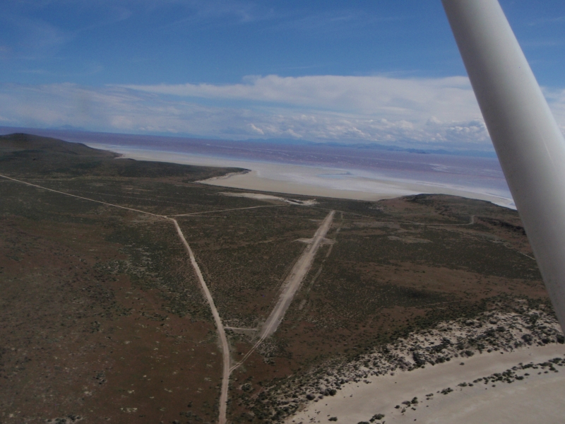
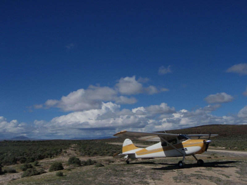
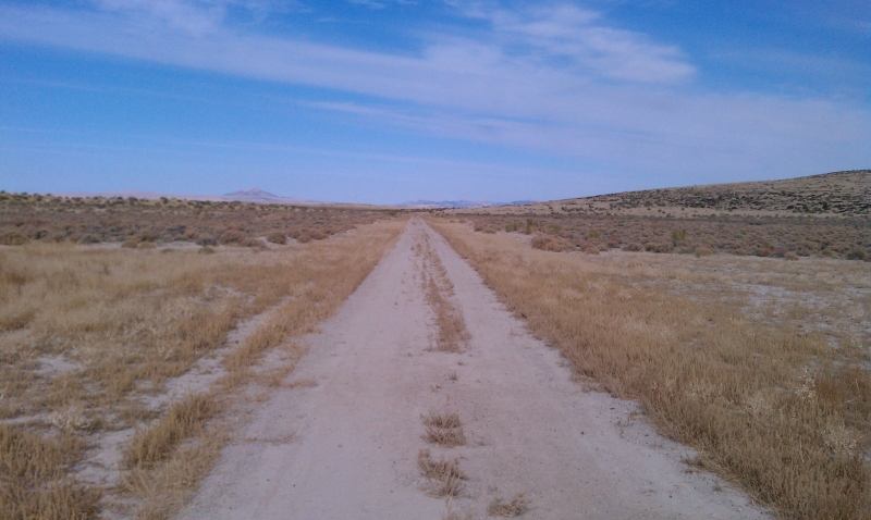
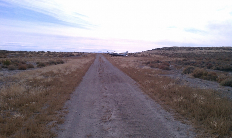
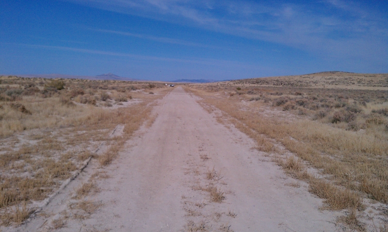
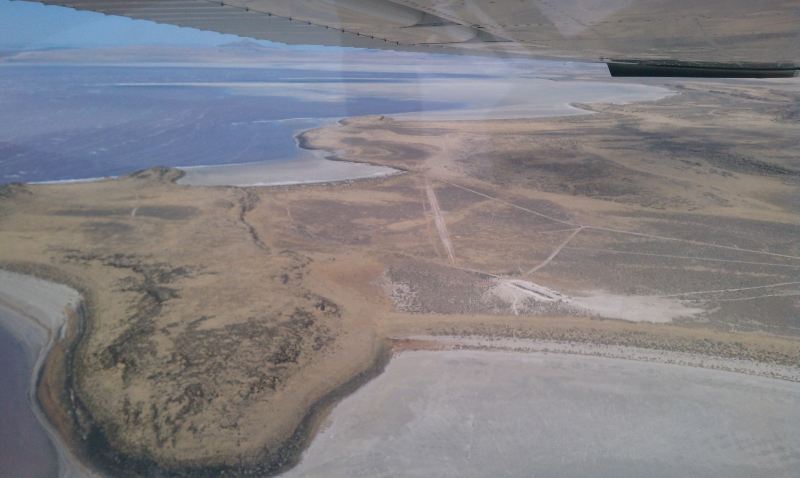
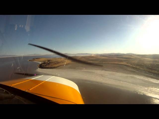
    This is a nice, long strip along the west side of Promontory Point with a nice view over the north arm of the Great Salt Lake. From the cattle and wildlife tracks on the ground, it appears that the runway can get pretty wet at times during the year.

    Runway
    • Length

      3185

    • Width

      30

    • Surface

      DIRT

    Details
    • Facility ID

      No ID 082

    • Elevation

      4223

    • CTAF

      122.9

    • State

      UT

    Gallery
    Location

    Lat: 41.55671691895 , Long: -112.78540039063 - UTAH, USA

    Get Directions
    Categories
    • Recreational
    Region
    • Northwest Mountain
    Ownership
    • Public
    Author
    shortfield
    mood_bad
  • No comments yet.
  • Add a review

    Leave a Reply · Cancel reply

    You must be logged in to post a comment.

    Related Videos
    Prev 1 of 724 Next
    • Kitfox Flight of Two, Black Mountain Airstrip, UT.wmv

      Kitfox Flight of Two, Black Mountain Airstrip, UT.wmv

      A flight of two Kitfoxes from Ogden to Black Mountain airstrip, UT
    • Mexican Mountain, UT - Takeoff (Utah backountry ) HD

      Mexican Mountain, UT - Takeoff (Utah backountry ) HD

      Taking off to the east from Mexican Mountain, UT... Shot with Drift HD170 Stealth available at www.MyPOV360.com

      Taking off to the east from Mexican Mountain, UT airstrip along the San Rafael River in the Utah back country with my Super Stinson 108-2.

      This is a beautiful airstrip on the San Rafael River - soft sand on the far east end, but overall in great condition year round. No facilities. Hazards including soft sand, narrow runway, tall trees on both sides, density altitude, and canyon / mountain weather, windshear. Please proceed with caution and make sure the weather is on your side. Also, make sure your piloting skills are top notch, planes have crashed at airstrips such as this one.

      Also, please support the Recreations Aviation Foundation ( RAF ) and the Utah Backcountry Pilots Association
      ( UBCP ).
    • Flying to the Mexican Mountain Airstrip in Southern Utah - HD

      Flying to the Mexican Mountain Airstrip in Southern Utah - HD

      If you enjoy backcountry flying, and incredible views, the Mexican Mountain airstrip is an incredible place to visit. Gorgeous red rock, the twisted, desert varnished walls of the Upper and Lower Black Boxes, and the towering plateau of Mexican Mountain itself make this an amazing destination.

      Visit our site for more details on flying in to this and other amazing Utah backcountry airstrips:

      http://disciplesofflight.com/fly-utah-backcountry/
    • Mack Mesa Fly-in 19' | Gateway Canyon | BLM airstrips in west CO and east UT

      Mack Mesa Fly-in 19' | Gateway Canyon | BLM airstrips in west CO and east UT

      Last video without the DJI osmo action. The last video had it (Black Canyon) but this footage is older, and right before I received the new camera - I sure wish I would have had it.... the terrain over on the west side of Colorado (and eastern Utah) is beautiful! Love anytime I can do some flying over there! Thanks for coming a long, the fly-in here is always a good time!


      MUSIC
      New Horizon by ADERIN https://soundcloud.com/andrei-burcea-...
      Creative Commons — Attribution-ShareAlike 3.0 Unported — CC BY-SA 3.0
      http://creativecommons.org/licenses/b...
      Music promoted by Audio Library https://youtu.be/qcJMMr-HR8Q
    • 20091109_hidden_splendor.wmv

      20091109_hidden_splendor.wmv

      In the remote Utah backcountry is an airstrip named "Hidden Splendor." How could anyone resist a spot with a name like that? Before our trip we reviewed the entry in the Utah Backcountry Pilots Online Guide.

      "This airstrip is usually in good condition, smooth and dry. It is still one of Utah's most hazardous airstrips. Both ends of the airstrip terminate at a cliff edge so landing either too short or too long would likely be fatal. Parts of the airstrip are also narrow with drop-offs off the edge of the runway. There is rising terrain in every direction. It is a narrow canyon to the southeast. The terrain to the North West looks gentle but rises at a deceptive rate."

      Our friend and guide, Mike Marker suggested we use the standard approach -- through a winding narrow canyon to the runway threshold. Sounded like fun.

      On our first pass we stayed above the canyon walls to test the winds. It was dead calm. A canyon run should be no problem today. I followed above Paul and watched him land then returned to the entrance for my approach and landing.

      The landing field was crossed by two deep gullies that were filled in for the runway. If you strayed off either edge, you were toast. High canyon walls pressed in on three sides, giving little room to maneuver. I understood why GA pilots preferred the canyon run over a downwind, base and final pattern below the rim. But the maneuverability and short take off and landing capability of our trikes made it easy for us. I touched down at midfield and parked next to Paul's trike in a sheltered spot at the north end of the runway. We ate lunch on the small hill next to the windsock. This was yet another fantastic camping spot, but we had one more airstrip to fly to today, Mexican Mountain.

      We took off and headed north through the approach canyon and turned north. Hidden Splendor is located at the southern end of the San Rafael Reef. Mexican Mountain is at the other end, 45 miles to the north. Paul pulled ahead of me and out of sight as I wandered around on our flight north. Although I had the coordinates for Mexican Mountain loaded into my GPS, I really didn't know where it was. I only knew it was next to a mountain and a river. The only river I could see was the Green, in a wide flat basin to the right,
      but my GPS pointed into the rough country west of the San Rafael Reef.

      I passed over a small stream cutting through the San Rafael Reef. Could this be the river? Then where was the mountain? The stream emerged from a jagged dark crevice cut through black rock, seeming to descend into hell itself. The crevice eventually led to a butte encircled by the river. This must be Mexican Mountain. Far ahead, I saw the strobes on Paul's trike going around a corner. When the airstrip finally came in view, Paul's trike was on ground at the center of the runway with Mike's S-18 and another plane parked in the trees. After circling around to let Paul clear the runway, I landed between the cottonwood trees which gave you the impression of flying through a slot. Mike had met another pilot, Griff, at Canyonlands Airport and had invited him along. The four of us took a short hike over to view a series of mysterious petroglyphs, the best I have ever seen. As it grew dark, we relaxed around the campfire for dinner. This was one of my best flying days ever.
    • (Gopro Mount Test) Kidderminster to Throckmorton airfield

      (Gopro Mount Test) Kidderminster to Throckmorton airfield

      Was having a track experience day at Throckmorton airfield and recently brought new Gopro mounts so deiced to test the car suction mount on a car journey to Throckmorton airfield
      Thanks for watching
      Like & Subscribe
    • Utah Backcountry Flying - Happy Canyon

      Utah Backcountry Flying - Happy Canyon

      Great Spot to camp! We spent two nights here next to the mining shack. Inside were a few chairs, some tools and business cards from folks visiting. The strip is pretty darn narrow and with the slight grade it can be pretty challenging to find the center. The winds on the second day were a direct crosswind and the canyon was a little rough on approach. The crossing runway was totally grown up with thick bushes. Not even suitable for 6" gear with 35" tires.
    • Montezuma Canyon track on Gaia

      Montezuma Canyon track on Gaia

      I do a brief overview of the GPX track on Gaia. Below is a link to where you can download the track.

      Jeep The USA Montezuma Creek trail.
      https://www.jeeptheusa.com/montezuma-creek-gp.html
    • FH3 Flag Rush - Airstrip X-Large in the '75 Ford Bronco (S1-class)

      FH3 Flag Rush - Airstrip X-Large in the '75 Ford Bronco (S1-class)

      Old gameplay from last year - using my own tune setup.
    • Low Pass Black Mountain strip Utah

      Low Pass Black Mountain strip Utah

    • Utah Airstrips - Mexican Mountain Low Pass RW29

      Utah Airstrips - Mexican Mountain Low Pass RW29

      Mexican Mountain is located just west of Green River, Utah. A short dirt strip with brush on both ends. Just a little too much for my under powered Cessna 150 so just a low pass on this one. Elevation is 4461. Strip is 1464x40.
    • Finding Hidden Splendor @ San Rafael Swell Scenic Drive March 2020

      Finding Hidden Splendor @ San Rafael Swell Scenic Drive March 2020

      Hidden Splendor Trailhead provides access to Muddy Creek, Chimney Canyon and other points of interest in the San Rafael Swell.

      Music by:
      Miro
      "Paradise"
    Prev 1 of 724 Next

    You May Also Be Interested In

    SPIRAL JETTY, UT

    This is basically a straight stretch of the road, but it is smooth and flat. The strip is narrow so make…
    • 41.45846557617, -112.68878173828
    • Recreational

    Lakeside, UT

    Lakeside is an abandoned, little used strip that sits right on the edge of the restricted area. From above…
    • 41.21284659716, -112.91352466296
    • Recreational

    PROMONTORY POINT, UT

    • 41.21165084839, -112.43520355225
    • Recreational

    © 2000-2021 shortfield.com

    Cart

      • Featured
      • Recreational
      • Restricted
      • Off-Airport
      • Abandoned
      • Outpost
      • Facebook
      • Twitter
      • WhatsApp
      • Telegram
      • LinkedIn
      • Tumblr
      • VKontakte
      • Mail
      • Copy link