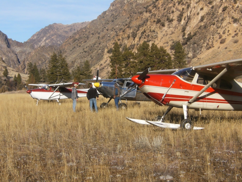
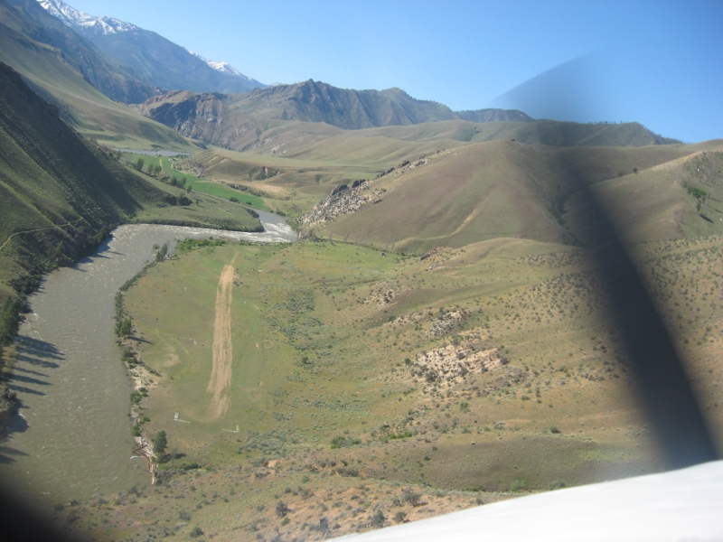
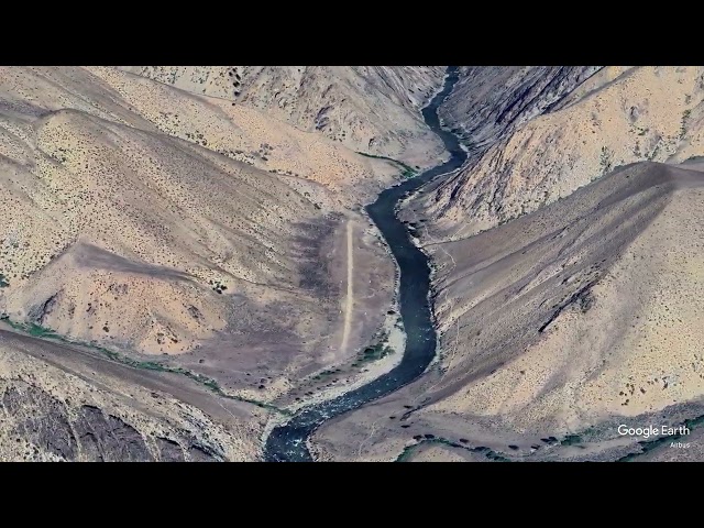
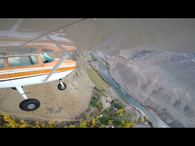
Sign in or Register
    • Featured
    • Recreational
    • Restricted
    • Off-Airport
    • Abandoned
    • Outpost
    • Home
    • Explore
    • Shop

    BERNARD USFS, ID

    • Overview
    • Reviews / PIREPs 0
    • Events
    • Videos
    • prev
    • next
    • Bookmark
    • Share
    • Leave a Review / PIREP
    • Report
    • prev
    • next
    Description

    Bernard is located on the Middle Fork of the Salmon river.  The surrounding terrain can be extremely steep and high and the summer temperatures can get into the 100s.  This strip a high performance airplane and (as always) the pilot needs to be proficient in mountain flying techinques.

    Camping:
    The "campground" consists of nothing more that a pit toilet and that's about it.  The baron landscape has a few trees, shrubs, and cacti.

    Recreation:
    There is a trail that can be take 1 mile upstream to the Flying B Ranch, or up Bernard Creek.  The Bernard Creek Trail follows the creek into a narrow canyon that is an oasis for local wildlife.  The location is said to have good fishing and hunting.

    There are tiedowns located at each end of the runway.

    Runway
    • Length

      1900

    • Width

      150

    • Surface

      TURF-DIRT-F

    Details
    • Facility ID

      U54

    • Elevation

      3626

    • CTAF

      122.9

    • State

      ID

    Gallery
    Location

    Lat: 44.97963666667 , Long: -114.73481361111 - IDAHO, USA

    Get Directions
    Categories
    • Recreational
    Tags
    • Mountains
    • Desert
    • Canyon
    Region
    • Northwest Mountain
    Ownership
    • Public
    Author
    shortfield
    mood_bad
  • No comments yet.
  • Add a review

    Leave a Reply · Cancel reply

    You must be logged in to post a comment.

    Related Videos
    Prev 1 of 14 Next
    • Bernard Airstrip Idaho Cessna 182

      Bernard Airstrip Idaho Cessna 182

      I created this video with the YouTube Video Editor (http://www.youtube.com/editor)
    • Landing Cougar Ranch Idaho

      Landing Cougar Ranch Idaho

      Landing and taking off at Cougar Ranch, a new strip on the Middle Fork of the Salmon River in Idaho.
    • Bernard Airstrip Idaho

      Bernard Airstrip Idaho

    • MVI_0594.AVI

      MVI_0594.AVI

      Cessna 172 H Landing Runway 20 at West Fork Lodge, Darby, Montana
    • Idaho Backcountry Air Strips

      Idaho Backcountry Air Strips

      U72 Upper Loon - 0U3 Mahony Creek - C53 Lower Loon - U54 Bernard - MYL Mccall
      Backcountry mountain & Canyon training on 10/12/18
    • Krassel Landing

      Krassel Landing

      Landing and Takeoff at Krassel Ranger Station Airstrip on the South Fork of the Salmon River in Idaho. 2016
    • Chamberlain Basin airstrip, Idaho

      Chamberlain Basin airstrip, Idaho

      C185 departing rwy 7 Chamberlain Basin airstrip, Idaho.
    • Landmark Airstrip

      Landmark Airstrip

      USFS Smokejumpers at Landmark Airstrip. Rode deep into the Frank Church Wilderness, on some road corridors.
    • Thomas Creek Landing Wing

      Thomas Creek Landing Wing

      Landing at the the Thomas Creek backcountry airstrip in Idaho. From wingtip camera.
    • Shearer Airstrip (2U5)

      Shearer Airstrip (2U5)

      Approach and landing on the Selway River at Shearer USFS airstrip in the Idaho Backcountry on October 29, 2020.
    • Flying North Idaho's Airstrips - HD

      Flying North Idaho's Airstrips - HD

    • Indian Creek Landing

      Indian Creek Landing

      Landing Indian Creek Airstrip on the Middle Fork of the Salmon River.
    Prev 1 of 14 Next

    You May Also Be Interested In

    FLYING B RANCH LANDING STRIP, ID

    The Flying B is the Jewel of our Ranches, we have something here for everybody and we aim to please! …
    • 44.96797000000, -114.73286861111
    • Restricted

    SOLDIER BAR USFS, ID

    Solder Bar is located about four miles upstream from the confluence of Big Creek and the Middle Fork of the…
    • 45.09991416667, -114.80092888889
    • Recreational

    HOODOO, ID

    THIS AIRSTRIP IS CLOSED!  This airstrip was closed in the mid-1970s and this information is offered as…
    • 45.05597, -114.55955
    • Abandoned

    © 2000-2021 shortfield.com

    Cart

      • Featured
      • Recreational
      • Restricted
      • Off-Airport
      • Abandoned
      • Outpost
      • Facebook
      • Twitter
      • WhatsApp
      • Telegram
      • LinkedIn
      • Tumblr
      • VKontakte
      • Mail
      • Copy link