Sign in or Register
    • Featured
    • Recreational
    • Restricted
    • Off-Airport
    • Abandoned
    • Outpost
    • Home
    • Explore
    • Shop

    POISON SPRING, UT

    • Overview
    • Reviews / PIREPs 0
    • Events
    • Videos
    • prev
    • next
    • Bookmark
    • Share
    • Leave a Review / PIREP
    • Report
    • prev
    • next
    Description

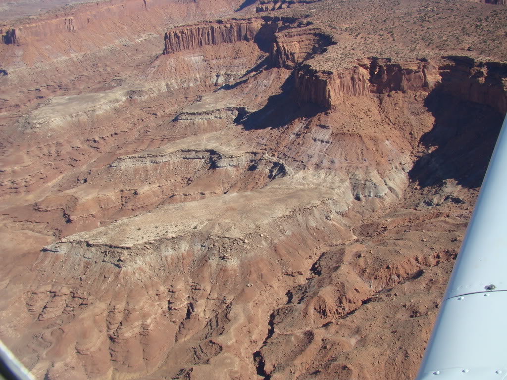
    This airstrip is located on top of a cliff to the west of the Dirty Devil airstrip.  This strip is reported to be rough and short with sections of the runway that are unusable on the NW end.

    This strip has been compared with Idaho's infamous Mile Hi and should be considered very dangerous and only suitable for big tired, high-performance bush planes and pilots with big skills and even bigger "tires".

    Runway
    • Length

      819

    • Width

      20

    • Surface

      SAND

    Details
    • Facility ID

      No ID 064

    • Elevation

      4721

    • CTAF

      122.9

    • State

      UT

    Gallery
    Location

    Lat: 38.10160400000 , Long: -110.39723400000 - UTAH, USA

    Get Directions
    Categories
    • Recreational
    Tags
    • Mountains
    • Desert
    • Canyon
    Region
    • Northwest Mountain
    Ownership
    • Public
    Author
    shortfield
    mood_bad
  • No comments yet.
  • Add a review

    Leave a Reply · Cancel reply

    You must be logged in to post a comment.

    Related Videos
    Prev 1 of 12 Next
    • Poison Spring Airstrip part 1

      Poison Spring Airstrip part 1

      The most hazardous airstrip in Utah (or so they say). I would have to agree that it's pretty bad.

      The right airplane, right pilot, right conditions - definitely landable.

      Did find some broken airplane parts on the airstrip for those who are brave and want to land there "just because". Looked like a fiberglass spinner.
    • Poison Spring Airstrip

      Poison Spring Airstrip

      Part two. Shows further down the strip.
    • Utah Backcountry Flying 2017 Landing Poison Spings

      Utah Backcountry Flying 2017 Landing Poison Spings

    • Poison Spring

      Poison Spring

      This is rated as THE most difficult strip in "Fly Utah.”

      "It's short, it's ugly, it's chopped up with unusable sections, it's got dips and humps, it's got blow sand, brush, cactus, slick rock and, oh yeah, it's got a 1,000-foot vertical drop off the approach and a 1,000-foot vertical cliff on the end. Sound almost impossible? You're starting to get the picture."

      - Galen Hanselman - FLY UTAH

      Todd Peterson in his KING KATMAI does Poison Spring the hard way ... from the direction of the canyon wall.
    • nokai_dome.wmv

      nokai_dome.wmv

      In November 2009, I flew to Monument Valley with my flying buddies Paul and Mike. We continued on for 3 days of flying and two nights of camping at Utah backcountry airstrips strips. The first was Nokai Dome, on a rise overlooking the San Juan River and Lake Powell.
    • Travel Adventure: Poison Spring

      Travel Adventure: Poison Spring

      The red rock bluffs outside of Hanksville Utah seem to be about as barren as you can get. There isn't even a hint of green as the boulders and canyons snake their way southward. For Dale Bartholomew, architect of the new Utah Trail Map CD, this is the perfect place to explore and add new trails to upcoming map CDs. What he found on one of his excursions surprised even him, so he decided to bring the Pathfinders ATV Club with him to see what took his breath away.

      What Dale found was a world defined not by the rocks and sand, but by water, with an amazing amount of rivers and streams cutting their way through the desert. Poison Springs is the name of the area, but there is really nothing poisonous about it. The Dirty Devil river makes for a hair-raising crossing on an ATV, but for the most part these streams just add a different paradigm to what is expected in the southwestern deserts of America.
    • Driving the West - the Poison Strip and the Yellowcat Road

      Driving the West - the Poison Strip and the Yellowcat Road

      Coming back from a little time in the desert, doing science. Playing around with a different camera mount this time and ended up taking a plant to the lens! Our first (but definitely not last) off highway video. Plenty more drives coming up too! I've got footage from Blanding to Moab and Grand Junction to Montrose, and will be driving/filming Delta County to Hotchkiss and Grand Junction to Vernal, Utah later this week. Stay tuned!

      Remember, if you enjoyed this please consider liking and subscribing.

      Cold Funk - Funkorama by Kevin MacLeod is licensed under a Creative Commons Attribution license (https://creativecommons.org/licenses/by/4.0/)
      Source: http://incompetech.com/music/royalty-free/index.html?isrc=USUAN1100499
      Artist: http://incompetech.com/
    • Keg Knoll & Colonnade Arch

      Keg Knoll & Colonnade Arch

      A late spring camping trip to Keg Knoll airstrip to checkout the Colonnade Arch.
    • Happy Canyon, UT - Approach and Landing  (Utah backountry ) HD

      Happy Canyon, UT - Approach and Landing (Utah backountry ) HD

      Approach and landing to the east at Happy Canyon, UT airstrip in the Utah back country with my Super Stinson 108-2.

      This is a old rugged mining airstrip - soft sand on the edges of the runway, but overall is in good condition year round. No facilities. Hazards including soft sand, short narrow runway, up to 2ft shrubs on edges of runway, density altitude, and canyon / mountain weather, windshear. Please proceed with caution and make sure the weather is on your side. Also, make sure your piloting skills are top notch, planes have crashed at airstrips such as this one.

      Shot with Drift HD170 Stealth and available at www.MyPOV360.com

      Also, please support the Recreations Aviation Foundation ( RAF ) and the Utah Backcountry Pilots Association ( UBCP ).
    • 20131005 dirty devil

      20131005 dirty devil

      A ultralight trike flight following the Dirty Devil River north from Lake Powell into Utah backcountry.

      We cruised up this spectacular canyon and landed at the Dirty Devil airstrip at sunset. After camping overnight, we followed the river upstream past towering sandstone cliffs.
    • The Flats - Tule Valley Hard Pan

      The Flats - Tule Valley Hard Pan

      Somewhere around 140th flight of the Phantom 2 Vision.

      Flats 6/29/15
    • Ultimate Adventure Happy Canyon and Dirty Devil River

      Ultimate Adventure Happy Canyon and Dirty Devil River

      Two friends dropped off at Dirty Devil airstrip and picked up three days later at the Happy Canyon Airstrip.
      coloradobackcountryflying.com
    Prev 1 of 12 Next

    You May Also Be Interested In

    BELOW BUCKACRE, UT

    • 38.08827509308, -110.36422996826
    • Recreational

    DIRTY DEVIL, UT

    The runway sits up on a a bench about 200' above the river. It is 1279' long with abrupt drop-offs on both…
    • 38.17777777778, -110.45333333333
    • Recreational

    HAPPY CANYON, UT

    The airstrip is about 10 miles upstream from the mouth of Happy Canyon, and sits on a bench at the base of a…
    • 38.15722222222, -110.29222222222
    • Restricted

    © 2000-2021 shortfield.com

    Cart

      • Featured
      • Recreational
      • Restricted
      • Off-Airport
      • Abandoned
      • Outpost
      • Facebook
      • Twitter
      • WhatsApp
      • Telegram
      • LinkedIn
      • Tumblr
      • VKontakte
      • Mail
      • Copy link