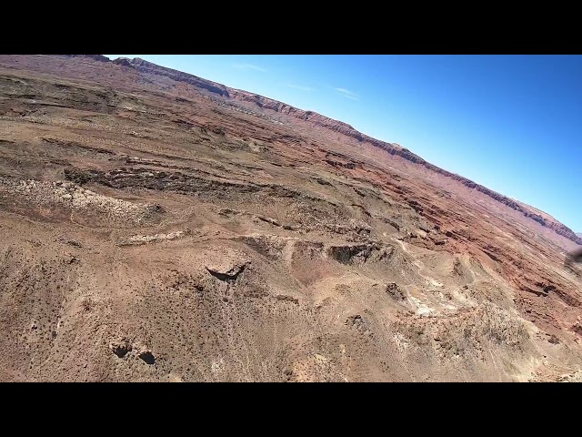
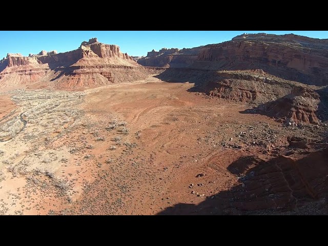
Sign in or Register
    • Featured
    • Recreational
    • Restricted
    • Off-Airport
    • Abandoned
    • Outpost
    • Home
    • Explore
    • Shop

    PIUTE CANYON, UT

    • Overview
    • Reviews / PIREPs 0
    • Events
    • Videos
    • prev
    • next
    • Bookmark
    • Share
    • Leave a Review / PIREP
    • Report
    • prev
    • next
    Runway
    • Length

      1541

    • Width

      40

    • Surface

      DIRT

    Details
    • Facility ID

      No ID 104

    • Elevation

      4952

    • CTAF

      122.9

    • State

      UT

    Location

    Lat: 37.64951705933 , Long: -110.29888153076 - UTAH, USA

    Get Directions
    Categories
    • Recreational
    Region
    • Northwest Mountain
    Ownership
    • Public
    Author
    shortfield
    mood_bad
  • No comments yet.
  • Add a review

    Leave a Reply · Cancel reply

    You must be logged in to post a comment.

    Related Videos
    Prev 1 of 19 Next
    • Piute Canyon

      Piute Canyon

      Piute Canyon airstrip, Utah
    • Utah Backcountry Flying - Piute Canyon

      Utah Backcountry Flying - Piute Canyon

      Piute Canyon looked like it hadn't seen a visitor for awhile. From the air the runways were recognizable, but once on the ground it was pretty difficult to see where it was. It would have been a little less rough had our tire pressure not creeped up in the mid morning heat. At the midpoint of the runway was some stacked wood and other building materials. Would be a great place to camp.
    • One Amazing Planet

      One Amazing Planet

      A little something to occupy a few minutes of your time (well, about 45) as you may be stuck inside these days. It's entirely stills of some of my favorite landscape(ish) photos--not an overlanding rig one to be found. I have something else in work for the overlanding enthusiasts, but that will take a bit more time. Meanwhile, please enjoy this, and maybe even share it with your non-overlanding friends. I hope that you tell them, "Seeing sights like this is one of the reasons I go overlanding!"

      The video is carefully rendered in 4K, so I encourage you to watch it on an appropriate device--your living room TV, for example. There are a few images shot with older cameras (including some film) that have been upscaled as best as possible to 4K, so, please be kind in your remarks. :-)

      I've created subtitles for all of the images. The subtitles can be turned off or on with the CC option in the lower right corner. Recommend enjoy the shots with the subtitles off, but turn them on briefly if you wish to learn where an image was shot. Or, you could watch twice, once with the subtitles off to enjoy the show, the second time with a pad and paper and the subtitles on, noting where you'd like to take future trips.

      Chris Zabriskie wrote, produced and performed all of the music I used. I downloaded it from the YouTube Audio Library. It is licensed under a Creative Commons Attribution License:

      https://creativecommons.org/licenses/by/4.0/
      Source: http://chriszabriskie.com
      Artist: http://chriszabriskie.com

      The music is what I'd call new age. It includes:

      "I Want to Fall in Love on Snapchat"
      "Mario Bava Sleeps In a Little Later Than He Expected To"
      "The Life and Death of a Certain K Zabriskie Patriarch"
      "Divider"
      "There Are Many Different Kinds of Love"
      "I Don't See the Branches, I See the Leaves"
      "Prelude No 20"

      If that's not to your liking, well, just turn it down and start your own playing. There is no audio to this video other than the music, so you won't miss anything (except some relaxing music). It's not necessary to share in the comments that you don't like my musical choices. It's neither surprising nor really much of a concern to me. To each their own--just one more thing that makes this ... One Amazing Planet.

      Please enjoy and stay safe.
    • Circleville, Utah to Junction, Utah. Going North on US-89

      Circleville, Utah to Junction, Utah. Going North on US-89

      Some more of Southern Utah. This on Highway US-89 going north.
    • Bookcliff airstrips

      Bookcliff airstrips

      Another great day of backcountry flying.
      Up to the top of the book cliffs in eastern Utah.
    • Utah Backcountry Flying - Wee Hope Mine

      Utah Backcountry Flying - Wee Hope Mine

      West side of the strip was in excellent condition. Looked recently graded. The second half of runway was narrow but still pretty smooth. Looked to be some recent off-road activity.
    • The Ultimate Ride - RZR in Moab

      The Ultimate Ride - RZR in Moab

      Our first trip to Moab Utah. Put the RZR to the test, rode some awesome trails and saw some beautiful country!
    • Breathtaking ATV Aerial Drone Footage #EpicAdventure

      Breathtaking ATV Aerial Drone Footage #EpicAdventure

      Breathtaking Aerial Drone Footage #EpicAdventure RIding in the Mountains
      Chill riding music
    • Nokai Dome

      Nokai Dome

    • Westwind Monument Valley Adventure with Test Voice Over

      Westwind Monument Valley Adventure with Test Voice Over

      A test video from the Monument Valley Flight with some test voice over tracks.
    • Driving from Reno, NV to Delta, UT via US50

      Driving from Reno, NV to Delta, UT via US50

      I'm not much of a gambler, so did not stay up late in Reno. I got a decent night's sleep, and then headed out pretty early today. My goal was to make well into Utah today, but first I wanted to have lunch with my friend "Rocket Man" in Fallon, Nevada.

      I was considering driving into Salt Lake City, but after talking to a new friend that I met at a rest area, I decided to take his suggestion of going to Moab, UT near Arches National Park (footage coming soon). Thanks Dave!

      My Sony HXR-NX100 rode shotgun on a tripod shooting at 4 fps. The tripod was held in place using bungee cords giving it I nice smooth feel, even on bumpy roads. I also used this same camera to shoot various scenes around the country, and to interview folks.

      Original music by Nim Portakey and/or created by Pinnacle Studio ScoreFitter.
    • Brown's Rim Departure

      Brown's Rim Departure

      Departing Brown's Rim airstrip in Utah in a Cessna 182
    Prev 1 of 19 Next

    You May Also Be Interested In

    WEE HOPE MINE, UT

    South end of airstrip is somewhat wider and 03 uphill so recommend landing 03, takeoff 21. Great scenery.
    • 37.57146835327, -110.22401428223
    • Recreational

    FRY CANYON FIELD, UT

    The Fry Canyon airstrip is a beautiful strip next to Fry Canyon - a slot canyon that contains ancient Anasazi…
    • 37.64833333333, -110.16694444444
    • Restricted

    RED CANYON MEADOW, UT

    • 37.57968139648, -110.17198181152
    • Recreational

    © 2000-2021 shortfield.com

    Cart

      • Featured
      • Recreational
      • Restricted
      • Off-Airport
      • Abandoned
      • Outpost
      • Facebook
      • Twitter
      • WhatsApp
      • Telegram
      • LinkedIn
      • Tumblr
      • VKontakte
      • Mail
      • Copy link