Sign in or Register
    • Featured
    • Recreational
    • Restricted
    • Off-Airport
    • Abandoned
    • Outpost
    • Home
    • Explore
    • Shop

    FRY CANYON FIELD, UT

    • Overview
    • Reviews / PIREPs 0
    • Events
    • Videos
    • prev
    • next
    • Bookmark
    • Share
    • Leave a Review / PIREP
    • Report
    • prev
    • next
    Description

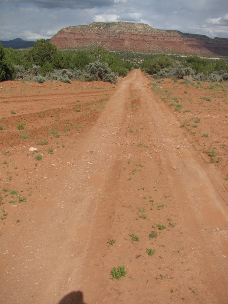
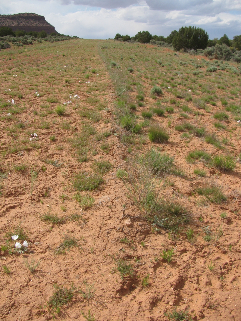
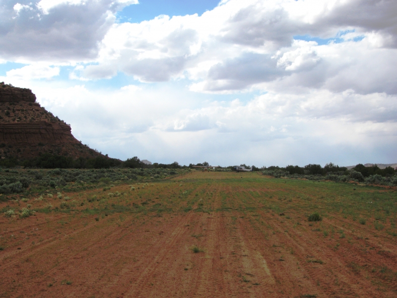
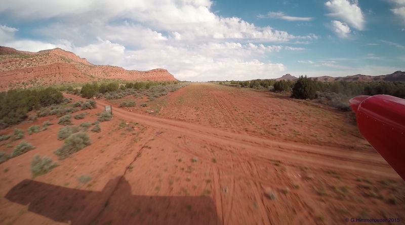
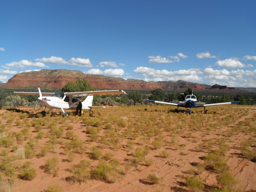
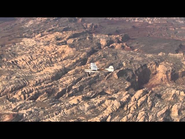
    The Fry Canyon airstrip is a beautiful strip next to Fry Canyon - a slot canyon that contains ancient Anasazi indian cliff dwellings. The runway (12-30) is adjacent to Hwy 95, and runs uphill 1.7% to the North. Land North of the road that crosses the runway, the area south of the road is good for camping, but be cautious when taxiing as there are ruts and very soft areas. The airstrip North of the road is about 2300' long. There is a windsock that is in decent condition.

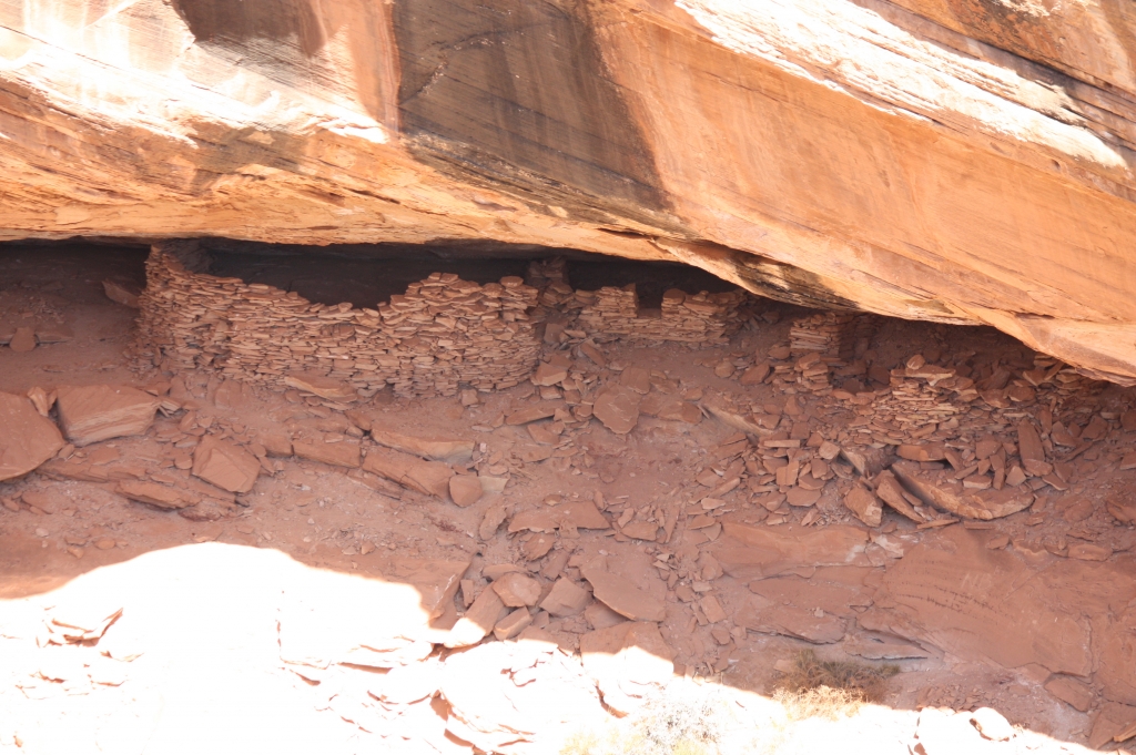
    If you follow the road that crosses the airstrip to the East about 1/4 mile, it dead ends on the edge of the canyon and gives you a fantastic view of the Anasazi ruins on the opposite side. Follow Hwy 95 South from the airstrip about 1 mile and you can enter the slot canyon under the bridge where the road crosses above the canyon. You will get wet, and if you intend to hike all the way North to the ruins, you will need harnesses and rope as there is a 45' rappel required.

    Runway
    • Length

      3160

    • Width

      120

    • Surface

      DIRT

    Details
    • Facility ID

      UT74

    • Elevation

      5372

    • CTAF

      122.9

    • State

      UT

    Gallery
    Location

    Lat: 37.64833333333 , Long: -110.16694444444 - UTAH, USA

    Get Directions
    Categories
    • Restricted
    Tags
    • Desert
    • Canyon
    Region
    • Northwest Mountain
    Ownership
    • Private
    Author
    shortfield
    mood_bad
  • No comments yet.
  • Add a review

    Leave a Reply · Cancel reply

    You must be logged in to post a comment.

    YouTube Search
    Prev 1 of 11 Next
    • FryCanyon

      FryCanyon

      Noreen and I took Chuck down to Fry Canyon in Southern Utah. Good times!
    • Landing at Hite Airstrip

      Landing at Hite Airstrip

      Today I flew into Hite, it is a 2000 ft. narrow paved strip. it has a 5% uphill grade for landing and you usually depart downhill no matter what the winds are doing.
    • hite utah departure redtail aviation cessna 172 enh1 movie

      hite utah departure redtail aviation cessna 172 enh1 movie

      Revisiting Hite airstrip in Utah (UT03) overlooking the Colorado river at the top end of the Glen Canyon Reservoir (Lake Powell). We were fortunate to be there to experience scattered thunderstorms with heavy rain as they drenched their way across the magnificent craggy landscape. Hite is at 3,840ft and on the Denver sectional marked as hazardous. It's 2,200ft long asphalt E/Wsloping up to the West with runway over-run off a nasty rocky escarpment. The aircraft taking off is a Cessna 172 from Redtail Aviation out of Canyonlands (CNY) Moab
    • nokai_dome.wmv

      nokai_dome.wmv

      In November 2009, I flew to Monument Valley with my flying buddies Paul and Mike. We continued on for 3 days of flying and two nights of camping at Utah backcountry airstrips strips. The first was Nokai Dome, on a rise overlooking the San Juan River and Lake Powell.
    • Utah Backcountry Flying - May 2020 - 8GCBC Scout

      Utah Backcountry Flying - May 2020 - 8GCBC Scout

      Flying Utah in an American Champion Scout. May 16-17, 2020. Airstrips: Delores Point, Mineral Canyon, Horseshoe Canyon, U34, Mexican Mountain, Cedar Mountain, 69V.

      www.utahbackcountrypilots.org
    • When your high school is famous 😱

      When your high school is famous 😱

    Prev 1 of 11 Next

    You May Also Be Interested In

    RED CANYON MEADOW, UT

    • 37.57968139648, -110.17198181152
    • Recreational

    WEE HOPE MINE, UT

    South end of airstrip is somewhat wider and 03 uphill so recommend landing 03, takeoff 21. Great scenery.
    • 37.57146835327, -110.22401428223
    • Recreational

    PIUTE CANYON, UT

    • 37.64951705933, -110.29888153076
    • Recreational

    © 2000-2021 shortfield.com

    Cart

      • Featured
      • Recreational
      • Restricted
      • Off-Airport
      • Abandoned
      • Outpost
      • Facebook
      • Twitter
      • WhatsApp
      • Telegram
      • LinkedIn
      • Tumblr
      • VKontakte
      • Mail
      • Copy link