Description
Location Overview
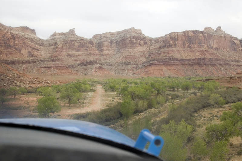
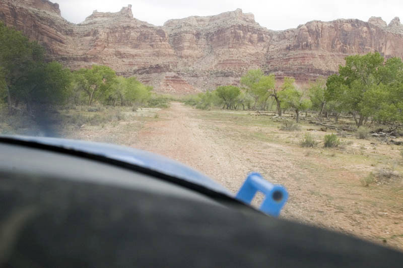
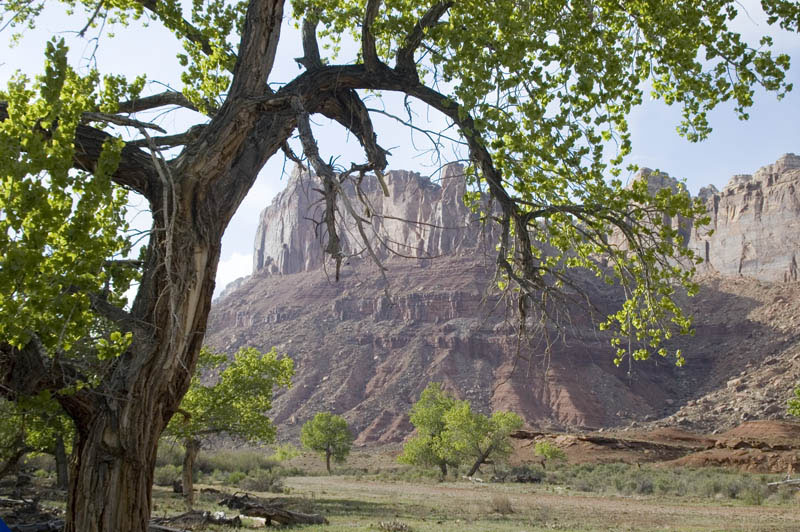
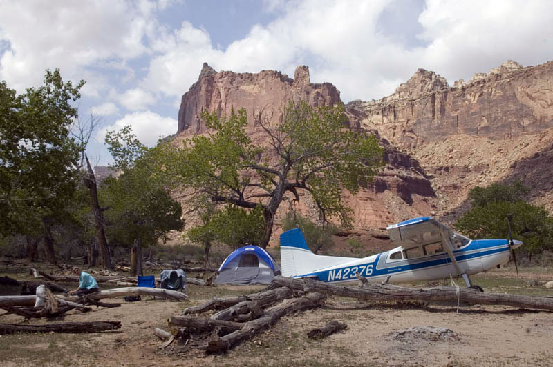
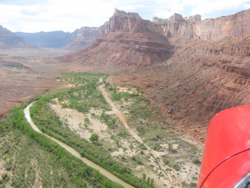
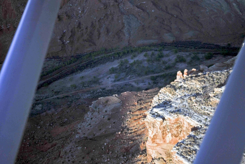
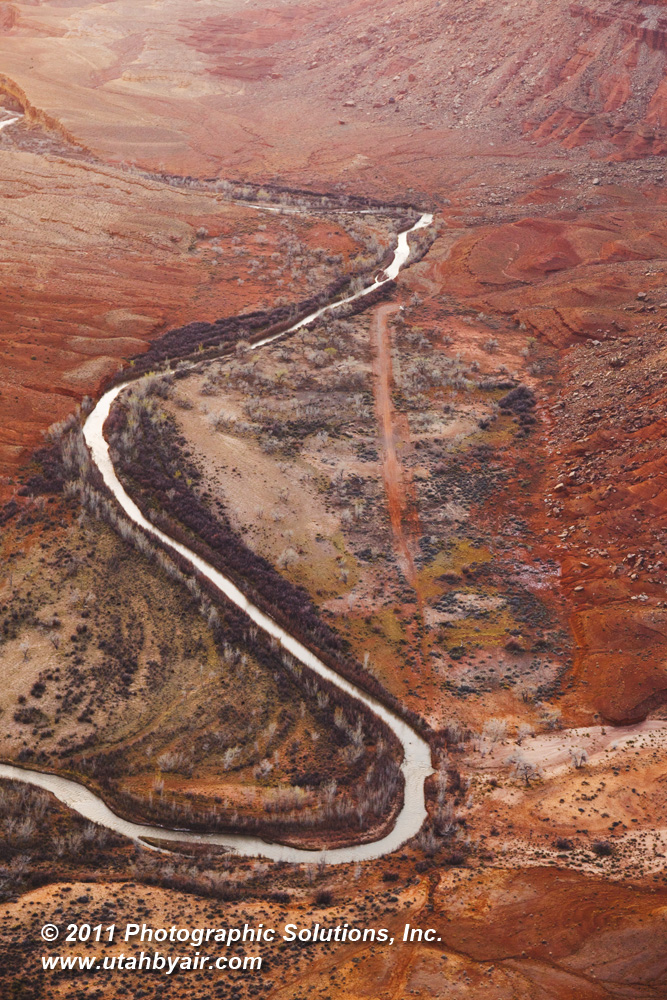
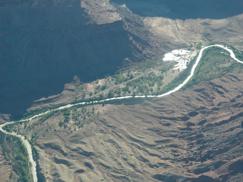
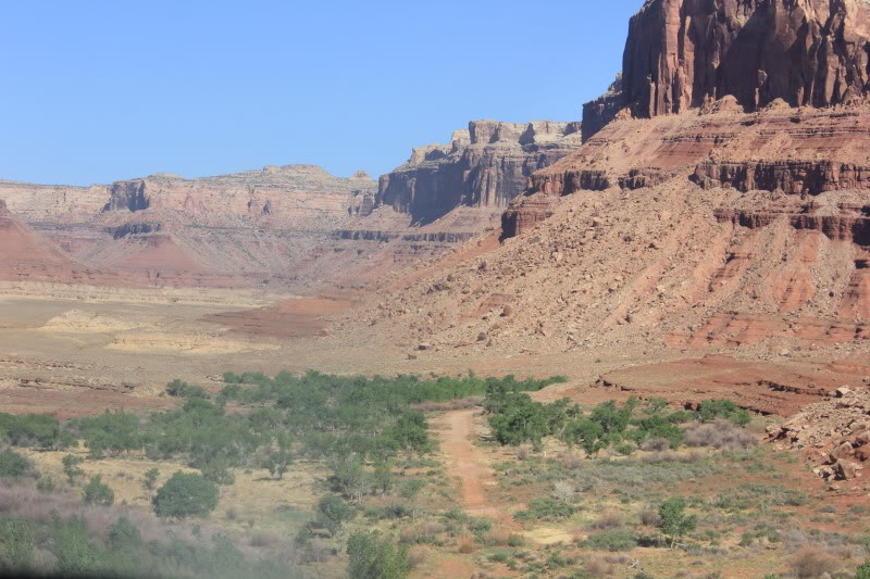
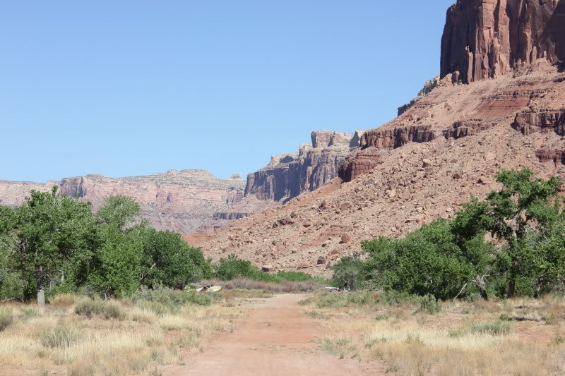
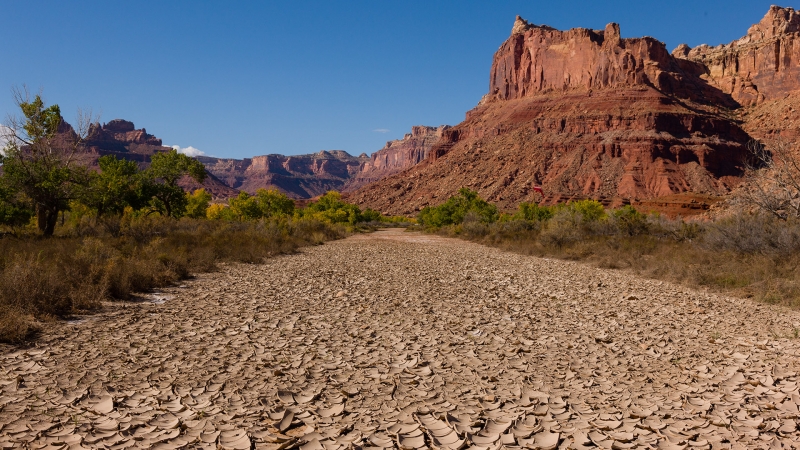
Mexican Mountain's runway sits alongside the San Rafael River, oriented west to east, deep within the Mexican Mountain Wilderness Study Area in central Utah. The strip lies at an elevation of 4,461 feet, approximately 10 miles northwest of Green River. From this vantage point at 4,460 feet, visitors can gaze up at multi-colored buttes, pinnacles, and alcoves, with Mexican Mountain itself towering over the canyon at 6,900 feet.
Camping & Recreation
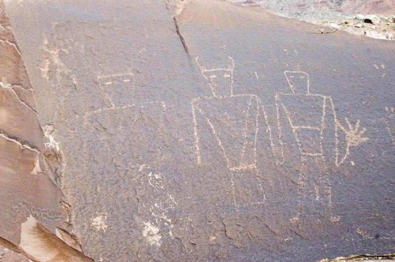
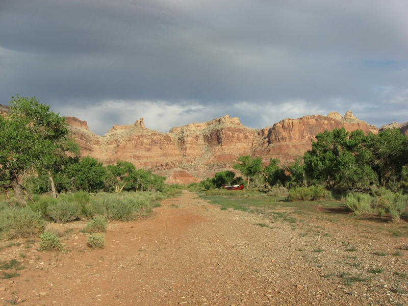
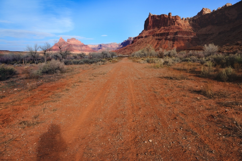
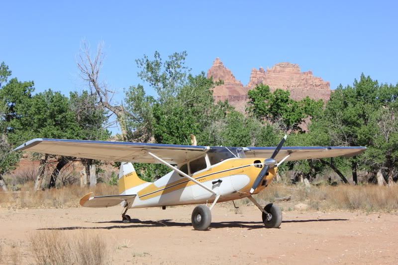
The airstrip offers established campgrounds and fire rings. Pilots are asked to use only existing camping spots, parking areas, and fire rings to minimize environmental impact. A windsock is located east of the runway. The airstrip serves as an excellent base camp for hiking the Black Boxes, Spring Canyon, and Mexican Mountain itself. Just a five-minute walk from the strip, visitors can view petroglyphs thought to have been left by peoples of the Fremont, Paiute, and Ute cultures from roughly 700 to 2,000 years ago.
Notes & Warnings
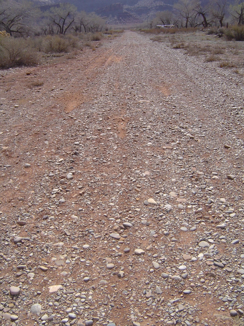
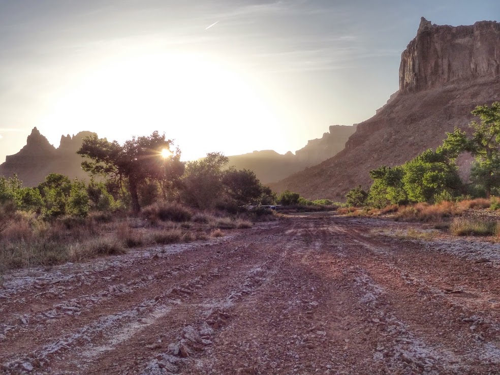
The runway is 1,900 feet long by 40 feet wide, dirt surface, in great condition, sloping slightly uphill toward the west. The first 500 feet from the eastern end tend to be softer than the rest of the strip and feature a "dark spot" that appears wet year-round. Tall trees exceeding 30 feet flank both sides of the runway, creating a particular hazard when landing to the east (downhill). The standard pattern is to land to the west and depart to the east. When approaching, pilots should fly in over Buckhorn Wash, turn east at the campground, and follow the San Rafael River out to Mexican Mountain, arriving at a manageable altitude below the cliff line. The runway can be unusable after rains, so checking weather well ahead of any planned visit is essential. Because this airstrip sits within a designated Wilderness Area, motorized or wheeled conveyances are prohibited on the airstrip and in surrounding areas. Pilots should follow the UBCP's Code of Conduct and practice Leave No Trace wilderness ethics; the use of WAG bags is strongly encouraged.
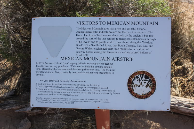
History
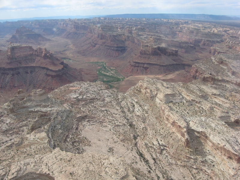
The Mexican Mountain backcountry airstrip was constructed in 1975 by Wainoco Inc. to provide access for drilling a test well to 4,060 feet, but the effort failed to discover any petroleum. The airstrip was left behind when the company moved on. Because it predated the area's wilderness designation, it remained open to the public and eligible for maintenance. The surrounding landscape is steeped in history — the Horse Thief Pass Trail was used not only by ancient peoples but also around the turn of the last century to move stolen horses through the Swell. It was along this very stretch of the San Rafael River that Butch Cassidy, Elzy Lay, and George Walker swapped out tired mounts for fresh horses during the famous Castle Gate payroll holdup of April 1897. The wider Mexican Mountain WSA is rich in geologic wonders, including deep slot canyons carved by the San Rafael River, vast Navajo Sandstone formations, and archaeological sites featuring impressive rock art panels scattered throughout the area. Today, the airstrip is maintained through a cooperative relationship between the Utah Back Country Pilots (UBCP) and the BLM, with volunteer crews periodically hiking in to repair flood damage and keep this beloved desert treasure accessible.
Runway
-
Length
1464
-
Width
40
-
Surface
DIRT
Details
-
Facility ID
No ID 008
-
Elevation
4461
-
CTAF
122.9
Gallery
Location
Lat: 39.019446 , Long: -110.451730 - UTAH, USA


Add a review