Sign in or Register
    • Featured
    • Recreational
    • Restricted
    • Off-Airport
    • Abandoned
    • Outpost
    • Home
    • Explore
    • STOL Gear

    LOWER LOON CREEK, ID

    A remote backcountry gem tucked deep in the Frank Church Wilderness, rewarding skilled pilots with hot springs, wild river scenery, and true Idaho adventure.

    • Overview
    • Reviews / PIREPs 0
    • Videos
    • Events
    • prev
    • next
    • Leave a Review / PIREP
    • Bookmark
    • Report
    • Share
    • prev
    • next
    Description

    Location Overview
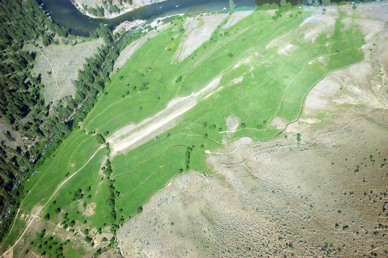
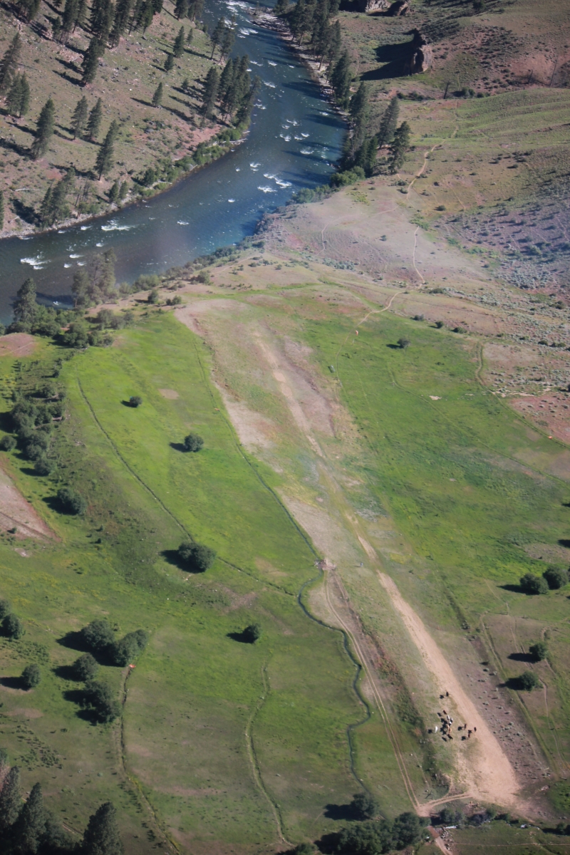
    Lower Loon Creek is located approximately 30 miles southwest of Challis, Idaho, sitting on a 5-acre parcel at an estimated elevation of 4,200 feet MSL. The airstrip sits on a plateau 50 to 75 feet above the river and is situated within a narrow, winding river canyon. It falls within Lemhi County and is currently operated by the Idaho Department of Fish and Game.

    Camping & Recreation
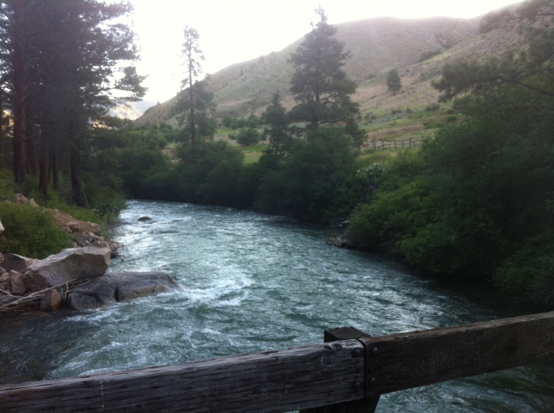
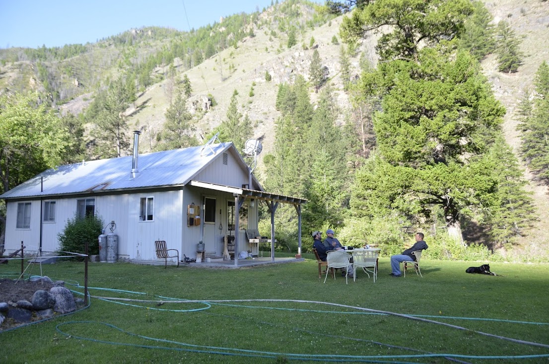
    The airstrip provides access to excellent hiking along both the Middle Fork of the Salmon River and up Loon Creek itself, with a hot springs reachable in about a twenty-minute walk up the Loon Creek trail. Camping is not permitted within the fenced runway area but is allowed nearby at the Big Loon Camp at the mouth of Loon Creek. The area sees a lively mix of visitors — rafter camps are located both a quarter mile south and a half mile north of the airstrip, and the hot springs tend to draw rafters around midday and into the evening, making it a great spot to socialize.

    Hotsprings - a rare attraction located about one mile south of the airstrip.  From the airstrip walk south toward the cabins and cross the bridge on Lower Loon Creek, and follow the trail for about a mile.  The pool is about 3'-4' deep and 10' by 20' wide.  The temp is approximately 120 degrees.

    Hiking - The main Middle Fork trail goes north about 25 miles to its confluence with Big Creek.  A nice hike with views all along the way is north to Hospital Bar, a hike of about 3 miles from the airstrip.  Hospital Bar is on the opposite side of the river and not accessible from the trail.  Another hike is south up Loon Creek to Benet pack bridge, a distance of about 2.5 miles from the airstrip or about 1.5 miles north of the hot tub (from the airstrip, follow the directions above under "hotsprings").  The views of Loon Creek canyon/gorge are fantastic.  The main Middle Fork trail goes south for many miles.  A nice hike with good views all along the way is south to the pack bridge crossing the Middle Fork, about 2 - 3 miles from the airstrip.  Although the Middle Fork trail continues on, a second trail heading south picks up at the bridge but on the other side of the river, paralleling the Middle Fork trail.  Either trial has great views heading south.

    Notes & Warnings
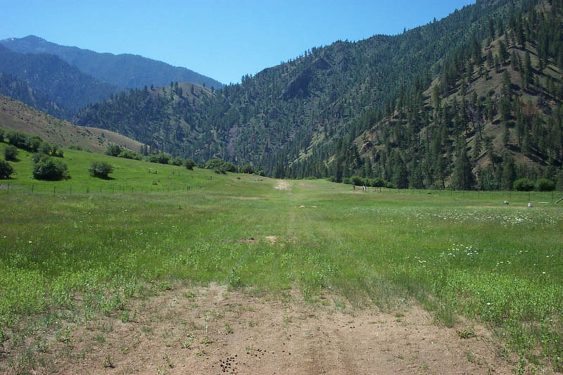
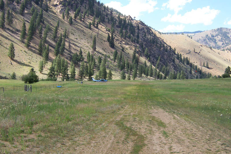
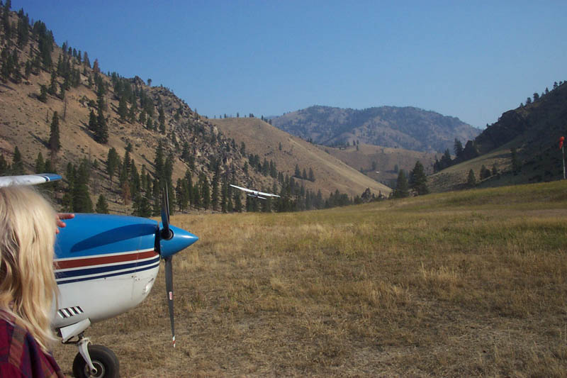
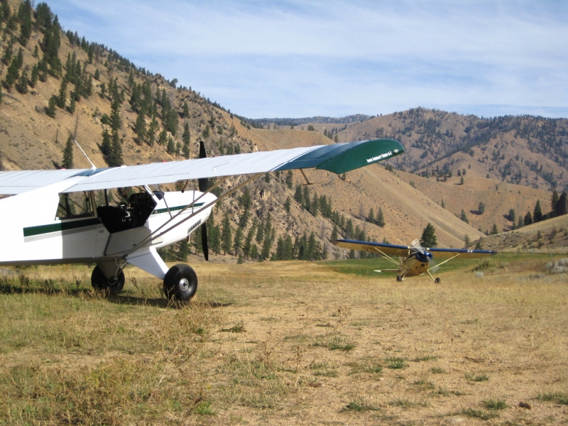
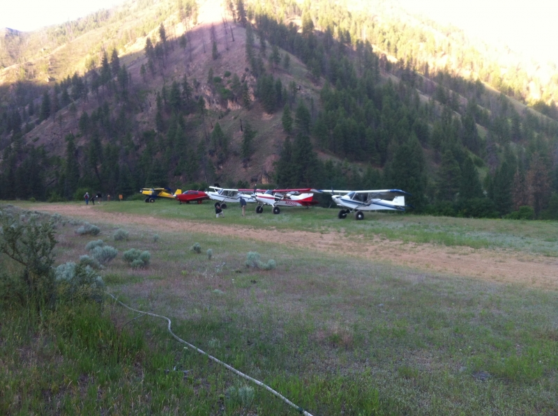
    Lower Loon is a short airstrip with a challenging approach that should only be attempted by skilled aviators when conditions are right. The runway is not marked, and pilots are advised to land on Runway 16 and depart on Runway 34 when wind conditions allow. There is no winter maintenance, and pilots should be alert for livestock, big game animals, and rodent activity adjacent to both sides of the runway. Commercial operators also use this strip to service river rafters during summer months, typically early in the morning, so extra vigilance for traffic is warranted.

    History
    Lower Loon Creek was formerly owned by J.R. Simplot — the prominent Idaho businessman and potato magnate — which is why it is also known as the Simplot Airstrip or Simplot Emergency Airfield. Ownership has since transferred to the Idaho Department of Fish and Game. Despite carrying a restricted "R" designation on FAA charts for many years, the strip has remained open to the public willing to tackle its short, technical runway, and the restricted designation is slated to be removed from future FAA charts. In 2018 the runway was resurfaced, and it continues to serve as an important access point for wilderness recreation in one of the most remote corners of Idaho.
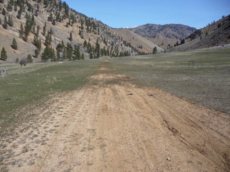


    Runway
    • Length

      1200

    • Width

      25

    • Surface

      TURF-DIRT

    Details
    • Facility ID

      C53

    • Elevation

      4200

    • CTAF

      122.9

    Gallery
    Location

    Lat: 44.80867119444 , Long: -114.80865988889 - IDAHO, USA

    Get Directions
    Flyover Video
    Prev 1 of 1 Next
    • Runway Flyover - Lower Loon, Idaho

      Runway Flyover - Lower Loon, Idaho

      @shortfieldvideos
    Prev 1 of 1 Next
    Categories
    • Recreational
    Tags
    • Mountains
    • Desert
    • Canyon
    • Hot Springs
    Region
    • Northwest Mountain
    Ownership
    • Public
    Author
    shortfield

    Land here, before you land out there!

    mood_bad
  • No reviews/PIREPs have been posted yet.

  • Add a review

    Leave a Reply · Cancel reply

    You must be logged in to post a comment.

    Shortfield Playlist
    Prev 1 of 1 Next
    • Cayuse Creek, ID

      Cayuse Creek, ID

    Prev 1 of 1 Next
    YouTube Search
    Prev 1 of 219 Next
    • Lower Loon Creek Idaho C53

      Lower Loon Creek Idaho C53

      Stopped in and had Coffee and Pastry at the Store. Horses were resting in the corral. Crossing Loon Creek Bridge to the Hot Springs Pool trail.
    • Lower Loon Airstrip

      Lower Loon Airstrip

      Lower Loon Airstrip Middle Fork Salmon River Idaho
      PPonk 182A Sportsman STOL Mini VG's
    • Lower Loon - U72 - Approach and Landing (Idaho backountry) HD

      Lower Loon - U72 - Approach and Landing (Idaho backountry) HD

      Landing at Lower Loon - U72 - airstrip in the Idaho backcountry with my Super Stinson 108-2.

      This is a one way in and one way out - no go around airstrip that is only 700ft long. Please proceed with caution and make sure the weather is on your side. Also, make sure your piloting skills are top notch, many planes crash at these strips every year.

      There is a very cool hot springs up the trail about a mile from the strip. If you have time, it's a must.

      Also, please support the IAF and the RAF, as they aid in keeping these beautiful places open to backcountry pilots.

      If you enjoy my clips, please let me know.
      Filmed with a Kodak Playsport
    • Upper Loon Airstrip Landing

      Upper Loon Airstrip Landing

      Landing at the Upper Loon backcountry airstrip in Idaho. From the wingtip camera.
    • Cutting it close at Lower Loon Creek- Idaho Backcountry

      Cutting it close at Lower Loon Creek- Idaho Backcountry

      Take off from Lower Loon Creek (C53) in the Idaho back country. Some bumps in the run way made it into a lot more of an ordeal than expected. Pushed me right to the threshold before I could get it stabilized to climb out.
      An honest debrief of the takeoff shows I made some mistakes coming off center line and correcting for it which undoubtedly cost some speed. Also a close eye on the airspeed (unreadable but I know the position of the needle as it pertains to my speed) shows I probably could have held it off instead of letting it settle back down at the end. If there was anything positive to review it was that I never felt the urge to panic and pull up I just kept waiting for the plane to give me the feedback that it was ready to fly.

      Citabria 7KCAB- IO-320

      Shot on GoPro Hero 3+ Black Edition

      Music
      Big Boi - "All Night"

      iTunes:
      https://itunes.apple.com/ca/album/all-night/1357747869?i=1357748625

      Google Play:
      https://play.google.com/store/music/album?id=Brtdgenlwky3r5axwzbv6wjurfe&tid=song-Tx3g5s4f6qgkxryjva7u4frqrgq
    • 2022 Idaho Backcountry Flying.  Many airstrips visited with tons of detailed info on each.

      2022 Idaho Backcountry Flying. Many airstrips visited with tons of detailed info on each.

      Idaho backcountry, truly an aviators paradise! Visited Johnson, Upper/Lower Loon, Thomas, Indian, Smiley, Krassel, Big Creek, Shearer, Fish, Moose, Cayuse. Five onboard cameras rolling to give you as much scenery as possible. Two GoPro Max 360 cameras allow for an "out of airplane" experience. This was a dream trip that we wanted to record for our own memory but hope we can entertain you to a degree as well...maybe even entice you to experience the same adventure yourself.
      A number of similar adventures on my channel, Rick Hiebert. Subscribe if you want to see more.
      Best viewed in 1080HD.

      Time stamps:
      01:57 Cowley WY (first night)
      02:59 Smiley Creek
      03:39 Johnson Creek (landing runway 35)
      07:46 Upper Loon Creek
      10:25 Lower Loon Creek
      12:22 Mahoney Creek
      12:43 Thomas Creek
      15:49 Indian Creek
      17:27 Johnson Creek
      20:08 Reed Ranch
      21:09 Krassel
      24:43 Big Creek
      27:22 Johnson Creek
      29:38 McCall (for fuel)
      30:32 Shearer
      33:02 Moose Creek
      35:07 Fish Lake
      36:26 Cayuse Creek
      38:14 Benchmark MT
      39:56 Chinese Wall, MT
      42:52 Gibson Reservoir & Dam
      44:53 Choteau MT (for fuel)
    Prev 1 of 219 Next

    You May Also Be Interested In

    MAHONEY CREEK USFS, ID

    A remote USFS bluff-top strip perched above one of Idaho's most spectacular wilderness river corridors, offering backcountry pilots a taste of the Frank Church without the most extreme technical demands.
    • 44.74458333333, -114.92138888889
    • Recreational

    Cougar Ranch, ID

    • 44.741142960523, -114.91922884025
    • Recreational

    Falconberry, ID

    Falconberry is closed and is included for historic and emergency purposes only.   The condition is entirely…
    • 44.6985, -114.7664
    • Abandoned

    © 2000-2025 shortfield.com

    Cart

      • Featured
      • Recreational
      • Restricted
      • Off-Airport
      • Abandoned
      • Outpost
      • Facebook
      • Twitter
      • Mail
      • Copy link