Sign in or Register
    • Featured
    • Recreational
    • Restricted
    • Off-Airport
    • Abandoned
    • Outpost
    • Home
    • Explore
    • STOL Gear

    Devils Hole, ID

    • Overview
    • Reviews / PIREPs 0
    • Videos
    • Events
    • prev
    • next
    • Leave a Review / PIREP
    • Bookmark
    • Report
    • Share
    • prev
    • next
    Description

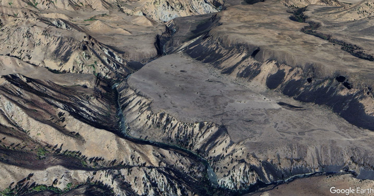
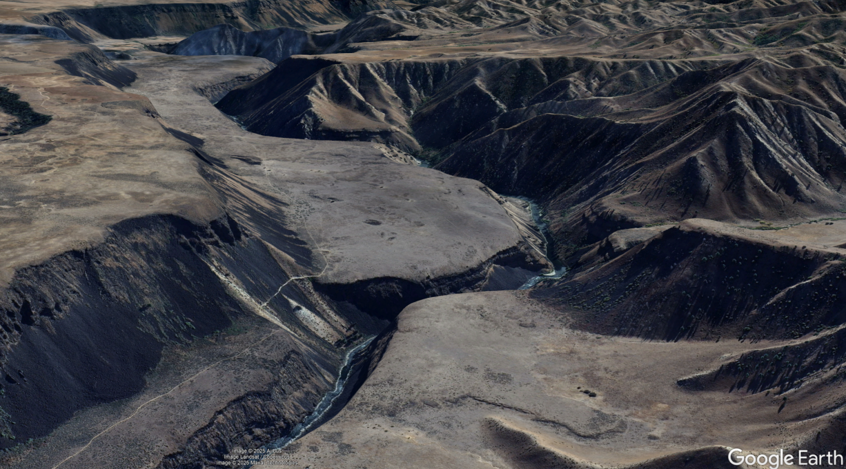
    This landing site appears to be an old abandoned airstrip and the original name is currently unknown.  For now we will call it Devils Hole which is the name of the creek located across the river to the south.

    It is located on a plateau high above the South Fork of the Boise river, approximately 6.5 miles southwest of the Smith Prairie airstrip.

    If you have additional information about this location, please post a PIREP/Review.


    Details
    • CTAF

      122.9

    • State

      Idaho

    Gallery
    Location

    43.48317388413451, -115.67768997133854

    Get Directions
    Flyover Video
    Prev 1 of 1 Next
    • Runway Flyover - Devils Hole, Idaho

      Runway Flyover - Devils Hole, Idaho

      @shortfieldvideos
    Prev 1 of 1 Next
    Categories
    • Off-Airport
    Tags
    • Camping
    • Canyon
    • Fishing
    • Lakes/Rivers
    Region
    • Northwest Mountain
    Ownership
    • Public
    Author
    shortfield

    Land here, before you land out there!

    mood_bad
  • No reviews/PIREPs have been posted yet.

  • Add a review

    Leave a Reply · Cancel reply

    You must be logged in to post a comment.

    Shortfield Playlist
    Prev 1 of 1 Next
    • Every backcountry pilot will want to know about this!

      Every backcountry pilot will want to know about this!

      Just when I thought I have seen it all, I discovered one of the most scenic places to land in Southern Idaho. It was right in my own back yard but I didn't know about it until now and it's now one of my favorite spots. This strip needs further investigating because it has some history to it. Let's go! DISCLAIMER: THIS VIDEO IS INTENDED ONLY FOR ENTERTAINMENT NOT FOR INSTRUCTIONAL PURPOSES.

      Coordinates: 43°28'52.4"N 115°40'41.2"W

      Google Earth Link to the Strip:
      https://na01.safelinks.protection.outlook.com/?url=https%3A%2F%2Fearth.google.com%2Fweb%2Fsearch%2FArrowrock%2BReservoir%2C%2BIdaho%2F%4043.48124157%2C-115.67577647%2C1165.8094083a%2C3536.09804858d%2C35y%2C0.00031397h%2C0t%2C0r%2Fdata%3DCiwiJgokCYtjt4vUvkVAETwnYRZQvEVAGfBeutSC6lzAIaRBmJ0h7FzAQgIIATIpCicKJQohMXhGQWNXUi1WU0tKZmxnQS05ZnJ3RG1pbjJ1ZUdhSnBDIAE6AwoBMEICCABKCAjy8NPIBhAB&data=05%7C02%7C%7C4873022ce65245423d4f08de41df5e8b%7C84df9e7fe9f640afb435aaaaaaaaaaaa%7C1%7C0%7C639020624780976690%7CUnknown%7CTWFpbGZsb3d8eyJFbXB0eU1hcGkiOnRydWUsIlYiOiIwLjAuMDAwMCIsIlAiOiJXaW4zMiIsIkFOIjoiTWFpbCIsIldUIjoyfQ%3D%3D%7C0%7C%7C%7C&sdata=d6hNMVGfRW1h8FbrBqjRwE66KMW%2BgJAY9z%2FoeM1YgWo%3D&reserved=0


      #aviation #flying #stol #backcountryflying #kitfox #cubcrafters
    Prev 1 of 1 Next

    You May Also Be Interested In

    PINE, ID

    A scenic, state-owned lakeside strip tucked into the Boise National Forest foothills, where the runway meets the reservoir's edge.
    • 43.46625, -115.31002777778
    • Recreational

    IDAHO CITY USFS, ID

    A rustic Forest Service gravel strip at the edge of a historic gold-rush ghost town in the Boise Basin.
    • 43.823885, -115.844398
    • Recreational

    WEATHERBY USFS, ID

    Located on the Middle Forek of the Boise River, nine miles downstream from Atlanta, Idaho (55H).No formal…
    • 43.82513888889, -115.33136111111
    • Recreational

    © 2000-2025 shortfield.com

    Cart

      • Featured
      • Recreational
      • Restricted
      • Off-Airport
      • Abandoned
      • Outpost
      • Facebook
      • Twitter
      • Mail
      • Copy link