Sign in or Register
    • Featured
    • Recreational
    • Restricted
    • Off-Airport
    • Abandoned
    • Outpost
    • Home
    • Explore
    • STOL Gear

    Johanson Lake, BC - Canada

    High-elevation wilderness airstrip in the rugged backcountry of northern British Columbia, now closed.

    • Overview
    • Reviews / PIREPs 0
    • Videos
    • Events
    • prev
    • next
    • Leave a Review / PIREP
    • Bookmark
    • Report
    • Share
    • prev
    • next
    Description

    Location Overview
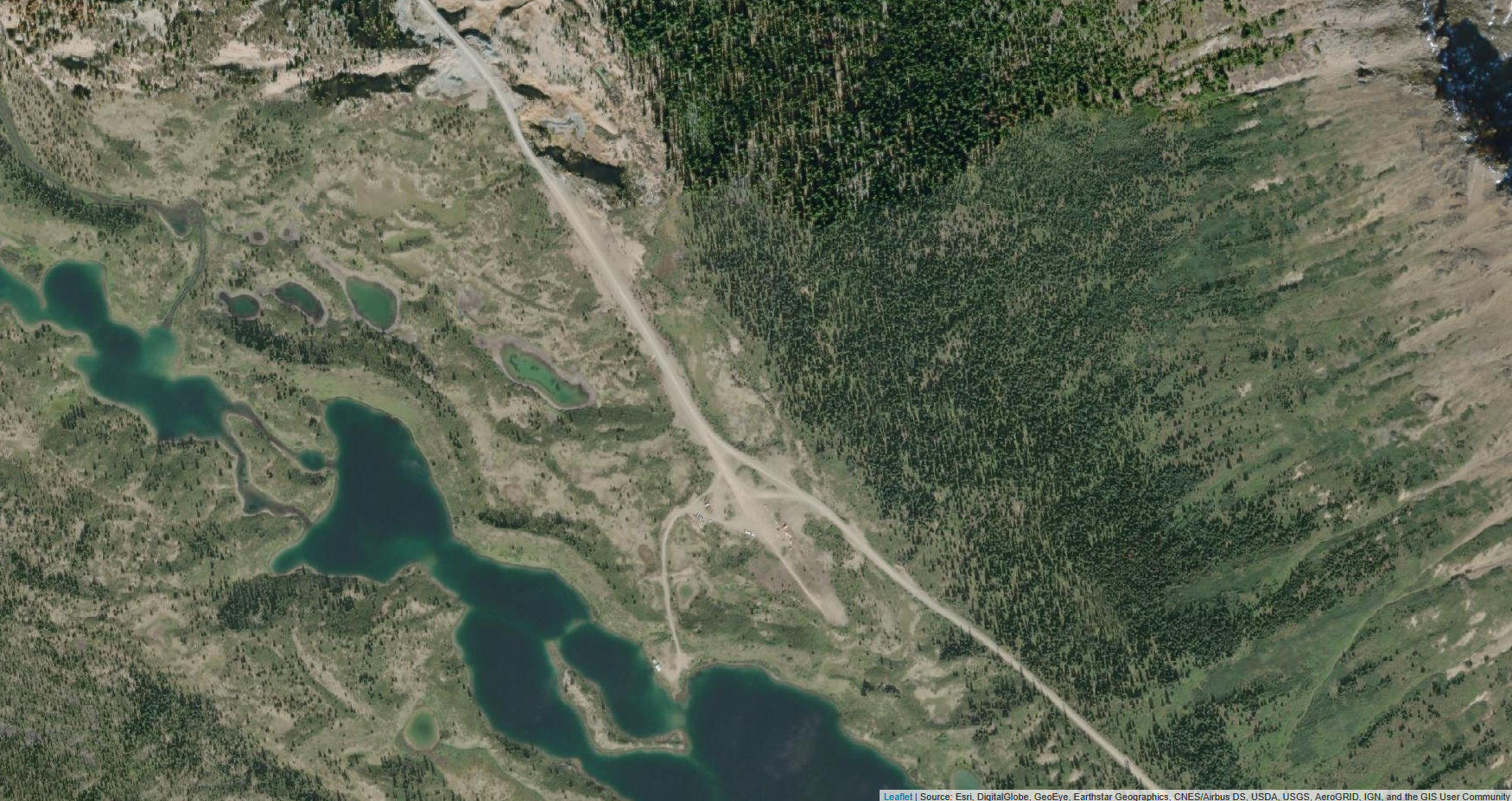
    Johanson Lake Airport sits at approximately 4,747 feet (1,447 m) elevation in the deep wilderness of northern British Columbia, near the small community of Fort Ware (Kwadacha) and the Finlay River country. The nearest significant service hub is Smithers, roughly 130 miles to the south. The surrounding landscape is classic northern BC boreal wilderness β€” dense forest, mountain terrain, and near-total isolation. The closest comparable airports are the Fort Ware Airport and Kemess Creek Airport, both small and remote themselves.

    Camping & Recreation
    No developed camping or recreational facilities are associated with the airstrip itself, given its defunct status. The broader region offers exceptional wilderness experiences β€” backcountry fishing, hunting, and wildlife viewing in the Finlay River watershed. The nearby Kwadacha Wilderness Provincial Park provides outstanding remote access for those equipped for self-sufficient backcountry travel. Any visit to this area requires thorough planning and full self-sufficiency.

    Notes & Warnings
    This airstrip is officially listed as closed/defunct and should not be treated as an active destination without thorough current reconnaissance. The high elevation (~4,747 ft MSL) demands careful density altitude calculations, particularly in warm months. The remote location means no fuel, no services, no communication infrastructure, and no rescue support. Weather in the northern BC mountains can change rapidly, and the terrain surrounding the strip offers limited options in the event of a go-around or emergency. Pilots should not attempt this strip without up-to-date condition reports from local contacts and a conservative safety margin.

    History
    Johanson Lake Airport was one of many small bush strips developed across northern BC to support resource industries, remote outfitting operations, and Indigenous community access in an era when aviation was often the only practical means of reaching these isolated areas. The Finlay River region it serves was historically significant as part of the vast territory of the Kwadacha (Fort Ware) First Nation and saw activity related to fur trading, prospecting, and forestry over the decades. The airstrip has since fallen out of regular use, earning its defunct classification, likely as the economics of supporting such a remote facility became difficult to justify without consistent demand. It remains a footnote in the broader story of bush aviation that opened up Canada's northern interior throughout the 20th century.

    Details
    • Facility ID

      CA-0175

    • CTAF

      122.9

    Gallery
    Location

    Lat: 56.602015, Long: -126.191964 - British Columbia - Canada

    Get Directions
    Categories
    • Abandoned
    Tags
    • Mountains
    • Trees
    • Lakes/Rivers
    Region
    • British Columbia (CA)
    Author
    shortfield

    Land here, before you land out there!

    mood_bad
  • No reviews/PIREPs have been posted yet.

  • Add a review

    Leave a Reply · Cancel reply

    You must be logged in to post a comment.

    YouTube Search
    Prev 1 of 2 Next
    • Coldest Graduation Walk EVER 😳πŸ”₯

      Coldest Graduation Walk EVER 😳πŸ”₯

      She remembered who was there for her… and who wasn’t πŸ‘πŸŽ“ Watch her walk past every teacher that didn’t support her, and show love only to the ones who did.

      πŸŽ₯ Credit: @urmomssidehoe.9 on TT
      #graduation #reels #viralvideo #respect #realones #schooldrama #shorts #fyp #viralshorts
    • Bushflying in Sweden

      Bushflying in Sweden

      Bush Flying and photographing with a 1965 Piper Super Cub. Video produced in Western Jamtland, Sweden, by photograper Tomas Johasson. See photos taken from the plane on www.LaponiaPictures.com
    • Sandspit, BC Canada

      Sandspit, BC Canada

    • missed approach at YMT

      missed approach at YMT

      flying a B1900 from Calgary to Masset,BC, on the Queen Charolette Island and ending up in Sandspit
    • Blue Sky Day Anglemont BC February 2011.wmv

      Blue Sky Day Anglemont BC February 2011.wmv

      Sledding in February
    • VFR BC Mountain Run

      VFR BC Mountain Run

      VFR Mountain Flight from Fort Ware to Kemess Creek, BC.
    Prev 1 of 2 Next

    You May Also Be Interested In

    Moose Valley, BC - Canada

    A defunct airstrip in the heart of northern BC's Omineca region - some of Canada's most untamed backcountry.
    • 56.730374, -126.659001
    • Abandoned

    Kemess Creek, BC - Canada

    • 56.97444400000, -126.74083300000
    • Recreational

    Swannel, BC - Canada

    • 56.72320299757, -125.11830520628
    • Recreational

    Β© 2000-2025 shortfield.com

    Cart

      • Featured
      • Recreational
      • Restricted
      • Off-Airport
      • Abandoned
      • Outpost
      • Facebook
      • Twitter
      • Mail
      • Copy link