Description
This is what the Oregon Department of Aviation has to say about Wakonda Beach State:
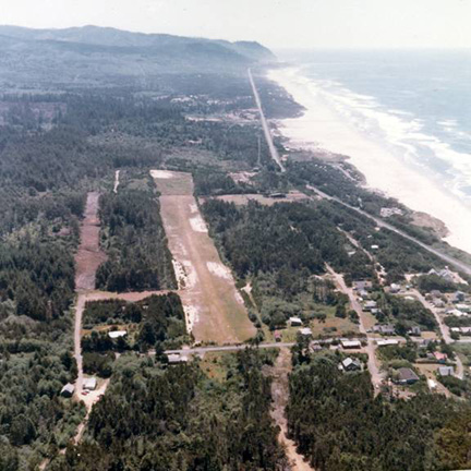
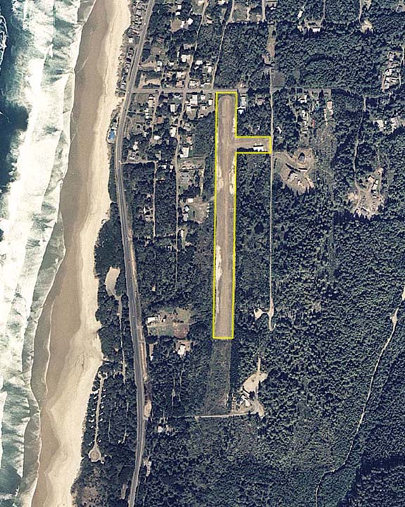
Wakonda Beach State Airport is an emergency/recreational airport, located on the east side of Highway 101 about 2 miles south of Waldport. It is less than a 1/4 mile walk to the beach, and Beachside State Park is just west of the highway across from the south end of the runway.
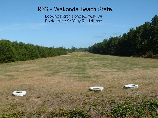
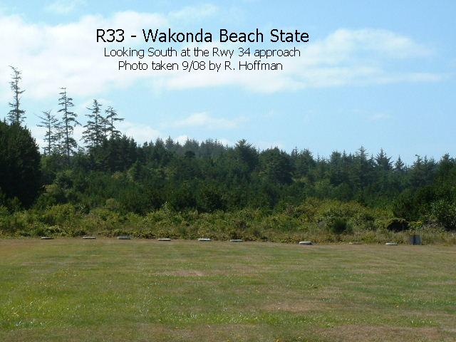
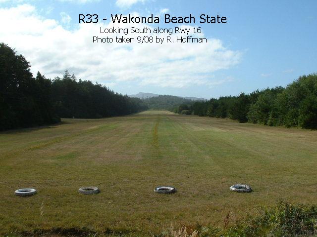
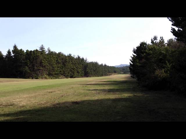
The runway is a 2000' X 50' turf strip. It can get soft in the winter after extensive rains, but it is normally in good condition and therefore usable year-round. Some wind erosion has occurred along the shoulders. These areas are obvious and while not abrupt or deep, they would be quite a dip if taken at any speed. There is a line of 60'-75' tall trees down the east side of the runway that are only 75' from the centerline. The west side is brushy, and more open, but low level turbulence should always be expected under cross wind conditions. There have been reports of a down draft off the north end under strong north wind conditions. Take offs to the north should be done with caution.
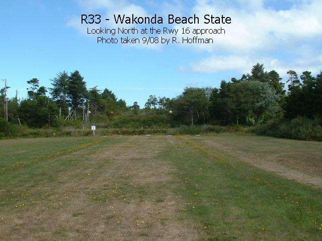
The main problem here is that both approaches have significant obstructions. The north end is the most challenging. We recently removed the tallest trees and powerlines on the north end, but there is still a road across the end, a lower telephone line and some lower trees. We recommend that when conditions permit, landings be made to the north and takeoffs be made to the south. This is not as critical now as it once was, however.
The terrain to the south rises slowly for over 1000'. There are also a few tall trees on the east side of the extended centerline of Runway 34. A slightly curved approach from the west helps to avoid the obstructions on this end.
Fly-in camping is allowed on the airport. There are no formal facilities established, but there is room to camp in the tiedown area. There is a chemical toilet near the hangar, and water is available near the parking area. We simply ask that airport users pick up their camp site and leave it in good condition. Also, we request that - here and at other State Airports - users sign in at the sign-in box. This helps us identify the level of use at these airports. Your comments and suggestions are always appreciated.
Runway
-
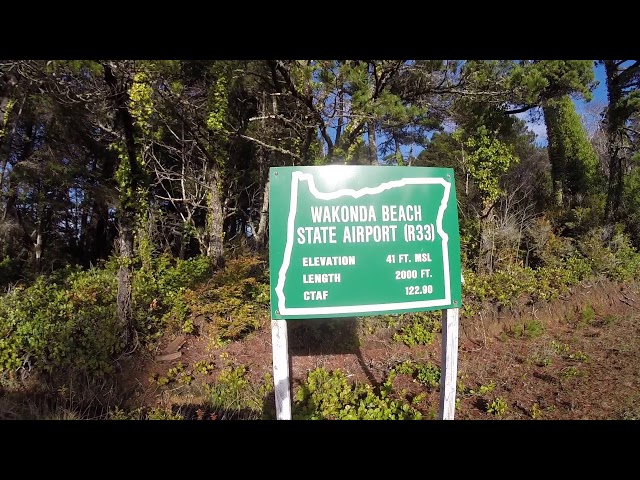
Length
2000
-
Width
30
-
Surface
TURF-F
Details
-
Facility ID
R33
-
Elevation
41
-
CTAF
122.9
-
State
OR
Gallery
Location
Lat: 44.38456388889 , Long: -124.08511944444 - OREGON, USA


Add a review