Sign in or Register
    • Featured
    • Recreational
    • Restricted
    • Off-Airport
    • Abandoned
    • Outpost
    • Home
    • Explore
    • Shop

    UPPER LOON CREEK USFS, ID

    • Overview
    • Reviews / PIREPs 0
    • Events
    • Videos
    • prev
    • next
    • Bookmark
    • Share
    • Leave a Review / PIREP
    • Report
    • prev
    • next
    Description

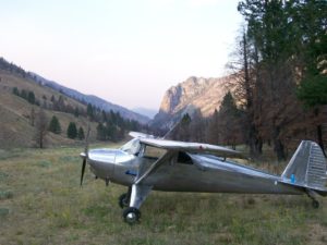
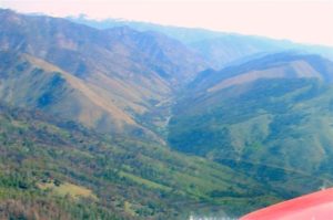
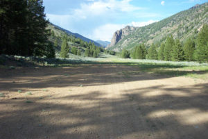
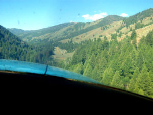
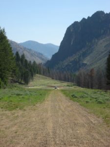
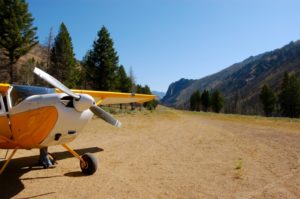
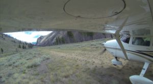
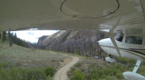
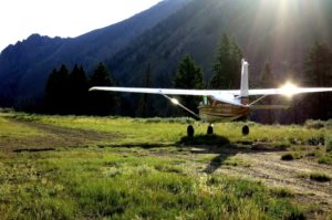
    There is a small hill and some trees to be cleared when departing runway 4.  Once past the hill and trees, continue down Loon Creek for descending terrain.  Density altitude, aircraft weight, and wind are factors to consider.  It is best to use this airstrip in the mornings or late afternoons when the air tends to be cool and calm.  

    The Diamond D Ranch is located 3 miles upstream and is pilot friendly. Guided fly-fishing, trail rides, guided hikes, outstanding food, and swimming in the pool & hot tub are just a few of things the Diamond D has to offer. E-mail first to ensure lodging is available. If you are looking to be picked up at Upper Loon to go to the ranch, circle the ranch before landing if you didn't arrange the pick up in advance. 

    Hikes
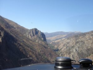
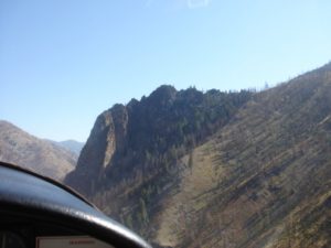
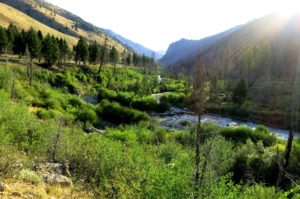
    There is a nice (but long) day hike from the Upper Loon airstrip to some hot springs down Loon Creek, about 7 miles one way.  From the airstrip, take the dirt road for about 1.5 miles northeast (off runway 4) past the Tin Cup camp ground to the Phillips Transfer camp (for horses).  The dirt road ends at the Phillips Transfer camp and the wilderness trail system begins.  Follow the trail down Loon creek past the huge rock monolith to some nice views of the Loon Creek canyon/gorge.  The hot springs are about 5.5 miles from the Phillips Transfer camp.  Rocks have been placed around the hot springs to form small, shallow pools to sit in and soak. 

    Runway
    • Length

      2500

    • Width

      75

    • Surface

      TURF-DIRT-F

    Details
    • Facility ID

      U72

    • Elevation

      5500

    • CTAF

      122.9

    • State

      ID

    Gallery
    Location

    Lat: 44.59157805556 , Long: -114.82314333333 - IDAHO, USA

    Get Directions
    Categories
    • Recreational
    Tags
    • Mountains
    • Canyon
    Region
    • Northwest Mountain
    Ownership
    • Public
    Author
    shortfield
    mood_bad
  • No comments yet.
  • Add a review

    Leave a Reply · Cancel reply

    You must be logged in to post a comment.

    Related Videos
    Prev 1 of 23 Next
    • Upper Loon Airstrip (U72)

      Upper Loon Airstrip (U72)

      Landing at Upper Loon to visit the Diamond D Ranch. Arrival from Stanley.
    • Landing and Fishing Chamberlain Guard Station

      Landing and Fishing Chamberlain Guard Station

      Landing and Fishing the Chamberlain Creek area of the Salmon River Wilderness in Idaho. Also landings and take offs at Upper Loon Creek, Landmark and Donnelly. Fly overs of Thomas Creek, Mahoney Creek, Indian Creek and Johnson Creek 2015
    • Upper Loon Creek

      Upper Loon Creek

      Heidi landing Bellanca Scout at Upper Loon Creek USFS airstrip July 2017
    • Flying and Camping in the Idaho Backcountry - Sept. 2019

      Flying and Camping in the Idaho Backcountry - Sept. 2019

      Another aviation camping trip to the Idaho backcountry. Four airplanes made the trip from New Mexico and base camped at Johnson Creek. Daily adventures to Big Creek, Sulphur Creek, Upper Loon, Cold Meadows, and Chamberlain Basin airstrips.
    • Idaho Backcountry Air Strips

      Idaho Backcountry Air Strips

      U72 Upper Loon - 0U3 Mahony Creek - C53 Lower Loon - U54 Bernard - MYL Mccall
      Backcountry mountain & Canyon training on 10/12/18
    • Upper Loon, ID (U72)

      Upper Loon, ID (U72)

      Landing at Upper Loon (U72) in the Frank Church River of No Return Wilderness area and home of the Diamond D Ranch.
    • Bruce Meadows Landing

      Bruce Meadows Landing

      high altitude Idaho mountain airstrip
      #Idahomountainflying
    • Landing Cougar Ranch Idaho

      Landing Cougar Ranch Idaho

      Landing and taking off at Cougar Ranch, a new strip on the Middle Fork of the Salmon River in Idaho.
    • Les's Idaho Landings

      Les's Idaho Landings

      July 2010: Flights in L-19 into remote airstrips in Western Idaho
    • flying into big creek idaho U60 p720

      flying into big creek idaho U60 p720

      Flight into Big Creek airstrip Idaho U60. The elevation is 5,700ft and the runway is long at 3,500ft surrounded by 9,000ft+ mountains. The ski jump runway and close in mountain slopes look to be a challenge but is not that tough. On take off one is literally launched into the air and out into the valley high above Big Creek The location is very isolated and beautiful spot for a fly in camping trip. The impressive new lodge should be open later this year. We will be back for a longer stay.
    • Lower Loon - U72 - Approach and Landing (Idaho backountry) HD

      Lower Loon - U72 - Approach and Landing (Idaho backountry) HD

      Landing at Lower Loon - U72 - airstrip in the Idaho backcountry with my Super Stinson 108-2.

      This is a one way in and one way out - no go around airstrip that is only 700ft long. Please proceed with caution and make sure the weather is on your side. Also, make sure your piloting skills are top notch, many planes crash at these strips every year.

      There is a very cool hot springs up the trail about a mile from the strip. If you have time, it's a must.

      Also, please support the IAF and the RAF, as they aid in keeping these beautiful places open to backcountry pilots.

      If you enjoy my clips, please let me know.
      Filmed with a Kodak Playsport
    • Chasing Fugly Around  Upper Loon Creek

      Chasing Fugly Around Upper Loon Creek

      Me and a buddy fly into Upper Loon Creek and then back home again.
    Prev 1 of 23 Next

    You May Also Be Interested In

    FALCONBERRY, ID

    Falconberry is currently closed and is included for historic and emergency purposes only.   The condition is…
    • 44.6985, -114.7664
    • Abandoned

    TRIPLE CREEK RANCH, ID

    This airstrip is included for historic/emergency purposes only.  The airstrip condition and legality of…
    • 44.655589, -114.643965
    • Restricted

    MAHONEY CREEK USFS, ID

    great
    • 44.74458333333, -114.92138888889
    • Recreational

    © 2000-2021 shortfield.com

    Cart

      • Featured
      • Recreational
      • Restricted
      • Off-Airport
      • Abandoned
      • Outpost
      • Facebook
      • Twitter
      • WhatsApp
      • Telegram
      • LinkedIn
      • Tumblr
      • VKontakte
      • Mail
      • Copy link