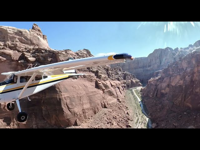
Sign in or Register
    • Featured
    • Recreational
    • Restricted
    • Off-Airport
    • Abandoned
    • Outpost
    • Home
    • Explore
    • Shop

    RANGE CREEK, UT

    • Overview
    • Reviews / PIREPs 0
    • Events
    • Videos
    • prev
    • next
    • Bookmark
    • Share
    • Leave a Review / PIREP
    • Report
    • prev
    • next
    Runway
    • Length

      1584

    • Width

      30

    • Surface

      DIRT/GRASS

    Details
    • Facility ID

      No ID 107

    • Elevation

      5018

    • CTAF

      122.9

    • State

      UT

    Location

    Lat: 39.35731506348 , Long: -110.12854766846 - UTAH, USA

    Get Directions
    Categories
    • Recreational
    Region
    • Northwest Mountain
    Ownership
    • Public
    Author
    shortfield
    mood_bad
  • No comments yet.
  • Add a review

    Leave a Reply · Cancel reply

    You must be logged in to post a comment.

    Related Videos
    Prev 1 of 25 Next
    • Johnson Creek Fly-in 2011

      Johnson Creek Fly-in 2011

      The backcountrypilot.org website annual fly-in at Johnson Creek airport in Idaho.
    • 2015 C.U.B. (Colorado Utah Backcountry) FlyOut

      2015 C.U.B. (Colorado Utah Backcountry) FlyOut

      As a customer appreciation event and adventure, SunCountry Cubs invited Carbon Cub owners to join in on a Colorado and Utah backcountry adventure for a week! The aspens were turning color and the scenery was gorgeous. Fun was had by all!
    • Flying and Camping in the Idaho Backcountry - Sept. 2019

      Flying and Camping in the Idaho Backcountry - Sept. 2019

      Another aviation camping trip to the Idaho backcountry. Four airplanes made the trip from New Mexico and base camped at Johnson Creek. Daily adventures to Big Creek, Sulphur Creek, Upper Loon, Cold Meadows, and Chamberlain Basin airstrips.
    • Flying the remote Mountains and BACKCOUNTRY of Idaho | Montana | Oregon - 4K

      Flying the remote Mountains and BACKCOUNTRY of Idaho | Montana | Oregon - 4K

      #IdahoBackcountry #FlyingIdaho #RANSaircraft
      Come along for an adventure in the backcountry!
      Moose Creek, Fish lake, Vines strip, Warren, Reed ranch, Johnson Creek, Red's horse ranch and the Minam River Lodge, Memaloose, Hell's Canyon, Big bar and Dug Bar, and scenes from all over Idaho, Northwestern Oregon, and the mountains south of Missoula.

      New logo built by a friend of mine - you can contact him through Twitter @ReelFearless
    • Roadtrip Vlog: Exploring the Tavaputs Ranch in Utah

      Roadtrip Vlog: Exploring the Tavaputs Ranch in Utah

      Take a quick tour of the Tavaputs Ranch with AutoWranglers. This incredible place has been around since 1887 as a sustainable cattle ranching operation in gorgeous eastern Utah. Join our Director of Client Relations John Hollingsworth and his archaeologist wife Jamie as they explore the Fremont Indian Ruins in Range Creek Canyon to check out some ancient Petroglyphs and take in a gorgeous sunset over Desolation Canyon from the 9000 foot elevation.

      There is nothing like getting away from the daily grind and taking a fun road trip. If you are planning on getting some new wheels for your own road trip adventure and need to sell an old car, ATV, RV or even your boat, be sure to check out our website at https://www.autowranglers.com to get an offer in seconds. You can also give our amazing team a call at 1-833-TOW-CASH or even text "OFFER" to 797979.

      At Auto Wranglers, our mission is to provide customers with the simplest and fairest process for selling their car with our game-changing process and team. We specialize in buying all types of cars and our offers are based on tons of data. We will provide you with a top dollar payout and the best part….no haggling required! Did we mention that we also pick up the car for free and pay you on the spot? It doesn’t get any easier than that!

      Our Instagram: https://www.instagram.com/autowranglers/
      Our Facebook: https://www.facebook.com/AutoWranglers
      Our Twitter: https://twitter.com/AutoWranglers_

      #CarSales #HowTo #SellYourCar #howtosellmycar #sellingcar #Cars #roadtrip #adventure #journey #trip
    • Hole in the Rock - Nokai Dome Road

      Hole in the Rock - Nokai Dome Road

      Riding the washout bypass along Nokai Dome Road to the Hole in the Rock Trail.
    • Idaho Backcountry Indian Creek Airport

      Idaho Backcountry Indian Creek Airport

      Indian Creek Idaho Backcountry Flying Cessna185
    • Utah Backcountry Flying 2017 Landing Poison Spings

      Utah Backcountry Flying 2017 Landing Poison Spings

    • Utah Backcountry Flying - Piute Canyon

      Utah Backcountry Flying - Piute Canyon

      Piute Canyon looked like it hadn't seen a visitor for awhile. From the air the runways were recognizable, but once on the ground it was pretty difficult to see where it was. It would have been a little less rough had our tire pressure not creeped up in the mid morning heat. At the midpoint of the runway was some stacked wood and other building materials. Would be a great place to camp.
    • Utah Backcountry Flying - Horseshoe Canyon

      Utah Backcountry Flying - Horseshoe Canyon

      Well used, smooth and long. Almost an international airport.
    • Backcountry Canyon Flying

      Backcountry Canyon Flying

      Owyhee canyonlands and Idaho Backcountry
    • La Garita Creek Ranch Airstrip, Colorado (Cessna 180 Style)

      La Garita Creek Ranch Airstrip, Colorado (Cessna 180 Style)

      A new backcountry airstrip located in the heart of Colorado. Please visit flycolorado.org for all the details. Private airstrip and prior permission required. Mountain experience a must. An amazing place and we are very fortunate to be able to enjoy it.

      http://www.flycolorado.org/index.php/airstrip-database/private-airports/la-garita-creek/
    Prev 1 of 25 Next

    You May Also Be Interested In

    TAVAPUTS RANCH, UT

    • 39.50051700000, -110.18201700000
    • Restricted

    SAGE BRUSH FLAT, UT

    • 39.74089813232, -110.11046600342
    • Recreational

    CEDAR MOUNTAIN, UT

    Well maintained airstrip to allow convenient access to nearby radio towers and repeaters. Land uphill to the…
    • 39.19096755981, -110.60563659668
    • Recreational

    © 2000-2021 shortfield.com

    Cart

      • Featured
      • Recreational
      • Restricted
      • Off-Airport
      • Abandoned
      • Outpost
      • Facebook
      • Twitter
      • WhatsApp
      • Telegram
      • LinkedIn
      • Tumblr
      • VKontakte
      • Mail
      • Copy link