Sign in or Register
    • Featured
    • Recreational
    • Restricted
    • Off-Airport
    • Abandoned
    • Outpost
    • Home
    • Explore
    • Shop

    PISTOL CREEK, ID

    • Overview
    • Reviews / PIREPs 0
    • Events
    • Videos
    • prev
    • next
    • Bookmark
    • Share
    • Leave a Review / PIREP
    • Report
    • prev
    • next
    Description

    This is a private airstrip.  Do not land without prior permission.

    The following information is from http://www.eaa103.org/member_stories/pistol_creek.html 

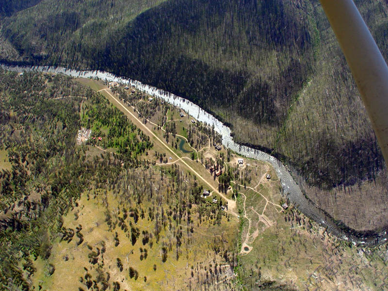
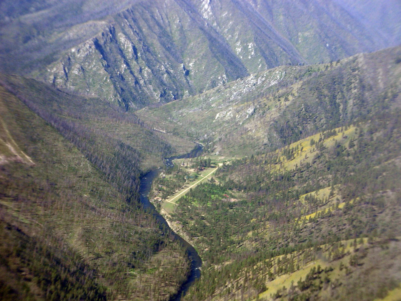
    "The Pistol Creek Runway is part of the Middlefork Ranch Inc.’s 220 Acres (ex homestead).  The Pistol Creek airstrip has one end (landing end) near the bank of the Middlefork of the Salmon River. The runway is about 2500 feet long at about 4800-4900 ft altitude, with the highest end up-river.  The river at the start of the runway is flowing just about magnetically north and the runway heading at the river (landing end) is about 215 degree magnetic.  The runway heads away from the river at about a 20 degree angle and goes slightly uphill—it is about 50 feet higher at one end than the other.  So the process of approaching the landing makes the heading almost magnetically south over the river and one is flying up river. "


    Runway
    • Length

      2500

    • Width

      ?

    • Surface

      DIRT

    Details
    • Facility ID

      No ID 026

    • Elevation

      4850

    • CTAF

      122.9

    • State

      ID

    Gallery
    Location

    Lat: 44.73500000000 , Long: -115.14500000000 - IDAHO, USA

    Get Directions
    Categories
    • Restricted
    Region
    • Northwest Mountain
    Ownership
    • Private
    Author
    shortfield
    mood_bad
  • No comments yet.
  • Add a review

    Leave a Reply · Cancel reply

    You must be logged in to post a comment.

    YouTube Search
    Prev 1 of 800 Next
    • 2019 Idaho Backcountry Landing (Pistol Creek)

      2019 Idaho Backcountry Landing (Pistol Creek)

      Landing at (Private) Pistol Creek Airstrip / Middle Fork of Salmon River. Cessna T206

      About: Conditions were pretty good this day - very light wind in the canyon, but warm and fairly bumpy - which is somewhat evident in the filming. Also, some pretty big bugs hit the windscreen prior to landing, and re-focused the lens on those bugs... so out the front is not as crisp as it otherwise could be. Still - a good example of a backcountry landing.
    • Approach and Landing to Pistol Creek Idaho

      Approach and Landing to Pistol Creek Idaho

      Landing a Piper Apache in the Idaho Backcountry. Airstrip is Pistol Creek Idaho.
    • Approach and Landing Pistol Creek Ranch Middl Fork of the Salmon River

      Approach and Landing Pistol Creek Ranch Middl Fork of the Salmon River

      Approach and Landing Pistol Creek Ranch Idaho
      Dirt runway. Middle Fork Salmon River
      Idaho Back Country Fly Fishing Trip
    • Pistol Creek Landing

      Pistol Creek Landing

      landing at Pistol Cr. airstrip, April 2011
    • Landing Thomas Creek, ID

      Landing Thomas Creek, ID

    • Mahoney Creek Airstrip Idaho

      Mahoney Creek Airstrip Idaho

    Prev 1 of 800 Next

    You May Also Be Interested In

    INDIAN CREEK USFS, ID

    Located on the Middle Fork of the Salmon River and is a busy place.  Charter operations haul in gear and…
    • 44.76113888889, -115.10736111111
    • Recreational

    THOMAS CREEK, ID

    Thomas Creek is a state owned airstrip located in the Frank Church River of No Return Wilderness, between…
    • 44.72330555556, -115.00397222222
    • Recreational

    Marble Creek, ID

    A short airstrip located on the banks of Marble Creek, a tributary to the Middle Fork of the Salmon River.
    • 44.773472, -114.985278
    • Recreational

    © 2000-2021 shortfield.com

    Cart

      • Featured
      • Recreational
      • Restricted
      • Off-Airport
      • Abandoned
      • Outpost
      • Facebook
      • Twitter
      • WhatsApp
      • Telegram
      • LinkedIn
      • Tumblr
      • VKontakte
      • Mail
      • Copy link