Sign in or Register
    • Featured
    • Recreational
    • Restricted
    • Off-Airport
    • Abandoned
    • Outpost
    • Home
    • Explore
    • Shop

    Panamint Springs, CA

    • Overview
    • Reviews / PIREPs 0
    • Events
    • Videos
    • prev
    • next
    • Website
    • Bookmark
    • Share
    • Leave a Review / PIREP
    • Report
    • prev
    • next
    Description

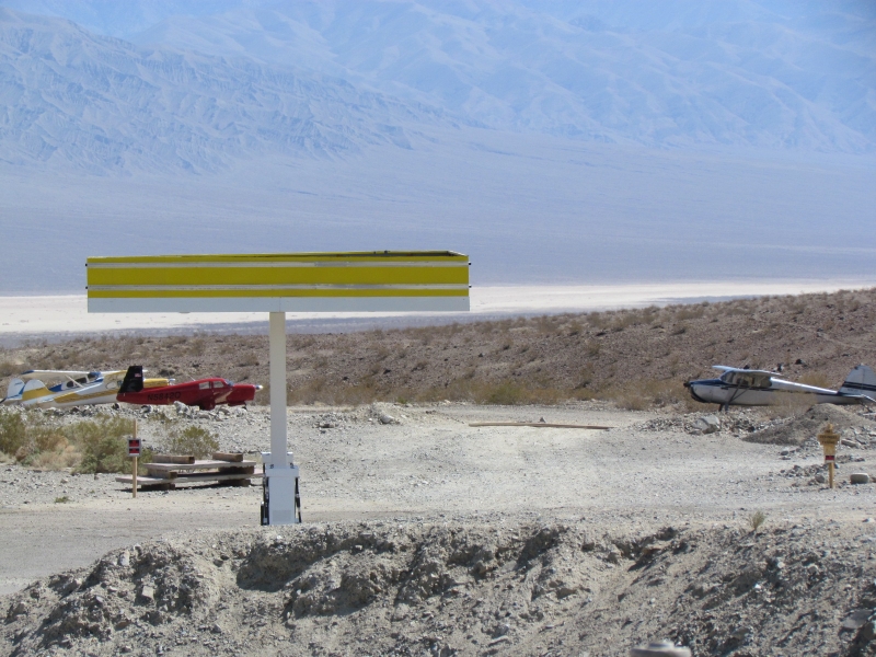
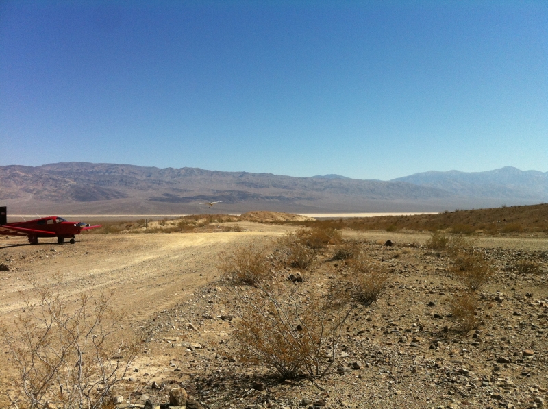
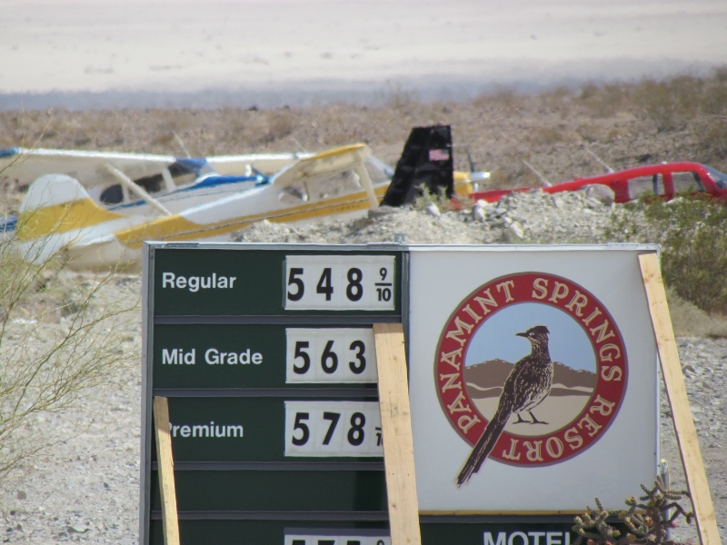
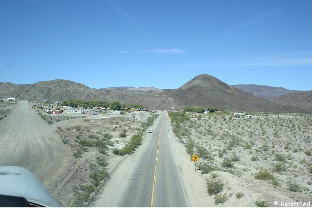
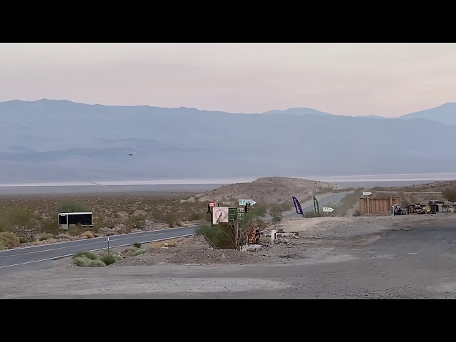
    The airstrip has resort within walking distance of the airstrip. They have a place you can eat or get some snacks at the gas station. Parking is on the North side to the East of the gas station. Watch your prop blast/dust bast and be kind to the airstrip owners.

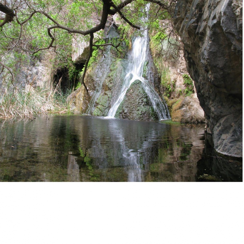
    Darwin Falls, which looks beautiful is up the road 4 miles (8 round trip). Google has lots of really good pictures, yelp has great reviews as well. We went here in March 2012

    http://www.panamintsprings.com

    http://www.tripadvisor.com/Hotel_Review-g143021-d119458-Reviews-Panamint_Springs_Resort-Death_Valley_National_Park_California.html

    Runway
    • Length

      2000

    • Width

      50

    • Surface

      DIRT

    Details
    • Facility ID

      new

    • Elevation

      1998

    • CTAF

      122.9

    Gallery
    Location

    Lat: 36.33831971384 , Long: -117.46675692047 - , USA

    Get Directions
    Categories
    • Recreational
    Tags
    • Mountains
    • Desert
    • Hot Springs
    • Camping
    • Dining
    • Food
    Region
    • Western Pacific
    Ownership
    • Public
    Author
    shortfield
    mood_bad
  • No comments yet.
  • Add a review

    Leave a Reply · Cancel reply

    You must be logged in to post a comment.

    YouTube Search
    Prev 1 of 20 Next
    • Airplane Landing at Panamint Springs

      Airplane Landing at Panamint Springs

    • Minietta Mine Airstrip

      Minietta Mine Airstrip

      A unique landing spot in the Panamint Valley of California. Many neat mining ruins in the surrounding hills including the well known Lookout City within hiking distance.
    • Piper pacer landing at Panamint Springs no-go-around private strip

      Piper pacer landing at Panamint Springs no-go-around private strip

    • Let's Go Flying:  Lone Pine to the Panamint and Saline Valleys

      Let's Go Flying: Lone Pine to the Panamint and Saline Valleys

      Dan flies his Cessna Cardinal 177RG from Lone Pine Airport east to the Inyo Mountains, Panamint Valley, and Saline Valley in Death Valley National Park.

      This video captures an exciting flight that explores the fascinating and diverse land of extremes between Mt. Whitney and Death Valley. Overflights include the movie-famous Alabama Hills, the Cerro Gordo Silver Mines, the extreme slopes of the Inyo Mountains, the Saline and Panamint Valleys, Star Wars Canyon (aka Rainbow Canyon) and the Panamint Sand Dunes. Close approaches to terrain are enhanced with glorious QHD video. Geographic features are labeled for the pleasure of learning about the region.

      Starting from Lone Pine Airport, we climb out over the Alabama Hills, then along the Inyo Mountains to the Cerro Gordo Mines, then from Saline Valley to the Malpais Mesa Wilderness. We then descend into jet-training-central Star Wars Canyon on our way to the Panamint Valley Dunes. Finally, we take one last jog back to the Saline Valley to point out the famous Racetrack Playa in Death Valley National Park.

      This is shot in glorious, multi-camera 2.7K HD, so be sure to use the highest resolution setting you can for your maximum enjoyment.

      And don’t forget - please subscribe to my channel so you don’t miss what’s next!

      #aviation #flying #cessna #avgeek #aviationphotography #pilot #airports #explore #southerncalifornia #sierranevada #deathvalley

      0:00 Introduction
      0:08 Lone Pine Airport California - September 2018
      2:57 Alabama Hills Owens Valley, California
      4:11 Inyo Mountains East of Lone Pine, California
      6:36 Cerro Gordo Mines Inyo Mountains, California
      9:47 Malpais Mesa Malpais Mesa Wilderness
      11:11 Rainbow Canyon aka Star Wars Canyon
      12:05 Panamint Springs Panamint Valley, California
      13:17 Panamint Dunes Panamint Valley, California
      14:22 Nelson Range North of Panamint Valley
      15:25 Saline Valley Death Valley National Park
    • Spring Fling 2019 Panamint Valley Part I

      Spring Fling 2019 Panamint Valley Part I

      April 1st 2019 we showed up in Panamint Valley, CA. for a week of off roading and exploring. In part one we bag the Minnietta Cabin in the Argus Range. This is one of the most sought after volunteer cabins in the valley and we got it all to ourselves for 8 days.

      We'll also visit the Osborne Cabin which is further up the canyons and washes from the Minnietta.
    • CHICKEN STRIP Airstrip, Death Valley Saline Warm Springs

      CHICKEN STRIP Airstrip, Death Valley Saline Warm Springs

      Pilot description of the remote Chicken Strip in Death Valley and the upper warm springs nearby. Be advised-fast moving jet activity from the China Lake MOA down to 200' AGL-contact Joshua Approach.
      Lets continue to keep this backcountry airstrip open.
    Prev 1 of 20 Next

    You May Also Be Interested In

    Darwin Airstrip, CA

    The dirt and gravel strip is in good condition.  A windsock is on the north end but the desert sun and…
    • 36.26559886882, -117.59637218290
    • Recreational

    Olancha, CA

    Dirt strip just west of HWY 395
    • 36.25602636478, -117.99714766086
    • Recreational

    Cinder Cone DL, CA

    Hard pan
    • 35.9835487602, -117.90019116936
    • Off-Airport

    © 2000-2021 shortfield.com

    Cart

      • Featured
      • Recreational
      • Restricted
      • Off-Airport
      • Abandoned
      • Outpost
      • Facebook
      • Twitter
      • WhatsApp
      • Telegram
      • LinkedIn
      • Tumblr
      • VKontakte
      • Mail
      • Copy link