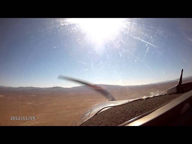
Sign in or Register
    • Featured
    • Recreational
    • Restricted
    • Off-Airport
    • Abandoned
    • Outpost
    • Home
    • Explore
    • Shop

    Olancha, CA

    • Overview
    • Reviews / PIREPs 0
    • Events
    • Videos
    • prev
    • next
    • Bookmark
    • Share
    • Leave a Review / PIREP
    • Report
    • prev
    • next
    Description

    Dirt strip just west of HWY 395

    Runway
    • Surface

      DIRT

    Details
    • Facility ID

      new

    • Elevation

      4000

    • CTAF

      122.9

    • State

      CA

    Location

    Lat: 36.25602636478 , Long: -117.99714766086 - , USA

    Get Directions
    Categories
    • Recreational
    Tags
    • Desert
    Region
    • Western Pacific
    Ownership
    • Public
    Author
    shortfield
    mood_bad
  • No comments yet.
  • Add a review

    Leave a Reply · Cancel reply

    You must be logged in to post a comment.

    Related Videos
    Prev 1 of 2 Next
    • Flying with Tony Arbini into the Lone Pine Airport (026)- Lone Pine, California

      Flying with Tony Arbini into the Lone Pine Airport (026)- Lone Pine, California

      Hello everyone, Tony Arbini here from Landing patterns bringing you another in-depth video, guiding you on our landing into the Lone Pine Airport (026) down in Lone Pine, California. Our landing into the Lone Pine Airport provide you with lots of information on charts, weights, altitudes, and airport information for pilots to plan for a safe landing!
    • Let's Go Flying:  Lone Pine via Olancha Peak and Whitney Portal

      Let's Go Flying: Lone Pine via Olancha Peak and Whitney Portal

      Shot on a spectacular flight within the High Sierra, this film thoroughly captures the experience of exploring some of California’s most amazing country with a small plane. Includes overflights of Domeland Wilderness in the Kern Plateau, the Sierra Nevada Crest and Whitney Portal. Close approaches to land features are enhanced with glorious QHD video. Major land features are labeled for the pleasure of learning about the region.

      Starting from Kern Valley Airport, this flight climbs up into the Domeland Wilderness of the Kern Plateau, then on to Olancha Pass, Cartego Canyon, Whitney Portal, and the Alabama Hills before landing in Lone Pine.

      This film is the first segment of a two-part flight. The second film (to be released later) covers the flight from Lone Pine, to Cerro Gordo Mine, Panamint Valley and then Saline Valley.

      This is shot in glorious, multi-camera 2.7K HD, so be sure to use the highest resolution setting you can for your maximum enjoyment.

      And don’t forget - please subscribe to my channel so you don’t miss what’s next!
    • Let's Go Flying:  Lone Pine to the Panamint and Saline Valleys

      Let's Go Flying: Lone Pine to the Panamint and Saline Valleys

      This video captures an exciting flight that explores the fascinating and diverse land of extremes between Mt. Whitney and Death Valley. Overflights include the movie-famous Alabama Hills, the Cerro Gordo Silver Mines, the extreme slopes of the Inyo Mountains, the Saline and Panamint Valleys, Star Wars Canyon (aka Rainbow Canyon) and the Panamint Sand Dunes. Close approaches to terrain are enhanced with glorious QHD video. Geographic features are labeled for the pleasure of learning about the region.

      Starting from Lone Pine Airport, we climb out over the Alabama Hills, then along the Inyo Mountains to the Cerro Gordo Mines, then from Saline Valley to the Malpais Mesa Wilderness. We then descend into jet-training-central Star Wars Canyon on our way to the Panamint Valley Dunes. Finally, we take one last jog back to the Saline Valley to point out the famous Racetrack Playa in Death Valley National Park.

      This is shot in glorious, multi-camera 2.7K HD, so be sure to use the highest resolution setting you can for your maximum enjoyment.

      And don’t forget - please subscribe to my channel so you don’t miss what’s next!
    • Lone Pine Airport Landing on the U2

      Lone Pine Airport Landing on the U2

      Landing the U2 at the Lone Pine Airport 05-13.
      Significant headwind and the previous 3 pilots broke downtubes.
    • Lone Pine Time Trials-What Is Is And Why Should You Go? What To Expect

      Lone Pine Time Trials-What Is Is And Why Should You Go? What To Expect

      There is not enough info out there about this event, so I figured I'd make a video with the content I collected on May 20th and 21st 2017 during my first time attending the Lone Pine Time Trials!
      If you're looking for a fun weekend, the Lone Pine Time Trials is a great opportunity to try pushing your car to the limits (yours too) while having fun and meeting other enthusiasts. This is in between an autox and a full on track day, so expect lots of speed and maneuvering around cones!
      There is a small time trial event that happens every year in California called the Lone Pine Time Trials. For many, they've never heard of this event, and stick to the typical autocross or track day events at more well known locations such as California Speedway, Buttonwillow, Willow Springs, or Laguna Seca. However, the Lone Pine Time Trials is an exciting event which invites visitors of the event to experience friendly competition, a challenging course, and gorgeous views.

      Nestled between the snow capped Sierras and Mount Whitney to the west, and the Inyo Mountain range on the east, the Lone Pine time trials takes place right off Highway 395, across from the infamous Manzanar War Relocation Center. If you live in southern California and have ever driven to mammoth, you most likely drove right past the Manzanar airfield where the time trials takes place without even realizing. That isn't really your fault, however, The Manzanar airfield in Owens Valley was built in 1939 primarily for military training purposes, but has since been abandoned. Although it sees occasional use for military activities, tv commercials, and special Motorsport events, the airfield runway and taxiway become subject to mother nature and is quickly overgrown with plants, debris, and even cattle. Luckily the Lone Pine organizers know this and participants and volunteers meet up to help clean up the track and get it ready for racers weeks before time trial weekend is scheduled. This isn't the typical, "we're just gonna sort of sweep up" kind of deal either, clean up participants deal with shrubs, bushes, weeds, and grass that hide the entire runway track. Even after cleanup, small debris litters the track which is blown away and cleaned up during the warm up laps each morning. The saying, "leave a place you visit nicer than when you arrived" describes this group to a tee. This isn't a new event either, 2017 marked the 47th anniversary and has attracted drivers of all ages, driving skill, and vehicles of every type.

      Now on to the fun part of the Lone Pine Time Trials, the driving. Split up into classes, drivers for 2017 were split up into three run groups on Saturday, and two run groups on Sunday. Everyone takes turns driving and working cones-which gives you a great opportunity to see the course, learn from others mistakes, help identify the driving line you want to take, and get some time behind the wheel! The whole course is over two miles long with lots of opportunity to push yourself and your car as hard or as easy as you want. Filled with slaloms, chicanes, slow turns, fast turns, and straightaways, this high speed time trial course will test nearly every aspect of your driving ability. Most of the time you'll be in 3rd and 4th gear, if that gives you an idea of the speeds for this event! Earlier in the day, you'll hear lots of little pebbles as you navigate the course, but shortly after you'll have a pretty clean track to drive on, plus as the course cleans up you'll have a very clear visual on where the driving line is that most drivers have been taking.

      When it comes to lodging, you can either stay in the nearby town of Lone Pine or pick one of the many campgrounds and spend the evenings with nature. I chose to stay at the Portagee Joe campground which was less than 15 minutes away from the airstrip making for a cheap and easy campout. While at the time trial event itself there was a food truck, available air compressors, and fancy bathrooms...okay, porta pottys, but still-No crouching behind bushes for this group. If you come out, be sure to bring lots of water, snacks, food, sunscreen, and more water!

      There is a good mix of competitors who drive their cars up, and plenty who bring their cars on trailers. In between racing and run groups, drivers and spectators socialize talking about their cars, thoughts on the course, and plans for next time.The mix of cars in attendance is pretty cool too, with daily driven cars all the way to track prepped racing machines. At the end of the day, everyone there is to turn out fast lap times, and have fun.

      Proceeds from the Lone Pine Time Trials go to support the Braille Institute, and with extremely affordable registration costs, going for the whole weekend is well worth it. Be sure to check out www.lonepinetimetrials.com for more information on the event and to register for driving, you won't regret it!

      We hope to see you out at the Lone Pine Time Trials!
    • HISTORIC Manzanar, CA | Abandoned Airport | Abandoned Japanese Internment Camp &  CEMETERY!

      HISTORIC Manzanar, CA | Abandoned Airport | Abandoned Japanese Internment Camp & CEMETERY!

      HISTORIC Manzanar, CA | Abandoned Airport | Abandoned Japanese Internment Camp & CEMETERY!
    • Fast run up the Sierras - Inyokern to Lone Pine

      Fast run up the Sierras - Inyokern to Lone Pine

      Sped up mostly 8x, but no cuts so the few circles are also included.

      Wind was light westerly, so not working ridge here, just the heated east facing slopes and thermal bubbles.
    • 2015 Southern Inyo Double Century

      2015 Southern Inyo Double Century

      The 2015 edition of the Southern Inyou Double Century, part of the California Triple Crown.

      From the course description:

      "The Southern Inyo Double is a beautiful course with many miles that resemble Death Valley. All riding is on well-maintained bicycle friendly state and county highways and byways. The course is set between Mount Whitney and Death Valley National Park. The scenic beauty is second to none. The film and automobile industry spend millions of dollars every year filming commercials and movies on these roads. You will be riding between the Sierra, the Inyo’s and Coso Range. You will ride around the Owens Dry Lake (Badwater’s Mother) past places like Dirty Socks, Keeler, the Alabama Hills the Olancha Sand Dunes. This area hasn’t changed in the last 150 years, other than well paved roads. It is the wild west as it was."
    • Let's Go Flying: Camarillo to Kern Valley

      Let's Go Flying: Camarillo to Kern Valley

      This amazing flight from Camarillo to Kern Valley showcases many of the landforms of Southern and Central California, from coastal plains to deep mountain canyons, and orange groves to pine forests. See closeup views of the seldom-seen Devil’s Potrero in the rugged Ventura County backcountry. Fly over the scenic and sprawling Tejon Ranch in the Tehachapi Mountains. Catch railroad action on the Tehachapi Grade before moving on to Walker Basin and then landing in spectacular Kern Valley. Clear and close views of the land are shot in glorious 2.7K HD, so be sure to use the highest resolution setting you can for your maximum enjoyment.
    • Video Of Alabama Hills,Lone Pine Ca

      Video Of Alabama Hills,Lone Pine Ca

    • Scenic Route 395 Johannesburg to Inyokern

      Scenic Route 395 Johannesburg to Inyokern

      Scenic Route 395 Johannesburg to Inyokern California USA/.

      Highway 395 is most often used to travel from Los Angeles, Highway 395 is probably my favorite road in California.
    • Soaring Pilots View

      Soaring Pilots View

      Take-off from California City on tow from 2-Tango. After release from tow I didn't find lift and ended up back near the airport at 800 feet, where I found a small thermal that I took to 6000 feet to begin my cross country flight.
    Prev 1 of 2 Next

    You May Also Be Interested In

    MONACHE MEADOWS, CA

    • 36.22400000000, -118.17100000000
    • Recreational

    Cinder Cone DL, CA

    Hard pan
    • 35.9835487602, -117.90019116936
    • Off-Airport

    Little Lake, CA

    Pvt Airstrip next to HWY 395
    • 35.95071672438, -117.90671430170
    • Recreational

    © 2000-2021 shortfield.com

    Cart

      • Featured
      • Recreational
      • Restricted
      • Off-Airport
      • Abandoned
      • Outpost
      • Facebook
      • Twitter
      • WhatsApp
      • Telegram
      • LinkedIn
      • Tumblr
      • VKontakte
      • Mail
      • Copy link