
Alert
Permanently closed - do not land here!
Permanently closed - do not land here!
Location Overview
The strip sits on the eastern half of Lower Table Rock's flat, mesa-top plateau in Jackson County, Oregon, just north of the Rogue River near Medford and Central Point. The mesa rises about 800 feet above the surrounding Rogue Valley, and Lower Table Rock itself sits at roughly 2,049 feet elevation. The roughly three-quarter-mile grass strip runs across the open, grassy top of the rock, bordered by seasonal wetlands and reachable only via a hiking trail or the old service road carved into the mesa's flank.
Camping & Recreation
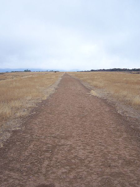
There's no developed camping at the airstrip itself, and camping isn't an established or sanctioned use on the mesa. The site is primarily a day-use hiking destination: a route follows an old road that becomes the grassy airstrip bordered by vernal pools, leading to a viewpoint overlooking the Rogue River. Hikers report fire rings and a low stone structure suggesting informal overnight use has occurred, but visitors are encouraged to pack out trash and treat the preserve as day-use only. Nearby recreation includes the Upper and Lower Table Rock hiking trails (a combined 45,000+ visitors a year), wildflower viewing in spring, vernal pool ecology, and Rogue River fishing, boating, and swimming in the valley below.
Notes & Warnings
This is not an active or legal landing strip. The runway was closed in the late 1980s, though small airplanes still occasionally attempt to land on it. It's BLM-managed land, and the agency does not want anyone landing there; pilots have reported large rocks deliberately placed on the strip to deter landings, and a public hiking trail now runs directly through the middle of the old runway, making any landing attempt hazardous to both pilots and hikers. The backcountry flying community has lost at least one pilot in this area in an unrelated midair collision, underscoring that this is a serious, professional flying environment, not a casual backcountry strip. Any approach here carries legal, regulatory, and physical risk, and is best treated as a scenic overflight only, not a place to land.
History
The airstrip dates to November 1948, when John Day, a local cattle rancher and developer, built the three-quarter-mile grass runway atop Lower Table Rock specifically to impress Hollywood celebrities he hoped to attract to residential lots he was developing nearby. A service road was cut up the inside of the mesa to support construction and access. The promotional scheme never fully took off, and the strip saw declining use over the following decades before its official closure in the late 1980s. By then, conservation interests had already begun reshaping the mesa's future: The Nature Conservancy, alarmed by overdevelopment pressure, launched a major fundraising campaign in 1978 and purchased nearly 1,900 acres to create the Lower Table Rock Preserve, later expanding its holdings in 2009 to end private ownership of the rock entirely. Today the old airstrip survives as a grassy, gently overgrown landmark crossed by hiking trails, a physical relic of a mid-century dream that gave way to one of southern Oregon's most cherished conservation landscapes.
3000
?
DIRT
No ID 060
2000
122.9
Oregon
Lat: 42.45186600000 , Long: -122.95168900000 - OREGON, USA

Add a review