Sign in or Register
    • Featured
    • Recreational
    • Restricted
    • Off-Airport
    • Abandoned
    • Outpost
    • Home
    • Explore
    • STOL Gear

    Landmark, ID

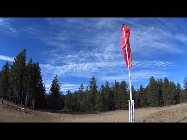
    A remote, tree-lined turf strip in a high mountain valley that serves as a classic gateway into Idaho's backcountry flying network.

    • Overview
    • Reviews / PIREPs 0
    • Videos
    • Events
    • prev
    • next
    • Leave a Review / PIREP
    • Bookmark
    • Report
    • Share
    • prev
    • next
    Description

    Location Overview
    Landmark USFS (0U0) sits in a high-elevation mountain valley near a slow-moving stretch of Johnson Creek, surrounded by forested slopes and high terrain, roughly a mile southeast of the small community of Landmark, Idaho, in the heart of the state's central backcountry. It's not far from the Warm Lake junction and lies along the corridor pilots use to reach other well-known strips like Johnson Creek, Big Creek, and Yellow Pine.

    Camping & Recreation
    The strip is set up for fly-in camping, with tie-downs and a small campground adjacent to the runway, though amenities are minimal — a pit toilet is essentially the only fixed facility on site. The surrounding valley and nearby Johnson Creek offer good hiking, fishing, and general backcountry recreation, and the area is a popular stop for pilots exploring the broader Yellow Pine/Warm Lake region.

    Notes & Warnings
    Landmark's single turf runway (16/34) is about 4,000 feet long and 100 feet wide, sitting at roughly 6,662 feet elevation, with no line of sight between the two runway ends and no winter maintenance. Wildlife and vehicle traffic are common on and around the airstrip, there's no phone service in the area, and the first several hundred feet of Runway 34 can stay soft and soggy from snowmelt into early summer. The surrounding high terrain and confined valley call for typical backcountry techniques — thorough approach "shopping," canyon-turn awareness, and conservative fuel loads — and pilots use it as a training ground for exactly these skills before tackling tighter strips nearby.

    History
    Landmark takes its name from the small Forest Service outpost of Landmark, Idaho, and the airstrip has long functioned as a U.S. Forest Service backcountry field supporting administrative access, firefighting, and recreational flying into the Payette and Boise National Forest lands. Because of its relatively open valley and generous runway length compared to some of its more notorious neighbors, it has become a favored practice and staging strip for mountain-flying instruction, often used alongside Johnson Creek, Sulphur Creek Ranch, and Big Creek as an introduction to Idaho's demanding backcountry airstrip network. Its condition and upkeep have fluctuated over the years with Forest Service maintenance cycles, and it remains a fixture on the itineraries of backcountry pilots exploring central Idaho's wilderness airstrips.

    Runway
    • Identifer

      16/34

    • Length

      4000

    • Width

      100

    • Surface

      Turf

    Details
    • Facility ID

      0U0

    • Elevation

      6680

    • CTAF

      122.9

    • State

      Idaho

    Location

    Lat: 44.642348898535, Long: -115.53342794072 - IDAHO, USA

    Get Directions
    Flyover Video
    Prev 1 of 1 Next
    • Runway Flyover - Landmark, Idaho

      Runway Flyover - Landmark, Idaho

      ​ @shortfieldvideos
    Prev 1 of 1 Next
    Categories
    • Recreational
    Tags
    • Mountains
    • Trees
    • Lakes/Rivers
    • Bicycling
    • Restrooms
    • Hunting
    • Fishing
    Region
    • Northwest Mountain
    Ownership
    • Public
    Author
    shortfield

    Land here, before you land out there!

    mood_bad
  • No reviews/PIREPs have been posted yet.

  • Add a review

    Leave a Reply · Cancel reply

    You must be logged in to post a comment.

    Shortfield Playlist
    Prev 1 of 2 Next
    • Landmark Airstrip touch and go, Idaho

      Landmark Airstrip touch and go, Idaho

      Landmark Airstrip touch and go, Idaho
    • Landmark Airstrip

      Landmark Airstrip

      USFS Smokejumpers at Landmark Airstrip. Rode deep into the Frank Church Wilderness, on some road corridors.
    • Backcountry Flying Northwest of Landmark USFS Airstrip to Warm Lake, Idaho

      Backcountry Flying Northwest of Landmark USFS Airstrip to Warm Lake, Idaho

      Backcountry Flying Northwest of Landmark USFS Airstrip to Warm Lake, Idaho
    • Landmark, ID

      Landmark, ID

      "Another nice wilderness strip with relatively easy approach and departure paths. A good strip for the novice backcountry pilot. But be sure to watch the DA!" ~ Todd
    • Landing and Departing Landmark

      Landing and Departing Landmark

    • Sulphur Creek Ranch Idaho backcountry flying Labor Day 2014 (and landmark airstrip)

      Sulphur Creek Ranch Idaho backcountry flying Labor Day 2014 (and landmark airstrip)

      I was supposed to go meet up with some friends at Landmark to go Jeeping, but the timing didn't work out. So, I headed off the Sulphur Creek Ranch instead to spend the night.
    Prev 1 of 2 Next

    You May Also Be Interested In

    SULPHUR CREEK RANCH, ID

    Sulphur Creek Ranch, where wilderness solitude meets cowboy hospitality at the edge of the Frank Church.
    • 44.537923, -115.36874
    • Restricted

    JOHNSON CREEK, ID

    Sometimes called the "Cadillac" of Idaho's backcountry airstrips, Johnson Creek pairs a pristine grass runway with luxury fly-in camping deep in the Salmon River Mountains.
    • 44.91172222222, -115.48552777778
    • Recreational

    BRUCE MEADOWS, ID

    Bruce Meadows is located in a large meadow  just outside the Frank Church River of No Return Wilderness,…
    • 44.41545916667, -115.31677111111
    • Recreational

    © 2000-2025 shortfield.com

    Cart

      • Featured
      • Recreational
      • Restricted
      • Off-Airport
      • Abandoned
      • Outpost
      • Facebook
      • Twitter
      • Mail
      • Copy link