Sign in or Register
    • Featured
    • Recreational
    • Restricted
    • Off-Airport
    • Abandoned
    • Outpost
    • Home
    • Explore
    • STOL Gear

    LA GARITA CREEK RANCH, CO

    • Overview
    • Reviews / PIREPs 0
    • Videos
    • Events
    • prev
    • next
    • Leave a Review / PIREP
    • Bookmark
    • Report
    • Share
    • prev
    • next
    Description

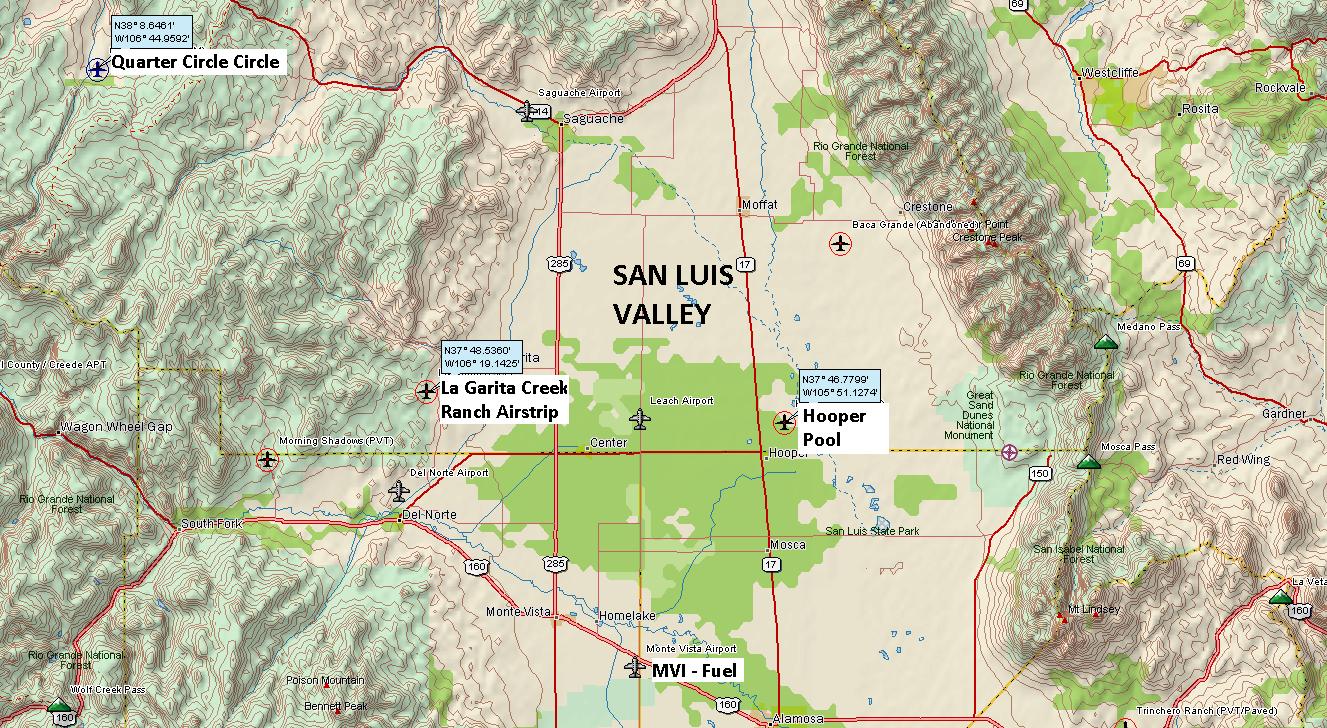
    This private ranch airstrip is located in the Rio Grande National Forest, near the
    La Garita Mountains, at an elevation of over 8000' MSL.

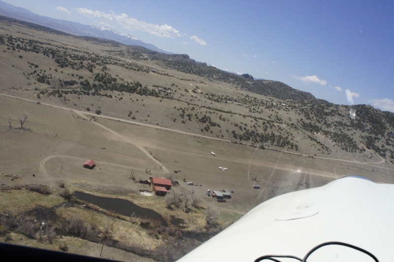
    The west 2600 feet of the runway is improved, while the east 800 feet is rough and only suitable for big-tired, bush equipped airplanes.  Caution: there are ditches on each side of the runway.  Taxi with caution.

    The strip is at roughly 8,000 ft MSL
    and is nestled up into the Lagarita Creek drainage. The strip is in great
    condition, but is probably a one way strip for less horse powered planes if
    landing to the west. The approach from the east is pretty neat as you have to
    snake your way down a little drainage. Once on the ground there are cabins for
    rent at a reasonable rate. As of now, camping is also allowed in the shade of
    some large cotton woods found along the creek. The lodge does have a fire
    place, bar, and kitchen; however it is a bring your own food situation at the
    moment. There are quite a few activities around as well and some great mountain
    biking, climbing, and fishing can be had nearby. Additionally, with the proper
    permission you have close access to a variety of private and public strips in
    the area.

    For more airstrip details and cabin info, please reference flycolorado.org: http://www.flycolorado.org/index.php/airstrip-database/private-airports/la-garita-creek/

    Runway
    • Length

      3400

    • Width

      50

    • Surface

      GRASS

    Details
    • Facility ID

      No ID 163

    • Elevation

      8050

    • CTAF

      122.9

    • State

      CO

    Gallery
    Location

    Lat: 37.81188600000 , Long: -106.31763700000 - COLORADO, USA

    Get Directions
    Categories
    • Restricted
    Tags
    • Mountains
    • Desert
    • Canyon
    Region
    • Northwest Mountain
    Ownership
    • Private
    Author
    shortfield

    Land here, before you land out there!

    mood_bad
  • No reviews/PIREPs have been posted yet.

  • Add a review

    Leave a Reply · Cancel reply

    You must be logged in to post a comment.

    You May Also Be Interested In

    MORNING SHADOWS RANCH, CO

    RWY Surface is combination of (uneven) dry grass, dirt, and gravel. Not maintained on regular basis. Large…
    • 37.74028027778, -106.52559611111
    • Restricted

    Hooper - Sand Dunes Pool, CO

    Fly-in Hot Springs Pool and Mile Deep Grill This is a high elevation dirt airfield located at the base of…
    • 37.78049580752, -105.85174036025
    • Recreational

    Quarter Circle Circle (BLM), CO

    BackCountry Airstrip with Cabin Rentals, Hunting, Horse rentals, Private fishing, is available from the…
    • 38.14276209603, -106.74626783832
    • Recreational

    © 2000-2025 shortfield.com

    Cart

      • Featured
      • Recreational
      • Restricted
      • Off-Airport
      • Abandoned
      • Outpost
      • Facebook
      • Twitter
      • Mail
      • Copy link