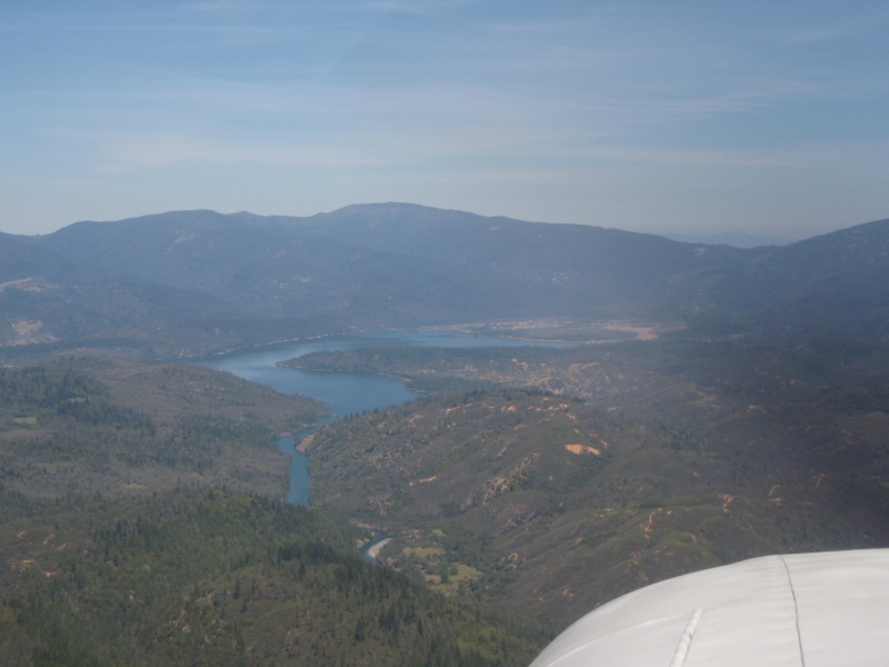
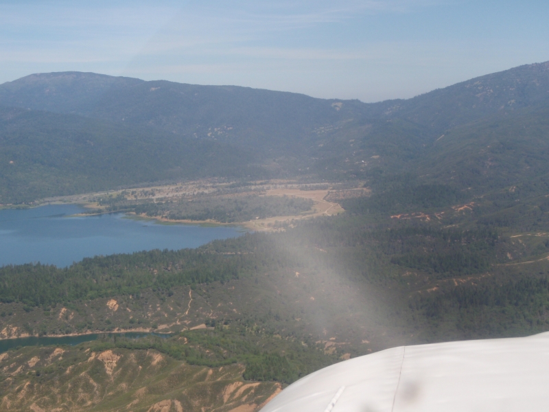
Sign in or Register
    • Featured
    • Recreational
    • Restricted
    • Off-Airport
    • Abandoned
    • Outpost
    • Home
    • Explore
    • Shop

    GRAVELLY VALLEY, CA

    • Overview
    • Reviews / PIREPs 0
    • Events
    • Videos
    • prev
    • next
    • Bookmark
    • Share
    • Leave a Review / PIREP
    • Report
    • prev
    • next
    Description

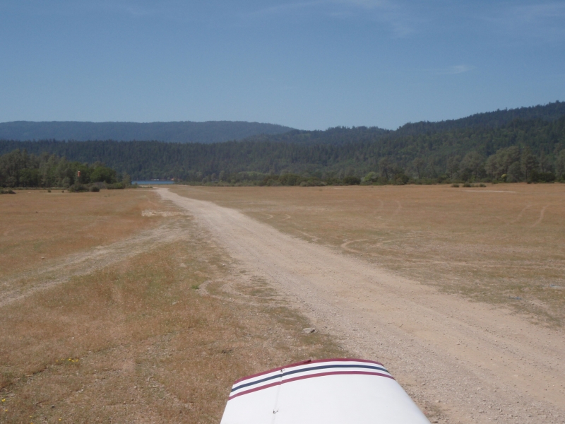
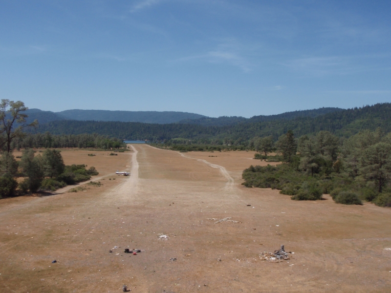
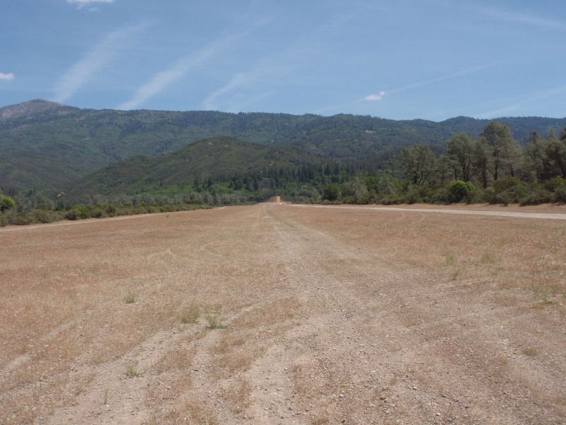
    This is a nice and easy destination from the San Francisco Bay Area.  The runway has adequate length and is in pretty good shape as of June, 2008.

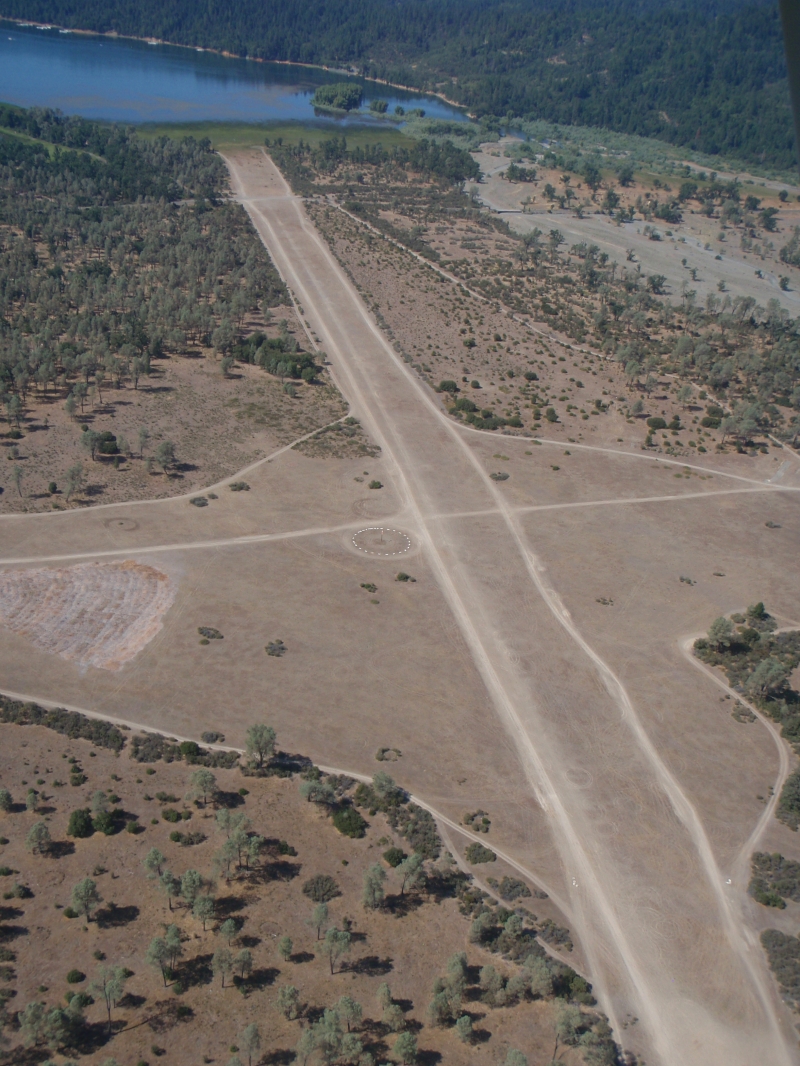
    The north end of the runway has primitive camping, and the south end of the runway has access to a Forest Service campground with picnic tables, firepits and rest rooms.   The fishing isn't bad in Lake Pillsbury if you have an inflatable.  Shore fishing sometimes pays off, but don't count on it for dinner. 

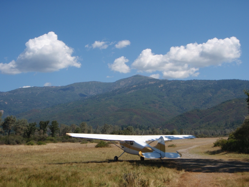
    The 4 wheelers and ATV'rs have been spinning doughnuts on the runway, but it is still ok for landing.  My aircraft is a C-205 and we usually go up there with another C-172 and a Mooney.  The ground clearance is tight for the Mooney but it has not been a problem.

    The runway slopes uphill to the North and the local lore suggests landing to the North, and take off to the South.  There is plenty of room here, so I always land according to the winds.

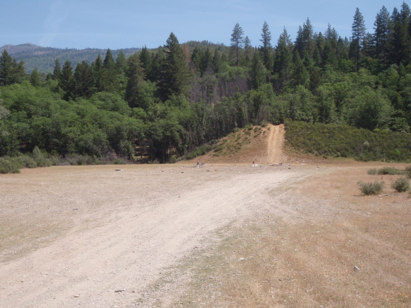
    It is a good idea to fly the runway, as there are a lot of target shooters in the area and they seem to congregate at the North end of the runway.  I think it is a good idea to let them know you are in the area and hopefully they figure out that an aircraft is setting up to land. 

     It is a great place for a week-end camping trip if you don't mind the other users.  Find another spot if you want isolation.


    Runway
    • Length

      4050

    • Width

      200

    • Surface

      GRAVEL-G

    Details
    • Facility ID

      1Q5

    • Elevation

      1900

    • CTAF

      122.9

    • State

      CA

    Gallery
    Location

    Lat: 39.45072222222 , Long: -122.95461111111 - CALIFORNIA, USA

    Get Directions
    Categories
    • Recreational
    Tags
    • Mountains
    • Trees
    Region
    • Western Pacific
    Ownership
    • Public
    Author
    shortfield
    mood_bad
  • No comments yet.
  • Add a review

    Leave a Reply · Cancel reply

    You must be logged in to post a comment.

    Related Videos
    Prev 1 of 178 Next
    • Airplane Camping! Gravelly Valley USFS Airstrip Mendocino NF

      Airplane Camping! Gravelly Valley USFS Airstrip Mendocino NF

      On the Mendocino NF Gravelly Valley USFS airstrip on Lake Pillsbury. Enjoy!
      Heading to Sun N Fun!
      LINKS:
      Patreon:
      https://www.patreon.com/user?u=5295000&fan_landing=true
      Paypal:
      https://www.paypal.me/juanbrowne
    • Gravelly Valley Airport

      Gravelly Valley Airport

      This video is about Gravelly Valley Airport
    • Colusa to Gravelly Valley   Jan 2021

      Colusa to Gravelly Valley Jan 2021

      O08 to 1Q5 in my Cessna 140. January sunset cruise in California.
    • Gravelly Valley(1Q5) departure pass

      Gravelly Valley(1Q5) departure pass

      Departure pass
    • Take Off and landing Gravelly Valley (1Q5) at lake Pilsbury

      Take Off and landing Gravelly Valley (1Q5) at lake Pilsbury

      Gravelly Valley (1Q5) at lake Pilsbury, Mendocino National Forest
    • Gravelly Valley and Back

      Gravelly Valley and Back

      There's something on the wing... some... THING. (It's a GoPro).

      A December 2013 trip in a Cessna 172 to Gravelly Valley airstrip in Mendocino National Forest, departing from Oakland and stopping at Petaluma Municipal Airport.
    • Flying with Tony Arbini into the Colusa County Airport (O08)-Colusa, California

      Flying with Tony Arbini into the Colusa County Airport (O08)-Colusa, California

      Landing patterns brings you another in-depth video, guiding you on our landing into the Colusa County Airport (O08). Our landing into the Elk Hills-Buttonwillow Airport in Buttonwillow California provides you with lots of information on charts, weights, altitudes, and airport information for pilots to plan for a safe landing!
    • Gravelly Valley takeoff.

      Gravelly Valley takeoff.

      One of very few, more primitive public use, less developed strips in California.
      The other that comes to mind, the Chicken strip in Death Valley.
    • My MiniWagon’s First Touch of DIRT: Gravelly Valley

      My MiniWagon’s First Touch of DIRT: Gravelly Valley

      After flying up to Ukiah from San Martin to visit some friends I noticed a public use dirt strip not too far from where I was. So, of course my and my buddy hopped in and went to check it out. We were blown away by the beauty of this little spot.
    • Beech Sierra Landing at Gravelly Valley - POV (2011)

      Beech Sierra Landing at Gravelly Valley - POV (2011)

      Beech Sierra landing at 1Q5 (Gravelly Valley, CA) on August 15, 2011. Strip is 4050' long. The surface is just like the name suggests... gravelly! No matter what the wind is you're probably better off coming in over the lake, there are hills at the end of the runway. On this day I had a slight downwind landing. If you attempt it, I recommend you refresh on your mountain flying and soft field landing knowledge. This video was shot during my pre-GoPro days. If you like this sort of thing, have a look at my later videos for some great landings and takeoffs with GoPro quality. Subscribers welcome too, thanks!
    • Gravelly Valley Landing and Takeoff 2015

      Gravelly Valley Landing and Takeoff 2015

      Description Gravelly Valley Landing and Takeoff in a Cessna 182
    • Landing Gravelly Valley Mendocino National Forest

      Landing Gravelly Valley Mendocino National Forest

      Landing Gravelly Valley airstrip (1Q5) at Lake Pilsbury in Mendocino National Forest
    Prev 1 of 178 Next

    You May Also Be Interested In

    INDIAN VALLEY RESERVOIR, CA

    • 39.06969600000, -122.44442900000
    • Recreational

    WILLOWS-GLENN COUNTY, CA

    WLW is home to Nancy's Airport Cafe.  I think more truckers than pilots eat at Nancy's, but it is right…
    • 39.51575000000, -122.21727777778
    • Recreational

    WILLIAMS, CA

    This is Williams Gliderport (CN12), you need to call for permission prior to arrival 530.473.5600 - there is…
    • 39.16350222222, -122.13164111111

    © 2000-2021 shortfield.com

    Cart

      • Featured
      • Recreational
      • Restricted
      • Off-Airport
      • Abandoned
      • Outpost
      • Facebook
      • Twitter
      • WhatsApp
      • Telegram
      • LinkedIn
      • Tumblr
      • VKontakte
      • Mail
      • Copy link