Sign in or Register
    • Featured
    • Recreational
    • Restricted
    • Off-Airport
    • Abandoned
    • Outpost
    • Home
    • Explore
    • STOL Gear

    Walker Ridge, CA

    A rare backcountry gem carved out of the wilderness, offering big-city pilots a genuine escape to dark skies and sweeping ridgeline views.

    • Overview
    • Reviews / PIREPs 0
    • Videos
    • Events
    • prev
    • next
    • Leave a Review / PIREP
    • Bookmark
    • Report
    • Share
    • prev
    • next
    Description

    Location Overview
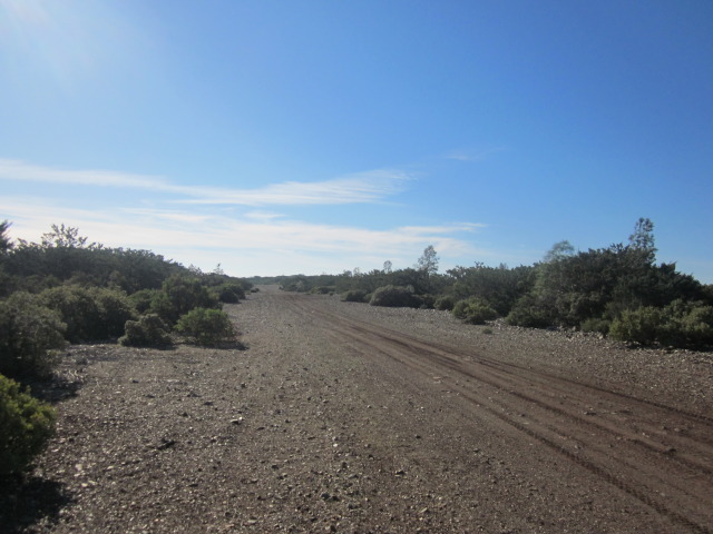
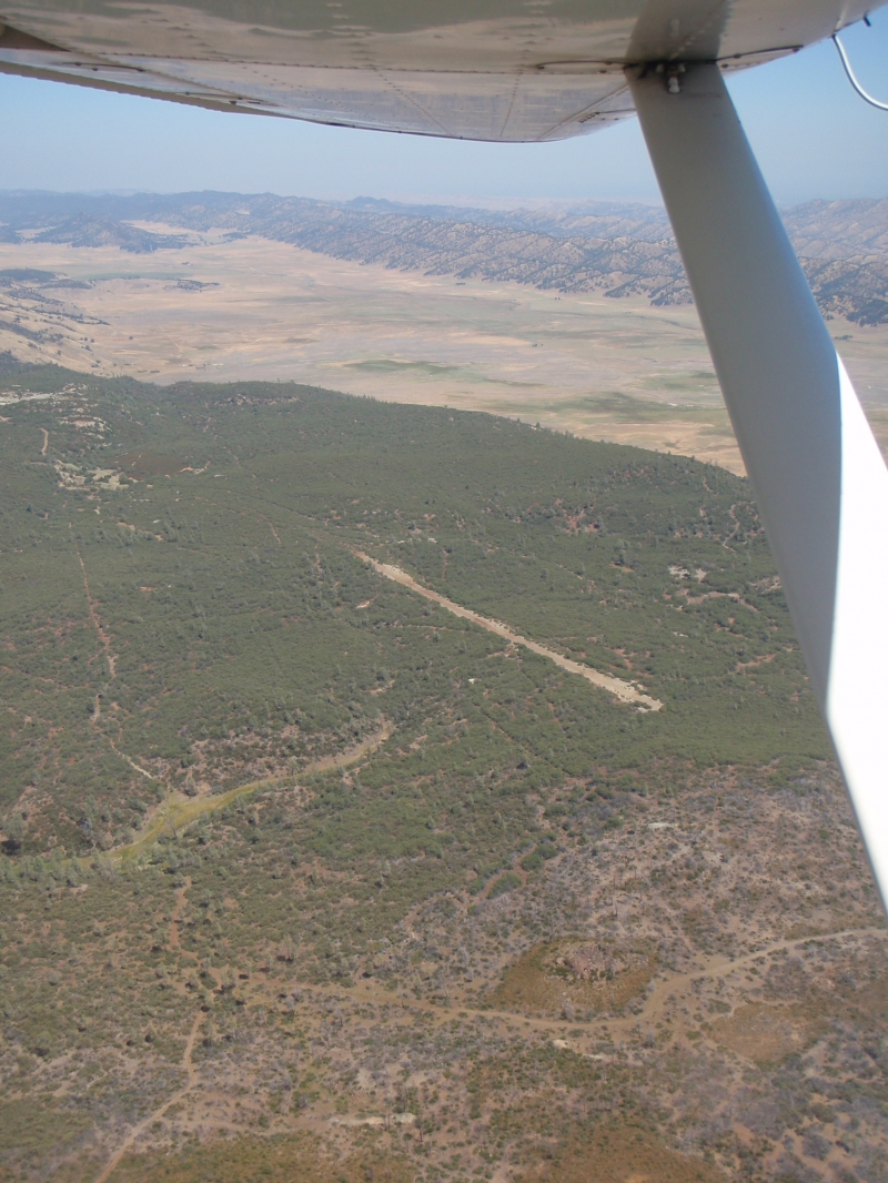
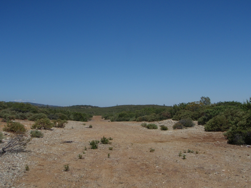
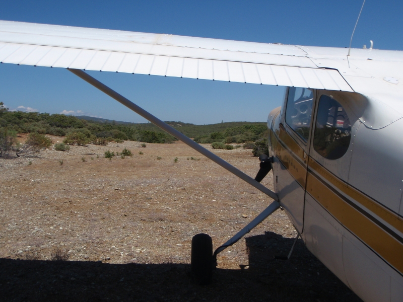
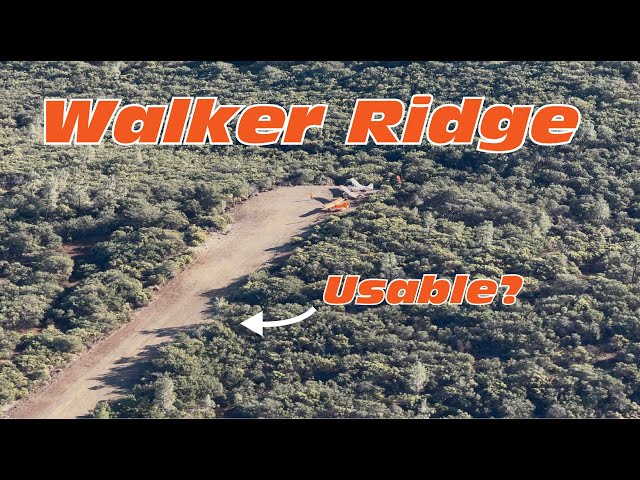
    Walker Ridge sits roughly 60 miles west of Sacramento and 100 miles north of San Francisco, within the Berryessa Snow Mountain National Monument on Bureau of Land Management land. The strip runs approximately 1,800 feet long and 70 feet wide at an elevation of about 2,200 feet. It is accessed via a rutted, steep jeep trail off Walker Ridge Road, making the drive in an adventure of its own.

    Camping & Recreation
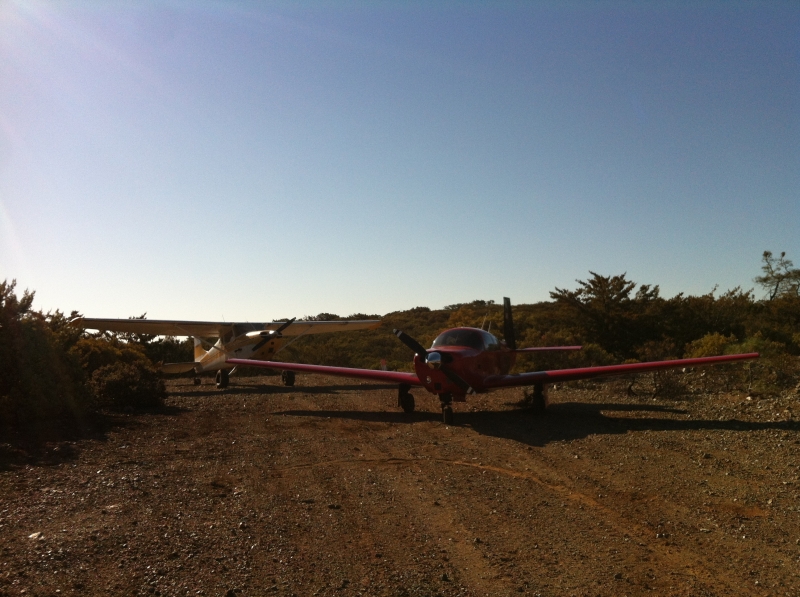
    Dispersed underwing camping is available at the south end of the strip, where visitors are treated to gorgeous valley views by day and stunning dark skies at night, with no artificial lighting for miles around. Recreational opportunities in the surrounding area include hunting for deer, wild boar, turkey, and quail, as well as hiking and mountain biking trails — one of which runs directly adjacent to the airstrip.

    Notes & Warnings
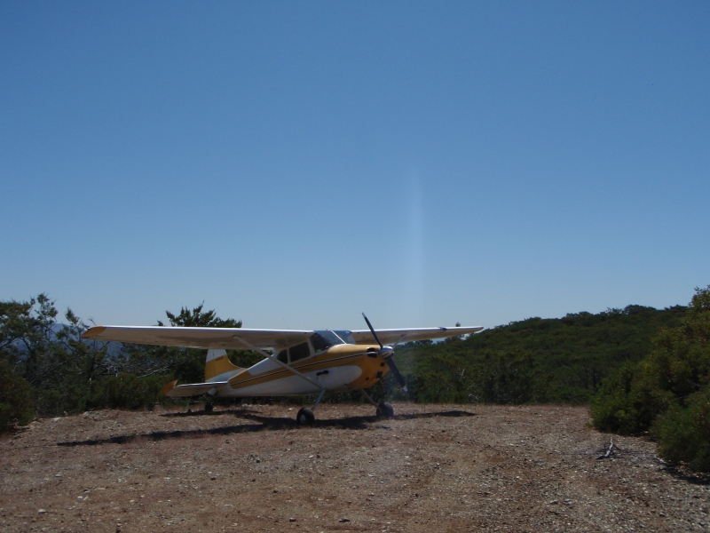
    This is a backcountry airstrip on BLM land and demands appropriate backcountry flying judgment. A windsock is in place, though a permanent installation is still pending BLM approval. Pilots should review available safety briefings before visiting, as the terrain, elevation, and remote setting require careful planning. The access road is rough and four-wheel drive is strongly recommended for ground vehicle access.

    History
    Walker Ridge was once an abandoned, overgrown BLM airstrip that had fallen into disuse and was largely reclaimed by encroaching vegetation. With BLM approval from the Ukiah Field Office secured, volunteer work parties were organized to rehabilitate the strip — a significant effort given the challenging access road. The airstrip was reopened in 2026, representing a meaningful win for backcountry aviation access in a part of California that had long been under served by recreational flying destinations.

    Runway
    • Length

      1400

    • Width

      70

    • Surface

      DIRT

    Details
    • Facility ID

      No ID 071

    • Elevation

      2200

    • CTAF

      122.9

    Gallery
    Location

    Lat: 39.06969600000 , Long: -122.44442900000 - CALIFORNIA, USA

    Get Directions
    Flyover Video
    Prev 1 of 1 Next
    • Runway Flyover - Walker Ridge, California

      Runway Flyover - Walker Ridge, California

      @shortfieldvideos
    Prev 1 of 1 Next
    Categories
    • Recreational
    Tags
    • Desert
    • Camping
    Region
    • Western Pacific
    Ownership
    • Public
    Author
    shortfield

    Land here, before you land out there!

    mood_bad
  • No reviews/PIREPs have been posted yet.

  • Add a review

    Leave a Reply · Cancel reply

    You must be logged in to post a comment.

    Shortfield Playlist
    Prev 1 of 1 Next
    • Too Tight for the Super Chief? | Back to Walker Ridge Airstrip...

      Too Tight for the Super Chief? | Back to Walker Ridge Airstrip...

      We take the Super Chief back to the recently cleaned up Walker Ridge Airstrip (Also known as Indian Valley Airstrip) to see if we can fit...

      Checkout the RAF here... https://www.theraf.org
    • Landing at Walker Ridge

      Landing at Walker Ridge

      The recently maintained RAF landing strip in the hills of Northern California was an inviting adventure today. Here is the overfly, approach and landing.
    Prev 1 of 1 Next
    YouTube Search
    Prev 1 of 16 Next
    • Too Tight for the Super Chief? | Back to Walker Ridge Airstrip...

      Too Tight for the Super Chief? | Back to Walker Ridge Airstrip...

      We take the Super Chief back to the recently cleaned up Walker Ridge Airstrip (Also known as Indian Valley Airstrip) to see if we can fit...

      Checkout the RAF here... https://www.theraf.org
    • Knowles Ranch Walker, CA

      Knowles Ranch Walker, CA

      81 Acres with Water Shares an airstrip ditch and reservoir.
      Property for sale in Walker, California
    • Plane Crashes In Trees on Takeoff!

      Plane Crashes In Trees on Takeoff!

      This AN-2 Colt crashed on takeoff in Sweden. The pilot and passengers survived. The pilot said the engine was working until it wasn't and they didn't have many options at that point.

      #aviation #shorts #pilotdebrief

      Join the Pilot Debrief channel to get access to perks:
      https://www.youtube.com/channel/UCBeZYVlqOeSSlrBSXl4aTig/join

      Copyright Disclaimer Under Section 107 of the Copyright Act 1976, allowance is made for "fair use" for purposes such as criticism, comment, news reporting, teaching, scholarship, and research. Fair use is a use permitted by copyright statute that might otherwise be infringing. No copyright infringement intended. All rights belong to their respective owners.

      This channel is for entertainment purposes only and represents solely my opinion and not the opinion, views, or position of anyone else.
    • That was a close one..🫣 #bowhunting #hunting #hoghunting #texas #archery #hunter

      That was a close one..🫣 #bowhunting #hunting #hoghunting #texas #archery #hunter

    • This 7th Grader Would Be The Starting Quarterback On YOUR High School Team! #shorts #football #nfl

      This 7th Grader Would Be The Starting Quarterback On YOUR High School Team! #shorts #football #nfl

    • Flying Cars in Real LIfe

      Flying Cars in Real LIfe

      How do flying cars work in real life? It's time to honor the timeless spirit of exploration, just like the cowboys of old who fearlessly rode the untamed wilderness.

      #XPENGAEROHT #XPENGX2 #FlyingCar #CalgaryStampede #Cowboy
    Prev 1 of 16 Next

    You May Also Be Interested In

    WILLIAMS, CA

    This is Williams Gliderport (CN12), you need to call for permission prior to arrival 530.473.5600 - there is…
    • 39.16350222222, -122.13164111111

    COLUSA COUNTY, CA

    Nice pilot lounge/restrooms. Quirky self serve fuel pump.
    • 39.17900052778, -121.99333677778
    • Recreational

    WILLOWS-GLENN COUNTY, CA

    WLW is home to Nancy's Airport Cafe.  I think more truckers than pilots eat at Nancy's, but it is right…
    • 39.51575000000, -122.21727777778
    • Recreational

    © 2000-2025 shortfield.com

    Cart

      • Featured
      • Recreational
      • Restricted
      • Off-Airport
      • Abandoned
      • Outpost
      • Facebook
      • Twitter
      • Mail
      • Copy link