Description
Location Overview
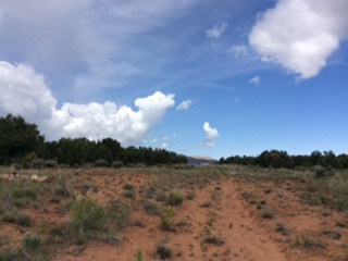
Flat Top Mesa sits in Mesa County, Colorado, in the area covered by the "Juanita Arch" USGS topo map, at approximately 6,345 feet elevation. The strip occupies the top of an isolated mesa on Bureau of Land Management land in the canyon country southwest of Grand Junction, near the Utah border. The approach on Runway 12 terminates at the edge of a 650-foot vertical cliff face, making for some of the most dramatic scenery — and most serious consequences — of any backcountry strip in the region. Visitors are treated to stunning views down into Gateway Canyon.
Camping & Recreation
There is a small parking area at the western edge of the strip on the edge of the cliff, reportedly large enough for a few planes. A campsite with a fire ring is tucked into the trees on the north end of the runway, just above the cliff face. Old uranium mining equipment and mine shafts are located within 200 yards of the strip and make for an interesting exploration. The surrounding canyon country offers sweeping views and solitude, and the proximity to Gateway Canyon makes it an appealing destination for those exploring the remote western Colorado plateau.
Notes & Warnings
The runway is designated 12/30 with 1,061 feet of usable length at 50 feet wide. Runway 30 is uphill, with the first 734 feet unusable due to washout and erosion — the threshold is marked with a pile of white logs on the left side, and landing short carries dire consequences. Runway 12 is downhill, with the approach end sitting atop the 650-foot vertical cliff face, requiring extreme caution.
This is considered a very challenging airstrip due to high altitude and hot temperatures (density altitude is a serious factor), a concave landing surface from old washout, turbulence, and typical late-day crosswinds that swirl on the strip. The Runway 12 approach end frequently experiences intense thermal activity from daytime heating of the cliff face. The strip is narrow with cedars on both sides, and the landing area is off-camber and rolling with some small foliage. Early morning flying is strongly recommended. The area is also active wildlife habitat — bears, mountain lions, and other wildlife are present.
History
Flat Top Mesa was originally a mining strip constructed to support uranium extraction operations dating back to the 1950s. Like many similar strips scattered across the canyon country of western Colorado and eastern Utah, it was likely built and maintained to ferry personnel, equipment, and ore samples to and from remote mining claims during the uranium boom that swept the Colorado Plateau following World War II. Today it sits largely unchanged from those early days, slowly being reclaimed by erosion and weather, with the remnants of old mining paraphernalia nearby as quiet testament to that industrial chapter in the region's past.
Runway
-
Length
1000
-
Width
40
-
Surface
DIRT
Details
-
Elevation
6300
-
CTAF
122.9
-
State
Utah
Gallery
Location
Lat: 38.5933, Long: -108.9145 - Colorado , USA


Add a review