Sign in or Register
    • Featured
    • Recreational
    • Restricted
    • Off-Airport
    • Abandoned
    • Outpost
    • Home
    • Explore
    • Shop

    CACHE CREEK, OR

    • Overview
    • Reviews / PIREPs 0
    • Events
    • Videos
    • prev
    • next
    • Bookmark
    • Share
    • Leave a Review / PIREP
    • Report
    • prev
    • next
    Description

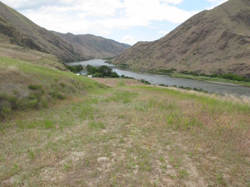
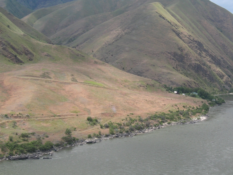
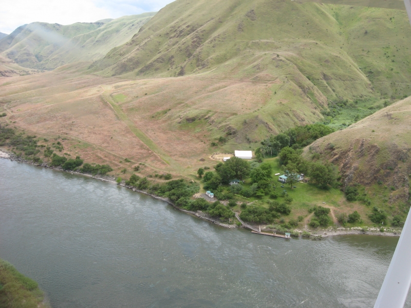
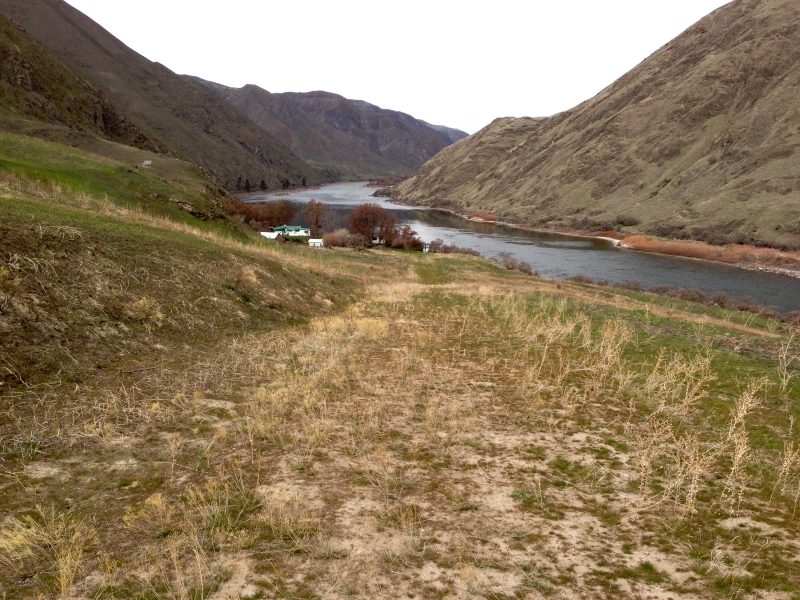
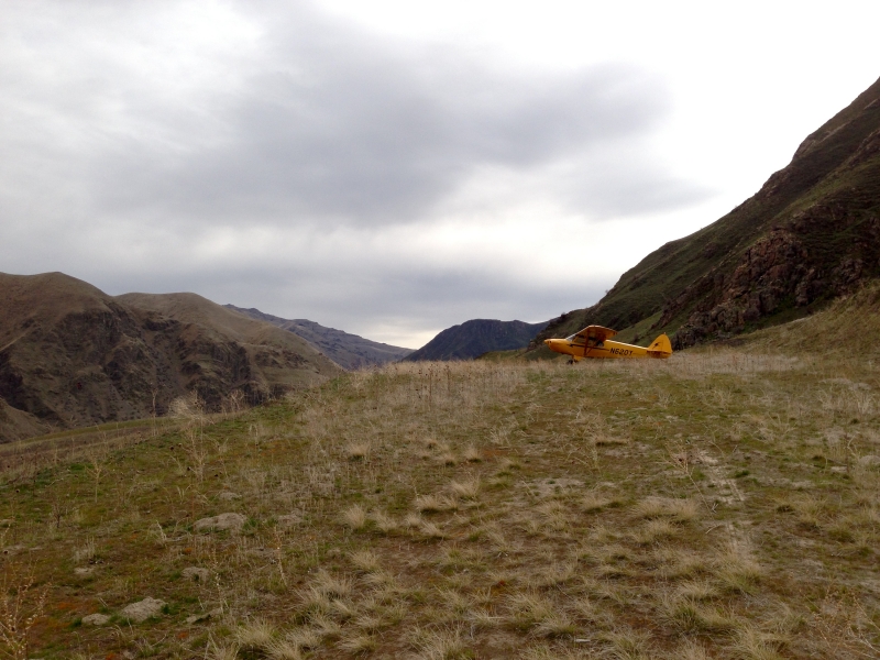
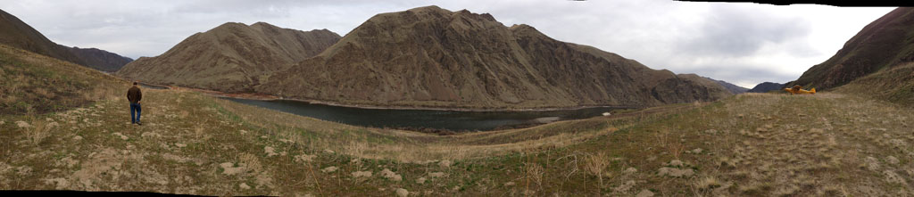
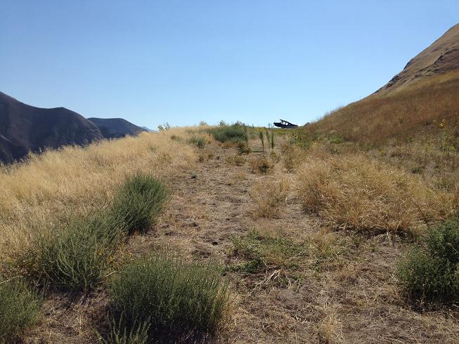
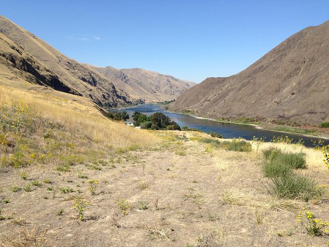
    Located on the Oregon side of the Snake River, Cache Creek is a rough, uphill, dog-legged strip located upstream from Rogersburg (D69) about six miles.  This strip is owned by the U.S. Forest Service and open to the public. There is a boat dock, restrooms, picnic area, and visitor center with information about Hell's Canyon. There is no camping allowed. This permit station marks the beginning of the "scenic portion" of the snake river. Caretakers are volunteers on one month rotations.  The strip IS OPEN to public use, but some volunteers may not know that or have never seen a plane land there before.

    This is a technical and rough mountain strip and may not always be suitable for use. Be current, be experienced, be safe!

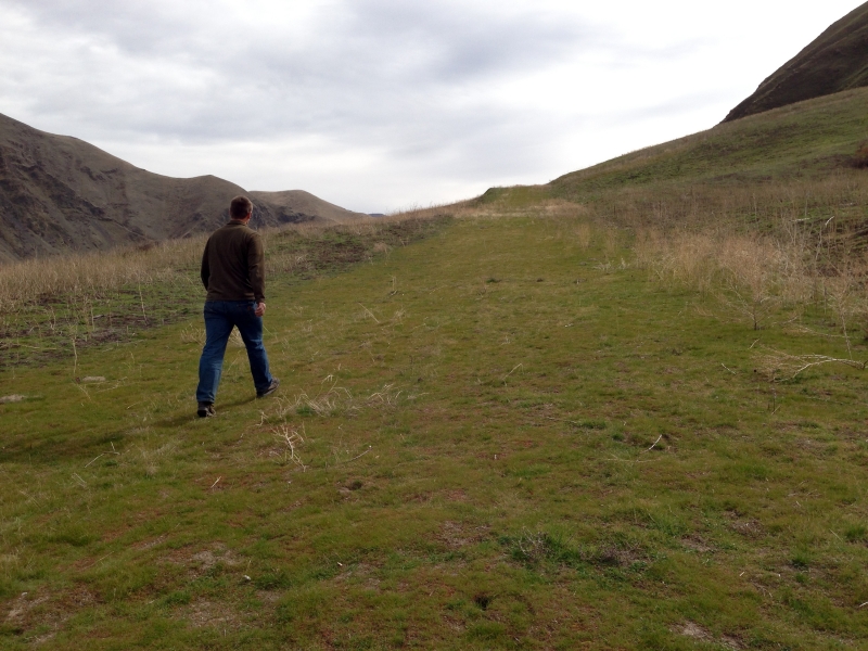
    Land to the south (uphill); takeoff north. The airstrip is quite steep in the middle, with less slope in the bottom and upper dogleg portions.  Depending on your confidence level, there is rarely a need to land at the bottom of the strip; rather land midpoint or higher and use the slope to slow down.  Park at the top. Takeoffs can be performed using only the dogleg portion in most aircraft.

    If you remember, bring a newspaper for the caretakers.

    You may check the current status before landing:
    Hells Canyon National Recreation Area
    Wallowa Whitman National Forest
    88401 Hwy 82
    Enterprise, Oregon  97828(541)426-5545

    Runway
    • Length

      1300

    • Width

      30

    • Surface

      TURF

    Details
    • Facility ID

      No ID 016

    • Elevation

      900

    • CTAF

      122.9

    • State

      OR

    Gallery
    Location

    Lat: 45.98055555556 , Long: -116.90305555556 - OREGON, USA

    Get Directions
    Categories
    • Recreational
    Tags
    • Mountains
    • Desert
    • Canyon
    Region
    • Northwest Mountain
    Ownership
    • Public
    Author
    shortfield
    mood_bad
  • No comments yet.
  • Add a review

    Leave a Reply · Cancel reply

    You must be logged in to post a comment.

    Related Videos
    Prev 1 of 68 Next
    • Landing and Departing Soldier Bar USFS Strip Idaho Backcountry in a RANS - 4K

      Landing and Departing Soldier Bar USFS Strip Idaho Backcountry in a RANS - 4K

      Quick stop at Soldier bar. This can be challenging depending on your aircraft. Pretty easy in the RANS, I just try to keep the nose light over the woops and bumps etc. Always gets the heart beating a bit faster when you depart this one. Thanks for coming along, subscribe for more flying of all sorts - Idaho Backcountry, off airport on BLM in he Rockies etc.
    • Cache Creek Run

      Cache Creek Run

      A dawn flight along Cache Creek, though one of its many canyons
    • Holland Camp Airstrip

      Holland Camp Airstrip

      A small little known airstrip accessing an old mining camp.
    • Cache Creek - Petersville Alaska - Land For Sale

      Cache Creek - Petersville Alaska - Land For Sale

      DIRECTIONS INTO: Cache Creek Recreational Gold Mining Subdivision. Lots of land for sale. 9+ acre lots - Over 130 to choose from! Road & Airstrip Access! Almost all lots are creek front - OR have astounding mountain views. Recreational opportunities abound! Hunting, camping, hiking, snow-machining, recreational gold mining OR easier access to the mountains. Historical Gold Mining Area! Road is ONLY accessible from June - Late September - Please be safe and aware.
    • Landing beautiful Reds Horse Ranch strip / Minam River Lodge - 4K

      Landing beautiful Reds Horse Ranch strip / Minam River Lodge - 4K

      What a neat place!!! Loved this one.... the Lodge was also pretty interesting! Friendly staff over there! Totally beautiful place in the Eagle Cap Wilderness area.

      Red's Wallowa Horse Ranch
    • 335. Flying to Tobiano, Walhachin and Cache Creek. Good Turbulence, Feb 21, 2021

      335. Flying to Tobiano, Walhachin and Cache Creek. Good Turbulence, Feb 21, 2021

      This was the first leg of my 1.5 hour flight to Cache Creek. I flew via golf and residential area high above Kamloops Lake, Tobiano and down in the valley on the end of Kamloops Lake, Savona. I continued in the complex valley of winding South Thompson River creating spectacular scenery. I flew over small historic village situated high above the river valley, Walhachin. I continued towards Ashcroft through to deep canyon of South Thompson River, but I felt in my bones that it would not be smooth sailing. The complex terrain and shifted winds create unpredictable flying conditions. Eventually, I had enough of bouncing around and got out before it would be too late. The Cache Creek Airport and its location are a bit intimidating. First it looks very small from the air especially when flying from Kamloops with such large airport runway. Secondly the location in the middle of the mountain slope creates good crosswinds and up or downdrafts by winds from the perpendicular valley. I met there another pilot, Daniel Berwin with his Zenair bird. We exchanged few Covid distant words and experiences. He followed me on my way back and took several pictures from his ultralight. It was nice.
    • Cayuse Creek USFS (C64) Idaho

      Cayuse Creek USFS (C64) Idaho

      Cayuse Creek USFS (C64) Idaho
    • Landing Dug Bar, Oregon OR8

      Landing Dug Bar, Oregon OR8

      5-16-20. First time into Dug Bar, landing 15. C206
    • Departure out of Moose Jaw Muni.

      Departure out of Moose Jaw Muni.

      Lori and I on our cross country to Regina via Estevan.
    • Seafloor Features - Oceanography - 3/2/21

      Seafloor Features - Oceanography - 3/2/21

    • Cessna 172P | Short Field Practice | Plaridel Airport

      Cessna 172P | Short Field Practice | Plaridel Airport

      Great weather for 1080's weekly exercise around the pattern with dad. Favorable winds for practicing short field landings , almost a direct headwind at about 10kts. We used only about 1200ft/365m of Plaridel's runway. Definitely my best flying day of the year so far.

      Bonus : Revealing the paint scheme of our "new" D2J-powered 172N.

      Cessna 172P (RP-C1080)
      Plaridel Airport (RPUX)
      GoPro H3+BE (1080p@60fps) and iPad Air 2 (1080p@30fps)
      Music by Derlee

      IG: @lanceguballa and @jonjie320

      Subscribe!
    • Nabesna rd Slana Alaska small stream creek crossing 1

      Nabesna rd Slana Alaska small stream creek crossing 1

    Prev 1 of 68 Next

    You May Also Be Interested In

    ROGERSBURG, WA

    Rogersburg is closed.  Do not land without permission from the managing agencies. This is a WSDOT strip. It…
    • 46.07444444444, -116.96611111111
    • Abandoned

    WAPSHILLA CREEK, ID

    • 45.94195900000, -116.76370400000
    • Recreational

    EAGLE CREEK, ID

    This an uncharted airstrip and the conditions are unknown.  The strip may be closed to the public and/or…
    • 45.99836300000, -116.70385800000
    • Recreational

    © 2000-2021 shortfield.com

    Cart

      • Featured
      • Recreational
      • Restricted
      • Off-Airport
      • Abandoned
      • Outpost
      • Facebook
      • Twitter
      • WhatsApp
      • Telegram
      • LinkedIn
      • Tumblr
      • VKontakte
      • Mail
      • Copy link