Sign in or Register
    • Featured
    • Recreational
    • Restricted
    • Off-Airport
    • Abandoned
    • Outpost
    • Home
    • Explore
    • STOL Gear

    BULL RUN, OR

    A legendary hidden gem tucked deep in a desert canyon, Bull Run rewards visitors with solitude, wild trout, and some of the most dramatic scenery in the Pacific Northwest.

    • Overview
    • Reviews / PIREPs 1
    • Videos
    • Events
    • prev
    • next
    • Leave a Review / PIREP
    • Bookmark
    • Report
    • Share
    • prev
    • next
    Alert

    Despite ongoing advocacy efforts to have the prohibition lifted through a future revision of the Resource Management Plan, the legal restriction has remained in place, leaving Bull Run in a gray zone — unofficially used and beloved, but technically off-limits.

    Description

    Location Overview
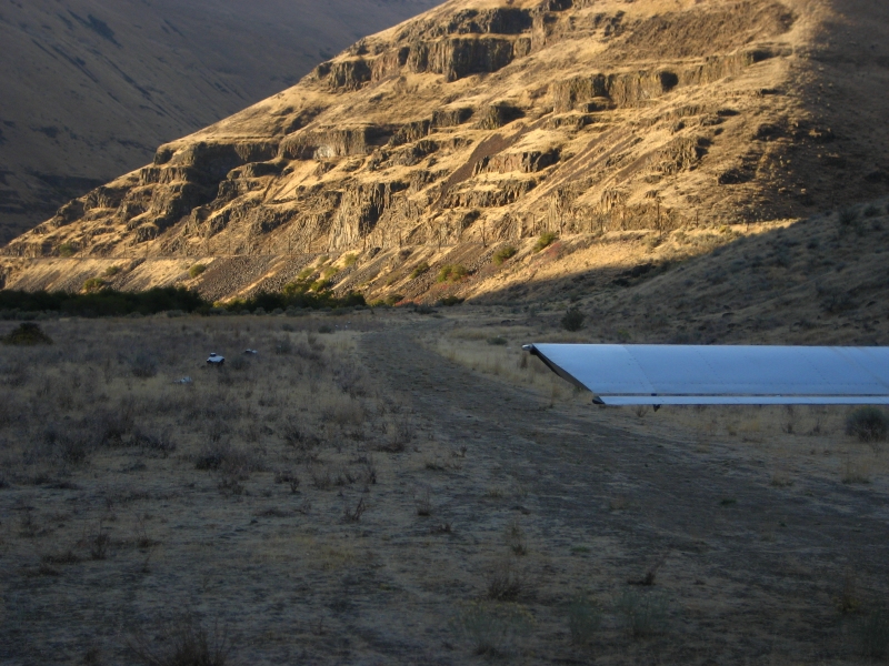
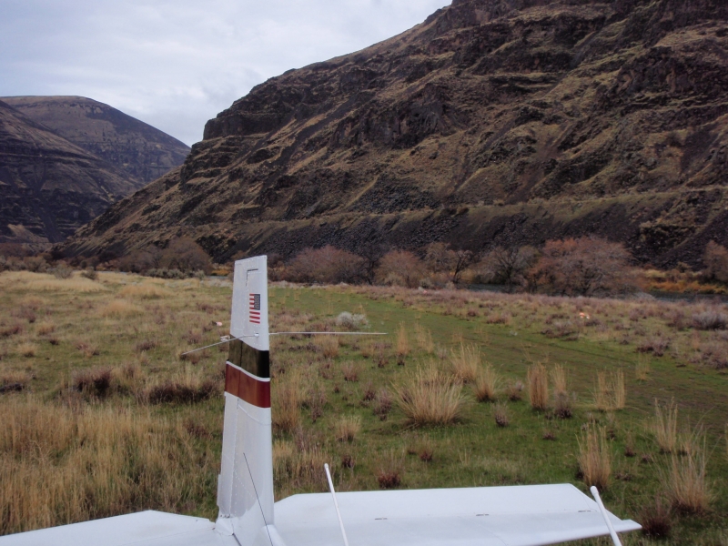
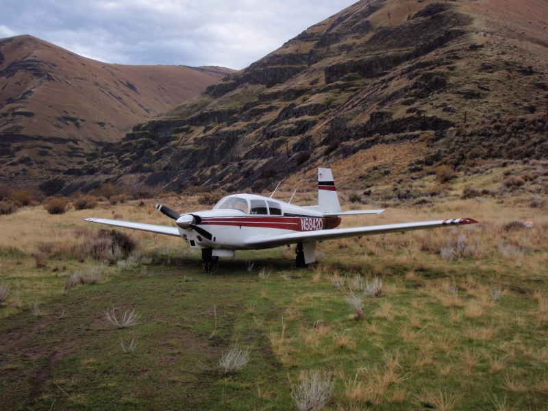
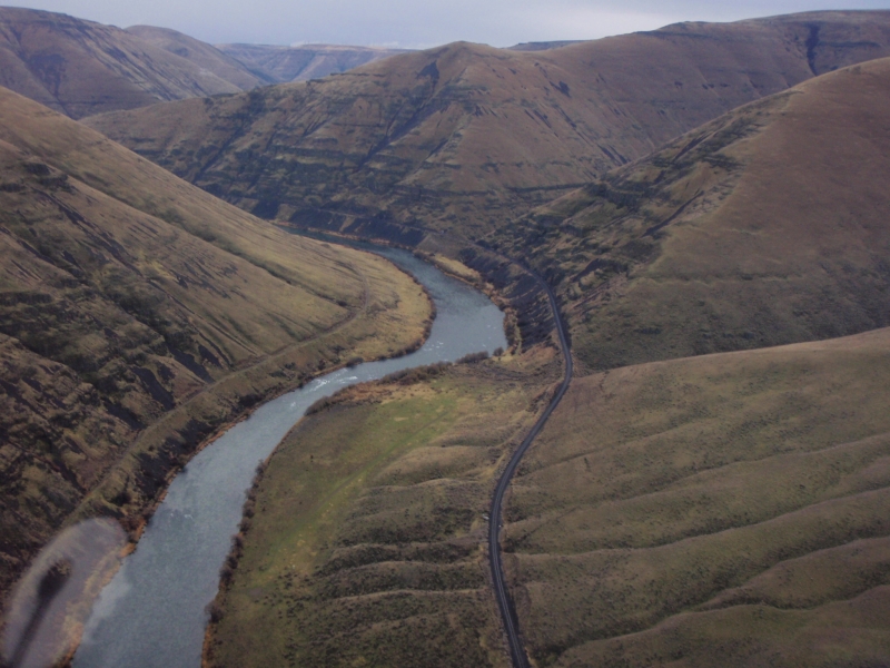
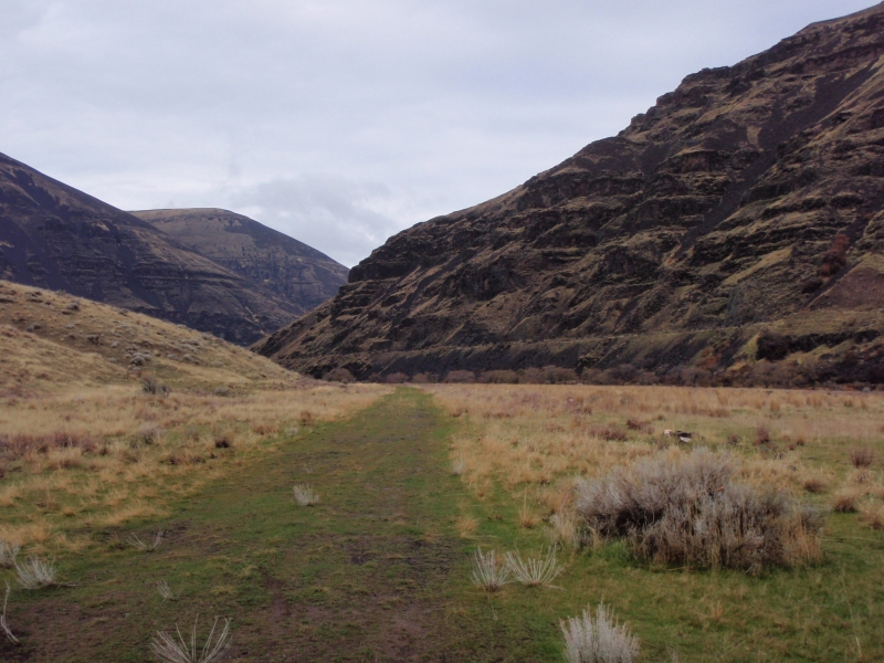
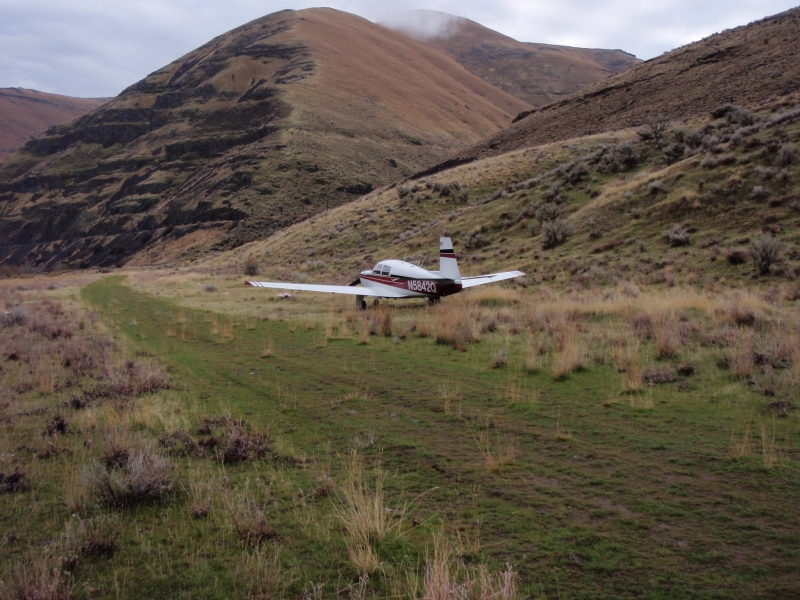
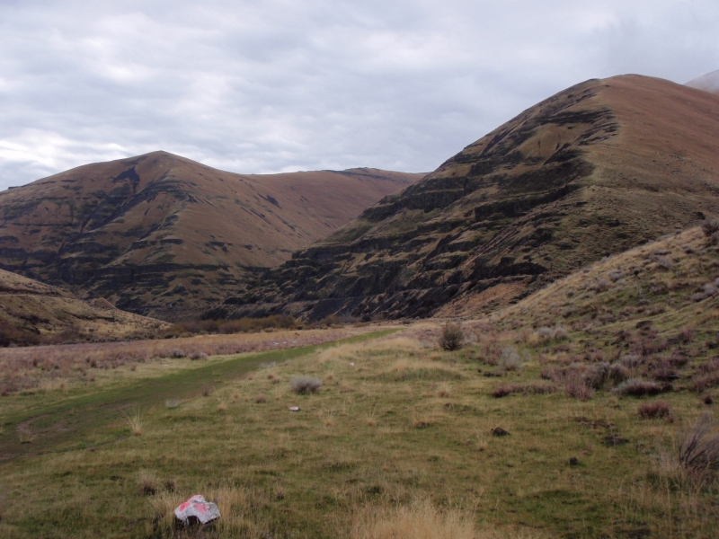
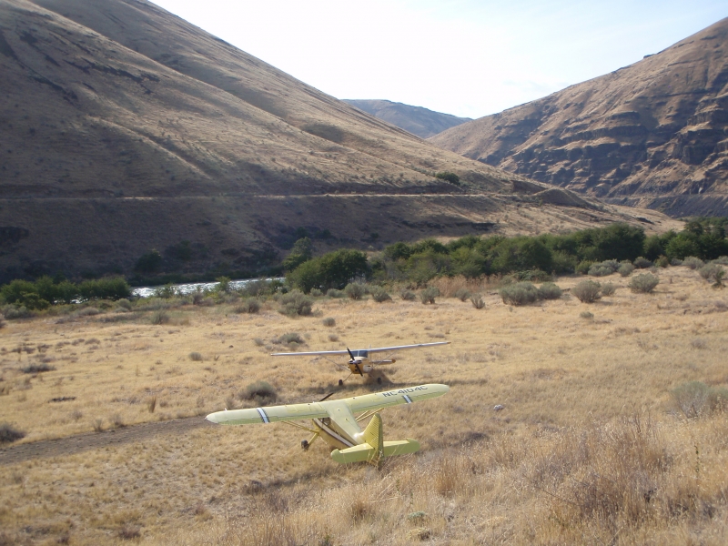
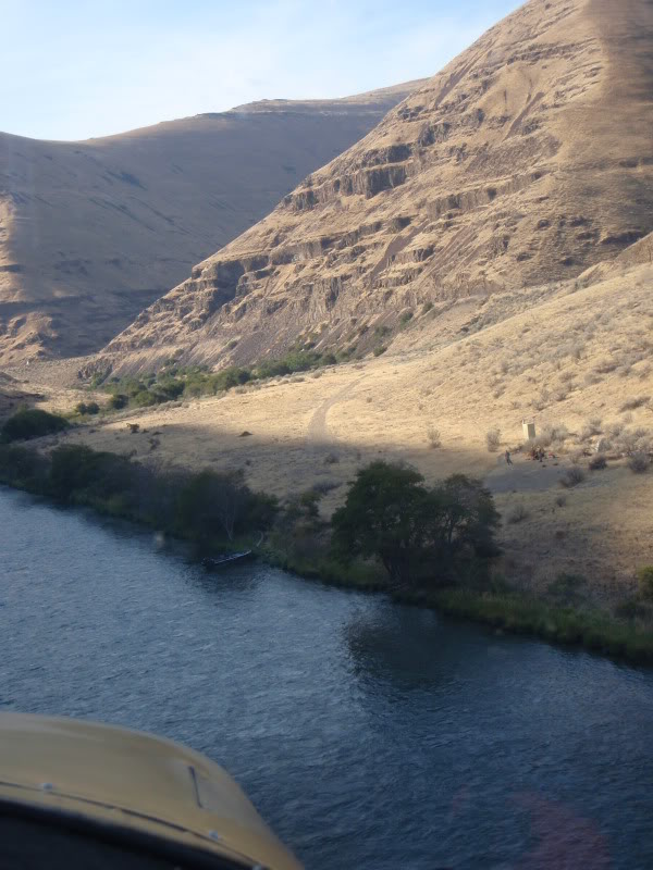
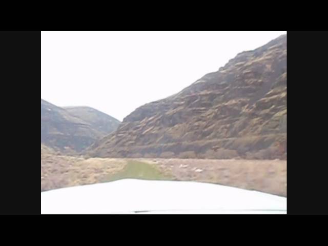
    Bull Run sits deep in a narrow canyon along the lower Deschutes River in eastern Oregon, squeezed between the river and the Union Pacific railroad tracks. The strip runs parallel to the river between two sharp bends, and the canyon walls tower roughly 1,000 feet on either side. Field elevation is approximately 400 feet MSL. The area is managed by the BLM as part of the Lower Deschutes Wild and Scenic River corridor, roughly 30 miles east of Hood River.

    Camping & Recreation
    There is a basic toilet on site and primitive camping, though there are no tie-downs or defined parking spots. Excellent trout and steelhead fishing can be found both upstream and downstream. The surrounding canyon is prime territory for whitewater rafting, with world-class runs along the lower Deschutes drawing kayakers and drift-boat guides throughout the season.

    Notes & Warnings
    The strip is approximately 800 feet in length with a small hump about two-thirds of the way from the upstream end and a roughly seven-degree dogleg at that same point. Approaching from either direction requires maneuvering through the steep, narrow canyon with little visibility of the strip until you are just a couple hundred feet above the water. The strip is relatively narrow, and rock piles mark either side of the runway — these can cause serious damage if you drift off centerline, and they are often obscured by grass. After liftoff heading upstream, pilots must execute a 30–40 degree turn followed by a quick S-turn to follow the river north while climbing out of the canyon — the landing approach is essentially that sequence in reverse. This strip is not recommended unless you have solid short-field skills and are comfortable maneuvering in tight terrain. Importantly, the BLM's 1993 River Management Plan specifically prohibits aircraft landings within the Wild and Scenic River Corridor — which includes this strip — extending from the Columbia River to approximately river mile 100 near Warm Springs. Enforcement is possible by federal, state, or tribal authorities.

    History
    Bull Run has been in continuous public use as an airstrip since at least the early 1980s, predating both the Wild and Scenic River designation of the Deschutes (1988) and the BLM River Management Plan finalized in 1993. Over time it became a beloved destination for Oregon's backcountry flying community — one of the very few such strips accessible in the state. When the BLM moved to formally close it around 2010, pilots and outfitters alike rallied strongly in its defense, with river guides and whitewater operators writing letters on behalf of the strip's continued use. Despite ongoing advocacy efforts to have the prohibition lifted through a future revision of the Resource Management Plan, the legal restriction has remained in place, leaving Bull Run in a gray zone — unofficially used and beloved, but technically off-limits.

    Runway
    • Length

      1000

    • Width

      ?

    • Surface

      DIRT

    Details
    • Facility ID

      No ID 033

    • Elevation

      400

    • CTAF

      122.9

    Gallery
    Location

    Lat: 45.450008 , Long: -120.863697 - OREGON, USA

    Get Directions
    Flyover Video
    Prev 1 of 1 Next
    • Runway Flyover - Bull Run, OR

      Runway Flyover - Bull Run, OR

      @shortfieldvideos
    Prev 1 of 1 Next
    Categories
    • Recreational
    Tags
    • Desert
    • Canyon
    Region
    • Northwest Mountain
    Ownership
    • Public
    Author
    shortfield

    Land here, before you land out there!

    • piperpainter
      October 21, 2022 at 10:02 am

      Flew over, didn’t land due to winds. Looks in good shape

      Log in to Reply
    Add a review

    Leave a Reply · Cancel reply

    You must be logged in to post a comment.

    Shortfield Playlist
    Prev 1 of 1 Next
    • Bull Run N148CC Landing

      Bull Run N148CC Landing

      A higher resolution video, Landing Upriver on the Bull Run Airstrip Deschutes River Oregon.
    • Super Cub Landing Deschutes River Bull  Run

      Super Cub Landing Deschutes River Bull Run

      Super Cub landing at the Bull Run Airstrip on the Deschutes River
    • Backcountry Flying Maule, Bull Run Oregon 8-2015

      Backcountry Flying Maule, Bull Run Oregon 8-2015

      flew in to Bull Run on the John Day River, Oregon. The Smoke from all of the fires in Washington and Oregon caused near IFR conditions for weeks.
    • Super Cub Fly Over Deschutes River Bull Run

      Super Cub Fly Over Deschutes River Bull Run

      Super Cub flying over the Bull Run Airstrip to check airstrip and wind direction prior to landing.
    • Takeoff From Bull Run, OR Mooney M20C .wmv

      Takeoff From Bull Run, OR Mooney M20C .wmv

      Went to Bull Run, OR on 27 Nov 2009 to check the place out. Its a great little airstrip not far from Grass Valley, OR. I plan on returning to camp here in the srping/summer!
    Prev 1 of 1 Next
    YouTube Search
    The request cannot be completed because you have exceeded your quota.

    You May Also Be Interested In

    SIXTEEN CANYON, OR

    Caution: The conditions of this airstrip are completely unknown.  It is most likley hazerdous and…
    • 45.40227700000, -120.86763400000
    • Recreational

    CHUKAR FLATS, OR

    Chukar Flat Airstrip is a jewel. The runway lies on a silty bar on the east side of the river. The flat is…
    • 45.226469, -120.543649
    • Recreational

    PINE HOLLOW, OR

    Pine hollow is a private strip. To land here you need to sign the permission slip and return it to the…
    • 45.25483944444, -121.29367805556
    • Restricted

    © 2000-2025 shortfield.com

    Cart

      • Featured
      • Recreational
      • Restricted
      • Off-Airport
      • Abandoned
      • Outpost
      • Facebook
      • Twitter
      • Mail
      • Copy link