Sign in or Register
    • Featured
    • Recreational
    • Restricted
    • Off-Airport
    • Abandoned
    • Outpost
    • Home
    • Explore
    • Shop

    BEAVER MARSH STATE, OR

    • Overview
    • Reviews / PIREPs 0
    • Events
    • Videos
    • prev
    • next
    • Bookmark
    • Share
    • Leave a Review / PIREP
    • Report
    • prev
    • next
    Description

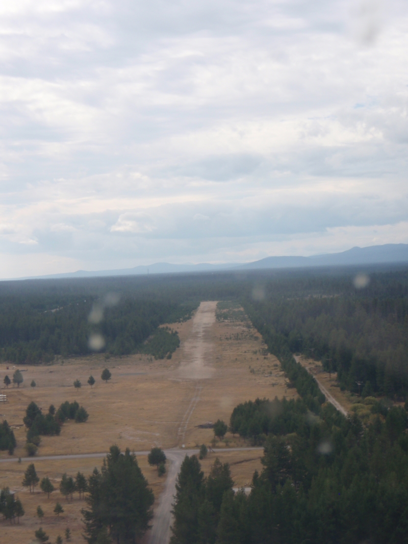
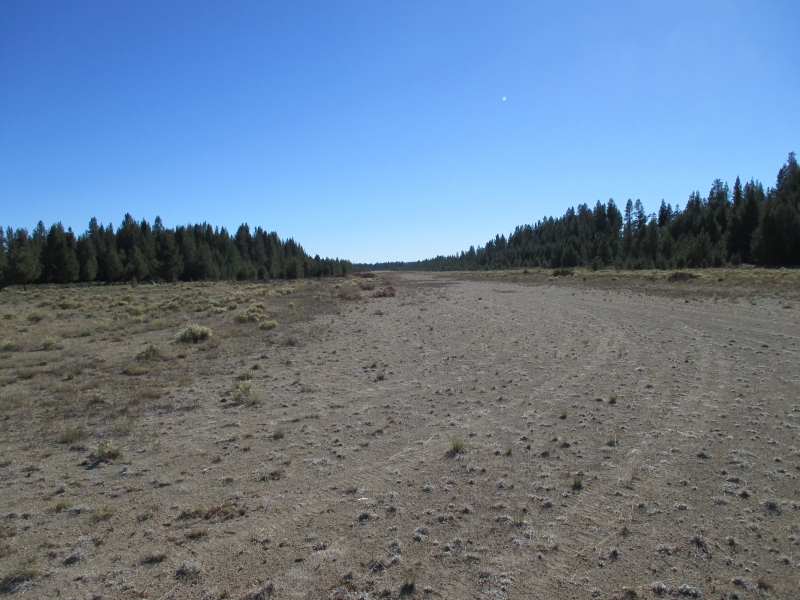
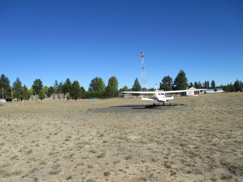
    Beaver Marsh is an extremely low use state airport just west of HW97 in the town of Beaver Marsh. Surface is soft with lots of big rocks in the middle of the runway, watch out as they are big enough to seriously ruin someones day. Windsock was missing. There is an old beacon there so maybe once upon a time there was a fair amount of use. Now it sits mostly deserted and is slowly becoming overgrown with small trees, brush and some big rocks in the runway. I would not be surprised if this one gets closed sometime in the near future. Not much of a reason to go here, but I bet you could walk into town and find some food.

    Runway
    • Length

      4500

    • Width

      60

    • Surface

      DIRT-P

    Details
    • Facility ID

      2S2

    • Elevation

      4638

    • CTAF

      122.9

    • State

      OR

    Gallery
    Location

    Lat: 43.12752777778 , Long: -121.80872222222 - OREGON, USA

    Get Directions
    Categories
    • Recreational
    Region
    • Northwest Mountain
    Ownership
    • Public
    Author
    shortfield
    mood_bad
  • No comments yet.
  • Add a review

    Leave a Reply · Cancel reply

    You must be logged in to post a comment.

    Related Videos
    The request cannot be completed because you have exceeded your quota.

    You May Also Be Interested In

    TOKETEE STATE, OR

    Toketee State Airport (FAA LID: 3S6), is a public airport located two miles (3.2 km) south of the small town…
    • 43.22344444444, -122.42116666667
    • Recreational

    SILVER LAKE F S STRIP, OR

    No particular reason to go here except to do it.  Absolutely no facilities or trees and about 3 miles…
    • 43.11097250000, -121.09416666667
    • Recreational

    CHILOQUIN STATE, OR

    Chiloquin is a small airstrip north of Kalamath Falls. This airport is the closest paved strip to Crater…
    • 42.58319166667, -121.87612611111
    • Recreational

    © 2000-2021 shortfield.com

    Cart

      • Featured
      • Recreational
      • Restricted
      • Off-Airport
      • Abandoned
      • Outpost
      • Facebook
      • Twitter
      • WhatsApp
      • Telegram
      • LinkedIn
      • Tumblr
      • VKontakte
      • Mail
      • Copy link