Description
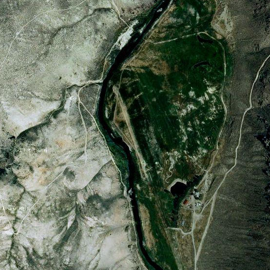
The 45 Ranch encompasses 240± deeded acres nestled in a distinctive canyon landscape, representing one of the most isolated yet accessible ranch properties in the contiguous United States. Small aircraft can reach the property from the Boise area in approximately 45 minutes.
Surrounded by the Owyhee River Wilderness Area and additional public lands, the ranch is situated near an alternative BLM dirt airstrip with intersecting runways just one mile away. The property stands as one of the few private landholdings within a 500± square mile expanse.
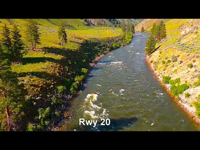
The South Fork of the Owyhee River traverses nearly a mile of the property, accompanied by senior water rights dating to 1896 for both irrigation and wildlife purposes.
The ranch features a furnished cabin equipped with user-friendly off-grid power and communication systems. Additional structures include a caretaker's residence, barns, and the original homesteaders' cabins currently under renovation for supplementary guest accommodations.
A 2,700± foot private grass airstrip, publicly accessible and situated at approximately 4,300 feet elevation, serves the property.
The runway is open (subject to occasional irrigation, call the caretaker at 541-212-6582 for an update), the cabin can be rented, the hiking is great, and the local fishing is outstanding!
Runway
-
Length
?
-
Width
?
-
Surface
DIRT
Details
-
Facility ID
No ID 131
-
Elevation
4400
-
CTAF
122.9
-
State
Idaho
Gallery
Location
Lat: 42.17463100000 , Long: -116.87631400000 - IDAHO, USA


Add a review