Sign in or Register
    • Featured
    • Recreational
    • Restricted
    • Off-Airport
    • Abandoned
    • Outpost
    • Home
    • Explore
    • STOL Gear

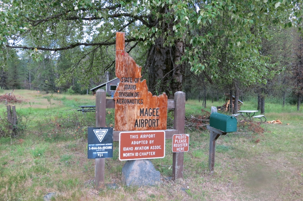
    MAGEE, ID

    A remote grass strip tucked in the Idaho Panhandle wilderness, where WWII history meets backcountry flying and creekside camping.

    • Overview
    • Reviews / PIREPs 0
    • Videos
    • Events
    • prev
    • next
    • Leave a Review / PIREP
    • Bookmark
    • Report
    • Share
    • prev
    • next
    Description

    Location Overview
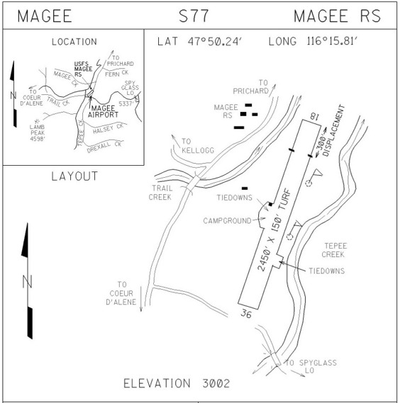
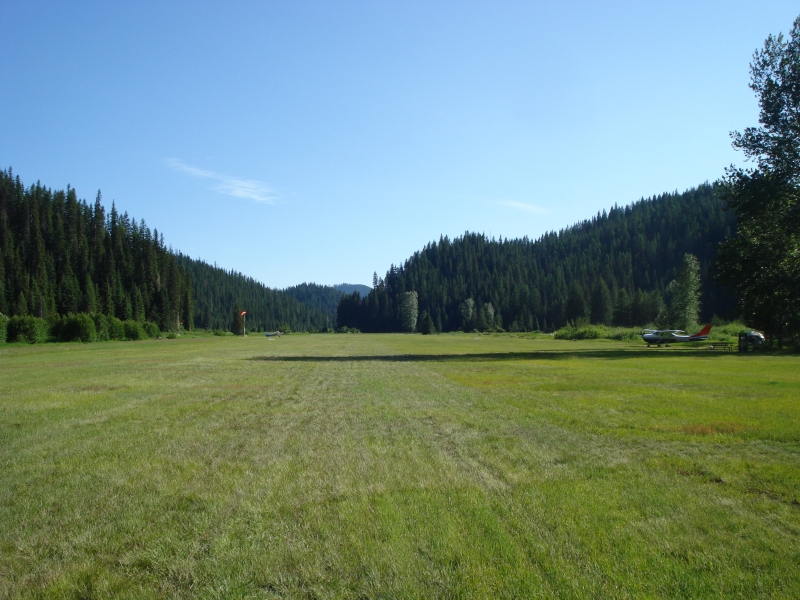
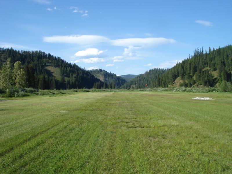
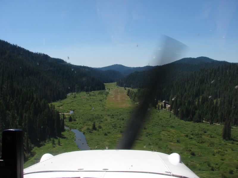
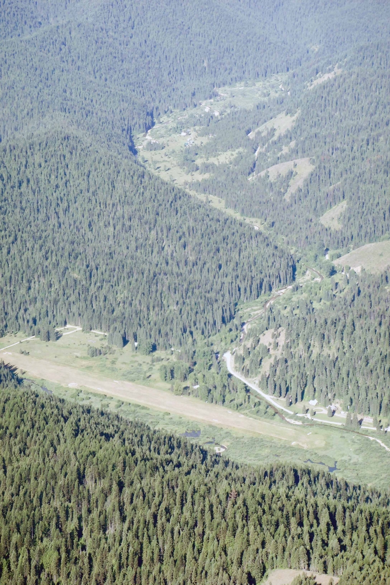
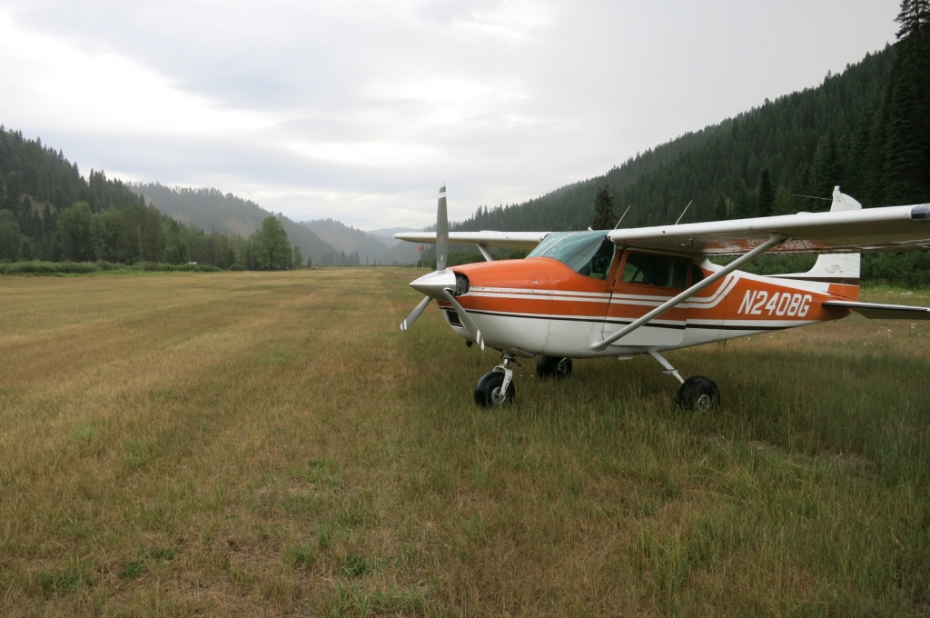
    Magee sits at the confluence of Trail Creek and Teepee Creek in Northern Idaho's Panhandle National Forest, about 23 miles NE of Coeur d'Alene, Idaho, on 20 acres of land, near Pritchard in Shoshone County. The field sits at an elevation of 3,002 feet and has a single turf runway oriented 1/19, 2,200 feet long.

    Camping & Recreation
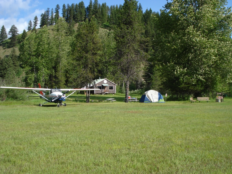
    The strip has tie downs, a campground, and potable water during summer months, along with a windsock and segmented circle. More specifically, there are two camping sites at the Magee Airstrip Campground with a pit toilet, tables, fire pits, and stoves, plus another site on the south end near the creek, and an old Forest Service Ranger cabin near the strip is available for rent. Both nearby creeks attract seasonal fishing, and a trail leads from the southwest end of the airfield to bridges across both waters.

    Notes & Warnings
    The strip gets no winter maintenance, and sees snowmobile activity in winter; the surface can be uneven and soft in the spring. Official guidance recommends landing on runway 19 and taking off on runway 01 when wind conditions permit. Because it sits within a Wilderness area, no roads or mechanized equipment can be used for maintenance, making runway logistics a challenge — a spring flooding problem has been eroding part of the field for years, and a volunteer-engineered restoration effort is underway with the Forest Service to recover about 700 feet of runway.

    History
    The site's story predates aviation entirely: Charles Magee built a homestead at the Trail Creek–Tepee Creek confluence in September 1905, and by 1908 the Forest Service had appropriated part of it as the Magee Ranger Station. In the 1930s it became a Civilian Conservation Corps base camp housing up to 400 men who built roads, maintained trails, and fought white-pine blister rust. The airstrip itself dates to WWII, when the Army Corps of Engineers created it in the 1940s as a hidden fighter base in case of a Japanese attack on the West Coast — though locals reported fighter aircraft never actually visited during the war. Today the historic ranger cabin still stands, the site is listed on the National Register of Historic Places, and the airstrip lives on as a beloved backcountry destination for Idaho pilots.

    Runway
    • Length

      2450

    • Width

      150

    • Surface

      TURF-G

    Details
    • Facility ID

      S77

    • Elevation

      3002

    • CTAF

      122.9

    Gallery
    Location

    Lat: 47.840685 , Long: -116.252838 - IDAHO, USA

    Get Directions
    Flyover Video
    Prev 1 of 1 Next
    • Runway Flyover - Magee, Idaho

      Runway Flyover - Magee, Idaho

    Prev 1 of 1 Next
    Categories
    • Recreational
    Tags
    • Mountains
    • Fishing
    • Potable Water
    • Camping
    • Lakes/Rivers
    • Hunting
    • Bicycling
    • Trees
    Region
    • Northwest Mountain
    Ownership
    • Public
    Author
    shortfield

    Land here, before you land out there!

    mood_bad
  • No reviews/PIREPs have been posted yet.

  • Add a review

    Leave a Reply · Cancel reply

    You must be logged in to post a comment.

    Shortfield Playlist
    Prev 1 of 2 Next
    • Short Final in Daher Kodiak airplane into Magee Airstrip, Idaho

      Short Final in Daher Kodiak airplane into Magee Airstrip, Idaho

      Back country landing at Magee airstrip in northern Idaho just east of Coeur d'Alane airport in Daher Kodiak airplane
    • Magee Airstrip

      Magee Airstrip

      I drove in to Magee Airstrip in north Idaho and did a little maintenance work over Labor Day weekend, filling in gopher holes and stocking firewood... got some rough video of a few arrivals and departures.
    • 2 Aerotreks flying to Magee Ranger Station, Idaho

      2 Aerotreks flying to Magee Ranger Station, Idaho

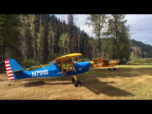
      This video is about 2 Aerotrek A220s flying from Timber Basin Airpark to Magee Ranger Station in northern Idaho.

      Magee Ranger station is a former USFS airstrip now owned and managed by the Idaho Dept of Aeronautics. It features tie downs and camping facilities for pilots and passengers only.

      The USFS maintains a cabin nearby that can be rented for overnight stays. Details can be found on the USFS website for Magee Ranger Station.

      If you are interested in the new Aeropro/Eurofox/Aerotrek owners’ website, please visit at

      https://teamaeropro.proboards.com
    • Magee (S77) in Winter

      Magee (S77) in Winter

      Taking advantage of minimal snow to check out Magee (S77) airstrip in Idaho. Did a low pass to check runway condition, circled back to land. Definitely could feel the snow on take off! Once the nose wheel lifted a bit accelerated quickly but wouldn't want to land in much deeper snow without some skis! Circled back on departure to check out my tracks. Zenith CH750 STOL for the win! @zenithairco
    • Landing at Magee Airport, Idaho

      Landing at Magee Airport, Idaho

      JT landing at Magee Airport (S77), Idaho, in a 1953 C-170B with the Sportsman STOL kit and 195 HP engine.
    • Flight to Magee Ranger Station, Idaho

      Flight to Magee Ranger Station, Idaho

      Flying Into north Idaho Backcountry.

      Magee Ranger station is a former USFS airstrip that is now owned by the Idaho Dept of Aeronautics. It has camping facilities for pilots only and usually has firewood cut and readily available. There is also a USFS cabin nearby that can be rented by the night, although it does not have electricity or running water.

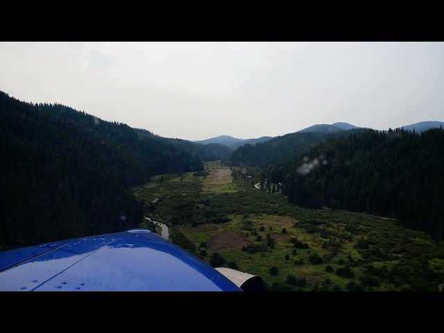
      I'm flying a 2016 Aerotrek A220 with a Rotax 912ULS 100HP engine. The best approach to Magee is to the northeast and safest takeoff is to the southwest down the river valley.
    Prev 1 of 2 Next

    You May Also Be Interested In

    HORSE HEAVEN / HORSEHAVEN, ID

    A rugged, semi-abandoned airstrip tucked into the North Fork Coeur d'Alene River drainage of the Idaho Panhandle.
    • 47.8269, -116.4973
    • Abandoned

    GREEN MOUNTAIN, WA

    Private! Don't land without permission.
    • 47.82277900000, -117.06988300000
    • Restricted

    ROCK CREEK FARM, ID

    This is a private airstrip.  Do not land without owner's permission.
    • 47.39240333333, -116.87295555556
    • Restricted

    © 2000-2025 shortfield.com

    Cart

      • Featured
      • Recreational
      • Restricted
      • Off-Airport
      • Abandoned
      • Outpost
      • Facebook
      • Twitter
      • Mail
      • Copy link