Sign in or Register
    • Featured
    • Recreational
    • Restricted
    • Off-Airport
    • Abandoned
    • Outpost
    • Home
    • Explore
    • Shop

    MILE HI, ID

    • Overview
    • Reviews / PIREPs 0
    • Events
    • Videos
    • prev
    • next
    • Bookmark
    • Share
    • Leave a Review / PIREP
    • Report
    • prev
    • next
    Description

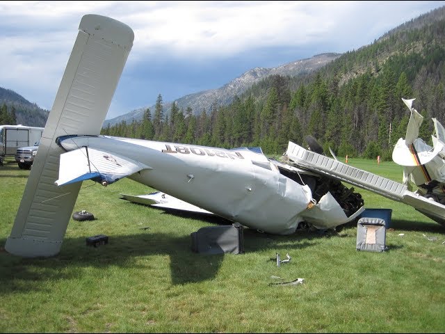
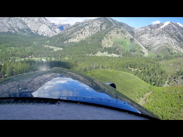
    CAUTION: this airstrip is only suitable for high performance STOL aircraft with experienced mountain pilots.

    Description:
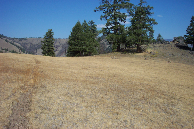
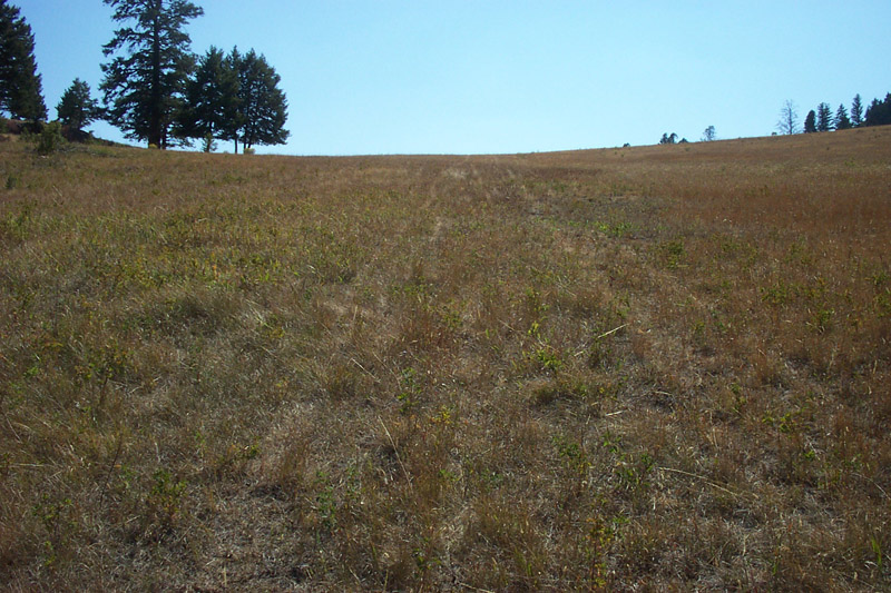
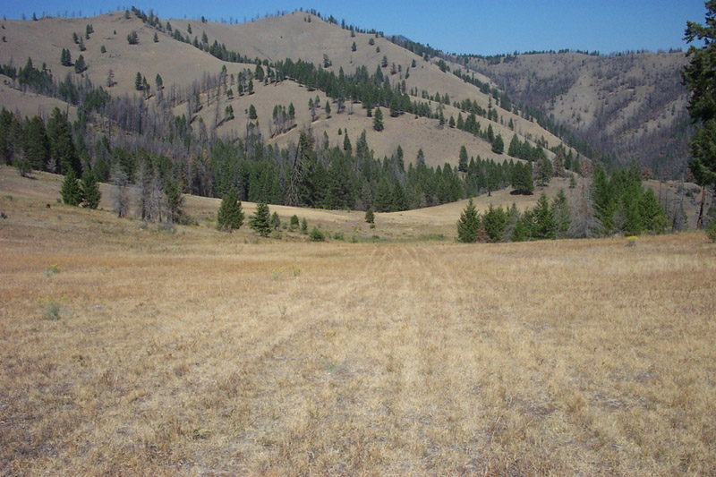
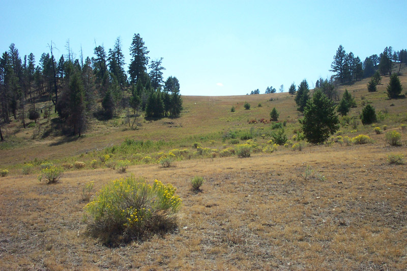
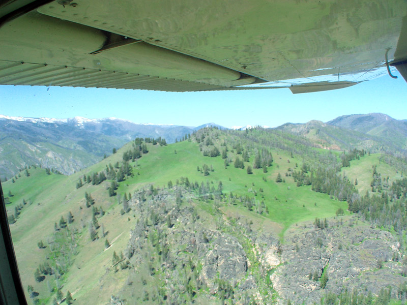
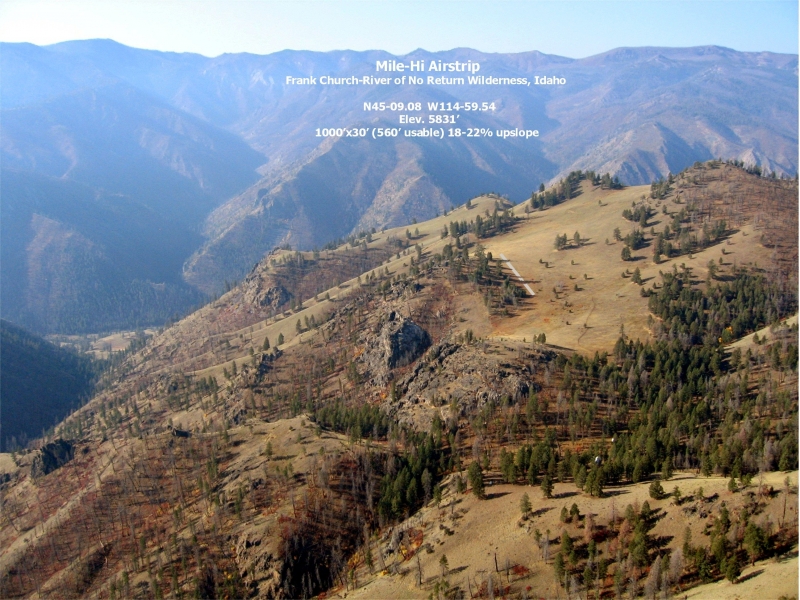
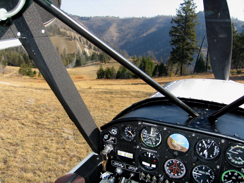
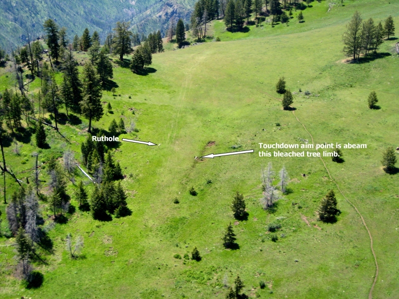
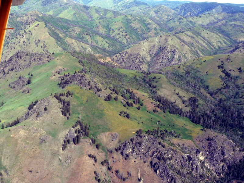
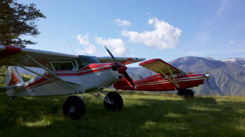
    Probably one of Idaho's most infamous backcountry airtrips, Mile Hi is a short, dog-legged, up-hill, un-maintained airstrip perched on a mountan top at 5831'.  The first 540' of the airstrip are unusable for landing, leaving a short 560' feet.  When departing, the runway is not fully visible.  

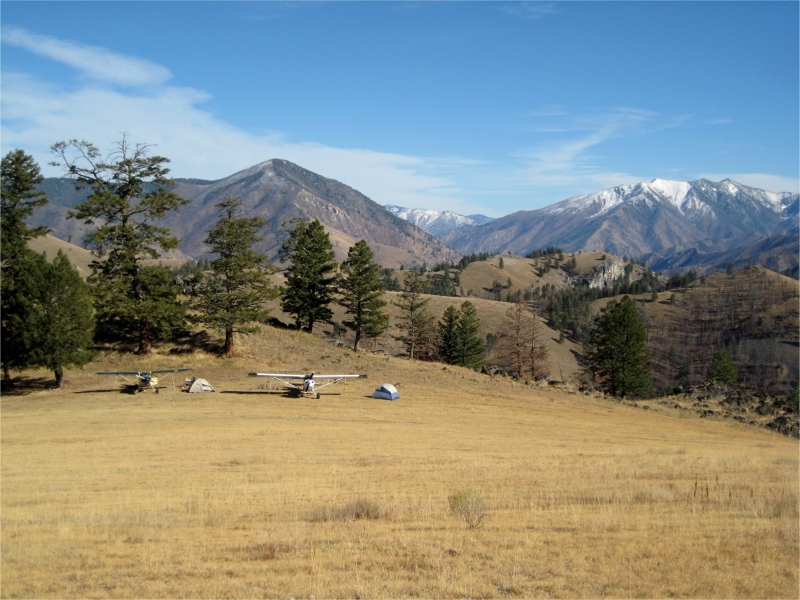
    There are no ammenities, or tie-downs and the strip is unmaintained.   

    For information call: 208.634.0746 

    Runway
    • Length

      560

    • Width

      30

    • Surface

      GRASS

    Details
    • Facility ID

      No ID 024

    • Elevation

      5831

    • CTAF

      122.9

    • State

      ID

    Gallery
    Location

    Lat: 45.15133333333 , Long: -114.99366666667 - IDAHO, USA

    Get Directions
    Categories
    • Recreational
    Tags
    • Mountains
    • Trees
    Region
    • Northwest Mountain
    Ownership
    • Public
    Author
    shortfield
    mood_bad
  • No comments yet.
  • Add a review

    Leave a Reply · Cancel reply

    You must be logged in to post a comment.

    Related Videos
    Prev 1 of 64970 Next
    • Mile Hi Airstrip Cessna 185 Idaho Backcountry

      Mile Hi Airstrip Cessna 185 Idaho Backcountry

    • Mile High Landing

      Mile High Landing

      Mile High. Idaho backcountry flying. Hunting. Big tire pilot
    • Taking off Mile Hi Idaho

      Taking off Mile Hi Idaho

    • Super Cub at Mile Hi Airstrip, Idaho

      Super Cub at Mile Hi Airstrip, Idaho

      Landing at Mile Hi Airstrip, Idaho
    • Chris Keating C-180 Mile Hi

      Chris Keating C-180 Mile Hi

      Chris Keating C-180 Mile Hi
    • Upper Loon Airstrip (U72)

      Upper Loon Airstrip (U72)

      Landing at Upper Loon to visit the Diamond D Ranch. Arrival from Stanley.
    • Krassel Landing

      Krassel Landing

      Landing and Takeoff at Krassel Ranger Station Airstrip on the South Fork of the Salmon River in Idaho. 2016
    • Story Time with Cory and Riley - Mile High Airstrip

      Story Time with Cory and Riley - Mile High Airstrip

      Join the community!
      https://www.youtube.com/flycory/join

      Become a supporter on Facebook https://www.facebook.com/becomesupporter/flycory/

      This 4k video was shot on the DJI OSMO Action https://click.dji.com/AHdyKihg-FRdt_GF82L_FQ?pm=link

      Please check out my relaxation flights channel:
      https://coryrobin.com/relax

      Merch: https://coryrobin.com

      No cost to you but supports my channel when you buy from my Amazon Store: https://amazon.com/shop/coryrobin

      Check out the music I use on Artlist and get a month FREE: https://goo.gl/j5DXXv

      Please help me transcribe and translate my channel, click here! http://www.youtube.com/timedtext_cs_panel?c=UCPMLBO8JzvBjy3N-hZcFWDQ&tab=2

      More to come! Don't miss it! Hit that subscribe and the bell button! Please hit the SHARE button to share with your friends.

      Flying Cowboy, Cory Robin, always finds a way to make any trip into a backcountry flying adventure in "Ghost" his Cubcrafters Carbon Cub EX! Ghostrider!

      Cory Robin Pilot Vlog © Cory Robin

      #CoryRobin #STOL #BackcountryFlying #Flying
    • Dave Kirsten at Mile Hi Idaho

      Dave Kirsten at Mile Hi Idaho

      Dave Kirsten at Mile Hi Idaho
    • Mile Hi, Idaho

      Mile Hi, Idaho

      Mile Hi is rated as the most difficult strip in Galen Hanselman's
      “Fly Idaho.”

      "I’m sure it has earned that ranking, but like the old Curtis Mathes TV commercial said, "it's darn well worth it." The grassy meadow at Mile Hi is just a beautiful sight. It’s green and smooth on the side of a mountain top with pine trees next to the landing area. The biggest concern to me was not the 540 foot length, nor the field elevation. It was the slope of the hillside. The first approach had me stopped well short of the top and I had to use a lot of power to taxi to the top. On the second approach I thought it better to land long and stop further up on the top. This strategy worked out well on the second flight. The King Katmai operated comfortably from Mile Hi using about half the length for landing and take off while carrying about 60 gallons of fuel and a lot of camp gear. It was incredibly relaxing just walking around and enjoying the scenery. A number of ground squirrels welcomed me by “chittering” away as I sat under a pine tree enjoying the peaceful mountain top view."

      ~ Todd Peterson
    • the road to mile hi

      the road to mile hi

      how to land at Johnson Creek to the north and avoid the white house

      La Grande @ 0:01

      Reds Horse Ranch @ 0:34

      Enterprise @ 1:41

      Joseph @ 1:50

      Memaloose @ 2:12

      Sluice Creek @ 2:50

      Temperance Creek @ 3:35

      Upper Loon @ 3:51

      Johnson Creek @ 5:10

      Solider Bar @ 6:18

      Mile Hi @ 6:55

      Cabin Creek @ 8:00

      Vines @ 8:26

      Dewey Moore @ 9:05

      Simonds @ 9:57
    • Mahoney Creek and Thomas Creek Landings and Takeoffs 2015

      Mahoney Creek and Thomas Creek Landings and Takeoffs 2015

      Mahoney Creek and Thomas Creek Landings and Takeoffs in the Idaho Wilderness. Cessna 182 2015
    Prev 1 of 64970 Next

    You May Also Be Interested In

    VINES, ID

    Vines airstrip is difficult and may be overgrown.  The airstrip is located on Big Creek approximately 3…
    • 45.13244444444, -115.00000000000
    • Recreational

    CABIN CREEK USFS, ID

    Cabin Creek airstrip is about 1.5 miles up Cabin Creek from Big Creek, nestled between mountains.  The…
    • 45.14352444444, -114.92898972222
    • Recreational

    DEWEY MOORE, ID

    This airport is a difficult, short (700 feet) runway located approximately five miles up Big Creek from Vines…
    • 45.14964600000, -115.07687300000
    • Recreational

    © 2000-2021 shortfield.com

    Cart

      • Featured
      • Recreational
      • Restricted
      • Off-Airport
      • Abandoned
      • Outpost
      • Facebook
      • Twitter
      • WhatsApp
      • Telegram
      • LinkedIn
      • Tumblr
      • VKontakte
      • Mail
      • Copy link