Sign in or Register
    • Featured
    • Recreational
    • Restricted
    • Off-Airport
    • Abandoned
    • Outpost
    • Home
    • Explore
    • Shop

    MARBLE CANYON, AZ

    • Overview
    • Reviews / PIREPs 0
    • Events
    • Videos
    • prev
    • next
    • Bookmark
    • Share
    • Leave a Review / PIREP
    • Report
    • prev
    • next
    Description

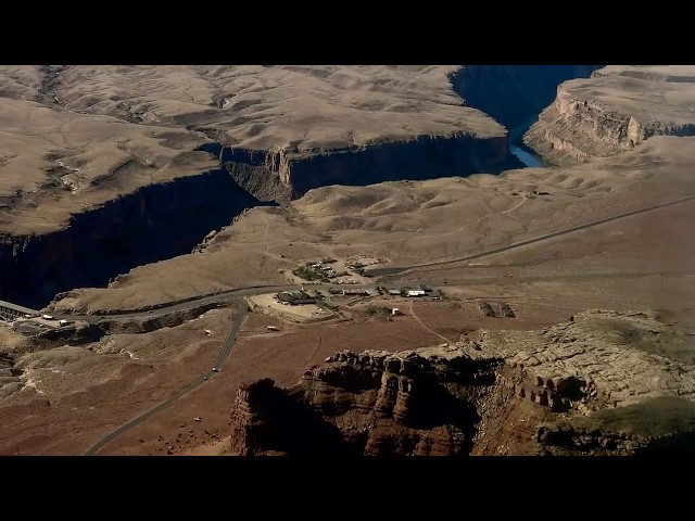
    Impressively narrow NS strip in canyon just south of Page with restaurant across the street at the north end.  Grand Canyon airspace restrictions nearby.  High density altitudes in summer.

    Runway
    • Length

      3715

    • Width

      35

    • Surface

      ASPH-P

    Details
    • Facility ID

      L41

    • Elevation

      3603

    • CTAF

      122.9

    • State

      AZ

    Location

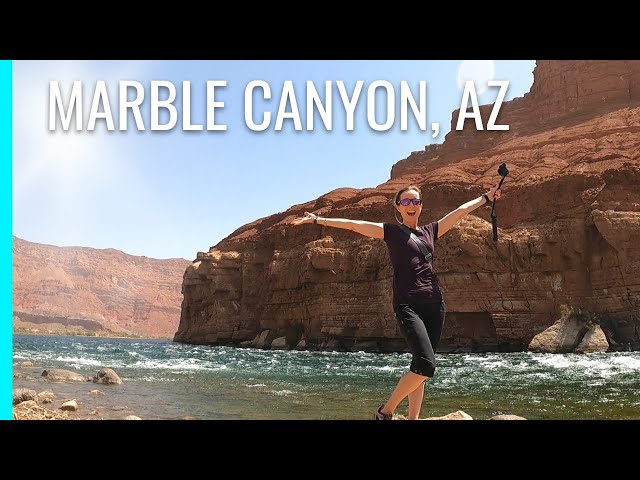
    Lat: 36.81080555556 , Long: -111.64444444444 - ARIZONA, USA

    Get Directions
    Categories
    • Recreational
    Tags
    • Mountains
    • Desert
    • Canyon
    Region
    • Western Pacific
    Ownership
    • Public
    Author
    shortfield
    mood_bad
  • No comments yet.
  • Add a review

    Leave a Reply · Cancel reply

    You must be logged in to post a comment.

    YouTube Search
    Prev 1 of 115 Next
    • Little Runway + Big Breakfast - Landing in Marble Canyon - High West: Part 5

      Little Runway + Big Breakfast - Landing in Marble Canyon - High West: Part 5

      Miles and I are on our way back south, but we can't pass through northern Arizona again without stopping at the Marble Canyon Lodge for a hearty breakfast. This is a 3,700ft-long runway sitting 3,600ft above sea level, so overall not a real challenging airport, but scenic nonetheless!

      Website: https://www.aviation101.com/
      STORE: https://www.aviation101.com/store
      COCKPIT CLUB: https://www.aviation101.com/cockpitclub
      Proudly Sponsored by:
      - Lightspeed: https://www.lightspeedaviation.com/?u...
      - FlyingEyesOptics: https://flyingeyesoptics.com/
      Email: mail@aviation101.com
      Facebook: https://www.facebook.com/Aviation101F...
      Twitter: https://twitter.com/Aviation101Film
      Instagram: @aviation101films

      #Flying #PiperCherokee #HighWestSeries
    • landing and take off marble canyon Az L41 720p

      landing and take off marble canyon Az L41 720p

      Landing our Cessna 206 at Marble Canyon, Az. (L41) on runway 03 El 3,603ft, 03/21 length 3,715x35ft asphalt with a 1 degree upslope. Take off downslope on runway 21
      We flew in from Boulder City after landing at Bar 10 ranch 1Z1 en route and approached L41 from the West alongside the Vermillion Cliffs and passed over the private Cliff Dwellers airstrip AZ03 about 7 miles West of L41
      Picturesque location and worth staying at the Navajo operated Lodge. Friendly and courteous service, very reasonable and comfortable accommodation and great food. We stayed three nights there. The tie downs are on rough and uneven ground with lots of nasty stones. There are robust if rusty cables, but bring your own ropes. L41 is close to Lee's Ferry the launch point for Grand Canyon rafting at the beginning of the gorge. For those pilots flying to L41 the winds and density altitude conditions can make for hazardous use. Fly in early when the air is cool and calm and enjoy. It's a must visit if you're flying in the area.
    • Landing at Marble Canyon airstrip

      Landing at Marble Canyon airstrip

      landing
    • AZ BOONDOCKING in Marble Canyon | Glen Canyon, Lees Ferry, Navajo Bridge | RV Living

      AZ BOONDOCKING in Marble Canyon | Glen Canyon, Lees Ferry, Navajo Bridge | RV Living

      Where do you boondock in Marble Canyon, AZ? We found a great boondocking site (Soap Creek) close to Lee's Ferry allowing us to explore that part of Glen Canyon National Recreation Area.

      We spent time in Lee's Ferry which is considered the beginning of the Grand Canyon and a popular launch place for water adventures down into the Grand Canyon. It's also one of the few places that you can drive right up to the Colorado River in the canyon!
      There is a dry camping campground and an RV dump within the park as well.
      We had fun exploring Lonely Dell Ranch learning the history and it's important river crossing.

      We also visited the Navajo Bridge off Rt 89A. The views of Marble Canyon and the Colorado River were amazing! Definitely a must see in Arizona


      ** 🫕Gear we love and use living in an RV on the road: https://resetyourjourney.com/gear/

      ** 💰 Help support us with a much appreciated donation:
      https://ko-fi.com/resetyourjourney
      Buy us a coffee, some Diesel, or some bugs for Max!

      **👕 We now have RYJ Merch! Please help support us by shopping our link!
      All our gear is designed by us!**
      https://resetyourjourney.com/shop-ryj-gear/#!/

      Timestamps:
      00:00 Intro
      01:07 Boondocking at Soap Creek in Marble Canyon
      01:40 Balanced Rock
      03:03 Lee's Ferry Campground
      03:08 Dump station at Lee's Ferry
      03:34 Paria Beach on Colorado River
      04:45 Lonely Dell Ranch
      05:52 Navajo Bridge

      Did you enjoy this video? If so, please SUBSCRIBE to our Channel:
      https://www.youtube.com/c/ResetYourJourney?sub_confirmation=1
      We hope you follow along!😁
      If you did, please comment📝, like👍, subscribe, and hit that 🔔 bell
      (L-A-S + BELL US!) for our full-time adventures! 🛣


      *If you’re already a subscriber and enjoy our videos… help us reach more people by clicking like! :)
      And be sure to follow us on Social media to keep in touch.
      We love hearing from subs in the comments!

      🌎RYJ Website:
      http://www.resetyourjourney.com

      Follow-us:
      🌳https://linktr.ee/ResetYourJourney
      👥https://www.facebook.com/Reset-Your-Journey
      📸https://www.instagram.com/resetyourjourney
      📰 Newsletter http://eepurl.com/hpm14f


      📣Useful Links Mentioned in this video:

      https://www.nps.gov/glca/learn/historyculture/navajobridge.htm
      https://www.nps.gov/glca/planyourvisit/lees-ferry.htm
      https://www.blm.gov/national-conservation-lands/arizona/vermilion-cliffs

      🎵Music:
      https://www.musicbed.com/
      https://www.epidemicsound.com/music/featured/

      👋We are an RV full-time family of 4, plus a bearded dragon (lizard). We sold everything in the Summer of 2020, moved in with family, and bought an RV to travel the country to RESET our lives: live debt free, challenge ourselves, follow the road less traveled and search for where we truly want to live!
      We love making memories in our Outdoors RV trailer!
      If you're in search of a change in your life, we hope to inspire you!


      Our RV boondocking systems:
      ☆340 watts of solar, but no inverter.
      ☆2 lead acid batteries that only run our 12 volt systems. Not enough power to run an inverter.
      ☆2 Yamaha Portable Inverter Generators

      ▶START HERE VIDEOS


      RYJ Playlists:
      Our Outdoors RV: https://youtube.com/playlist?list=PLDQNyzDhee_LTQ7VGsqOqECqhFVMo6C9Z
      From The Beginning: https://youtube.com/playlist?list=PLDQNyzDhee_KTzlHocCuutMn-EVWzRi2C


      ▶OTHER VIDEOS YOU MAY LIKE:


      *How We Boondock (Part 1): https://youtu.be/k0qpu-ug7pE
      *How We Boondock (Part 2): https://youtu.be/kCdn17Utuw4
      *BOONDOCKING and BIKING: https://youtu.be/K8IQC9G3QHo


      ▶︎ Reset Your Journey, All Rights Reserved
      *This channel for entertainment purposes only. We are not RV or travel experts. We share our opinions and what works for us, but you should do your own research.


      #marblecanyonaz #boondocking #fulltimervliving
    • Prescott Flyers go to Marble Canyon

      Prescott Flyers go to Marble Canyon

      Prescott Breakfast fly's to Marble Canyon Airstrip (L41) with 10 aircraft. Marble Canyon is within the Grand Canyon SFAR 50-2 airspace and special procedures must be followed.
    • Marble Canyon takeoff

      Marble Canyon takeoff

      Taking off from Marble Canyon Airport (L41), Arizona. On our way south a few clips from our Grand Canyon tour. Very smoky and hazy day.
    Prev 1 of 115 Next

    You May Also Be Interested In

    EMERGENCY MEDICAL, AZ

    Copter Pad Ownership: Privately Owned Owner: PAGE HOSPITAL DISTRICT PO BOX 1447 PAGE, AZ…
    • 36.91721083333, -111.46376861111

    SANDHILL RANCH, AZ

    AKA, Poverty Flat. Unknown status. One of many airstrips put in to support ranching and agriculture. …
    • 36.93193000000, -111.96962138889
    • Restricted

    HOLE-IN-THE-ROCK, UT

    This strip needs adopted! This strip offers nearby access to amazing terrain. One could walk to the East…
    • 37.26675033569, -110.93614959717
    • Recreational

    © 2000-2021 shortfield.com

    Cart

      • Featured
      • Recreational
      • Restricted
      • Off-Airport
      • Abandoned
      • Outpost
      • Facebook
      • Twitter
      • WhatsApp
      • Telegram
      • LinkedIn
      • Tumblr
      • VKontakte
      • Mail
      • Copy link