Description
Location Overview
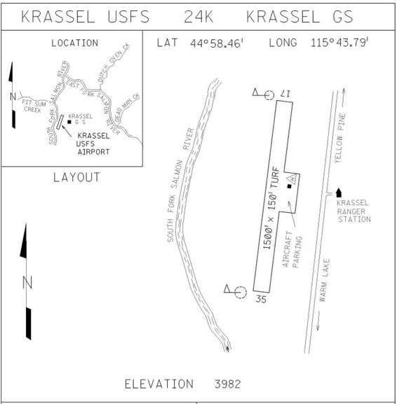
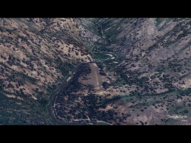
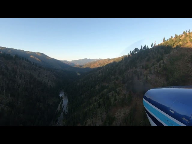
Krassel airstrip sits on a bluff high above the South Fork of the Salmon River, deep within the Payette National Forest. The valley is narrow, with mountains rising steeply on either side, and the surrounding terrain is covered in ponderosa pine and Douglas fir. The strip falls under the jurisdiction of the Krassel Ranger District and is accessible only by air or via rugged forest roads. The Krassel Ranger Station sits on the east side of the airstrip.
Camping & Recreation
There are no camping facilities at the airstrip itself, but Buckhorn Bar Campground is located 3.5 miles upstream and offers 10 developed campsites with tables, potable water, toilets, and fire pits. The surrounding Payette National Forest offers outstanding fishing on the South Fork of the Salmon River, as well as hunting, hiking, and wildlife viewing in a spectacular canyon setting.
Notes & Warnings
Krassel is a short 1,500-foot grass strip perched on a terrace above the river, with steep drop-offs at each end. The runway is short with trees on the departure end, and each end drops off steeply to the river below. Pilots should plan a careful field inspection pass before committing to land. A Forest Service guard station and helipad are located at the airstrip, and fire suppression activities may be operating from the strip at times — always monitor the CTAF and be alert for aerial firefighting traffic. This is strictly an experienced backcountry pilots-only destination; density altitude, canyon winds, and the absence of any go-around option demand thorough preparation.
History
The Krassel Ranger Station area has a remarkably deep history — the site sits on an alluvial fan on the east bank of the South Fork of the Salmon River, and archaeological evidence points to a prehistoric fishing and hunting campsite used by Native peoples. The site is listed in the National Register of Historic Places, and the Civilian Conservation Corps constructed the historic ranger station buildings and Pack Bridge between 1935 and 1942. The prehistoric site itself is a buried campsite on the river terrace occupied between approximately A.D. 1200 and A.D. 1750. The airstrip developed alongside the ranger station as the Forest Service expanded its use of aircraft for fire suppression and backcountry administration throughout the mid-20th century, eventually becoming part of the Idaho Airstrip Network as a designated public-use backcountry strip.
More Information:
Krassel Ranger District
Payett National Forest
Box 1026
McCall, Idaho 83638
(208) 634-0600
Runway
-
Length
1500
-
Width
150
-
Surface
TURF-F
Details
-
Facility ID
24K
-
Elevation
3982
-
CTAF
122.9
Gallery


Location
Lat: 44.97422222222 , Long: -115.72975000000 - IDAHO, USA


Add a review