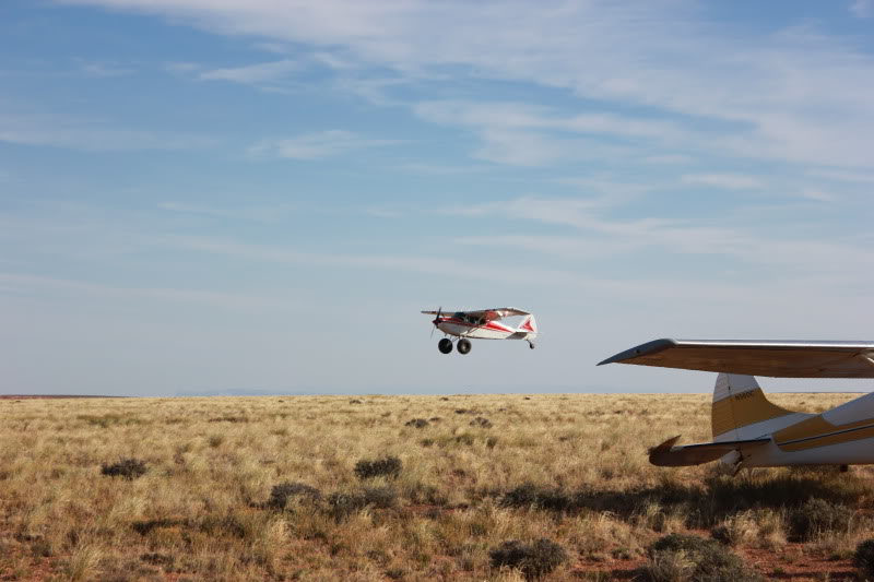
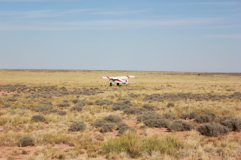
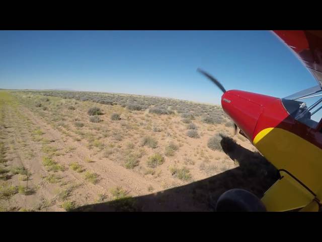
Sign in or Register
    • Featured
    • Recreational
    • Restricted
    • Off-Airport
    • Abandoned
    • Outpost
    • Home
    • Explore
    • Shop

    HORSESHOE CANYON, UT

    • Overview
    • Reviews / PIREPs 0
    • Events
    • Videos
    • prev
    • next
    • Bookmark
    • Share
    • Leave a Review / PIREP
    • Report
    • prev
    • next
    Runway
    • Length

      3629

    • Width

      40

    • Surface

      DIRT/GRASS

    Details
    • Facility ID

      No ID 097

    • Elevation

      5209

    • CTAF

      122.9

    • State

      UT

    Gallery
    Location

    Lat: 38.51318359375 , Long: -110.10618591309 - UTAH, USA

    Get Directions
    Categories
    • Recreational
    Region
    • Northwest Mountain
    Ownership
    • Public
    Author
    shortfield
    mood_bad
  • No comments yet.
  • Add a review

    Leave a Reply · Cancel reply

    You must be logged in to post a comment.

    Related Videos
    Prev 1 of 521 Next
    • Piper Pacer takeoff Horseshoe Canyon airstrip

      Piper Pacer takeoff Horseshoe Canyon airstrip

    • Landing at Monument Valley Airport and Flying the Grand Canyon

      Landing at Monument Valley Airport and Flying the Grand Canyon

      Weekend trip to Monument Valley Utah and the Grand Canyon in a Cessna 182 Skylane. We landed at Goulding's Lodge / Hotel airstrip (UT25) in Monument Valley, Utah. Once we got there the weather was amazing. On the ground we toured the 17 mile scenic loop at the national park.

      Then flew the Zuni and Dragon corridors at the Grand Canyon. Flew up the Marble Canyon (Arizona). The next day we flew to Moab, UT via Valley of the Gods and Mexican Mountain.
    • Utah Backcountry Flying - Horseshoe Canyon

      Utah Backcountry Flying - Horseshoe Canyon

      Well used, smooth and long. Almost an international airport.
    • Hiking down Horseshoe Canyon (360 degree video)

      Hiking down Horseshoe Canyon (360 degree video)

      A hike through Horseshoe Canyon in Alberta. This was taken in the spring of 2016.
    • Horseshoe Canyon

      Horseshoe Canyon

      A hike through Utah's Horseshoe Canyon
    • Hite, UT (UT03)- Takeoff over Lake Powell (Utah backcountry ) HD

      Hite, UT (UT03)- Takeoff over Lake Powell (Utah backcountry ) HD

      Canyon approach and landing on runway W at the Hite, UT airstrip in the Utah back country with a Super Stinson 108-2.

      This is narrow, paved runway near the Hite crossing overlooking Lake Powell. No facilities (parking area and covered picnic bench which aids in a drop off and pick up point for rafters). Hazards include narrow runway with gradual slope, density altitude, canyon / mountain weather, and windshear. Please proceed with caution and make sure the weather is on your side. Also, make sure your piloting skills are top notch.

      Shot with Kodak Playsport zx3

      Also, please support the Recreations Aviation Foundation ( RAF ) and the Utah Backcountry Pilots Association ( UBCP ).
    • Horseshoe canyon

      Horseshoe canyon

      Page, Arizona
    • ROAD TRIP: ARIZONA + UTAH 🏜 | Grand Canyon, Sedona, Lake Powell e Horseshoe Bend | Work and Travel

      ROAD TRIP: ARIZONA + UTAH 🏜 | Grand Canyon, Sedona, Lake Powell e Horseshoe Bend | Work and Travel

      Mais um Road Trip incrível que fiz durante meu Work and Travel; Arizona + Utah. Realizei o sonho de conhecer o Grand Canyon e fiz uma trilha que levava a uma ponte totalmente diferente do que qualquer coisa que eu já tinha visto.

      Deixe seu 👍, se inscreva no canal, ative o 🔔 e siga no instagram @Reisscah
    • Utah - Horseshoe Canyon  - HD

      Utah - Horseshoe Canyon - HD

      Horseshoe Canyon Trailhead - HD
    • Horseshoe Bend | Arizona | Olim_Travels

      Horseshoe Bend | Arizona | Olim_Travels

    • Trapped in Horseshoe Canyon

      Trapped in Horseshoe Canyon

      My family and I got trapped in Horseshoe Canyon by a flash flood in Utah. It was about a 1hour drive there on a very bumpy dirt road followed by a 2 hour hike into the canyon. We had no supplies except matches and little food but we survived!
    • USA Roadtrip 2014 – From the East Coast to the West Coast (GoPro Hero)

      USA Roadtrip 2014 – From the East Coast to the West Coast (GoPro Hero)

      It has been the trip of our lifetime. „From the east coast to the west coast“ – more than just song lyrics... Exploring America – a childhood dream has become true! I took this journey from March to April with my best friend. We drove 3.794 miles (6.106 kilometers) through the USA (only by car) – met unbelievable people, saw breathtaking places and had the best five weeks of our lives! Thanks to everyone who contributed to this outstanding experience! And now enjoy the video - I hope you can grasp some of that awesome USA road trip spirit!

      Our route:
      New York City, New York
      Philadelphia, Pennsylvania
      Dallas, Texas
      Fort Worth, Texas
      Albuquerque, New Mexico
      Telluride, Colorado
      Moab, Utah (Arches Park, Dead Horse Point & Canyonlands)
      Monument Valley, Utah
      Grand Canyon Village, Arizona
      Page, Arizona (Horseshoe Bend, Antelope Canyon & Lake Powell)
      Bryce Canyon, Utah
      Springdale, Utah (Zion National Park)
      Las Vegas, Nevada
      Los Angeles, California
      San Francisco, California

      Here is a list of the places you will find in the movie:
      0:04 Manhattan (Timesquare, Brooklyn Bridge, Statue Of Liberty (take the free ferry to Staten Island, 9/11 Memorial Ground Zero, NYC, Brooklyn Bridge Park)
      0:24 View from midtown to lower Manhattan (Rockefeller Center)
      0:26 JFK Airport New York from above
      0:28 American Airlines Center, Dallas (NBA: Dallas Mavericks vs. Indiana Pacers)
      0:35 Fort Worth Stock Yards
      0:40 Highway from Dallas to Albuquerque
      0:51 Walter White’s House from Breaking Bad, Albuquerque
      0:54 A1A Car Wash from Breaking Bad, Albuquerque
      0:55 Crossraods Motel from Breaking Bad, Albuquerque (we slept here for one night in the filmed room :D)
      0:56 To’Hajiilee desert from Breaking Bad, Albuquerque
      0:57 Highway from Albuquerque to Telluride
      1:02 Telluride Ski Resort
      1:17 Hole N'' the Rock, Moab
      1:18 Moab
      1:22 Arches National Park, Moab
      2:15 Canyonlands National Park, Moab
      2:20 Dead Horse Point State Park, Moab
      2:22 Canyonlands National Park, Moab
      2:33 Monument Valley
      2:38 Grand Canyon
      2:57 Horseshoe Bend, Page
      3:04 Lake Powell, Page
      3:07 Antelope Canyon, Page
      3:22 Horseshoe Bend, Page
      3:28 Dirt road from Page to Bryce Canyon
      3:37 Bryce Canyon National Park
      3:43 Zion National Park (Hiking Angels Landing Trail)
      4:08 Highway from Zion National Park to Las Vegas,
      4:19 Las Vegas (Strip, Pub Crawl, Fremont Street, Downtown Las Vegas, Stratosphere, Las Vegas Hostel)
      5:15 On the road to Los Angeles
      5:20 Hollywood (Hollywod Sign, Walk of Fame, Hollywood Boulevard, Rodeo Street)
      5:30 Universal Studios Hollywood (Back to the Future, Krustyland, Jaws, Desperate Housewives, Bates Motel, Transformers, etc.)
      5:49 View to Los Angeles from Santa Monica Mountains Conservancy
      5:50 Venice Beach (Pier, Boardwalk & Skate Park)
      6:07 Los Angeles Freeway by night
      6:12 Staples Center, Los Angeles (NHL: LA Kings vs. San Jose Sharks)
      6:16 Pacific Coast Highway (Highway 1) from Los Angeles to San Francisco
      6:43 San Francisco (Cable Car, Golden Gate Bridge, Twin Peaks, Fisherman’s Wharf, Painted Ladies,
      7:39 Oracle Arena, Oakland (NBA: Golden State Warriors vs. Sacramento Kings)
      7:56 Alcatraz, San Francisco

      Filmed with a Sony DSC-RX 100 II and a GoPro Hero 3 Black Edition.

      Make sure to check out my YouTube channel and SUBSCRIBE ME if you like my stuff! ;)
      http://www.youtube.com/dennisschmelz

      © 2014
      Film made by Dennis Schmelz.
    Prev 1 of 521 Next

    You May Also Be Interested In

    WILLOW SPRING, UT

    • 38.48944854736, -110.11914825440
    • Recreational

    KEG KNOLL, UT

    The strip is on BLM land and is roughly 2 miles from the Colonnade Arch, also known as 5 Hole Arch.  The…
    • 38.56748199463, -110.10048675537
    • Recreational

    MINERAL CANYON STRIP, UT

    Mineral Canyon is a beautiful strip in the bottom of a 1000ft canyon right on the edge of the Green River.…
    • 38.53333333333, -109.98333333333
    • Restricted

    © 2000-2021 shortfield.com

    Cart

      • Featured
      • Recreational
      • Restricted
      • Off-Airport
      • Abandoned
      • Outpost
      • Facebook
      • Twitter
      • WhatsApp
      • Telegram
      • LinkedIn
      • Tumblr
      • VKontakte
      • Mail
      • Copy link