Sign in or Register
    • Featured
    • Recreational
    • Restricted
    • Off-Airport
    • Abandoned
    • Outpost
    • Home
    • Explore
    • STOL Gear

    ELK RIVER, ID

    A grassy backcountry strip tucked beside a former logging town in Idaho's northern timber country, where landing means trading trees for huckleberries

    • Overview
    • Reviews / PIREPs 0
    • Videos
    • Events
    • prev
    • next
    • Leave a Review / PIREP
    • Bookmark
    • Report
    • Share
    • prev
    • next
    Description

    Location Overview
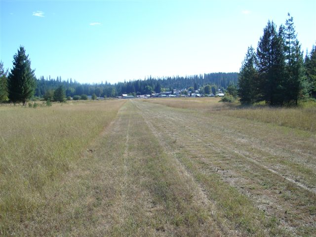
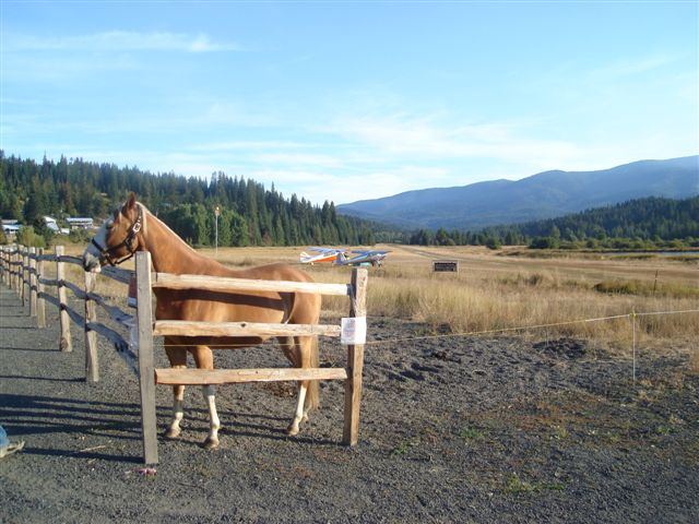
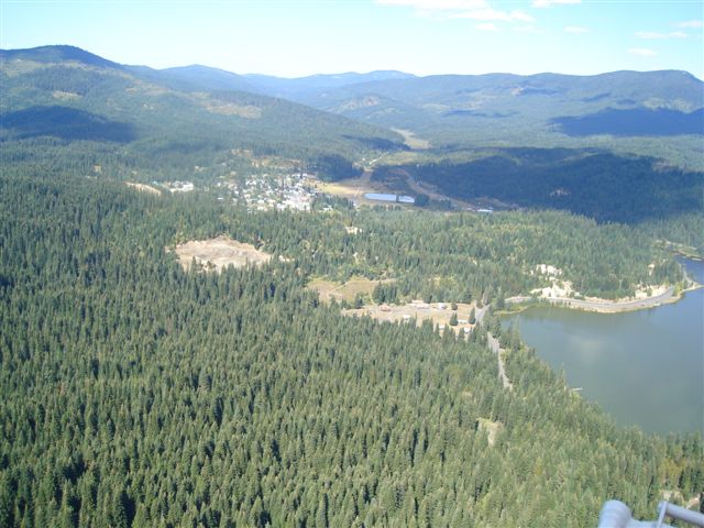
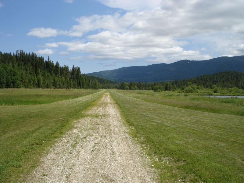
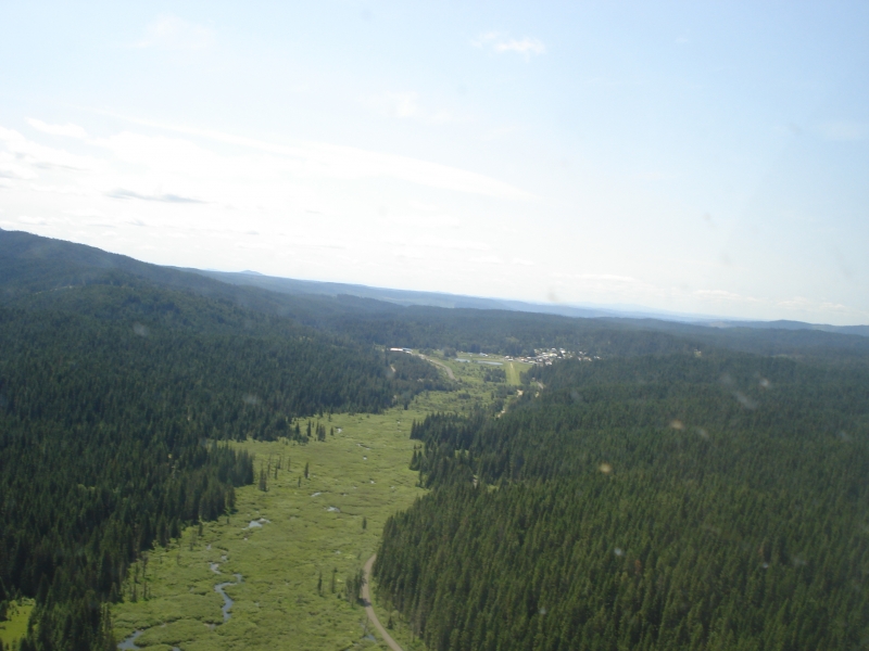
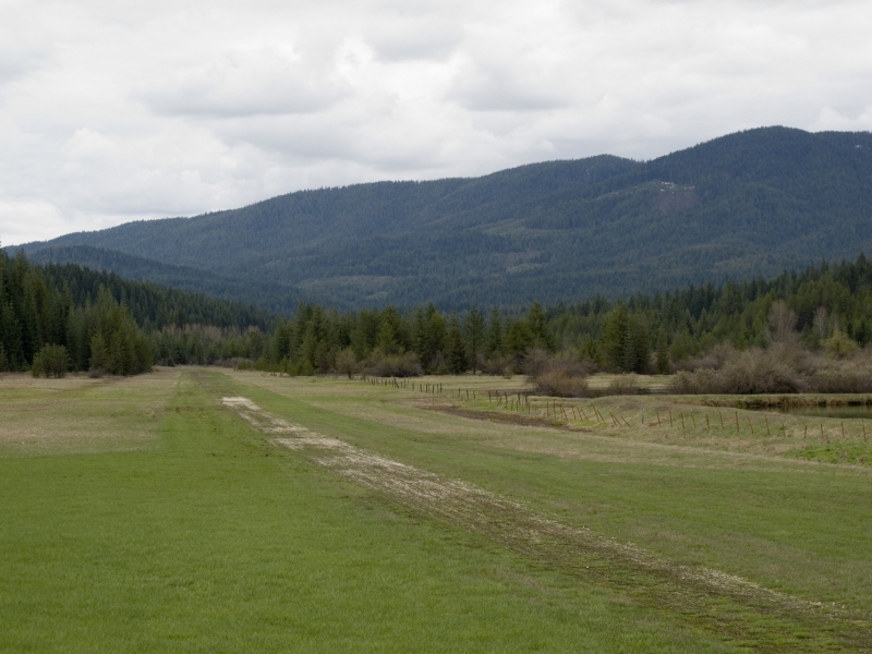
    Elk River Airport sits at roughly 2,827 feet elevation right on the edge of the small town of Elk River, in north-central Idaho's Clearwater County. The 3,000-foot turf runway (17/35) occupies about 18 acres and is hemmed in by tall stands of white pine and cedar, with Elk Butte and Shattuck's Butte rising nearby. The setting is classic Idaho backcountry: forested, hilly, and remote, though the town itself is within easy walking distance of the strip.

    Camping & Recreation
    The airstrip itself has only basic facilities, but the town of Elk River, just steps away, offers food, lodging, general supplies, and local huckleberry treats. About a mile downstream, Elk Creek Reservoir has established campgrounds and is known for excellent fishing. The broader area is also a gateway to outdoor attractions such as Elk Creek Falls, with its scenic upper, middle, and lower cascades, and the Giant Cedar Grove, home to an ancient, massive old-growth cedar.

    Notes & Warnings
    Pilots should treat this as a genuine backcountry strip: it's a privately-owned field open to the public, with turf surface and no winter maintenance, meaning it can be unusable or hazardous in snow season. Numerous obstructions exist in town on the approach to Runway 35, and the field is closely surrounded by tall trees, leaving very few options for an emergency landing if something goes wrong on departure or arrival. Wildlife on the runway (deer have been reported grazing on it) is a real hazard, and pilots should expect a tight, tree-lined approach that rewards caution even in calm wind conditions.

    History
    Elk River began life in 1897 as a homestead claimed by Willard Trumbull, and the settlement itself was first known as Trumbull. In 1909 the Potlatch Lumber Company purchased the homestead and, the following year, built the country's first electric sawmill there, spurring rapid growth; the town was renamed Elk River around this time and a rail spur was extended in from Bovill. By 1912 it was a thriving company town with dozens of businesses, a school, waterworks, and even a hospital housed in the old Trumbull cabin. The timber economy soured after a larger mill was built in Lewiston in 1927, and Elk River's own sawmill and planing mill shut down in the early 1930s. The town found new purpose in aviation a decade later: an airfield was approved by state and federal agencies in 1944 and was operational by 1945, giving this once-isolated logging community a durable link to the outside world that persists today as the small public-use airstrip pilots visit for its scenery, fishing, and small-town charm.

    Runway
    • Length

      3000

    • Width

      150

    • Surface

      TURF-GRVL-G

    Details
    • Facility ID

      ID85

    • Elevation

      2827

    • CTAF

      122.9

    Gallery
    Location

    Lat: 46.78740305556 , Long: -116.16765000000 - IDAHO, USA

    Get Directions
    Flyover Video
    Prev 1 of 1 Next
    • Runway Flyover - Elk River, Idaho

      Runway Flyover - Elk River, Idaho

      @shortfieldvideos
    Prev 1 of 1 Next
    Categories
    • Restricted
    Tags
    • Mountains
    Region
    • Northwest Mountain
    Ownership
    • Private
    Author
    shortfield

    Land here, before you land out there!

    mood_bad
  • No reviews/PIREPs have been posted yet.

  • Add a review

    Leave a Reply · Cancel reply

    You must be logged in to post a comment.

    Shortfield Playlist
    Prev 1 of 1 Next
    • Idaho Backcountry Flight Elk River, ID ID85

      Idaho Backcountry Flight Elk River, ID ID85

      Kodiak 100 Landing at Elk River Idaho
    • Flight of 3 taildraggers to Elk River, Idaho

      Flight of 3 taildraggers to Elk River, Idaho

      Met up with my friends. Bob and Richard, at Tekoa, Wa for a 40 minute flight to the small town of Elk River, Idaho for lunch. Very windy day and at first weren’t sure we could get into Elk River airport as it’s tucked into the mountains with a one way in and one way out airport. When we arrived the winds were calm and stayed that way until we departed after lunch. On the way back, though, the winds picked up stronger and it was too rough for videos and formation flying. Bob and Richard landed at Tekoa and I continued on home for another 20 minutes. Great flight in spite of the winds and excellent food at the local eateries in Elk River.

      Aerotrek A220
      Highly modified Piper Super Pacer
      Luscombe 8E
    • Elk River Idaho

      Elk River Idaho

      Here's just a sampling of video I shot during the late July 2013 Elk River Idaho Fly-in. If it looks like I was having fun ..... well ... I was!
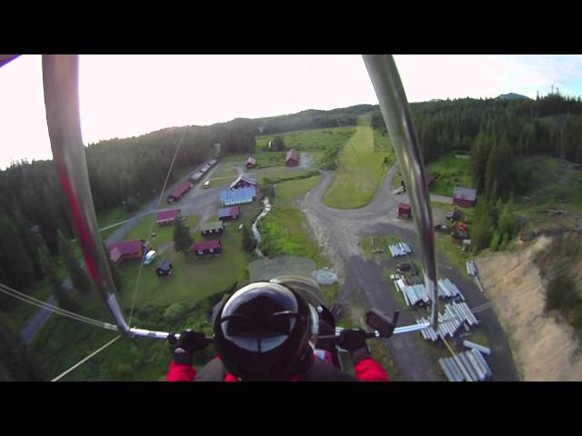
    • Elk River first run - to Headquarters Idaho -  Trike Flying

      Elk River first run - to Headquarters Idaho - Trike Flying

      This was the flight I waited a long time for. I've hunted this area for many years and often looked into the sky back there and wondered what it would be like to fly the area. This is a 125 square mile area I'm very familiar with. Then comes the Dworshak Reservoir. That has alway been a hard boundary for me ... until now. This is my first visit to Headquarters Idaho. Since I don't have to worry anymore about power lines, the whole way there and back I'm constantly looking for emergency landing areas. Unfortunately, some areas aren't as good as others. It ain't the end of the world, but I do believe ... I can see it from here!!!!

      Google Earth Elk River ID, Headquarters ID, and/or Dworshak ID for a look at this country!
    Prev 1 of 1 Next

    You May Also Be Interested In

    BIG ISLAND, ID

    • 46.698030262675, -115.9832195453
    • Restricted

    STOCKING MEADOWS, ID

    In the 1920s there was a forest ranger in change of this area. He rode a horse named…
    • 46.93601777778, -115.86487583333
    • Restricted

    DFGX, ID

    This is a PRIVATE airstrip. Do NOT land without prior, written permission from the owner.
    • 46.85851800000, -116.82221900000
    • Restricted

    © 2000-2025 shortfield.com

    Cart

      • Featured
      • Recreational
      • Restricted
      • Off-Airport
      • Abandoned
      • Outpost
      • Facebook
      • Twitter
      • Mail
      • Copy link