Sign in or Register
    • Featured
    • Recreational
    • Restricted
    • Off-Airport
    • Abandoned
    • Outpost
    • Home
    • Explore
    • Shop

    CHAMBERLAIN USFS, ID

    • Overview
    • Reviews / PIREPs 0
    • Events
    • Videos
    • prev
    • next
    • Bookmark
    • Share
    • Leave a Review / PIREP
    • Report
    • prev
    • next
    Description

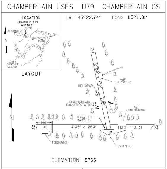
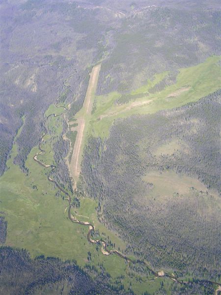
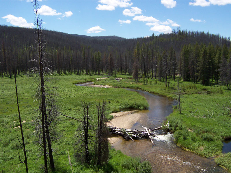
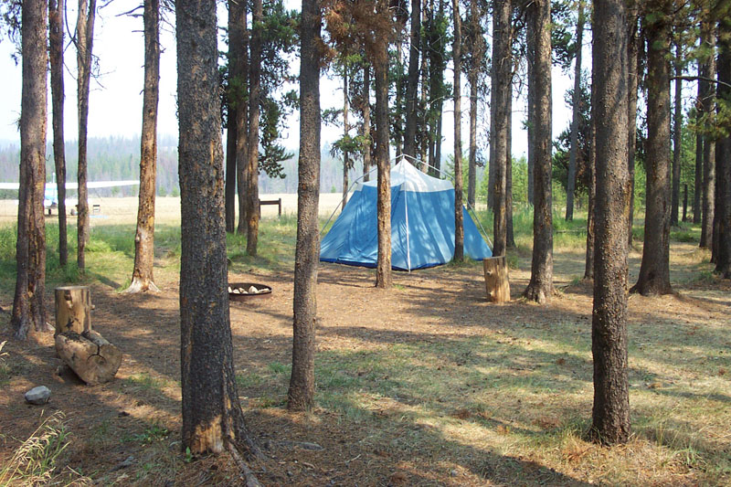
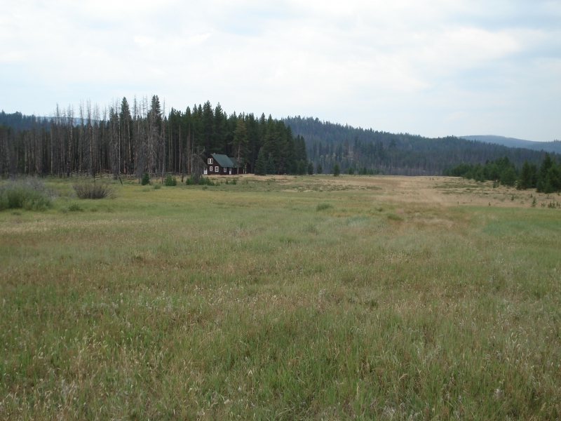
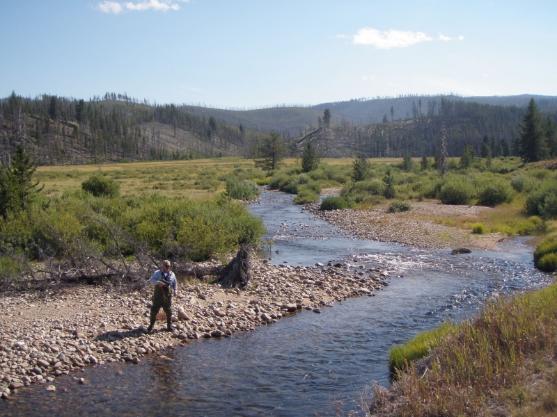
    There is a camping area about mid-field, on the south side of 7-25, and another one at the west end of runway 25.  Both are in the trees (shaded) and have pit toilets as well as chain tie-downs.  There are some nice views of Chamberlain Creek and sometimes wildlife can be seen off the bluff on the south side of the mid-field camping area (see photo).  The guard station usually has a ranger or two in for the summer. 

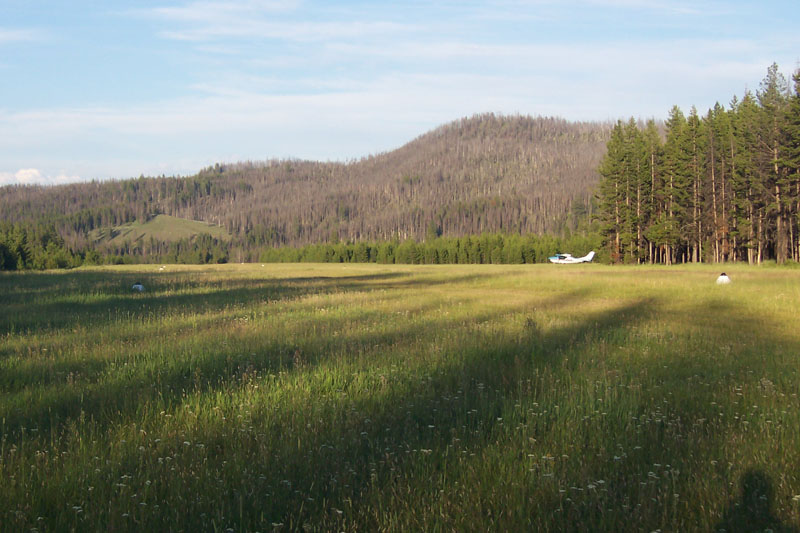
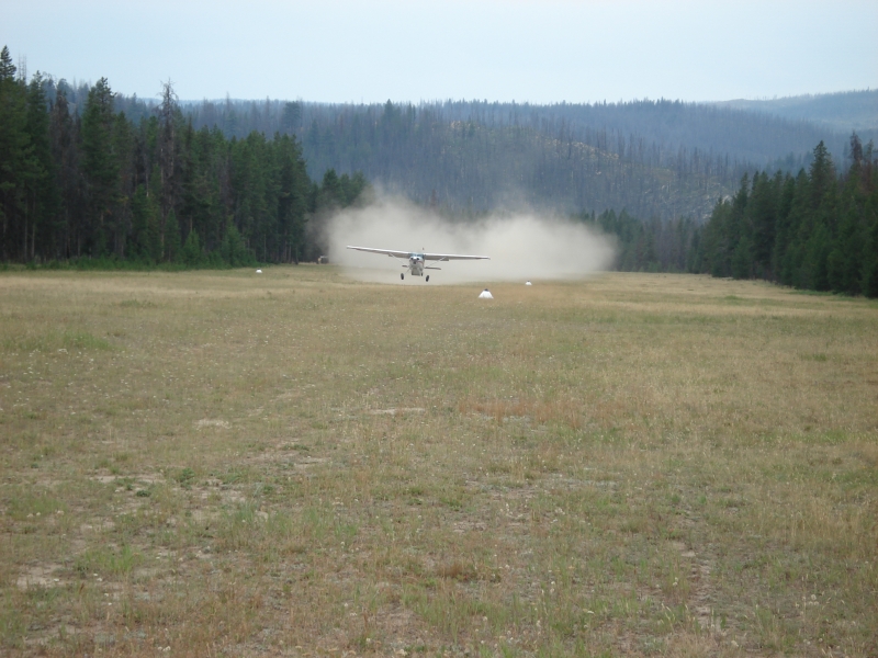
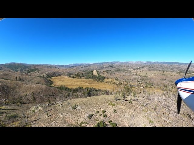
    Watch out for the white and black runway marker cones on runway 7-25 as they may be shifted a little to the south to ease wear on the old runway centerline.  If you are landing in the morning during the summer on runway 7, the glare from the sun can hide the cones.  On final approach, what appears to be the center of the airstrip, as judging from the distance between tree lines that border the strip, is not necessarily the center and may have cones in it. 

    Hiking

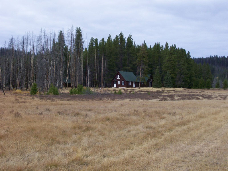
    The Stonebreaker Ranch is about 1.5 miles off the north end of runway 33.  A trail is visible in a slight embankment off to the right side of the end of runway 33.  Follow the trail (actually an old road bed) to the right and it will take you eventually north to the ranch.  There is an interesting old barn at the ranch with old tools and implements.  Sometimes the ranch is manned and you might get lucky and get a glass of lemonade and some conversation. 

    Navigation with Google Earth

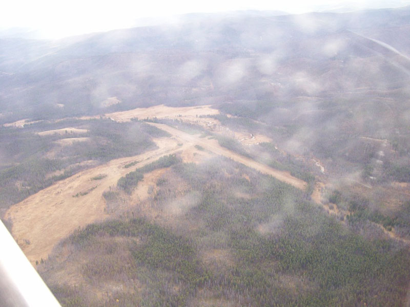
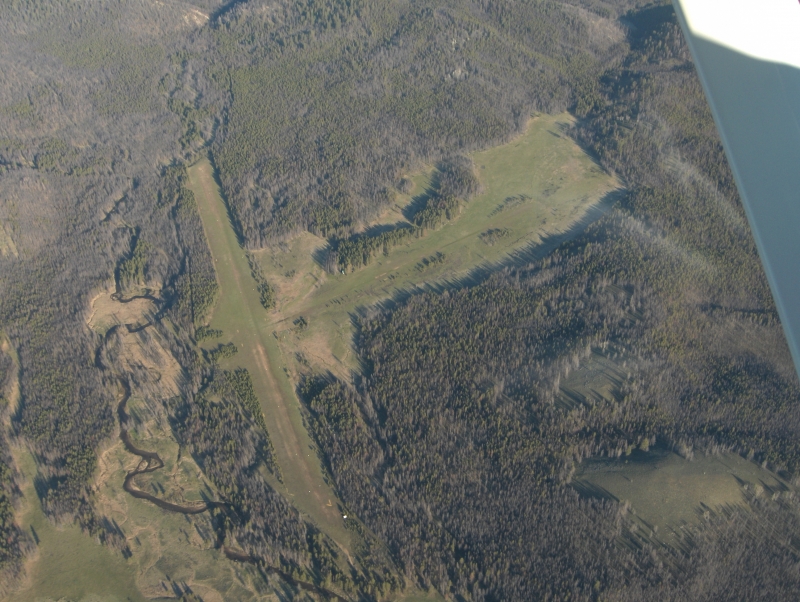
     This is my first-ever experience with an error in Google Earth.  The satellite photo is clearly NOT Chamberlain Basin airstrip.  Look at the aerial photos on this site and compare them to the satellite shots from GE...pretty interesting and a good reminder that not even Google always gets it right.  I noticed this several years ago before a flight to Moose Cr.  I thought the satelliite shot was wrong and then confirmed it on my flight.  I have no idea which airstrip is in the GE shot...

    Nice descriptive entry- thanks. Yes, very odd on the Google earth image.  What is shown, is in fact Chamberlain, but the east side of the East/West runway and the South side of the North/South runway was swallowed by their incorrect "stitching" of the satellite images. Wow!  Didn't realize the stitching could be that problematic.  

    Runway
    • Length

      4100

    • Width

      200

    • Surface

      TURF-DIRT-F

    All Runways
    Identifier Length Width Surface
    07/25 4100 200 TURF-DIRT-F
    15/33 2700 140 TURF-P
    Details
    • Facility ID

      U79

    • Elevation

      5765

    • CTAF

      122.9

    • State

      ID

    Gallery
    Location

    Lat: 45.37907833333 , Long: -115.19677972222 - IDAHO, USA

    Get Directions
    Categories
    • Recreational
    Tags
    • Mountains
    • Trees
    Region
    • Northwest Mountain
    Ownership
    • Public
    Author
    shortfield
    mood_bad
  • No comments yet.
  • Add a review

    Leave a Reply · Cancel reply

    You must be logged in to post a comment.

    Related Videos
    Prev 1 of 19 Next
    • Landing and Fishing Chamberlain Guard Station

      Landing and Fishing Chamberlain Guard Station

      Landing and Fishing the Chamberlain Creek area of the Salmon River Wilderness in Idaho. Also landings and take offs at Upper Loon Creek, Landmark and Donnelly. Fly overs of Thomas Creek, Mahoney Creek, Indian Creek and Johnson Creek 2015
    • Short flight from ranch to Chamberlain USFS airstrip

      Short flight from ranch to Chamberlain USFS airstrip

      G&S Aviation, departing very short runway, empty, and flying two minutes to Chamberlain Airstrip in ID Wilderness
    • Chamberlain Idaho airstrip.

      Chamberlain Idaho airstrip.

      Idaho backcountry flying. Big tire pilots. Chamberlain Basin
    • RV-4 Landing at Chamberlain Basin Airstrip

      RV-4 Landing at Chamberlain Basin Airstrip

      RV-4 landing at the Chamberlain Basin backcountry airstrip in Idaho.
    • Chamberlain Basin airstrip, Idaho

      Chamberlain Basin airstrip, Idaho

      C185 departing rwy 7 Chamberlain Basin airstrip, Idaho.
    • G&S landing at a private ranch, Chamberlain, ID

      G&S landing at a private ranch, Chamberlain, ID

      G&S Aviation delivers freight to a Private Ranch in Chamberlain Basin, ID. This airport , at 5,500 ft MSL, is only 1,000 long before an unusable dog leg occurs. Essentially, the dog leg gives you a survivable overrun, and that's all - if you aren't slowed down. This Ranch isn't open to public traffic, so please respect their property rights.
    • Backcountry Airstrip-Chamberlain Basin

      Backcountry Airstrip-Chamberlain Basin

      Chop N' saw. Chamberlain station, Payette National Forest Idaho. Great summer
    • Chamberlin Basin, ID Landing

      Chamberlin Basin, ID Landing

      #VIRBAdventures
    • Bruce Meadows Landing

      Bruce Meadows Landing

      high altitude Idaho mountain airstrip
      #Idahomountainflying
    • Chamberlain Basin Landing - Frank Church Wilderness Area

      Chamberlain Basin Landing - Frank Church Wilderness Area

      Landed at Chamberlain Basin in the Frank Church Wilderness Area located in Central Idaho. This is a great airstrip by backcountry standards but continues to be degraded by ground squirrel and other wildlife damage. This is my third camping trip here and love the remoteness, but recent fire damage has left the area rather desolate and exposed.
    • Landing at Chamberlain Guard Station, ID  -  U79

      Landing at Chamberlain Guard Station, ID - U79

      Middle of the 'back country'. Long and wide and fairly smooth. 5765' MSL. Good place to camp. In a 100 hp 7EC Champ.
    • Flying and Camping in the Idaho Backcountry - Sept. 2019

      Flying and Camping in the Idaho Backcountry - Sept. 2019

      Another aviation camping trip to the Idaho backcountry. Four airplanes made the trip from New Mexico and base camped at Johnson Creek. Daily adventures to Big Creek, Sulphur Creek, Upper Loon, Cold Meadows, and Chamberlain Basin airstrips.
    Prev 1 of 19 Next

    You May Also Be Interested In

    ROOT RANCH, ID

    The Root Ranch is located 48 miles west of Salmon, Idaho in the heart of the Frank Church Wilderness Area, in…
    • 45.31000000000, -115.02700000000
    • Restricted

    CAMBELL'S FERRY, ID

    This is a private airstrip.  Do not land without permission.More information from their website:…
    • 45.48685400000, -115.32992400000
    • Restricted

    YELLOW PINE BAR, ID

    This is a private airstrip located on Idaho's Salmon River.  Do not land without permission unless…
    • 45.54104400000, -115.25366300000
    • Restricted

    © 2000-2021 shortfield.com

    Cart

      • Featured
      • Recreational
      • Restricted
      • Off-Airport
      • Abandoned
      • Outpost
      • Facebook
      • Twitter
      • WhatsApp
      • Telegram
      • LinkedIn
      • Tumblr
      • VKontakte
      • Mail
      • Copy link