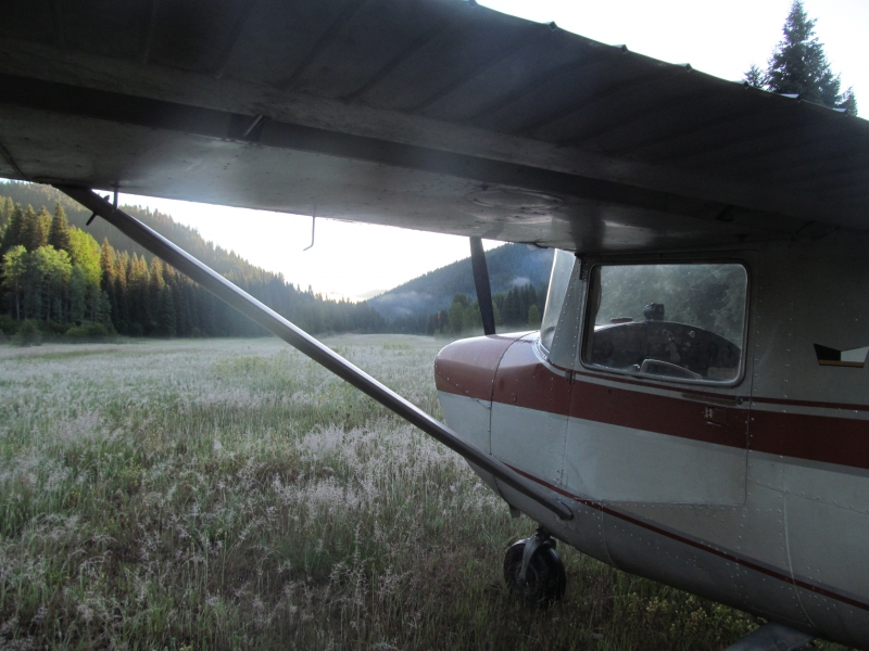
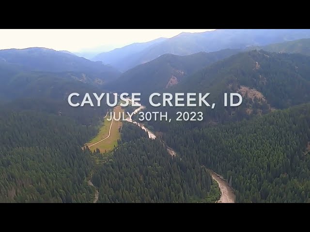
Sign in or Register
    • Featured
    • Recreational
    • Restricted
    • Off-Airport
    • Abandoned
    • Outpost
    • Home
    • Explore
    • Shop

    CAYUSE CREEK USFS, ID

    • Overview
    • Reviews / PIREPs 0
    • Events
    • Videos
    • prev
    • next
    • Bookmark
    • Share
    • Leave a Review / PIREP
    • Report
    • prev
    • next
    Description

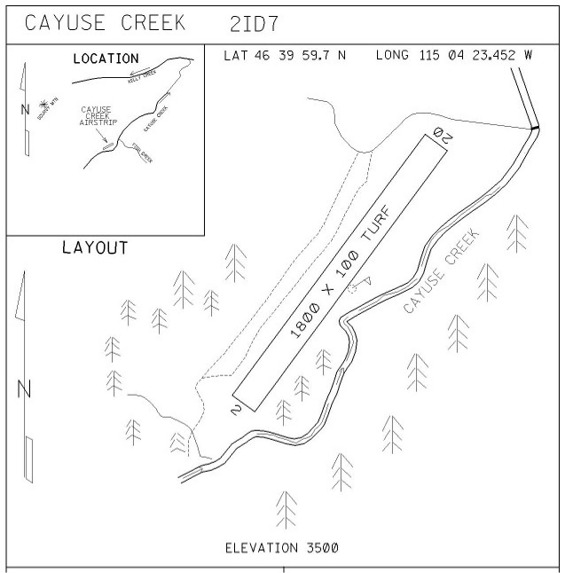
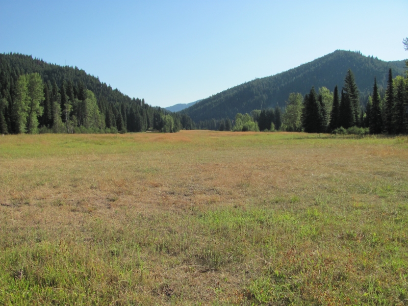
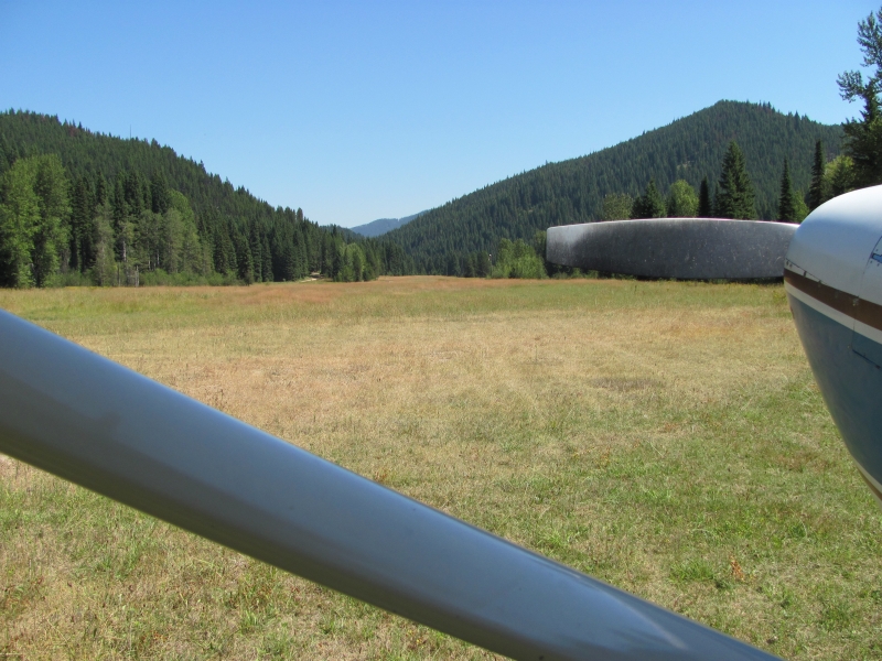
    Cayuse Creek is an undeveloped airstrip located at a U.S. Forest Service Guard Station in Idaho's Clearwater National Forest.  Cayuse Creek is a tributary to the Clearwater River and is known for great trout fishing.  Cayuse Creek is the north-most strip in a string of backcountry strips located on tributaries to the Clearwater River: Cayuse Creek, Fish Lake, Moose Creek, and Shearer.

    Camping
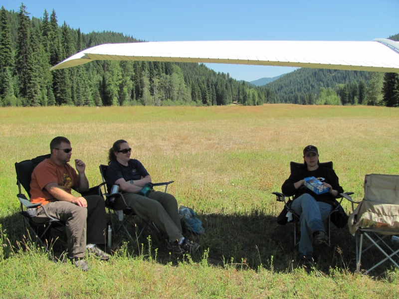
    There is no formal camping facilities, but camping is allowed.


    Runway
    • Length

      1800

    • Width

      75

    • Surface

      TURF-F

    Details
    • Facility ID

      C64

    • Elevation

      3500

    • CTAF

      122.9

    Gallery
    Location

    Lat: 46.66658416667 , Long: -115.07318111111 - IDAHO, USA

    Get Directions
    Categories
    • Recreational
    Tags
    • Mountains
    Region
    • Northwest Mountain
    Ownership
    • Public
    Author
    shortfield
    mood_bad
  • No comments yet.
  • Add a review

    Leave a Reply · Cancel reply

    You must be logged in to post a comment.

    Shortfield Playlist
    Prev 1 of 1 Next
    • Cayuse Creek, ID

      Cayuse Creek, ID

    Prev 1 of 1 Next
    YouTube Search
    Prev 1 of 17 Next
    • Cayuse Creek USFS (C64) Idaho

      Cayuse Creek USFS (C64) Idaho

      Cayuse Creek USFS (C64) Idaho
    • Take off from Cayuse Creek

      Take off from Cayuse Creek

      Departing Cayuse Creek, USFS airstrip in Idaho
    • Cayuse Creek

      Cayuse Creek

      "A beautiful strip surrounded by high terrain. I'd classify it as moderately difficult. Watch the DA here!" ~ Todd
    • Landing at Cayuse Creek

      Landing at Cayuse Creek

    • Mahoney Creek Airstrip Idaho

      Mahoney Creek Airstrip Idaho

    • 2022 Idaho Backcountry Flying.  Many airstrips visited with tons of detailed info on each.

      2022 Idaho Backcountry Flying. Many airstrips visited with tons of detailed info on each.

      Idaho backcountry, truly an aviators paradise! Visited Johnson, Upper/Lower Loon, Thomas, Indian, Smiley, Krassel, Big Creek, Shearer, Fish, Moose, Cayuse. Five onboard cameras rolling to give you as much scenery as possible. Two GoPro Max 360 cameras allow for an "out of airplane" experience. This was a dream trip that we wanted to record for our own memory but hope we can entertain you to a degree as well...maybe even entice you to experience the same adventure yourself.
      A number of similar adventures on my channel, Rick Hiebert. Subscribe if you want to see more.
      Best viewed in 1080HD.

      Time stamps:
      01:57 Cowley WY (first night)
      02:59 Smiley Creek
      03:39 Johnson Creek (landing runway 35)
      07:46 Upper Loon Creek
      10:25 Lower Loon Creek
      12:22 Mahoney Creek
      12:43 Thomas Creek
      15:49 Indian Creek
      17:27 Johnson Creek
      20:08 Reed Ranch
      21:09 Krassel
      24:43 Big Creek
      27:22 Johnson Creek
      29:38 McCall (for fuel)
      30:32 Shearer
      33:02 Moose Creek
      35:07 Fish Lake
      36:26 Cayuse Creek
      38:14 Benchmark MT
      39:56 Chinese Wall, MT
      42:52 Gibson Reservoir & Dam
      44:53 Choteau MT (for fuel)
    Prev 1 of 17 Next

    You May Also Be Interested In

    FISH LAKE USFS, ID

    This runway is located in Idaho's Selway-Bitterroot Wilderness and features access to hunting, camping, and…
    • 46.33019527778, -115.06317416667
    • Recreational

    MOOSE CREEK USFS, ID

    Moose Creek is a must visit airstrip.  It's located deep in the Bitterroot Selway Wilderness of Idaho, and is…
    • 46.12075083333, -114.92733333333
    • Recreational

    STOCKING MEADOWS, ID

    In the 1920s there was a forest ranger in change of this area. He rode a horse named…
    • 46.93601777778, -115.86487583333
    • Restricted

    © 2000-2021 shortfield.com

    Cart

      • Featured
      • Recreational
      • Restricted
      • Off-Airport
      • Abandoned
      • Outpost
      • Facebook
      • Twitter
      • WhatsApp
      • Telegram
      • LinkedIn
      • Tumblr
      • VKontakte
      • Mail
      • Copy link