Description
Location Overview
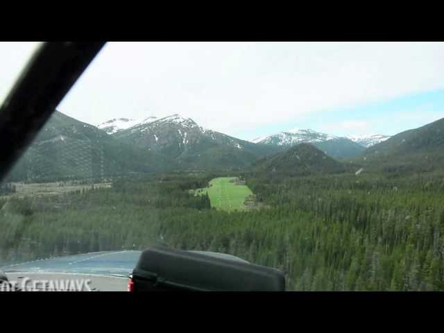
Benchmark is located approximately 19 miles west of Augusta, Montana, at an estimated elevation of 5,434 feet MSL. The 145-acre airport is owned by the US Forest Service and is nestled within the Lewis and Clark National Forest. It lies along the eastern front of the Rocky Mountains, with dramatic mountain terrain rising to the east and west.
Camping & Recreation
The airstrip has an associated campground — the Fly-In Campground — located in the nearby forest, serving as a basecamp for adventures into the Bob Marshall and Scapegoat Wilderness areas. Visitors have used the strip to stage multi-day hikes along the Continental Divide, fish pristine mountain streams, and explore country of remarkable natural beauty. A cabin is also noted approximately one mile to the northwest.
Notes & Warnings
The runway rises uphill 120 feet with rising terrain beyond, and a recommended departure condition permits when possible. Mountains run parallel to the east and west, affecting the transition surface. The CTAF frequency is 122.9 MHz, there is no control tower, and no snow removal is performed. The strip is unattended and accessible only by small, light aircraft. Density altitude is a serious consideration given the 5,400+ foot elevation, and pilots should be proficient in mountain and short-field flying techniques before attempting a landing here.
History
Benchmark Airport was activated on March 1, 1965, and has been drawing backcountry pilots to the Montana wilderness ever since. Owned and operated by the US Forest Service, it was established to provide access to the roadless terrain bordering the Bob Marshall Wilderness — one of the largest roadless areas in the contiguous United States. Over the decades it has become something of a flagship destination in the backcountry aviation community, celebrated by organizations like the Recreational Aviation Foundation as a model of what a Forest Service airstrip can offer: a true launchpad for wilderness adventure accessible only by foot or by air.
Runway
-
Identifer
12/30
-
Length
6000
-
Width
100
Details
-
Facility ID
3U7
-
Elevation
5434
-
State
Montana
Location
Lat: 47.480951, Long: -112.870907 - Montana, USA


Add a review