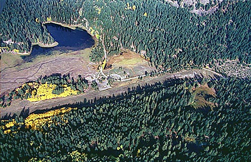
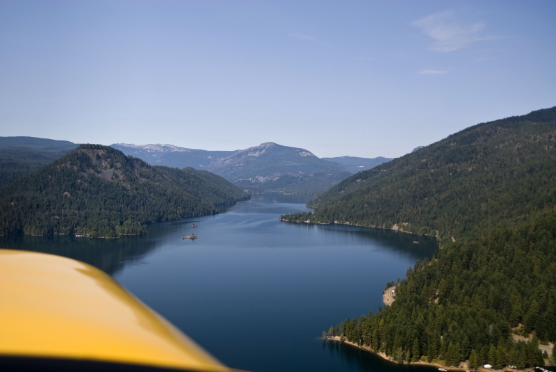
Sign in or Register
    • Featured
    • Recreational
    • Restricted
    • Off-Airport
    • Abandoned
    • Outpost
    • Home
    • Explore
    • STOL Gear

    TIETON STATE, WA

    • Overview
    • Reviews / PIREPs 0
    • Videos
    • Events
    • prev
    • next
    • Leave a Review / PIREP
    • Bookmark
    • Report
    • Share
    • prev
    • next
    Description

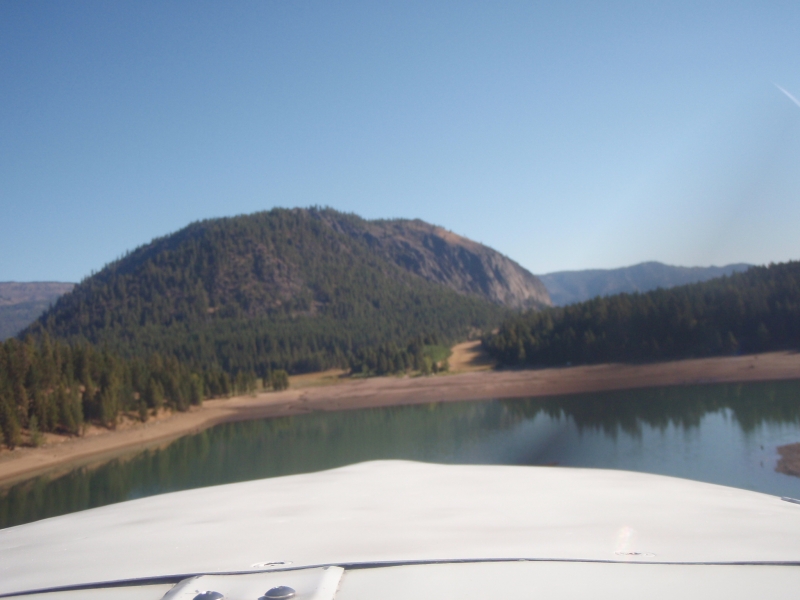
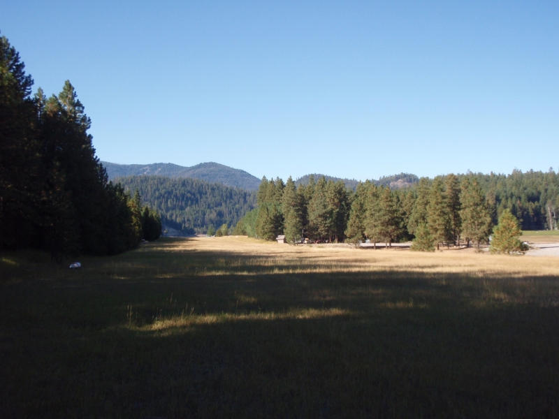
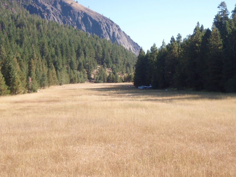
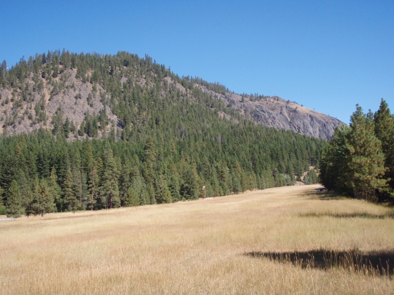
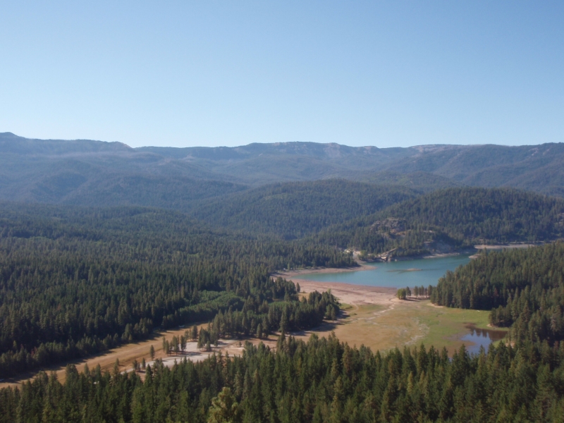
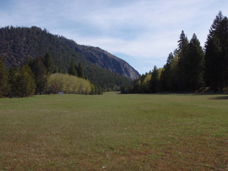
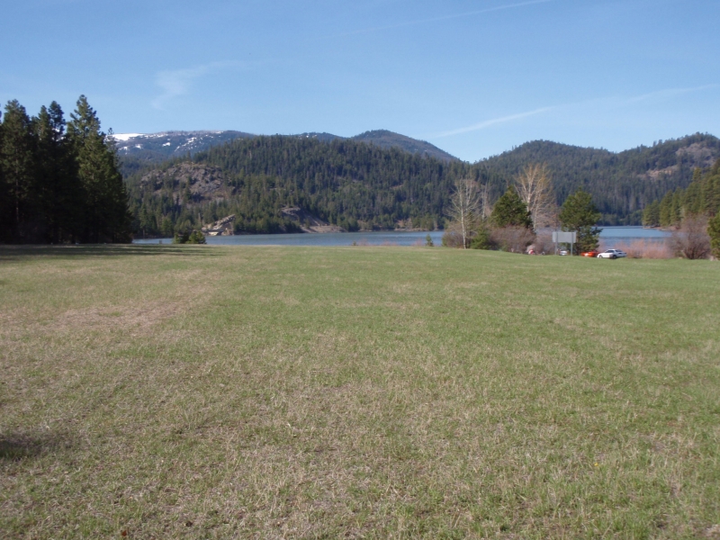
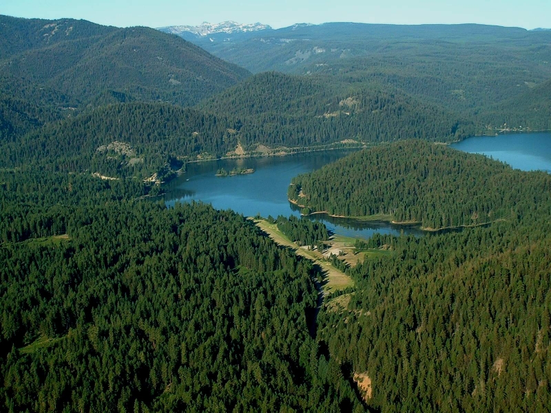
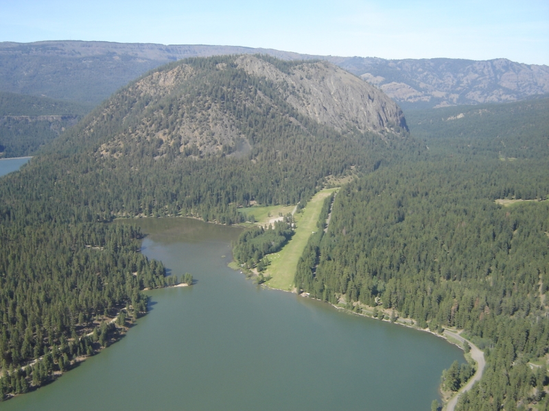
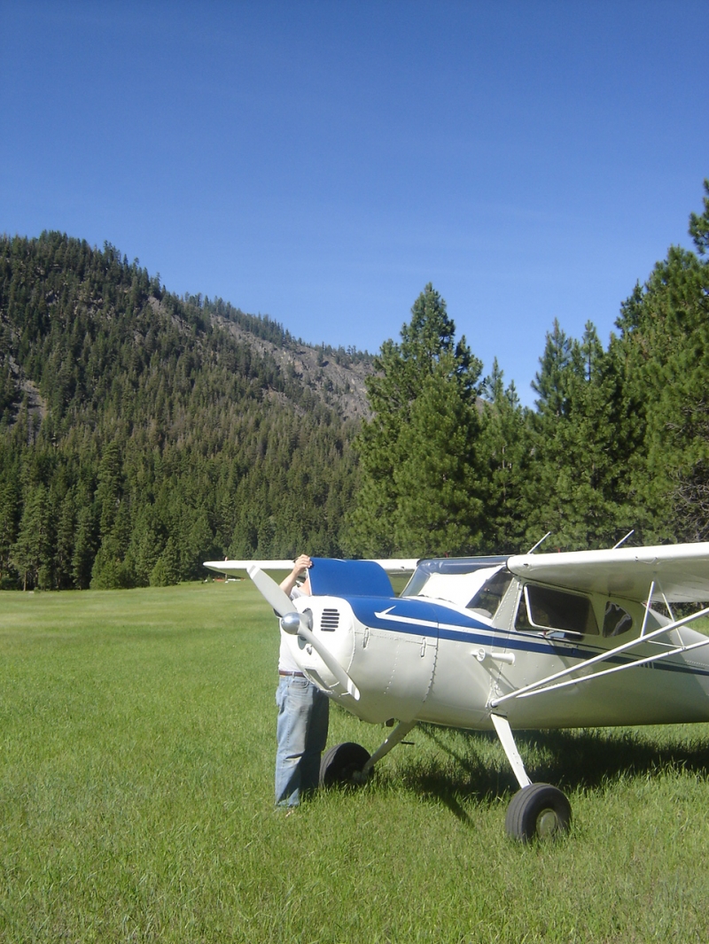
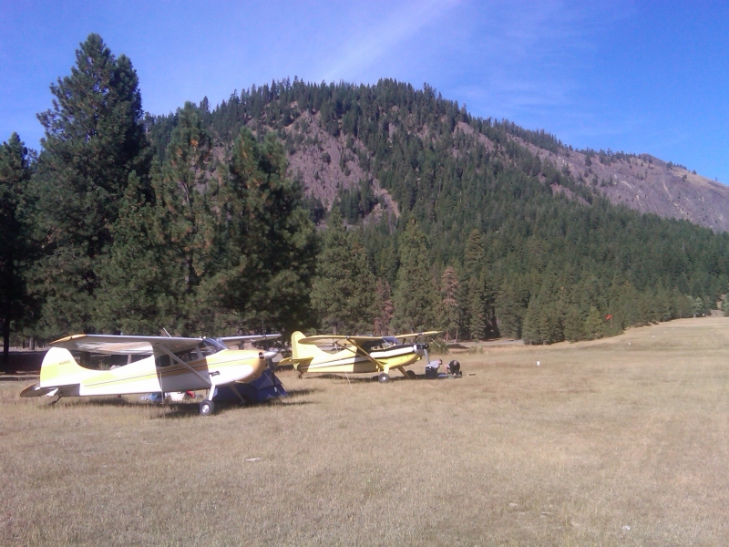
    Overlooking Rimrock Lake, on the east side of White Pass, is the beautiful Tieton Airport. In 1980, it was naturally resurfaced with six inches of ash from Mount St. Helen's, and the surface is rough. There is a large Forest Service campground adjacent, and a boat launching area only a few hundred feet away. Fishing is excellent, there are many hiking trails, and the scenery is superb. Tieton is such a nice place to go that some of the flying clubs have made the field their summer campground.

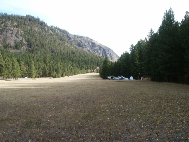
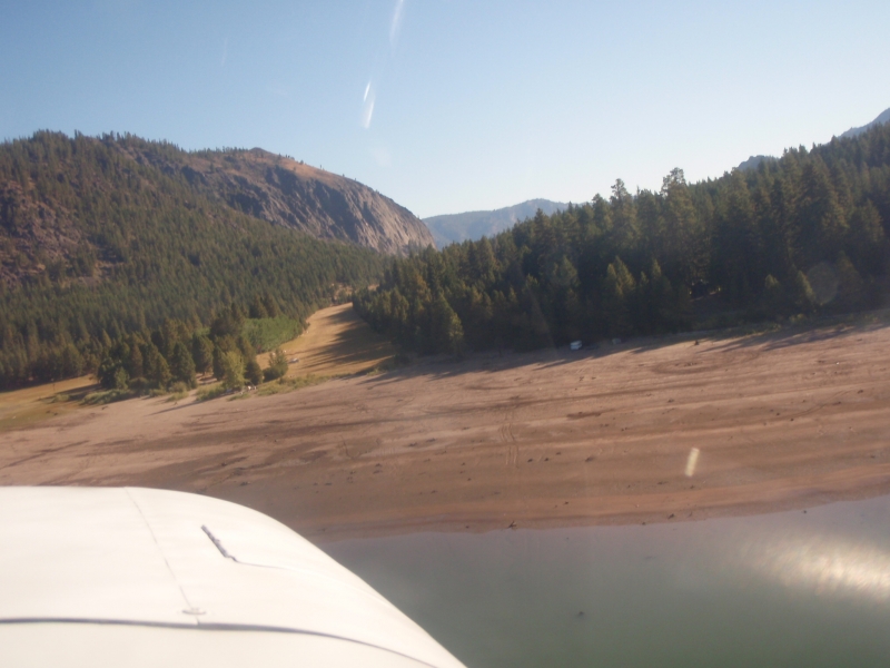
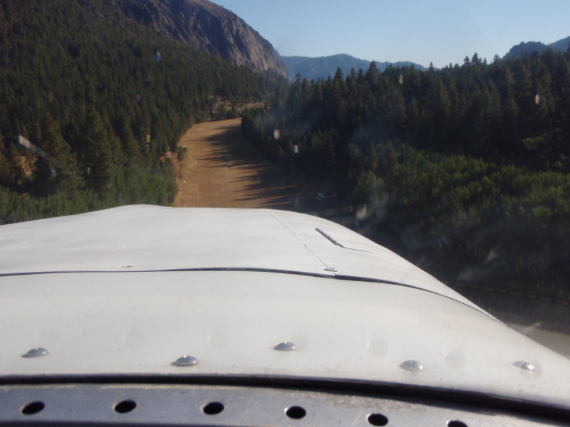
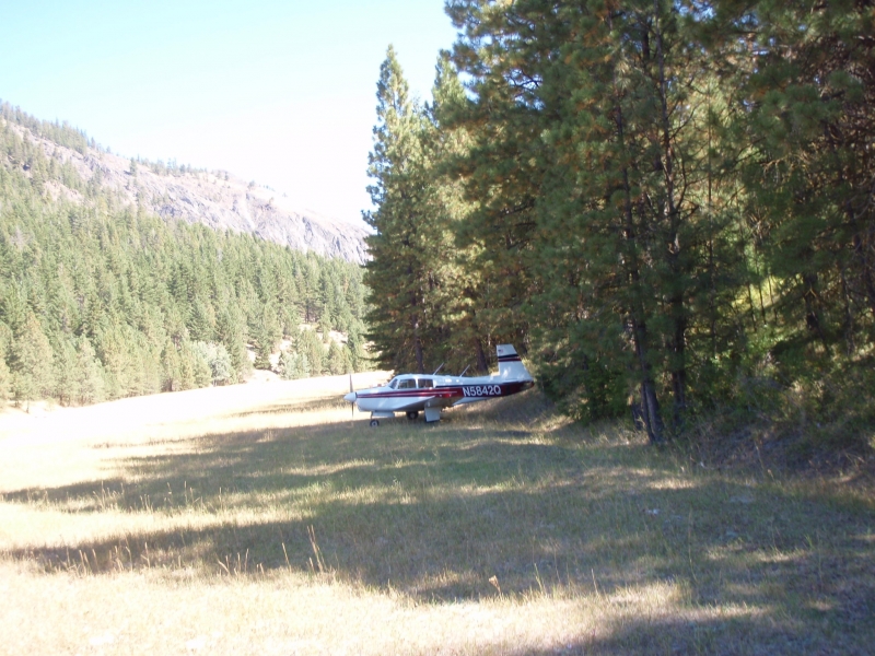
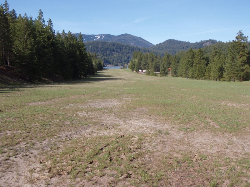
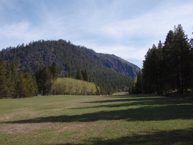
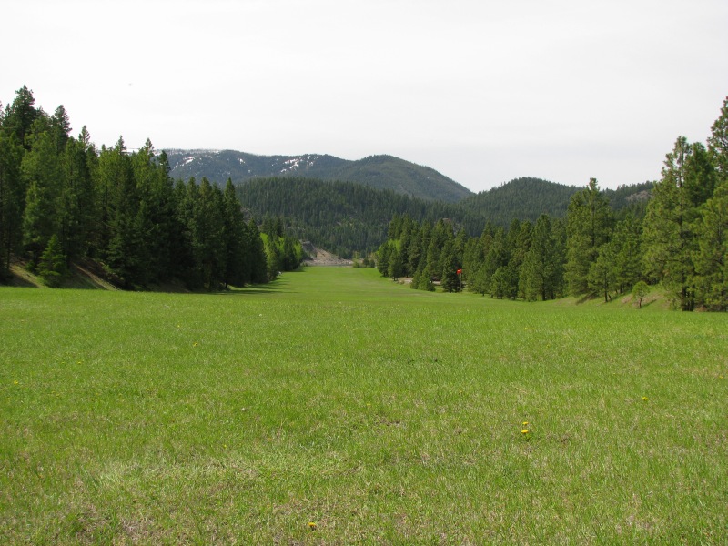
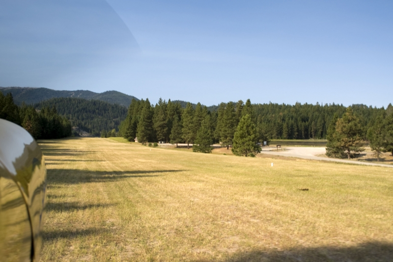
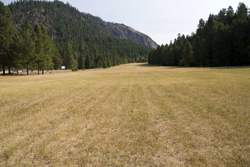
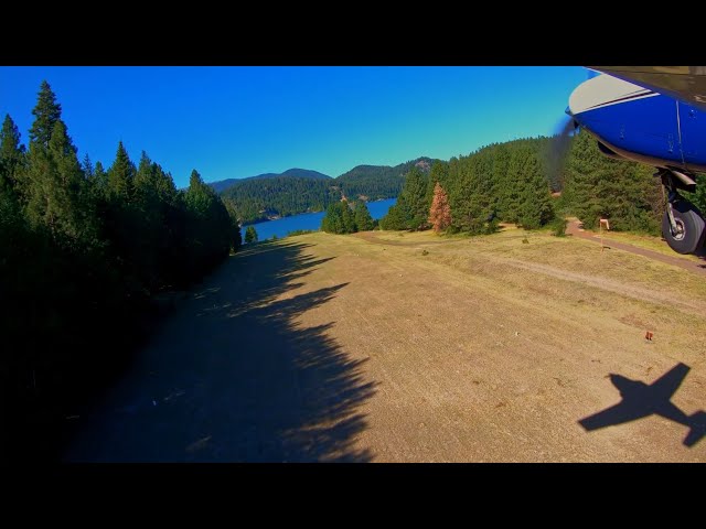
    The west end of the 2,471 foot turf runway is right at the edge of the lake. The approach from the west is long and clear. In addition, the runway slopes uphill to the east for easy deceleration. The parking area is small, but has a tiedown cable. The 2,961 foot field elevation does cause some summertime density altitude problems. The approach from the east is difficult. There is a mountain right on the east end, the runway drops rapidly away to the west, and there are trees in the approach path. Most folks seem to prefer to ignore the wind and land uphill to the east, and depart downhill to the west. It is recommended to overfly the field to check conditions, look for obstructions, and plan your approach. The field is generally open from June 1st to October 1st.

    Landing east to west is generally preferred when winds allow. This is a downhill landing and the approach is more difficult as indicated above, but it does allow for the ability to go around if the need arises. The runway becomes horizontal about midway.

    Runway
    • Length

      2509

    • Width

      140

    • Surface

      TURF-F

    Details
    • Facility ID

      4S6

    • Elevation

      2964

    • CTAF

      122.9

    Gallery
    Location

    Lat: 46.63755138889 , Long: -121.12397888889 - WASHINGTON, USA

    Get Directions
    Flyover Video
    Prev 1 of 1 Next
    • Runway Flyover - Tieton State, WA

      Runway Flyover - Tieton State, WA

      @shortfieldvideos
    Prev 1 of 1 Next
    Categories
    • Recreational
    Tags
    • Mountains
    • Canyon
    • Lakes/Rivers
    • Boating
    • Fishing
    • Camping
    Region
    • Northwest Mountain
    Ownership
    • Public
    Author
    shortfield

    Land here, before you land out there!

    mood_bad
  • No reviews/PIREPs have been posted yet.

  • Add a review

    Leave a Reply · Cancel reply

    You must be logged in to post a comment.

    Shortfield Playlist
    Prev 1 of 2 Next
    • BONKERS Approach & Landing with CRAZY gusts at Tieton State Airport!!!

      BONKERS Approach & Landing with CRAZY gusts at Tieton State Airport!!!

      At the very beginning of the "Heat Dome" in the Pacific Northwest in 2021, I did a big trip around the state landing at all the shortest runways (upcoming video). Although not one of the shortest runways, Tieton State Airport (4S6) was on the way, so I had to land there. It's 2,509 x 100 feet, so it's not huge, but plenty long, and I was able to land uphill and takeoff downhill, so that was helpful on this hot day. It was super gusty on the approach and I had to work really hard, but it worked out.

      https://www.patreon.com/jayphilipwilliamsaviation
      http://www.jpwphoto.com

      Please Check out my Books on Amazon.com

      Insurgency—Refreshing the Tree of Liberty
      https://www.amazon.com/Insurgency-Refreshing-Jay-Philip-Williams-ebook/dp/B06X3ZNPJY

      Liberty—New Beginnings
      https://www.amazon.com/Liberty-New-Beginnings-Tree-Book-ebook/dp/B07ZCCDX1F
    • Tieton State Airstrip Takeoff

      Tieton State Airstrip Takeoff

      Takeoff from Tieton State, over Rimrock Lake, through White Pass and on towards Mt. Rainier. Music by Potsu
    • ‘56 Cessna 172 approach and landing at Tieton State Airport  4S6

      ‘56 Cessna 172 approach and landing at Tieton State Airport 4S6

    • Tieton State, 4S6, landing Rwy 02

      Tieton State, 4S6, landing Rwy 02

      This airport is in good condition for a grass strip. On my visit the campground was closed to campers using cars but not airplanes. The restroom was locked, had to walk a half mile to the nearest port a potty. It appears that the state allows a rancher to keep his cows near and on the airport. WATCH out when landing! This next warning is important, If you are allergic to bees STAY AWAY from this airport. There are lots of them, "Yellow Jackets." Aircraft used C172 Passport Location
    • Zenith CH 701 - Landing and Take-off at Tieton State Airport (short version)

      Zenith CH 701 - Landing and Take-off at Tieton State Airport (short version)

      This is the short version of the trip into Tieton State Airport.
      For more detailed info about Mountain Flying, check out the full version, Cashmere to Tieton State Airport - Mountain Flying advice from Doug Stewart. Doug is my good friend and mentor, with experience flying helicopters into the mountains for fire and recuse operations and other missions. He also has thousands of hours flying in fixed wing aircraft.
      Having resources like Doug and his brother Dan at the Cashmere Airport can't be quantified. We all need to seek out these veteran pilots and soak up their knowledge.
    • Landing at Tieton State - 4S6 RWY 20

      Landing at Tieton State - 4S6 RWY 20

      Landing 20, downhill with slight tailwind. Chosen over 02 due to high DA and unfavorable go-around into rising terrain. Video is 4x actual speed.
    Prev 1 of 2 Next
    YouTube Search
    Prev 1 of 49 Next
    • BONKERS Approach & Landing with CRAZY gusts at Tieton State Airport!!!

      BONKERS Approach & Landing with CRAZY gusts at Tieton State Airport!!!

      At the very beginning of the "Heat Dome" in the Pacific Northwest in 2021, I did a big trip around the state landing at all the shortest runways (upcoming video). Although not one of the shortest runways, Tieton State Airport (4S6) was on the way, so I had to land there. It's 2,509 x 100 feet, so it's not huge, but plenty long, and I was able to land uphill and takeoff downhill, so that was helpful on this hot day. It was super gusty on the approach and I had to work really hard, but it worked out.

      https://www.patreon.com/jayphilipwilliamsaviation
      http://www.jpwphoto.com

      Please Check out my Books on Amazon.com

      Insurgency—Refreshing the Tree of Liberty
      https://www.amazon.com/Insurgency-Refreshing-Jay-Philip-Williams-ebook/dp/B06X3ZNPJY

      Liberty—New Beginnings
      https://www.amazon.com/Liberty-New-Beginnings-Tree-Book-ebook/dp/B07ZCCDX1F
    • Tieton State Airstrip Takeoff

      Tieton State Airstrip Takeoff

      Takeoff from Tieton State, over Rimrock Lake, through White Pass and on towards Mt. Rainier. Music by Potsu
    • Landing at Tieton State Airport (4S5)

      Landing at Tieton State Airport (4S5)

    • Tieton State Airstrip Landing M20C

      Tieton State Airstrip Landing M20C

      Landing my Mooney M20C at Tieton airstrip to visit a few friends staying over night at the airstrip. Awesome day for flying!
    • Tieton State Departure

      Tieton State Departure

      1956 Cessna 172 departing Tieton State Airport/Rimrock Lake in Washington
    • TIETON STATE AIRPORT

      TIETON STATE AIRPORT

      Our takeoff from Tieton State Airport (4S6).
      Interesting place. on this day, it was quite windy and, shifting. our landing was a little longer but, the runway is long and uphill.
      I included some video from Tiffany's Phone.
      Fun day even though, we were supposed to go to Stehekin but, the this fire smoke prevented us to do that.

      Music by Audionautics.com
    Prev 1 of 49 Next

    You May Also Be Interested In

    FLYING ROCK AIRPARK, WA

    This airstrip is closed, and last I looked one of the land owners had run a fence across it to increase…
    • 47.15370555556, -120.63696111111
    • Restricted

    EASTON STATE, WA

    Easton is a small grass strip maintained by the State of Washington. The field slopes gently up going to the…
    • 47.25418388889, -121.18553166667
    • Recreational

    ENUMCLAW, WA

    The strip has been widened. Loose gravel, but stable. Owners prefer landing to the east. Depart to the west.…
    • 47.19565694444, -122.02205611111
    • Restricted

    © 2000-2025 shortfield.com

    Cart

      • Featured
      • Recreational
      • Restricted
      • Off-Airport
      • Abandoned
      • Outpost
      • Facebook
      • Twitter
      • Mail
      • Copy link