Description
Location Overview
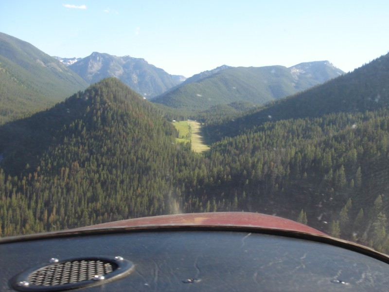
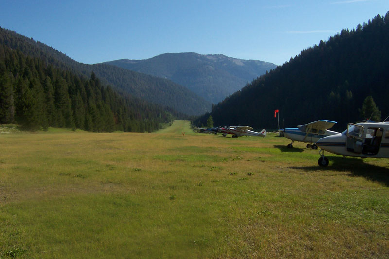
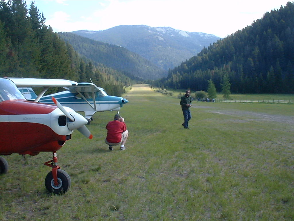
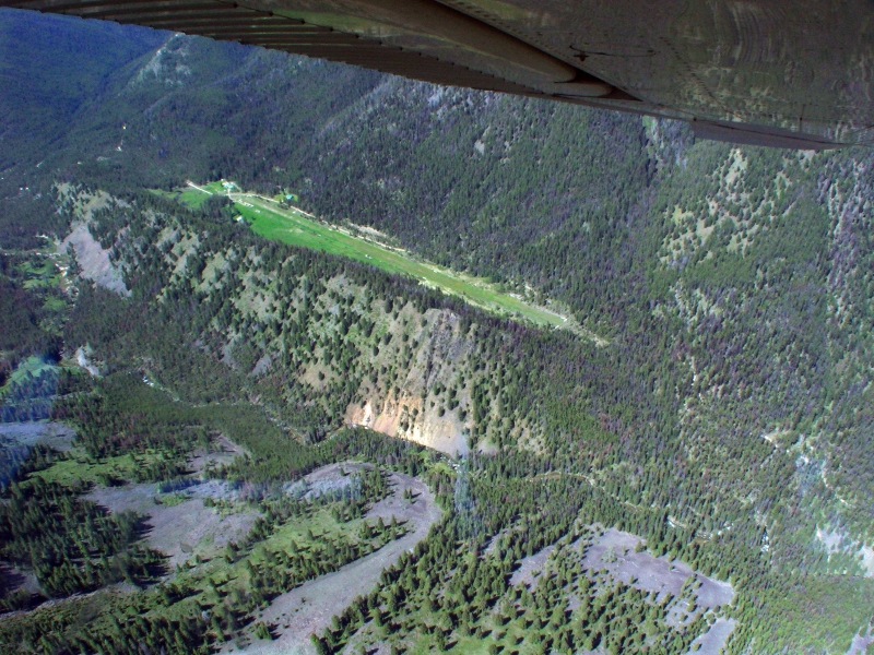
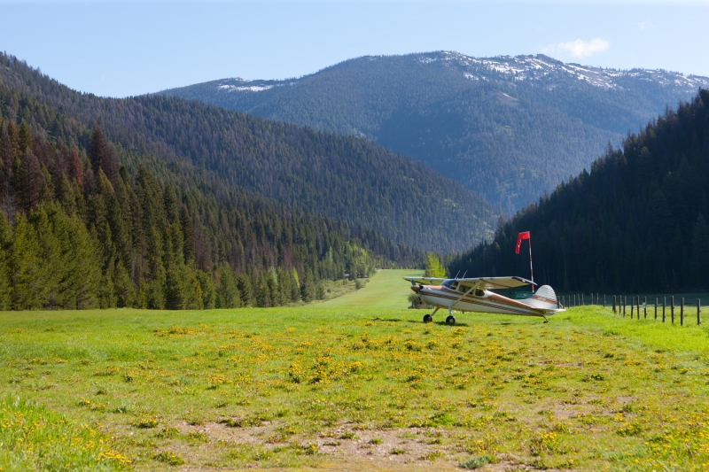
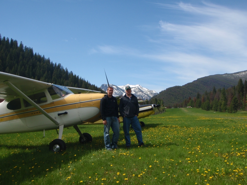
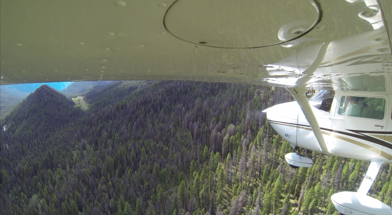
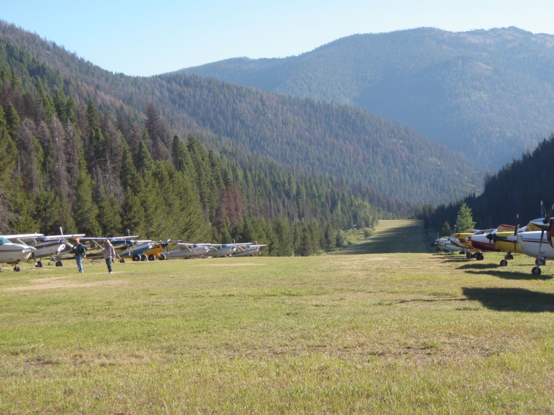
Big Creek Airport sits deep in the Payette National Forest at 5,743 feet elevation in Valley County, Idaho. The strip serves the small community of Edwardsburg and is vital to the area given its very limited road access — it's roughly a 15-minute flight from McCall and about 50 minutes from Boise. The Forest Service-maintained strip sits at the heart of Idaho's backcountry aviation network, offering access to the Frank Church River of No Return Wilderness.
Camping & Recreation
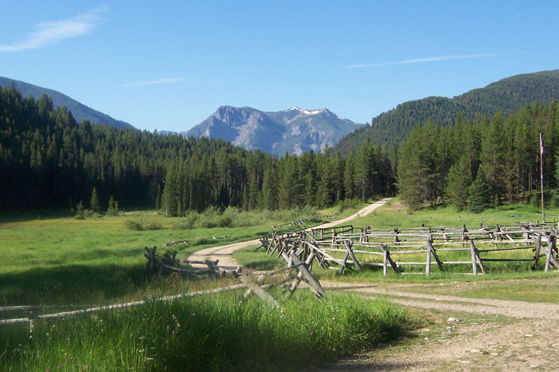
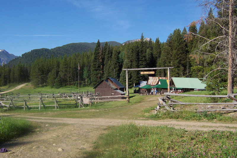
A developed campground sits in the shade of the trees just west of the runway, offering a pit toilet, drinking water, fire rings, and picnic tables. For recreation, the Big Creek trail begins about 2 miles south of the airstrip and runs approximately 36 miles east to its confluence with the Middle Fork of the Salmon River, passing several other backcountry airstrips along the way. Fishing along Big Creek and nearby streams is excellent for cutthroat trout, and the Big Creek Lodge — located right at the airstrip — offers a restaurant, cabins, and a yurt along with guided hunting, hiking, and horseback riding.
Notes & Warnings
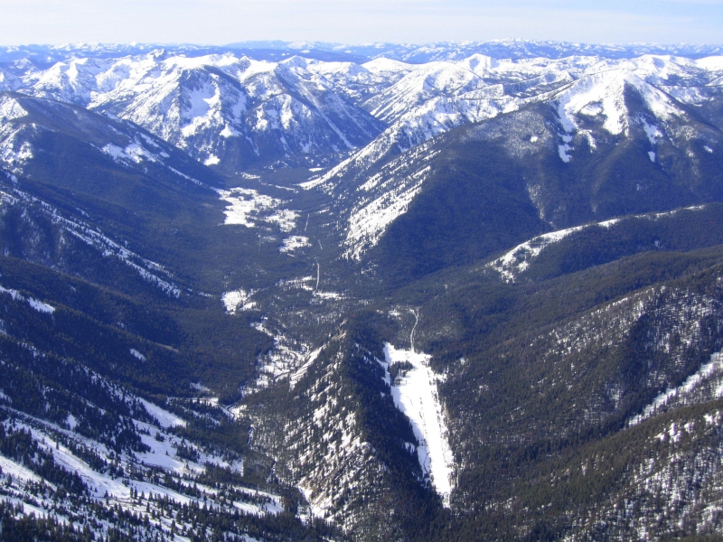
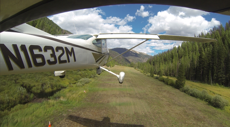
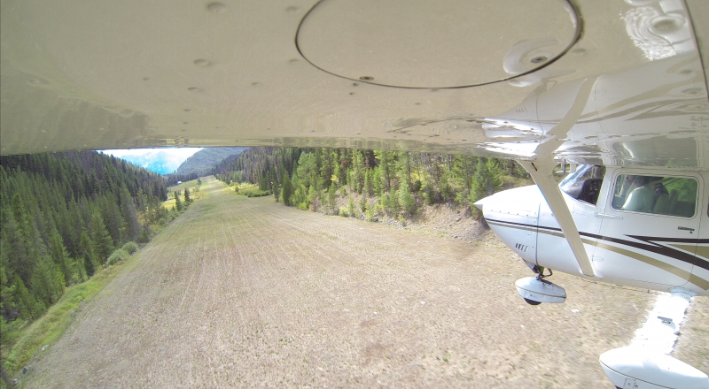
The runway is 3,500 feet long — generous by backcountry standards — but at nearly 5,743 feet in elevation and surrounded by terrain, it still presents real challenges. Standard procedure calls for westbound (uphill) landings and eastbound (downhill) departures. No fuel is available on site; the nearest fuel is at McCall (MYL), roughly 40 miles to the northwest. The strip is generally snow-free from early May to late October; ski-equipped aircraft are required during winter months. Cell service is nonexistent — a satellite communicator is strongly recommended. Pilots unfamiliar with mountain or backcountry flying should seek qualified instruction before attempting the approach.
History
Big Creek has been a beloved destination for backcountry pilots for nearly a century, developing a reputation as one of Idaho's most storied wilderness strips. The Big Creek Lodge served as a hub for pilots and visitors seeking food and lodging deep in the backcountry for decades, until a fire destroyed it in 2008. Beginning in 2013, the Idaho Aviation Foundation partnered with the USFS Payette National Forest to rebuild the lodge as a nonprofit public resource — a years-long effort of fundraising, planning, and painstaking construction at an elevation of 5,743 feet in an area that's snow-free only five months a year. The rebuilt lodge reopened in August 2018 and continues to serve as the IAF's flagship example of preserving Idaho's backcountry aviation heritage for pilots and non-pilots alike.
Runway
-
Length
3550
-
Width
110
-
Surface
TURF-G
Details
-
Facility ID
U60
-
Elevation
5743
-
CTAF
122.9
Gallery

Location
Lat: 45.13324305556 , Long: -115.32177888889 - IDAHO, USA
Add a review