
Description
Location Overview
The airstrip sits in the remote high desert of west-central Arizona, about five miles south of Alamo Lake, and now operates under the Wayside Oasis name near Wenden and Aguila. It's roughly twenty-eight miles southeast of Aguila, positioned as the main overnight stop between Alamo Lake and Wickenburg. Ground access is notoriously rough — the place is reachable via a long dirt road from Date Creek off Highway 93, or a mix of paved and dirt roads running from Wendon to Alamo Lake, with a third route from the north that floods when the lake is full. That isolation is a big part of the appeal, and most visitors these days simply fly in.
Camping & Recreation
The property functions as a working RV park and campground alongside the airstrip, with full hookup sites and dry camping spread across the property, showers and a dump station available for a fee. Recreational draws include fishing, ATV and off-road trails, geocaching, hiking, gold panning, and photography, plus kayaking on the lake and monthly community events and campfires. An on-site bar and restaurant rounds it out, with a store, propane, and laundry facilities also available on site.
Notes & Warnings
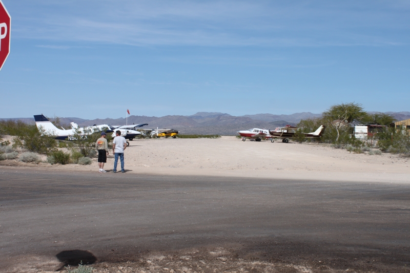
This is a genuine backcountry strip, not a paved municipal field. One visitor account notes the original landing strip became overgrown with brush and was left unmaintained, so pilots instead land on the dirt road out front. Other sources describe it more simply as a small dirt strip just east of Alamo Lake and note it does not appear on the sectional chart, meaning pilots need outside sources (GPS coordinates, online listings, or word of mouth) to find and assess it before attempting a landing. Expect a gravel/dirt surface, dust on landing, and the kind of informal, non-towered field where local knowledge matters more than official documentation.
History
The Wayside Inn began as a modest trailer park with a small restaurant, functioning for decades as a hidden treasure in the middle of nowhere, originally visited mostly by lake-goers. Over time its reputation for good food in an unlikely setting spread among pilots, off-roaders, and hunters, and it grew into a well-known fly-in destination — the kind of spot where a "$100 hamburger" flight became a local tradition. One long-time visitor even recalls landing there by helicopter back in 2003, describing it as an oasis with horseshoe tournaments, ATV clubs, and desert wildlife drawing regulars year after year. Eventually the business was rebranded as the Wayside Oasis, expanding into a fuller RV park and recreation destination while keeping its rustic, remote character and the airstrip that first put it on the map for aviators.
Runway
-
Length
2000
-
Width
60
-
Surface
DIRT
Details
-
Facility ID
new
-
Elevation
1450
-
CTAF
122.9
Gallery
Location
Lat: 34.24762752660 , Long: -113.48567588373 - , USA

Add a review