Sign in or Register
    • Featured
    • Recreational
    • Restricted
    • Off-Airport
    • Abandoned
    • Outpost
    • Home
    • Explore
    • STOL Gear

    Coyote Flats USFS, CA

    • Overview
    • Reviews / PIREPs 0
    • Videos
    • Events
    • prev
    • next
    • Leave a Review / PIREP
    • Bookmark
    • Report
    • Share
    • prev
    • next
    Description

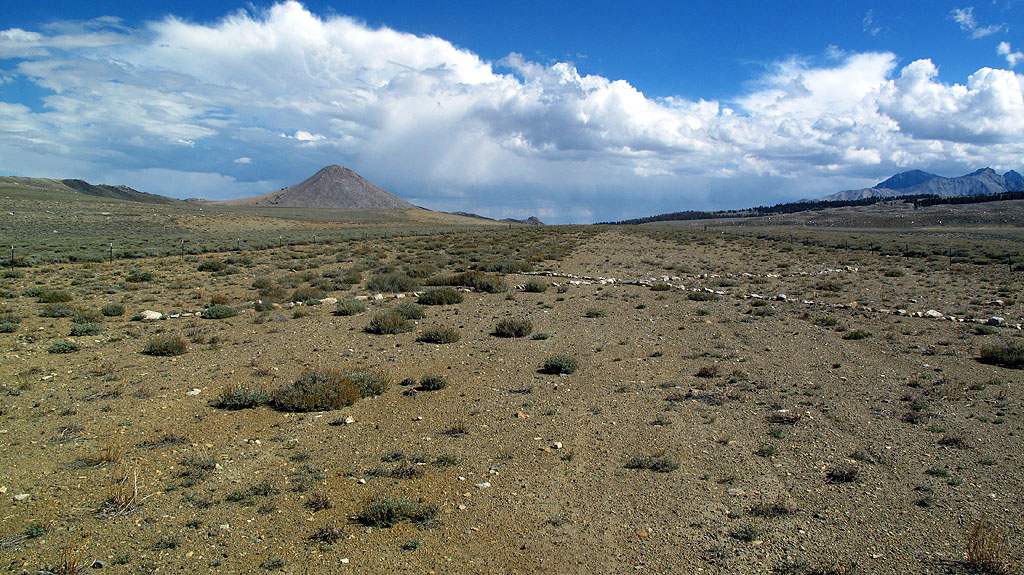
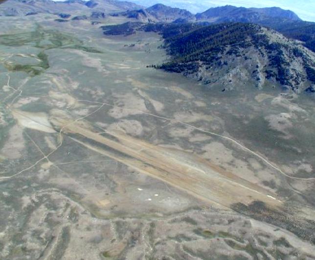
    Coyote Flats Airstrip sits in Inyo National Forest about ten miles west of Big Pine, California, at nearly 10,000 feet elevation. Built in 1968 by the Army High Altitude Test Center, it was once the highest airfield in North America and served as a high-altitude test site for the Air Force Flight Test Center at Edwards AFB, with helicopter operations on the site dating back to 1958.

    The airstrip had a single asphalt runway, 5,000 feet long and 150 feet wide, that was never modified or repaired after construction. It closed around 1997–98. The Forest Service subsequently rutted the surface and marked it with branch X's to deter landings, and eventually removed the runway and all structures entirely. The outline of the strip is still visible on the ground.

    The area is now popular with overlanders and hikers. Reaching it requires a 4x4 capable of climbing nearly 4,000 feet over 8 miles of shelf roads and switchbacks. Baker Lake, Rocky Bottom Lake, Funnel Lake, and Twin Lakes are all within a 5–6 mile hike from the flat.

    Runway
    • Length

      ?

    • Width

      ?

    • Surface

      DIRT

    Details
    • Facility ID

      No ID 189

    • Elevation

      10,000

    • CTAF

      122.9

    • State

      California

    Gallery
    Location

    Lat: 37.20395459617 , Long: -118.47844146117 - , USA

    Get Directions
    Flyover Video
    Prev 1 of 1 Next
    • Runway Flyover - Coyote Flats, California

      Runway Flyover - Coyote Flats, California

      @shortfieldvideos
    Prev 1 of 1 Next
    Categories
    • Off-Airport
    Tags
    • Desert
    • Camping
    • Bicycling
    Region
    • Western Pacific
    Ownership
    • Public
    Author
    shortfield

    Land here, before you land out there!

    mood_bad
  • No reviews/PIREPs have been posted yet.

  • Add a review

    Leave a Reply · Cancel reply

    You must be logged in to post a comment.

    Shortfield Playlist
    Prev 1 of 1 Next
    • The Actual Highest Airstrip in the US - Coyote Flats

      The Actual Highest Airstrip in the US - Coyote Flats

      A quick visit to the actual highest airstrip in the US: Coyote Flats up at 10,000 ft MSL.
    Prev 1 of 1 Next

    You May Also Be Interested In

    Manzinar, CA

    Abandon WW2 AAF base owned by L.A. Water and power Posted no Trespassing.
    • 36.73686709944, -118.14470134318
    • Recreational

    CHICKEN STRIP, CA

    The Chicken Strip, formally known as the Saline Valley Warm Springs Airfield, is a non-towered dirt airstrip…
    • 36.8068672, -117.7816819
    • Recreational

    LONE PINE, CA

    • 36.58869444444, -118.04938888889
    • Outpost

    © 2000-2025 shortfield.com

    Cart

      • Featured
      • Recreational
      • Restricted
      • Off-Airport
      • Abandoned
      • Outpost
      • Facebook
      • Twitter
      • Mail
      • Copy link