Sign in or Register
    • Featured
    • Recreational
    • Restricted
    • Off-Airport
    • Abandoned
    • Outpost
    • Home
    • Explore
    • Shop

    CHICKEN STRIP, CA

    • Overview
    • Reviews / PIREPs 0
    • Events
    • Videos
    • prev
    • next
    • Bookmark
    • Share
    • Leave a Review / PIREP
    • Report
    • prev
    • next
    Description

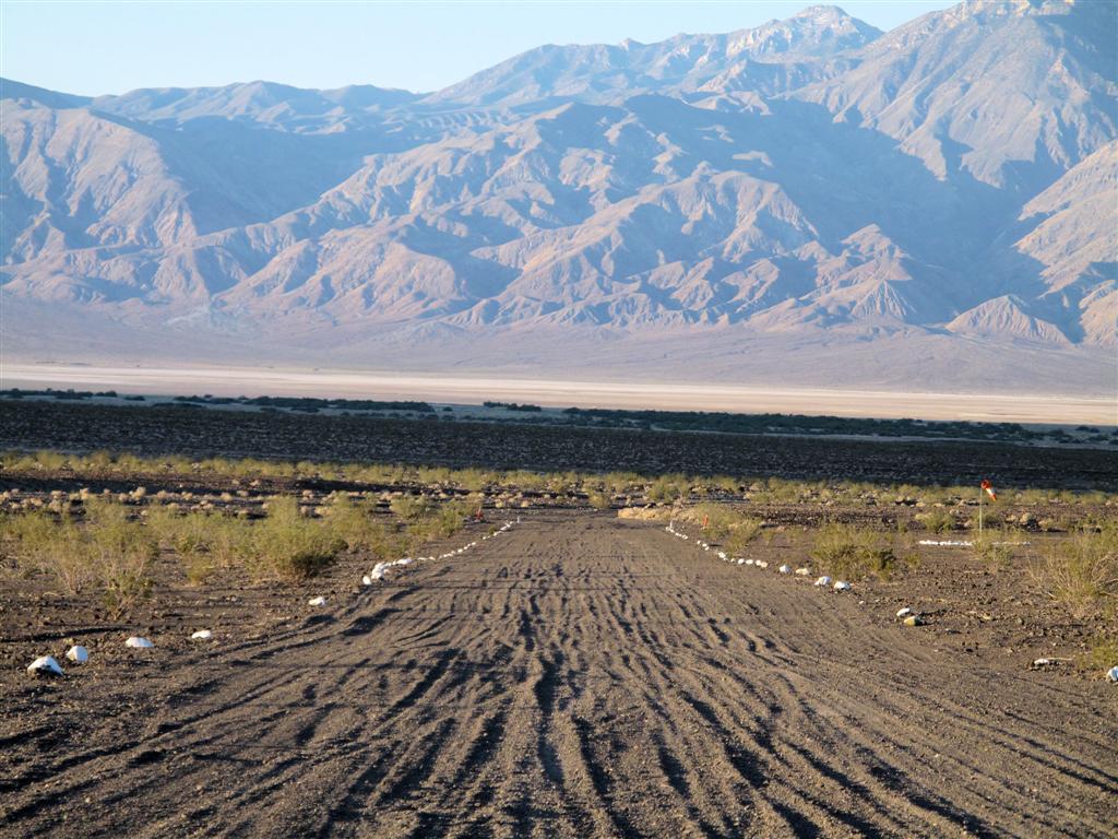
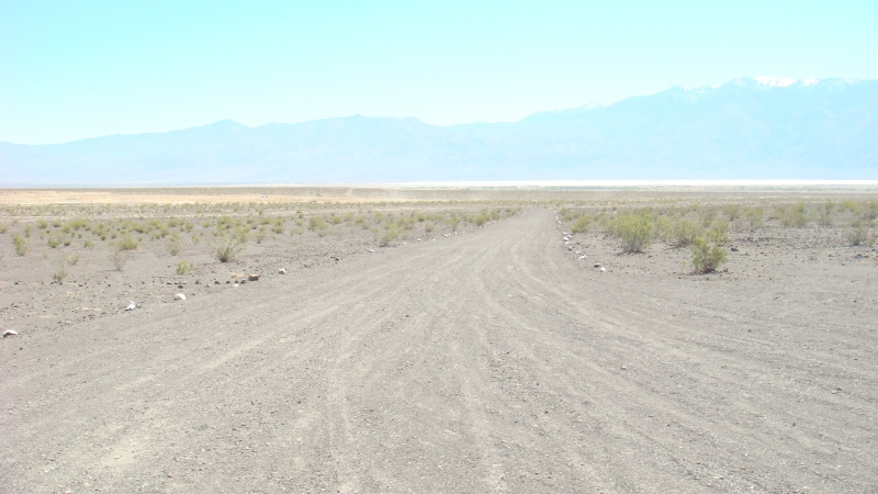
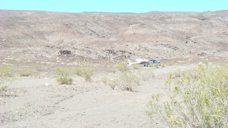
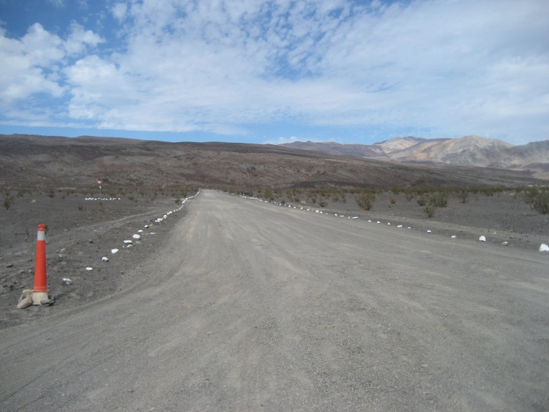
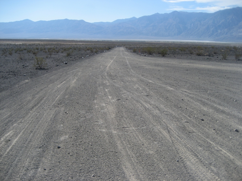
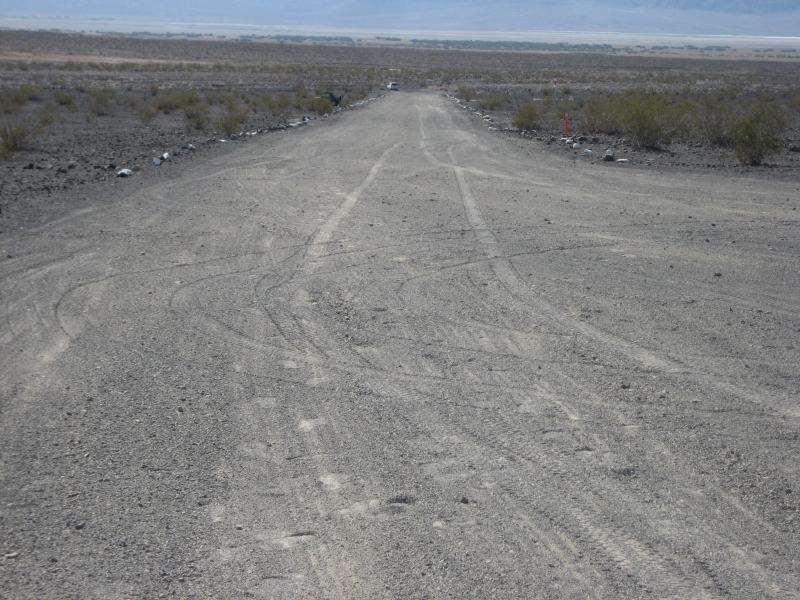
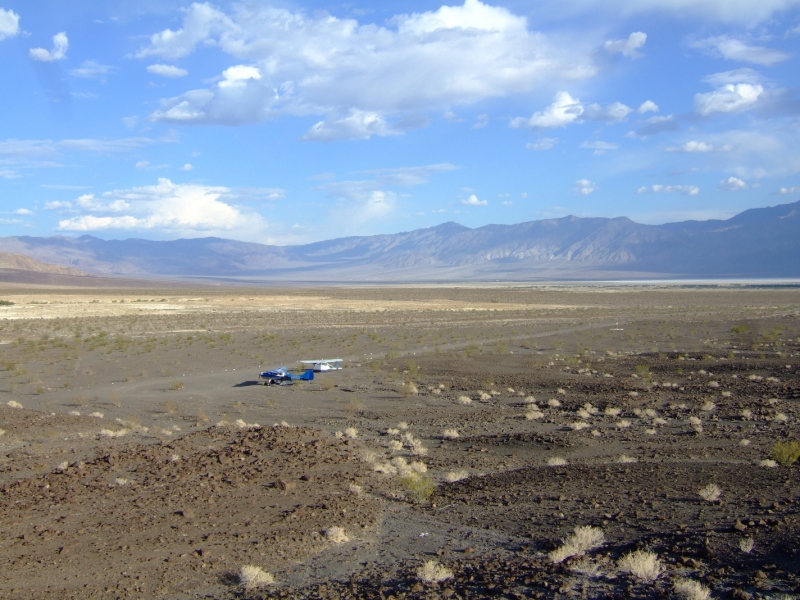
    1500' x 35' land up hill to the north, take off down hill to south.  Cinder or gravel like material gets dragged occassionaly. Don't land on the old strip by the hot springs is not maintained and you'll get chewed out by the park attendant.

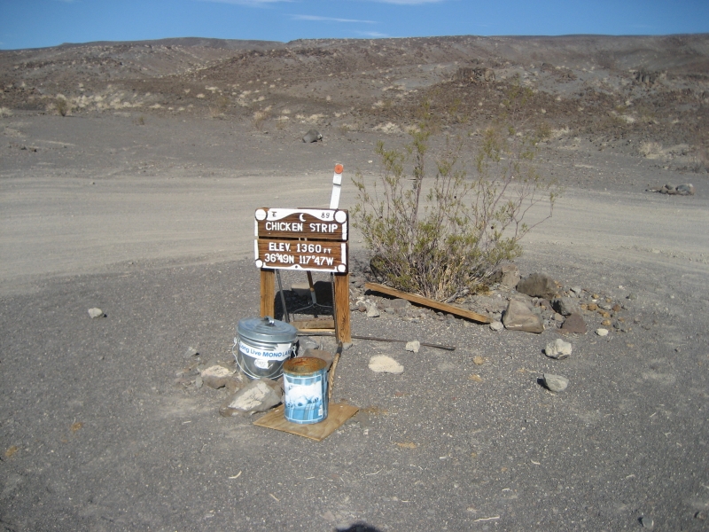
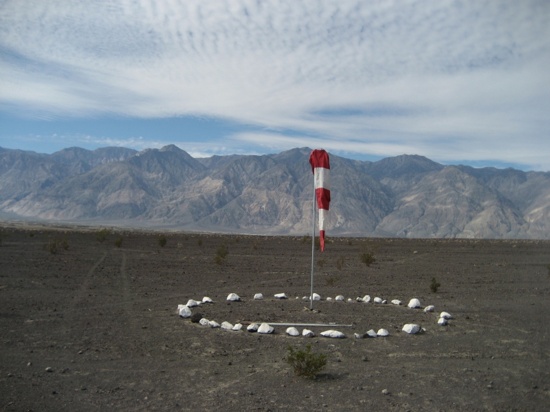
    10-15-2011...... Remeasured the runway and came up with 1300' x 30' usable. The sign at the strip reads the the field elevation is 1360' (I assume MSL). At the north end of the runway it is approximately 1385' and at the south end of the runway, it is approximately 1340'. About a 3-4% uphill slope to the north. There are two tie down spots on the north end of the strip.

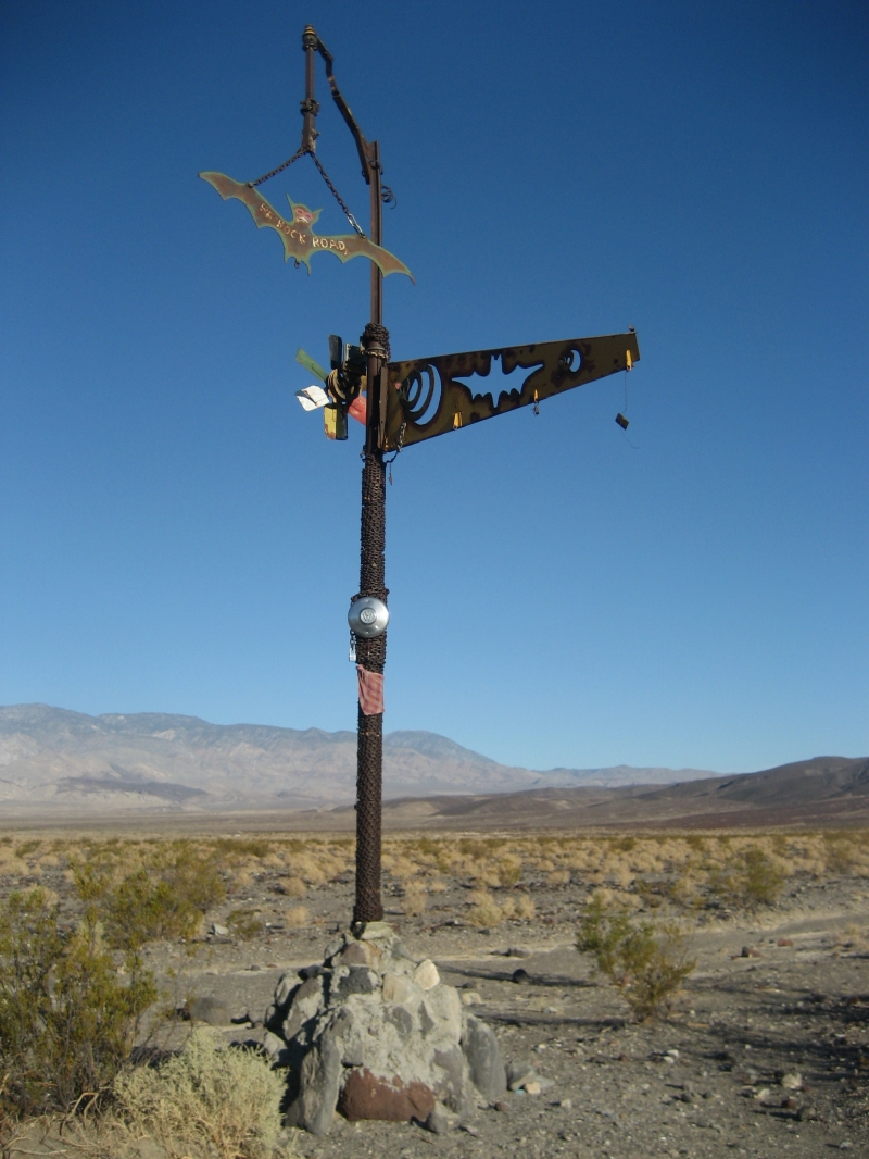
    6-12-13.......The Saline Valley is on the Las Vegas Sectional, but they do not show the strip on the Sectional. The strip is located in the north east corner of the Valley. Also the Restrooms are 1/2 mile from the strip over at the Hot Springs. They are some of the nicest and cleanest I have ever seen.

    Runway
    • Length

      1300

    • Width

      30

    • Surface

      DIRT

    Details
    • Facility ID

      No ID 067

    • Elevation

      1360

    • CTAF

      122.9

    • Chart

      Las Vegas

    • State

      California

    Gallery
    Location

    Lat: 36.80394200000 , Long: -117.77401700000 - CALIFORNIA, USA

    Get Directions
    Categories
    • Recreational
    Tags
    • Desert
    • Canyon
    • Camping
    • Hot Springs
    • Restrooms
    Region
    • Western Pacific
    Ownership
    • Public
    Author
    shortfield
    mood_bad
  • No comments yet.
  • Add a review

    Leave a Reply · Cancel reply

    You must be logged in to post a comment.

    YouTube Search
    Prev 1 of 59681 Next
    • Saline Valley

      Saline Valley "Chicken Strip"- Back Country Airport Report

      Advanced Airport Operations
    • Landing Chicken Strip Saline Valley 10/10/21

      Landing Chicken Strip Saline Valley 10/10/21

      landing at Chicken Strip in a Bonanza.
    • Don't do this

      Don't do this

      V tail Bonanza escapes Johnson Creek - 2 pm. Light south winds 90 degree F.

      This video had about 150 views total until late Sept 2023 and for some reason went totally viral. Yes it has a click bait title but that was not my intention. If you fly in and out of mountain strips you must understand density altitude. Density altitude is effected by elevation, temperature and humidity. There are less air molecules at altitude and on hotter days to create lift under the wing and produce compression within the cylinders of the engine. Consequently the performance of the wing and engine are reduced as the density altitude is increased. Humidity effects density altitude because the vaporized water displaces the air molecules further reducing lift and compression in the engine.

      Johnson Creek (3U2) sits at an elevation of 5000 feet and 3500 feet long. It is in the heart of the Frank Church Wilderness in Idaho. It is a spectacular place to camp, hike, fish, and commune with nature. It is a focal point in the Frank Church Wilderness with a rich history. Mountain Flying caries more risk in part due to density altitude and needs to be factored into one's risk assessment. With proper training, proficiency and education much of the risk can be mitigated. Many of the strips have non standard approaches often with no option for a go around or rejected takeoff. I have other videos on this channel that show a lot backcountry strips in Idaho, Montana, Oregon, and Washington. I have a CFII/MEI and stay active instructing in a variety of aircraft and am very passionate about about aviation..

      This video is instructional to anyone wanting to learn about Density Altitude. The temperature was over 90 degree F this afternoon and it was unusually humid. There was a 5-10 knot quartering tailwind. The DA was about 8200 feet that day. Runway 35 is standard departure from Johnson Creek. The 35 Bonanza was loaded with 4 adults. . Unknown how much fuel or baggage was onboard. I doubt he was in a turbocharged aircraft. When we heard the engine start and taxi down toward the departure end of 35 we were all surprised. Most people do not fly in the afternoons in Idaho and the general recommendations among most seasoned mountain/canyon pilots is to be down on the ground by 11-11:30 AM. Certainly on cooler days you can fly later and on hotter days you may need to get down sooner. Fly early and fly light.

      This pilot did a good job once airborne not to stall the airplane. He kept the nose down and contoured the terrain. I believe he wisely headed up the canyon to gain lift created by updrafts on the northwest walls. I agree he should have deployed 10-20 degrees of flaps on the departure. Maybe flown out solo at first to test the conditions. A wiser decision would have been to wait until it cooled off. Below is a video of a loaded Stinson departing from Bruce Meadows with 4 people that crashed into the trees on the departure end in 2012 luckily not killing anyone. Every year people die because they do not factor DA into their flight planning.

      https://www.youtube.com/watch?v=OVM3RRd1vf0

      Hope this answers most of the questions. Safe Flying for Everyone and Support the RAF (Recreational Aviation Foundation) and IAA (Idaho Aviation Association).
    • Mid Winter Airplane Camping! The 'Chicken Strip' Death Valley Aviat Husky

      Mid Winter Airplane Camping! The 'Chicken Strip' Death Valley Aviat Husky

      LINKS:
      RAF: https://theraf.org/
      PFoZ: https://www.youtube.com/watch?v=jKcde6tagy0
      Saline Valley Warm Springs FB: https://www.facebook.com/groups/59065266090

      CREDITS:
      F-35 Flyby: Kevin Rupp
      F-35 Stills: Dafydd Phillips, Jim Mumaw


      Learning the Finer Points: https://www.learnthefinerpoints.com/

      Patreon: https://www.patreon.com/user?u=5295000&fan_landing=true

      Product Links:

      Solo Stove 'campfire': https://www.solostove.com/solo-stove-campfire/

      Garmin Inreach: https://discover.garmin.com/en-US/inreach/personal/
    • The Chicken Strip

      The Chicken Strip

      My first time visiting the Chicken Strip in my 1956 C182!
    • Landing at the Chicken Strip, Saline Valley Warm Springs, CA

      Landing at the Chicken Strip, Saline Valley Warm Springs, CA

      This 1300 foot long gravel strip serves the Saline Valley Warm Springs in Death Valley National Park, CA
    Prev 1 of 59681 Next

    You May Also Be Interested In

    LONE PINE, CA

    • 36.58869444444, -118.04938888889
    • Outpost

    Panamint Springs, CA

    The airstrip has resort within walking distance of the airstrip. They have a place you can eat or get some…
    • 36.33831971384, -117.46675692047
    • Recreational

    Darwin Airstrip, CA

    The dirt and gravel strip is in good condition.  A windsock is on the north end but the desert sun and…
    • 36.26559886882, -117.59637218290
    • Recreational

    © 2000-2021 shortfield.com

    Cart

      • Featured
      • Recreational
      • Restricted
      • Off-Airport
      • Abandoned
      • Outpost
      • Facebook
      • Twitter
      • WhatsApp
      • Telegram
      • LinkedIn
      • Tumblr
      • VKontakte
      • Mail
      • Copy link