Alert
This is an uncharted landing site and conditions are completely unknown.
This is an uncharted landing site and conditions are completely unknown.
Location Overview
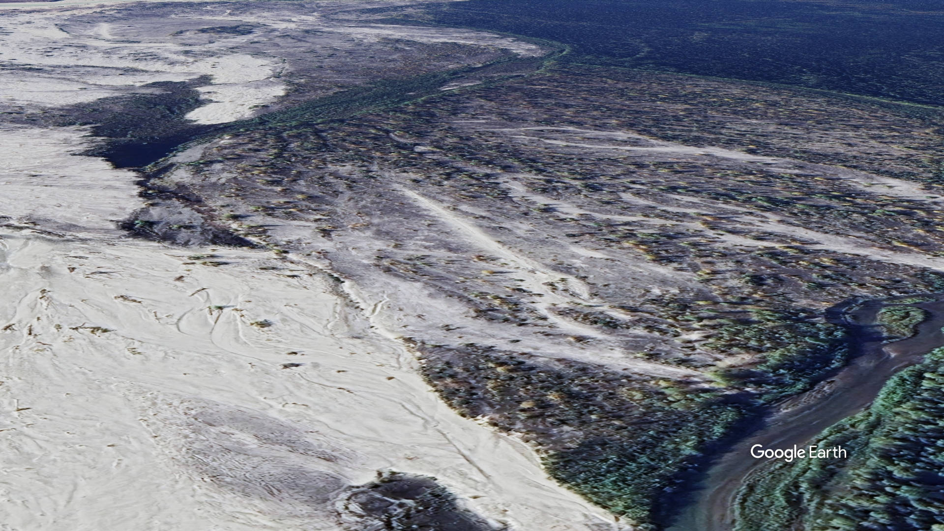
These coordinates sit along the Chakachatna River in the northwestern Kenai Peninsula Borough, in the foothills below the Tordrillo/Alaska Range and not far from the Merrill Pass corridor used by bush pilots crossing the range. The Chakachatna flows out of Chakachamna Lake and is known for heavy glacial silt, braided channels, and shifting gravel bars — terrain typical of informal, unmaintained "uncharted" strips that pilots use opportunistically on sandbars rather than fixed, graded runways.
Camping & Recreation
There are no documented facilities at this location — no maintained campsites, services, or signage, consistent with its uncharted status. Recreational draw in the area is centered on the river itself: the Chakachatna/Chakachamna system is regarded by paddlers as a world-class but extremely difficult (Class V) whitewater run, and the surrounding wilderness offers backcountry hunting, fishing (though heavy silt limits sportfishing success), and remote wildlife viewing. Any camping here would be primitive, self-supported backcountry camping on a gravel bar.
Notes & Warnings
There appears to be at least four other airstrips within a three mile radius of this location, so watch for traffic. Gravel-bar strips on glacial rivers like the Chakachatna are notoriously unstable — channels shift, bars erode or wash out between seasons, and surface conditions (soft silt, rocks, standing water) can change significantly with river flow. Pilots should expect no maintenance, no windsock, and no guarantee the strip is currently usable; a pre-flight overflight to check the bar's condition is standard practice for this kind of site. The area is also close to mountainous terrain and the Merrill Pass route, so weather, downdrafts, and rapidly changing visibility are real considerations. This should be treated as an experienced bush-flying location only, with proper survival gear given the remoteness.
History
The broader area has a notable place in Alaska backcountry lore: the Chakachatna's whitewater was long considered unrunnable, with a famous failed 1980s attempt by paddlers Andrew Embick and Chris Roach that ended in an arduous overland hike out rather than a float, before a team led by Rob Lesser successfully kayaked the river top-to-bottom without portages in 1991, using a bush pilot to ferry them to and from remote sandbar landing spots — the kind of informal airstrip use this location likely represents.
Sand
?
122.9
Alaska
61.071611, -152.020151


Add a review