Description
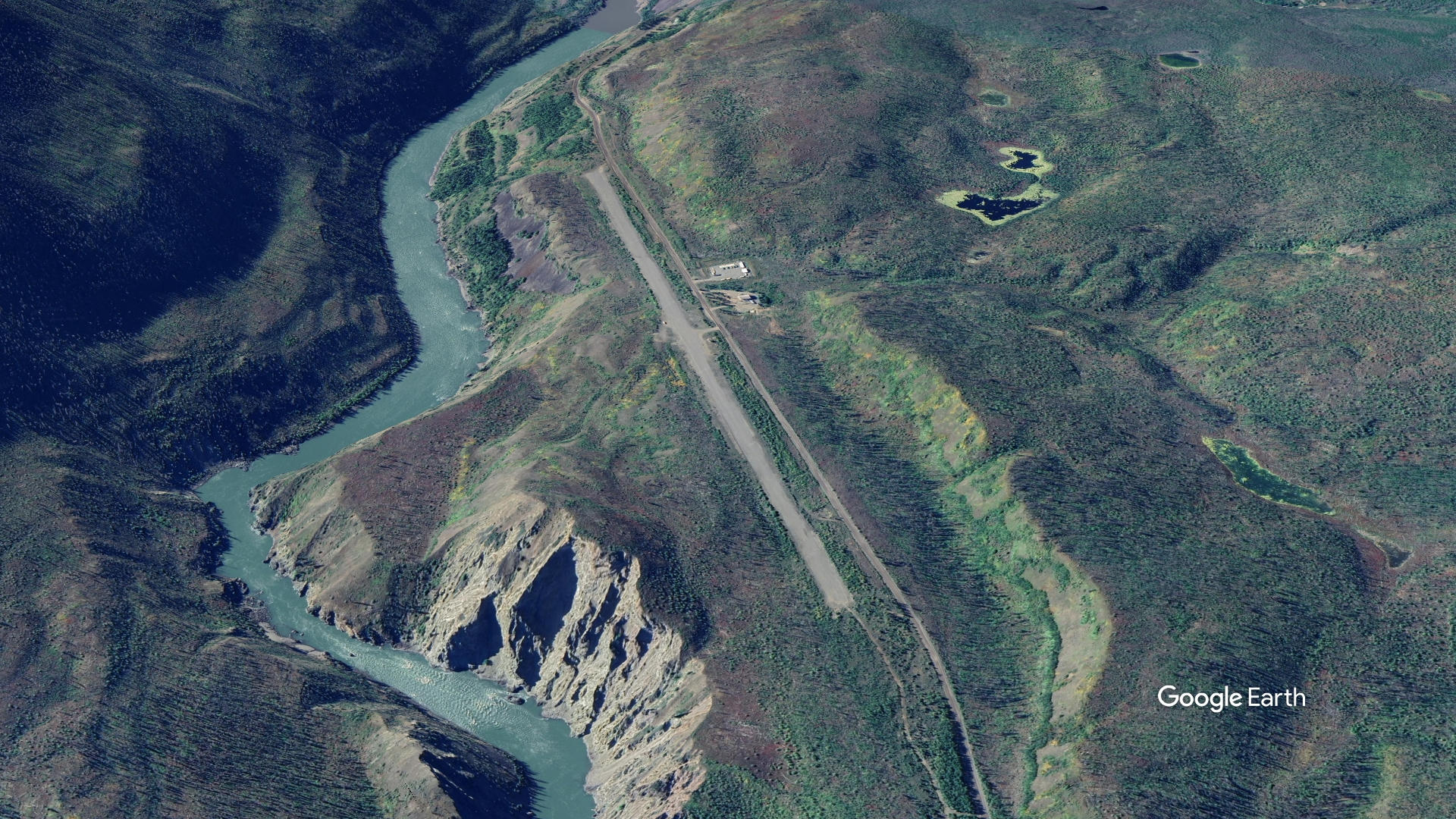
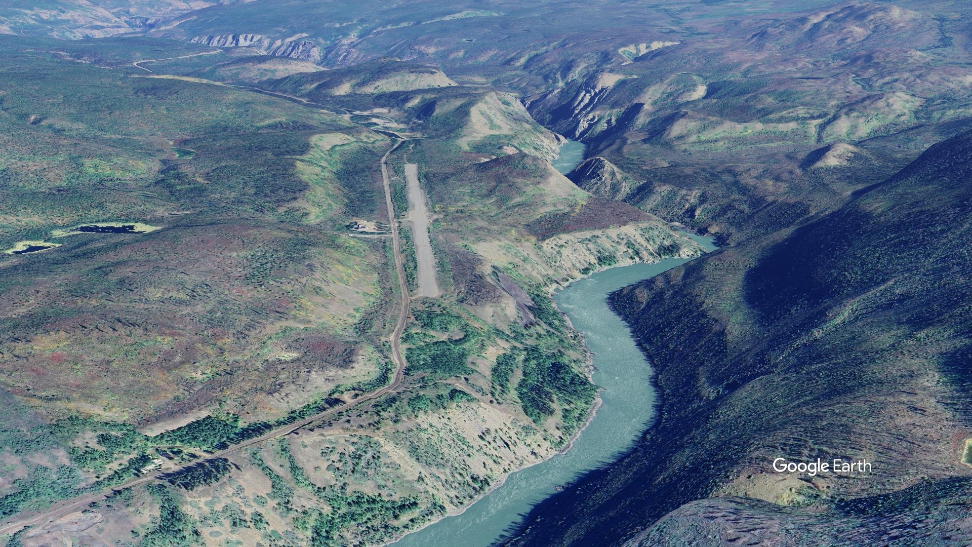
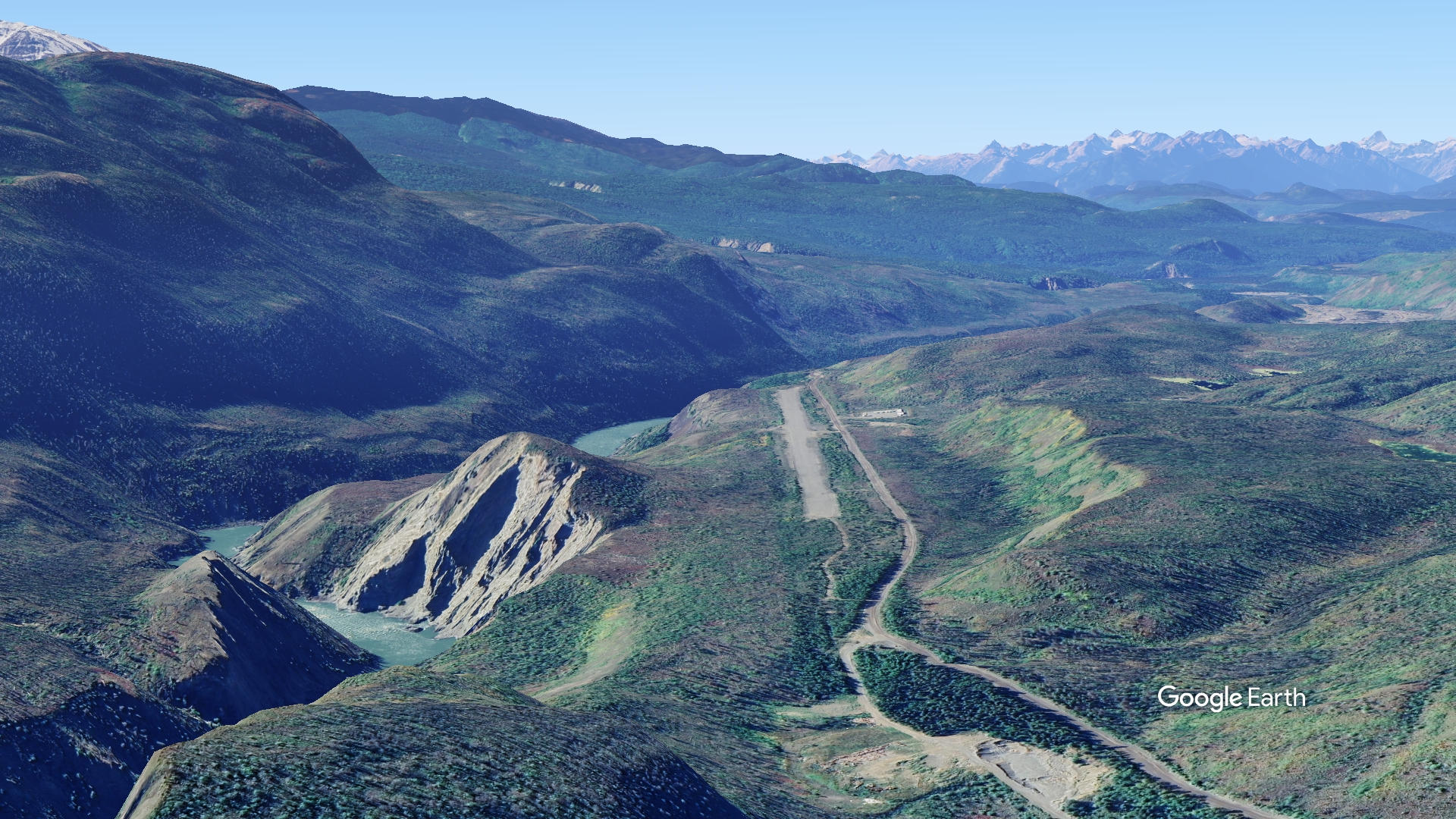
The airport sits above the Stikine River, about one mile east of central Telegraph Creek village - a small, remote community in northwestern BC that is one of the more isolated settlements in the province.
The runway runs on a 19/01 orientation and measures 5,000 ft long by 40 ft wide. It is an unpaved (gravel) strip, not maintained but reportedly still well used.
The historic town is about a half hour walk and is an interesting part of the telegraph trail up to Atlin and onto Dawson.
There are no facilities in town except a small store.
There is also a separate Telegraph Creek Seaplane Base (CAH9) about 4 km away, serving floatplanes on the Stikine River — a common arrangement in remote BC communities. Aircraft types historically operating into Telegraph Creek include bush planes like the de Havilland Beaver/Otter and Britten-Norman Islander — well-suited to short, remote strips.
The airstrip is a critical lifeline for Telegraph Creek, as road access is limited to a single, rough road from Dease Lake. The strip supports general aviation, charter flights, medevac, and resupply.
Runway
-
Length
2000
-
Width
50
-
Surface
GRAVEL
Details
-
Facility ID
new
-
Elevation
1000
-
CTAF
122.9
Gallery
Location
Lat: 57.91406, Long: -131.12565 - Telegraph Creek, BC
Add a review