
Description
Orange Hill Airstrip is a primitive, unregistered backcountry landing area within Wrangell-St. Elias National Park and Preserve, situated in the Nabesna River valley approximately 13 miles southeast of the small community of Nabesna, near the coordinates N62.212042, W142.848128.
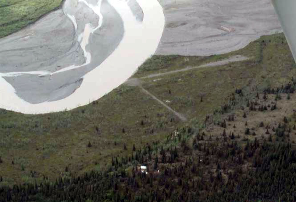
Important Pilot Alert: The original inland airstrip in the Nabesna River valley has been completely lost to river erosion. According to the most current NPS information, the former strip is gone. What remains is a 300-foot gravel sandbar on the Nabesna River itself, with landing entirely at the pilot's discretion based on conditions. The older text provided describing a 700-foot gravel airstrip reflects a situation that has since been dramatically altered — the Nabesna River has been aggressively eroding and shortening the usable landing area each summer, and that process has now run its course. An overflight inspection before any landing attempt is essential. There is no FAA identifier.
The associated NPS public-use cabin sits in dense spruce forest near the Nabesna Glacier and measures 12 by 16 feet — a compact but functional shelter with two twin bunks, a woodstove, table and bench, a bulletin board, and a pit toilet. No reservations are required; it is first-come, first-served with a maximum stay of seven days in any thirty-day period. Water is not reliably available on-site, so pilots and visitors are advised to bring all the water they need. The cabin is also reachable in winter by snowmachine via a roughly 20-mile route from the Nabesna Road.
The area takes its name from Orange Hill, a significant porphyry copper prospect first staked as early as 1902 that sits about a half mile southeast of the airstrip. The surrounding terrain offers short hikes and off-trail exploration, with direct access to the Nabesna Glacier — one of the longest valley glaciers in North America — as a primary draw. The location also sees use as a fly-in staging point for Nabesna River float trips, with rafters and kayakers using it as a put-in before running the swift, braided upper river downstream toward the Tetlin Wildlife Refuge.
Standard Wrangell-St. Elias backcountry cautions apply: no fuel is available anywhere within the park, cell service is extremely limited, all trash must be packed out, and large tundra tires are strongly recommended for any aircraft operating on river gravel.
Runway
-
Length
700
-
Surface
TURF
Details
-
Facility ID
new
-
CTAF
122.9
Gallery
Location
Lat: 62.21204200000 , Long: -142.84812800000 - , USA

Add a review