Goat Trail - Skolai Pass to Wolverine (Wrangell-St. Elias National Park, Alaska) - Part 1
The Goat Trail is an excellent remote Alaska backpacking trip in Wrangell - St Elias National Park. It is a trek in the park exploring the Chitistone valley and features spectacular views, glacier clad, and high mountain peaks.
watch days 5-8 in part 2: https://youtu.be/3-dBXoBpt5s
Trail map: http://www.hillmap.com/m/ag1zfmhpbGxtYXAtaGRychULEghTYXZlZE1hcBiAgIDu6NvrCAw
At a glance:
-- 7 nights in the backcountry: Aug. 1 – Aug. 8
-- 28 miles from Skolai pass to Wolverine land strip
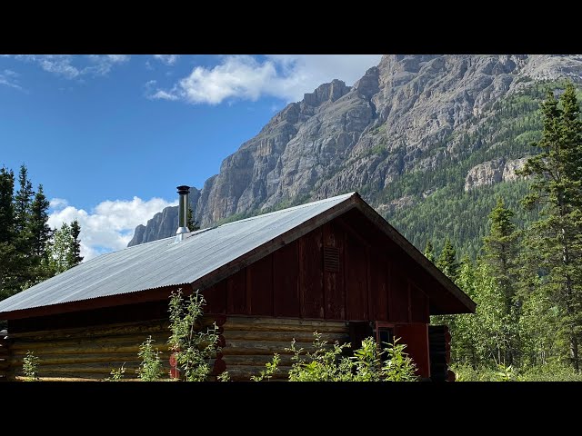
-- Elevation between 3000 and 5000 feet
-- Stunning Alaska Scenery
-- Bush Flights through Wrangle Mountains
Hike Story
-- 0:04 Day 1 (5 miles): After loading our packs, we got on a 20 minutes’ bush flight to Skolai pass. After being dropped off, we left the weight of our big backpacks and grabbed some water, snack, and bear spray to explore the area around Skolai lake and see the beauty and spirit of HOLE-IN-THE-WALL Glacier. We took about a 5 mile round hike to have a surreal view of the glacier. We had to cross one or two glacier rivers that flow right from the glaciers and were extremely cold. But it absolutely was worth it.
-- 0:21 Day 2 (6-7 miles): We don our packs and started our hike to upper Skolai Lake, where you can touch the mystical RUSSELL Glacier. On our way, we saw a huge grizzly bear with her cubs beside a river at a considerable distance. After having some tea by the glacier and enjoying the fantastic view, we headed back to the beginning of the Chitistone pass, climbed up a little bit and camped in a windy, exposed spot.
-- 1:49 Day 3 (4-5 miles): Today we passed by some gorgeous lakes, crossed several shallow and deep rivers, and saw numerous beautiful waterfalls along our hike. A half mile or so before the trailhead of the Goat trail we confronted a fast-flowing river. After failing in our first attempt, we decided it was extremely dangerous to cross the river. We camped before the river to try crossing it the next day.
-- 3:26 Day 4 (4-5 miles): Early this morning, river’s flow was much less and we could manage to cross it. After hiking about 2 miles we arrived to where the trail got difficult. There was no path and we had to follow faint goat trails across the scree slopes. the last scree slope is the steepest and where people typically have trouble. After reaching the Chitistone Gorge, we did not follow goat trail down the river. Instead, we turned to the right of Goat trail and hiked about two miles a river upwards to find our fabulous camp site. By dinner time, we found that all our fuel canisters were nearly empty. we had consumed more fuels than we should due to high elevation.
-- Day 5 (3 miles): We crossed several small rivers, walked on a little bit snow, and saw an old crashed plane by the mountains. We were lucky enough to ran into two other hikers who were heading to goat trail beginning from Wolverine. They generously gave us a small fuel canister. It meant a lot to us knowing that they had scarified some of their hot morning coffees for us.
-- Day 6 (4 miles): Early morning we explored Hasen Creek a little bit. After having breakfast, we started wandering among the surrounding mountains and valleys further and further towards the west where no many people would dare to go. We were lucky enough to see a wolverine. Finally, we were at high Wolverine landing strip, where we got to soak in all the scenic highlights.
-- Day 7: We just relaxed under the sun, finished the book we were reading together in the tent during our journey, played a few games, and shared chats, teas and laughter. Such an awesome and unforgettable day!
-- Day 8: we departed Wolverine land with a bush flight back to McCarthy where we could see spectacular views of Nizina Glacier and Nizina river.


Add a review