Description
Location
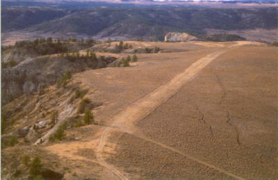
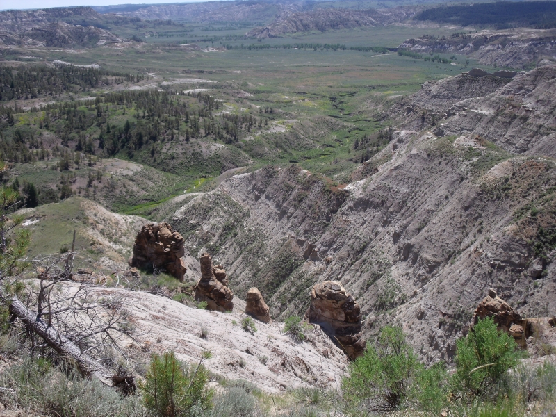
Overview Cow Creek Airport sits roughly 27 miles northeast of Winifred, Montana, at coordinates N47°56.85' / W109°0.48', with a field elevation around 3,300 feet MSL. The strip occupies a bluff overlooking Cow Creek, about ten miles upstream from where the creek empties into the Missouri River. It's one of several backcountry strips scattered through the Upper Missouri River Breaks National Monument, a 149-mile stretch of rugged, eroded terrain along the Missouri that Lewis and Clark's journals described as "broken land."
Camping & Recreation
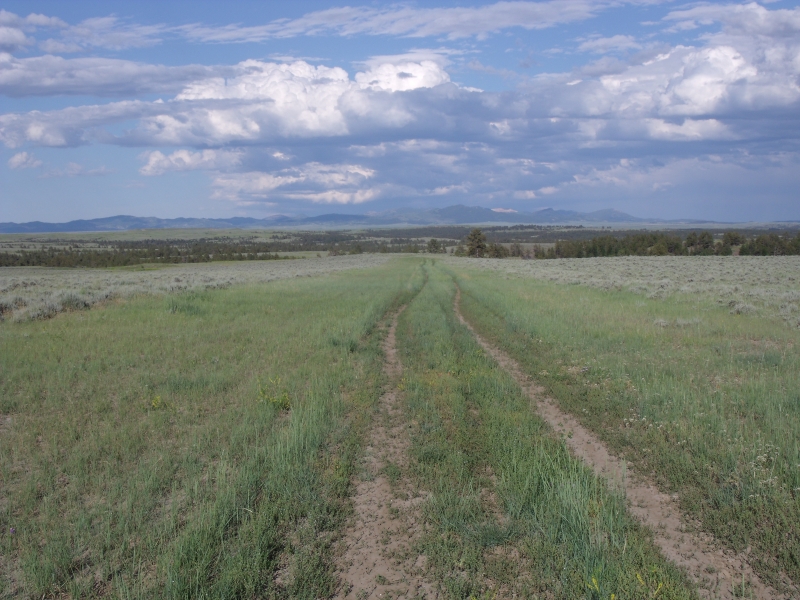
Cow Creek is one of six charted backcountry airstrips in the Breaks that offer scenic, remote dry camping — meaning no developed facilities, just primitive tent/underwing camping in a strikingly open, isolated landscape. The surrounding public land is open for floating the river, fishing, and hunting, and a short hike from the strip rewards visitors with sweeping badlands scenery. Nearby Winifred and Lewistown host an annual June fly-in that includes a number of these Breaks strips as flying destinations, though Cow Creek itself has no amenities on site — pack in everything you need.
Notes & Warnings
Several cautions are worth noting before flying in:
The runway is soft and muddy when wet, runway maintenance is irregular, and there is no snow removal.
Wildlife and cattle are commonly on and around the airport.
Local pilots warn that the Breaks soils "turn to glue" when wet, so the strip should not be used if the surface is saturated.
Commercial aircraft operators are directed to contact the BLM manager, and clearance delivery routes through Salt Lake ARTCC.
The strip has at times been graded to remove ruts, which can leave it freshly soft and more vulnerable to damage, occasionally prompting temporary NOTAM'd closures while it firms up.
History
Cow Creek's airstrip predates the 2001 presidential proclamation that created the Upper Missouri River Breaks National Monument, and its survival became something of a rallying point for backcountry aviation advocacy. When the monument designation threatened the closure of all roads and airstrips in the area, pilot organizations mobilized to fight for their preservation — a fight that helped spur the founding of the Recreational Aviation Foundation itself. RAF co-founder Chuck Jarecki tracked down historic photographs of each of the ten original Breaks airstrips, and together with Montana Pilots Association advocates, pushed through public meetings to keep them open. That effort paid off: six of the original ten strips, including Cow Creek, remain charted today. More recently, the Montana Pilots Association, RAF, and BLM partnered to fence the airstrip and post educational signage after years of vehicle-track damage to the runway surface — a small but telling chapter in the ongoing, cooperative effort to keep these historic backcountry strips open for future generations of pilots.
Runway
-
Length
2430
-
Width
50
-
Surface
TURF
Details
-
Facility ID
CW0
-
Elevation
3250
-
CTAF
122.9
Gallery
Location
Lat: 47.947500, Long: -109.008611 - MONTANA, USA


Add a review