Sign in or Register
    • Featured
    • Recreational
    • Restricted
    • Off-Airport
    • Abandoned
    • Outpost
    • Home
    • Explore
    • STOL Gear
    • Search Airstrips

    CHICKEN STRIP, CA

    • Overview
    • Reviews / PIREPs 0
    • Videos
    • Events
    • prev
    • next
    • Leave a Review / PIREP
    • Bookmark
    • Report
    • Share
    • prev
    • next
    Description

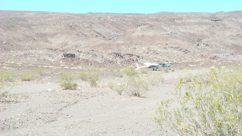
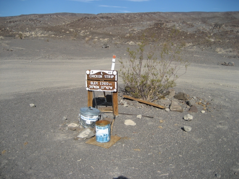
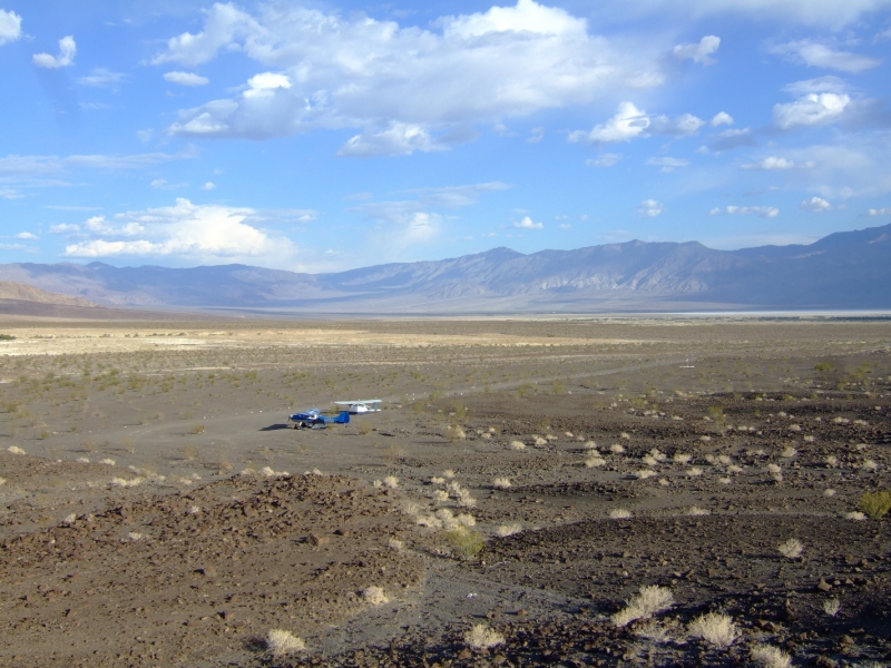
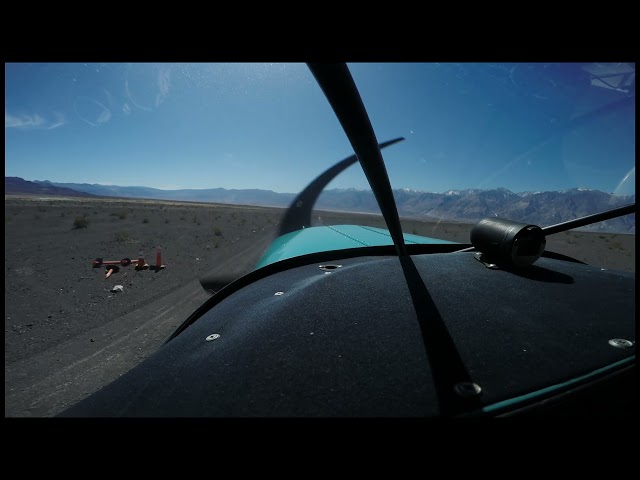
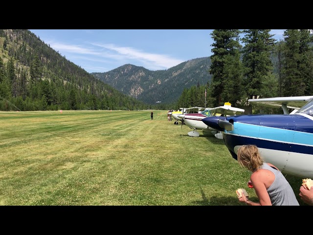
    The Chicken Strip, formally known as the Saline Valley Warm Springs Airfield, is a non-towered dirt airstrip located within Death Valley National Park. It provides general aviation fly-in access to the Saline Valley hot springs and sits at an elevation of 1,360 feet above mean sea level.

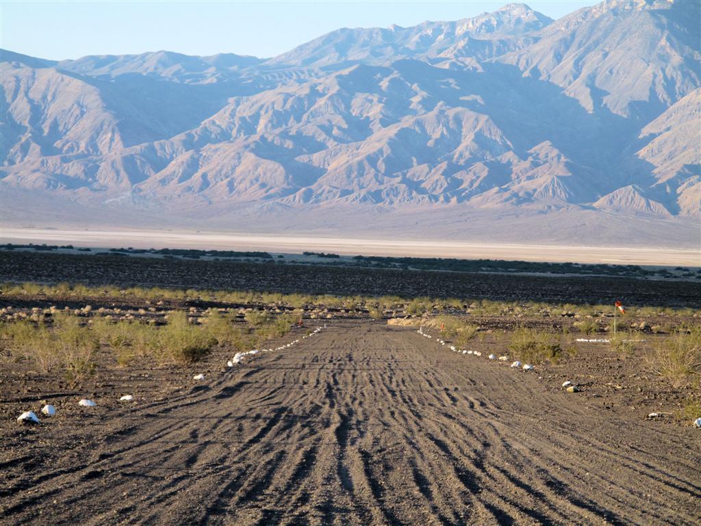
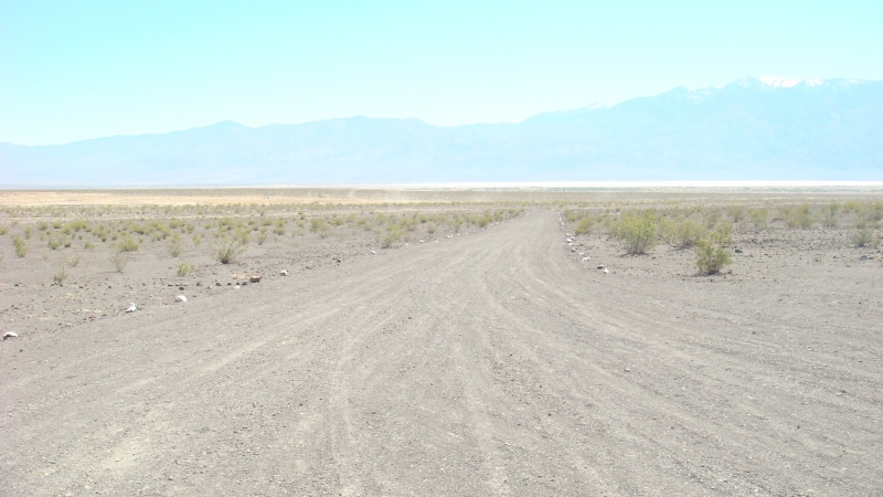
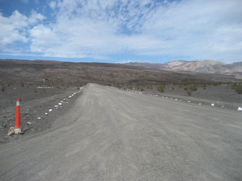
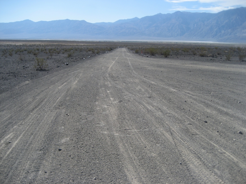
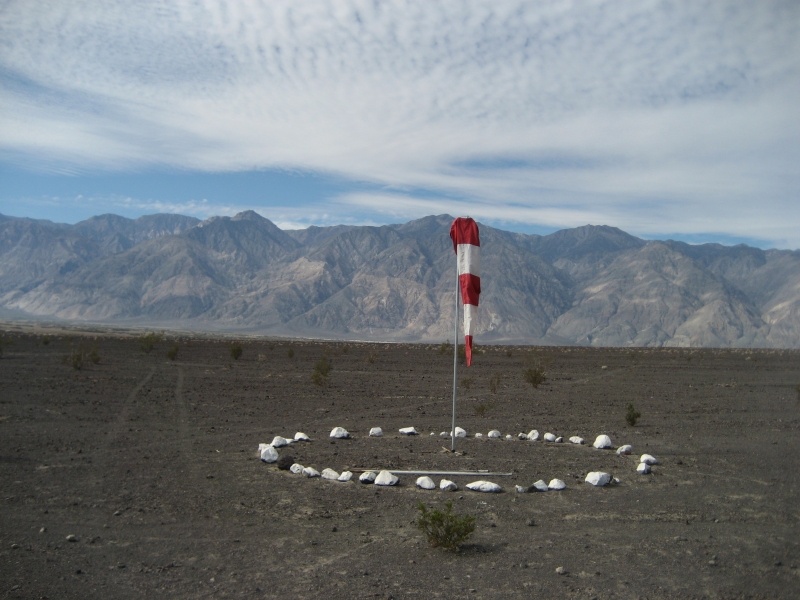
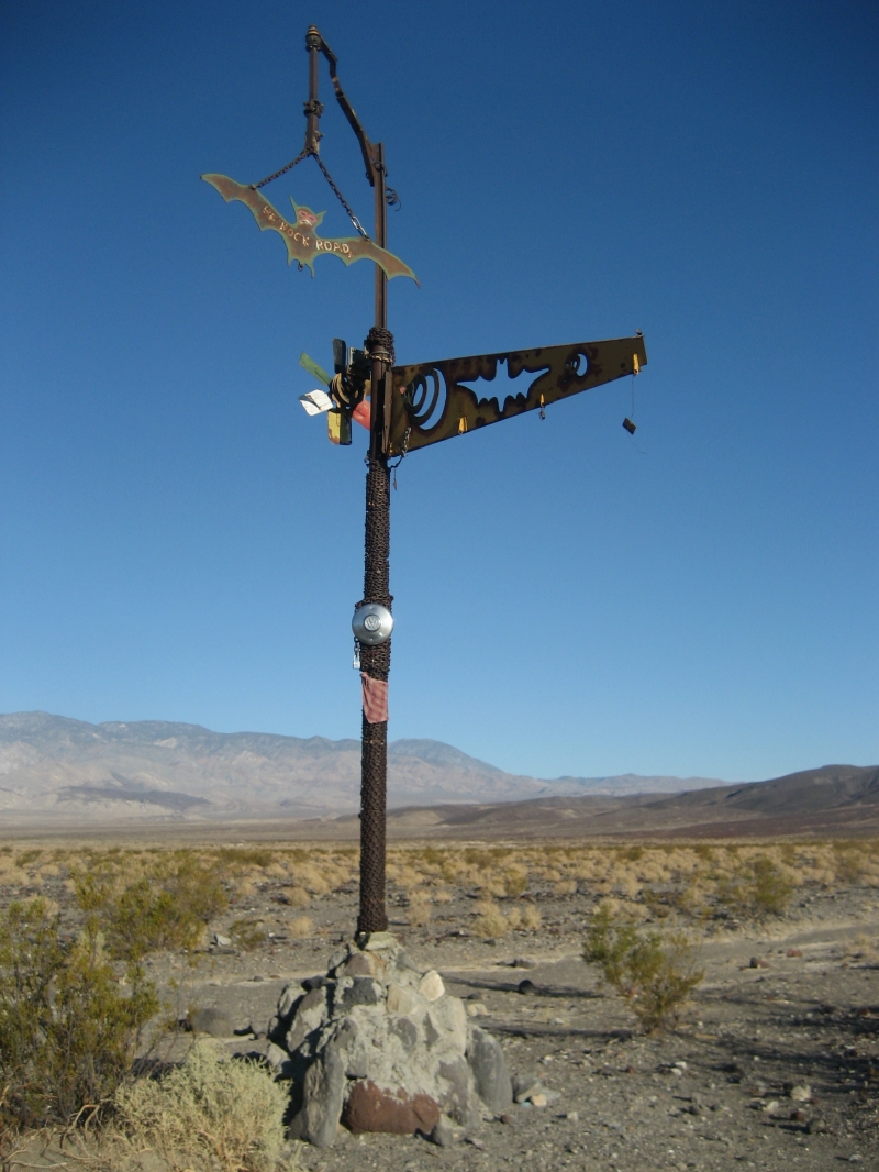
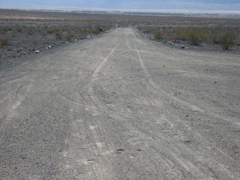
    The strip measures approximately 1,400 feet long and 35 feet wide, includes a tie-down area for up to five small planes, and features a windsock and painted rocks lining the runway. Visitors who fly in often camp next to their aircraft.

    History and Purpose
    The airstrip was built in the 1960s to provide quicker access to the nearby hot springs. Without it, the only alternative access is an arduous 40-mile dirt road that can take three to four hours to complete.

    Historically, the land was managed by the Bureau of Land Management, which did not restrict use of the airstrip. When roughly one million acres were transferred to Death Valley National Park under the California Desert Protection Act in 1994, the Chicken Strip technically became closed by default, since NPS lands require specific authorization for aircraft operations — though the closure was never enforced.

    Legal Authorization
    On August 19, 2019, the NPS issued an official authorization, legally sanctioning the long-established use of the backcountry airstrip.

    Maintenance and Use
    Volunteers with the Recreational Aviation Foundation (RAF) maintain the airstrip at no cost to taxpayers.

    Challenges
    The Chicken Strip is famous among recreational pilots for its dramatic desert scenery and the challenges it poses to small plane pilots. It has faced periodic closures due to storm damage — most notably after a rare flooding event brought nearly two inches of rain in just three hours, cutting deep ruts into the gravel runway — but volunteer crews have consistently worked to restore it to operation.

    Runway
    • Length

      1300

    • Width

      30

    • Surface

      DIRT

    Details
    • Facility ID

      No ID 067

    • Elevation

      1360

    • CTAF

      122.9

    • Chart

      Las Vegas

    • State

      California

    Gallery
    Location

    Lat: 36.8068672, Long: -117.7816819 - CALIFORNIA, USA

    Get Directions
    Flyover Video
    Prev 1 of 1 Next
    • Runway Flyover - Chicken Strip, California

      Runway Flyover - Chicken Strip, California

      @shortfieldvideos
    Prev 1 of 1 Next
    Categories
    • Recreational
    Tags
    • Desert
    • Canyon
    • Camping
    • Hot Springs
    • Restrooms
    Region
    • Western Pacific
    Ownership
    • Public
    Author
    shortfield

    Land here, before you land out there!

    mood_bad
  • No reviews/PIREPs have been posted yet.

  • Add a review

    Leave a Reply · Cancel reply

    You must be logged in to post a comment.

    Shortfield Playlist
    Prev 1 of 5 Next
    • Chicken Strip and Darwin

      Chicken Strip and Darwin

      A trip out to the famous Chicken Strip and the little known town of Darwin.
    • CHICKEN STRIP Airstrip, Death Valley Saline Warm Springs

      CHICKEN STRIP Airstrip, Death Valley Saline Warm Springs

      Pilot description of the remote Chicken Strip in Death Valley and the upper warm springs nearby. Be advised-fast moving jet activity from the China Lake MOA down to 200' AGL-contact Joshua Approach.
      Lets continue to keep this backcountry airstrip open.
    • Chicken Strip Landing (Death Valley National Park) - Cessna C182 Skylane

      Chicken Strip Landing (Death Valley National Park) - Cessna C182 Skylane

      Landing a ‘59 Cessna C182 at the “Chicken Strip” in Saline Valley in Death Valley National Park. The strip is 1,300’ at 1,360’ MSL.
    • Landing at the Chicken Strip, Saline Valley Warm Springs, CA

      Landing at the Chicken Strip, Saline Valley Warm Springs, CA

      This 1300 foot long gravel strip serves the Saline Valley Warm Springs in Death Valley National Park, CA
    • Landing Chicken Strip Saline Valley 10/10/21

      Landing Chicken Strip Saline Valley 10/10/21

      landing at Chicken Strip in a Bonanza.
    • Chicken Strip Take Off

      Chicken Strip Take Off

      Piper Pacer PA22/20 Taking Off from Chicken Strip , Saline Valley California
    Prev 1 of 5 Next
    YouTube Search
    Prev 1 of 59681 Next
    • Saline Valley

      Saline Valley "Chicken Strip"- Back Country Airport Report

      Advanced Airport Operations
    • Landing Chicken Strip Saline Valley 10/10/21

      Landing Chicken Strip Saline Valley 10/10/21

      landing at Chicken Strip in a Bonanza.
    • Don't do this

      Don't do this

      V tail Bonanza escapes Johnson Creek - 2 pm. Light south winds 90 degree F.

      This video had about 150 views total until late Sept 2023 and for some reason went totally viral. Yes it has a click bait title but that was not my intention. If you fly in and out of mountain strips you must understand density altitude. Density altitude is effected by elevation, temperature and humidity. There are less air molecules at altitude and on hotter days to create lift under the wing and produce compression within the cylinders of the engine. Consequently the performance of the wing and engine are reduced as the density altitude is increased. Humidity effects density altitude because the vaporized water displaces the air molecules further reducing lift and compression in the engine.

      Johnson Creek (3U2) sits at an elevation of 5000 feet and 3500 feet long. It is in the heart of the Frank Church Wilderness in Idaho. It is a spectacular place to camp, hike, fish, and commune with nature. It is a focal point in the Frank Church Wilderness with a rich history. Mountain Flying caries more risk in part due to density altitude and needs to be factored into one's risk assessment. With proper training, proficiency and education much of the risk can be mitigated. Many of the strips have non standard approaches often with no option for a go around or rejected takeoff. I have other videos on this channel that show a lot backcountry strips in Idaho, Montana, Oregon, and Washington. I have a CFII/MEI and stay active instructing in a variety of aircraft and am very passionate about about aviation..

      This video is instructional to anyone wanting to learn about Density Altitude. The temperature was over 90 degree F this afternoon and it was unusually humid. There was a 5-10 knot quartering tailwind. The DA was about 8200 feet that day. Runway 35 is standard departure from Johnson Creek. The 35 Bonanza was loaded with 4 adults. . Unknown how much fuel or baggage was onboard. I doubt he was in a turbocharged aircraft. When we heard the engine start and taxi down toward the departure end of 35 we were all surprised. Most people do not fly in the afternoons in Idaho and the general recommendations among most seasoned mountain/canyon pilots is to be down on the ground by 11-11:30 AM. Certainly on cooler days you can fly later and on hotter days you may need to get down sooner. Fly early and fly light.

      This pilot did a good job once airborne not to stall the airplane. He kept the nose down and contoured the terrain. I believe he wisely headed up the canyon to gain lift created by updrafts on the northwest walls. I agree he should have deployed 10-20 degrees of flaps on the departure. Maybe flown out solo at first to test the conditions. A wiser decision would have been to wait until it cooled off. Below is a video of a loaded Stinson departing from Bruce Meadows with 4 people that crashed into the trees on the departure end in 2012 luckily not killing anyone. Every year people die because they do not factor DA into their flight planning.

      https://www.youtube.com/watch?v=OVM3RRd1vf0

      Hope this answers most of the questions. Safe Flying for Everyone and Support the RAF (Recreational Aviation Foundation) and IAA (Idaho Aviation Association).
    • Mid Winter Airplane Camping! The 'Chicken Strip' Death Valley Aviat Husky

      Mid Winter Airplane Camping! The 'Chicken Strip' Death Valley Aviat Husky

      LINKS:
      RAF: https://theraf.org/
      PFoZ: https://www.youtube.com/watch?v=jKcde6tagy0
      Saline Valley Warm Springs FB: https://www.facebook.com/groups/59065266090

      CREDITS:
      F-35 Flyby: Kevin Rupp
      F-35 Stills: Dafydd Phillips, Jim Mumaw


      Learning the Finer Points: https://www.learnthefinerpoints.com/

      Patreon: https://www.patreon.com/user?u=5295000&fan_landing=true

      Product Links:

      Solo Stove 'campfire': https://www.solostove.com/solo-stove-campfire/

      Garmin Inreach: https://discover.garmin.com/en-US/inreach/personal/
    • The Chicken Strip

      The Chicken Strip

      My first time visiting the Chicken Strip in my 1956 C182!
    • Landing at the Chicken Strip, Saline Valley Warm Springs, CA

      Landing at the Chicken Strip, Saline Valley Warm Springs, CA

      This 1300 foot long gravel strip serves the Saline Valley Warm Springs in Death Valley National Park, CA
    Prev 1 of 59681 Next

    You May Also Be Interested In

    Manzinar, CA

    Abandon WW2 AAF base owned by L.A. Water and power Posted no Trespassing.
    • 36.73686709944, -118.14470134318
    • Recreational

    LONE PINE, CA

    • 36.58869444444, -118.04938888889
    • Outpost

    Panamint Springs, CA

    The airstrip has resort within walking distance of the airstrip. They have a place you can eat or get some…
    • 36.33831971384, -117.46675692047
    • Recreational

    © 2000-2025 shortfield.com

    Cart

      • Featured
      • Recreational
      • Restricted
      • Off-Airport
      • Abandoned
      • Outpost
      • Facebook
      • Twitter
      • Mail
      • Copy link