Sign in or Register
    • Featured
    • Recreational
    • Restricted
    • Off-Airport
    • Abandoned
    • Outpost
    • Home
    • Explore
    • Shop

    ANGEL POINT, UT

    • Overview
    • Reviews / PIREPs 0
    • Events
    • Videos
    • prev
    • next
    • Bookmark
    • Share
    • Leave a Review / PIREP
    • Report
    • prev
    • next
    Description

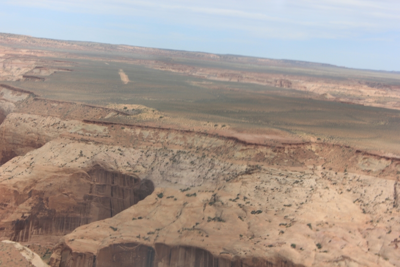
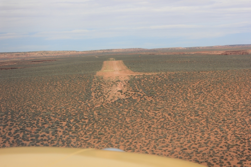
    Spectacular setting above Dirty Devil canyons. Airstrip which is just a widening of the road, has windsock and slopes up to west (and then down hill). Possible to taxi on road to the south to the edge of the plateau. About 3 miles following road to Angle Point lookout. Great hiking.

    Runway
    • Length

      2695

    • Width

      20

    • Surface

      DIRT

    Details
    • Facility ID

      No ID 081

    • Elevation

      5287

    • CTAF

      122.9

    • State

      UT

    Gallery
    Location

    Lat: 38.32545089722 , Long: -110.43531799316 - UTAH, USA

    Get Directions
    Categories
    • Recreational
    Region
    • Northwest Mountain
    Ownership
    • Public
    Author
    shortfield
    mood_bad
  • No comments yet.
  • Add a review

    Leave a Reply · Cancel reply

    You must be logged in to post a comment.

    YouTube Search
    The request cannot be completed because you have exceeded your quota.

    You May Also Be Interested In

    ROBBERS ROOST, UT

    • 38.29351806641, -110.35638427734
    • Recreational

    Little Y, UT

    • 38.37416743705, -110.30648189519
    • Recreational

    DIRTY DEVIL, UT

    The runway sits up on a a bench about 200' above the river. It is 1279' long with abrupt drop-offs on both…
    • 38.17777777778, -110.45333333333
    • Recreational

    © 2000-2021 shortfield.com

    Cart

      • Featured
      • Recreational
      • Restricted
      • Off-Airport
      • Abandoned
      • Outpost
      • Facebook
      • Twitter
      • WhatsApp
      • Telegram
      • LinkedIn
      • Tumblr
      • VKontakte
      • Mail
      • Copy link